Mississippi Valley Severe Storms & Heavy Rain from Cristobal

Special Stories
9 Jun 2020 11:00 AM
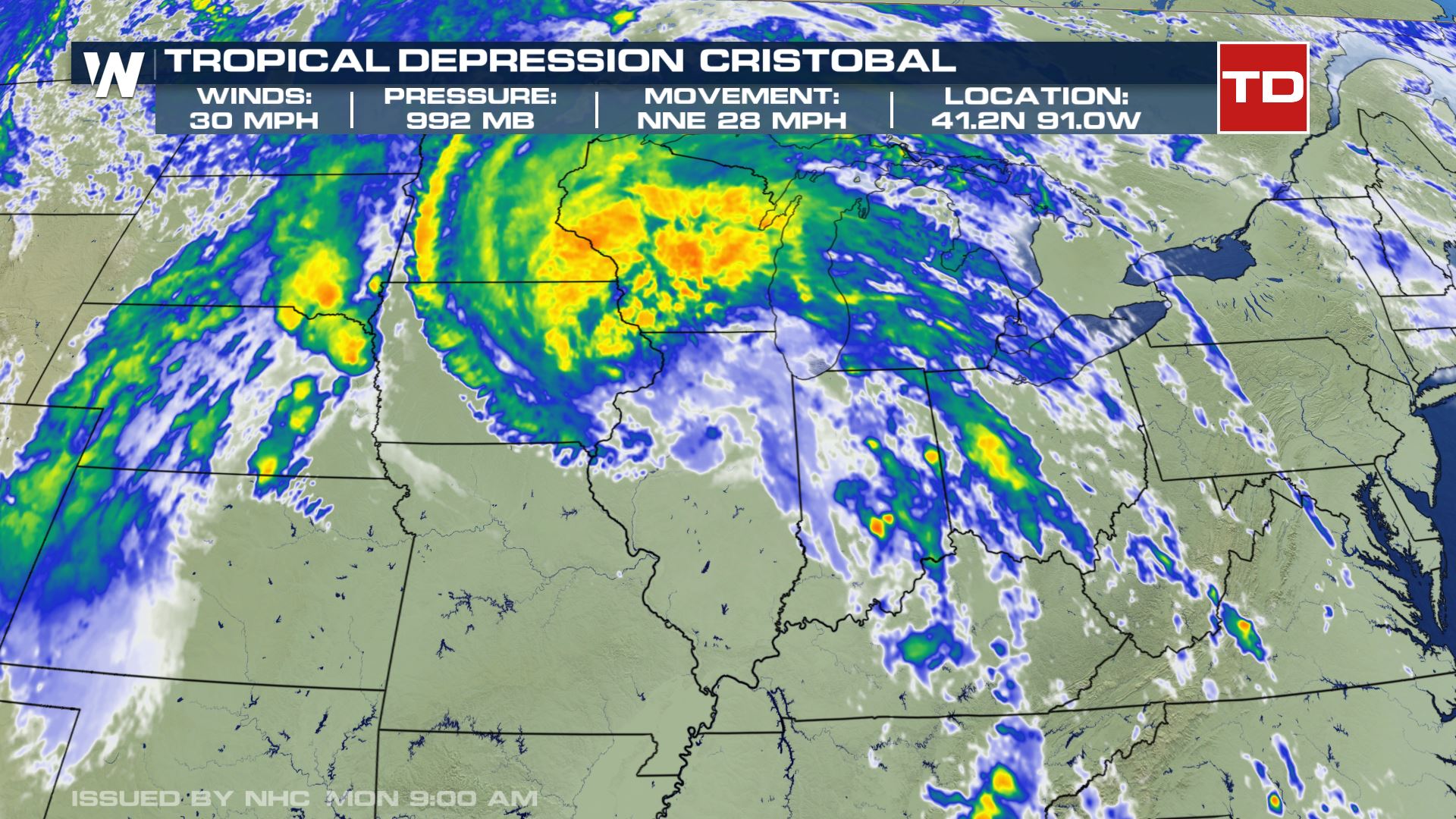
Flooding rains and severe storms continue in the Mississippi Valley as Tropical Depression Cristobal moves northward through the middle of the nation. Even as the storm loses it's tropical characteristics, tropical downpours, strong wind gusts, and isolated tornadoes are likely. The storm made landfall along the Louisiana coast Sunday.
The storm continues to accelerate as well, moving at a (meteorologically-speaking) rapid 28 mph.
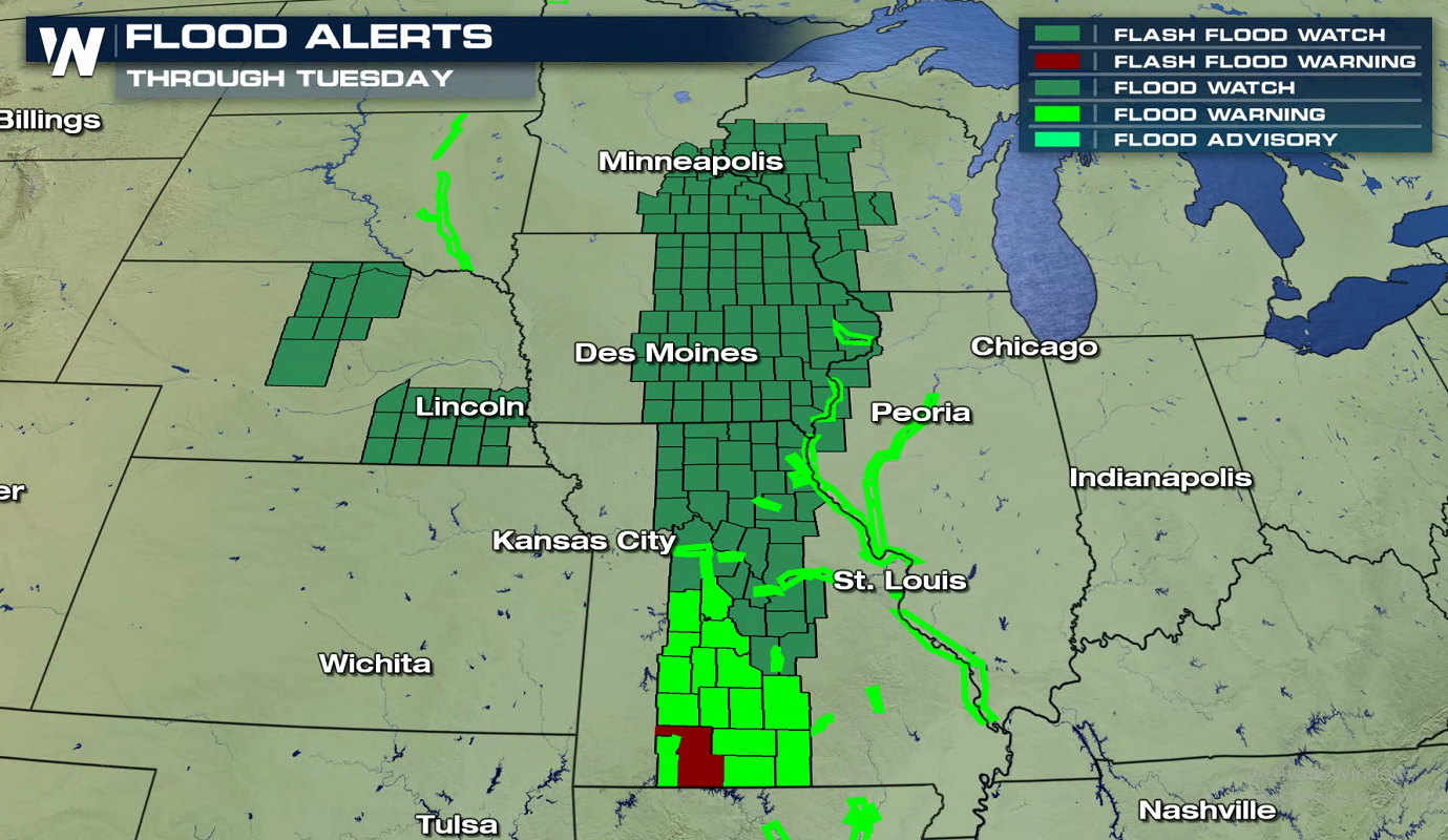
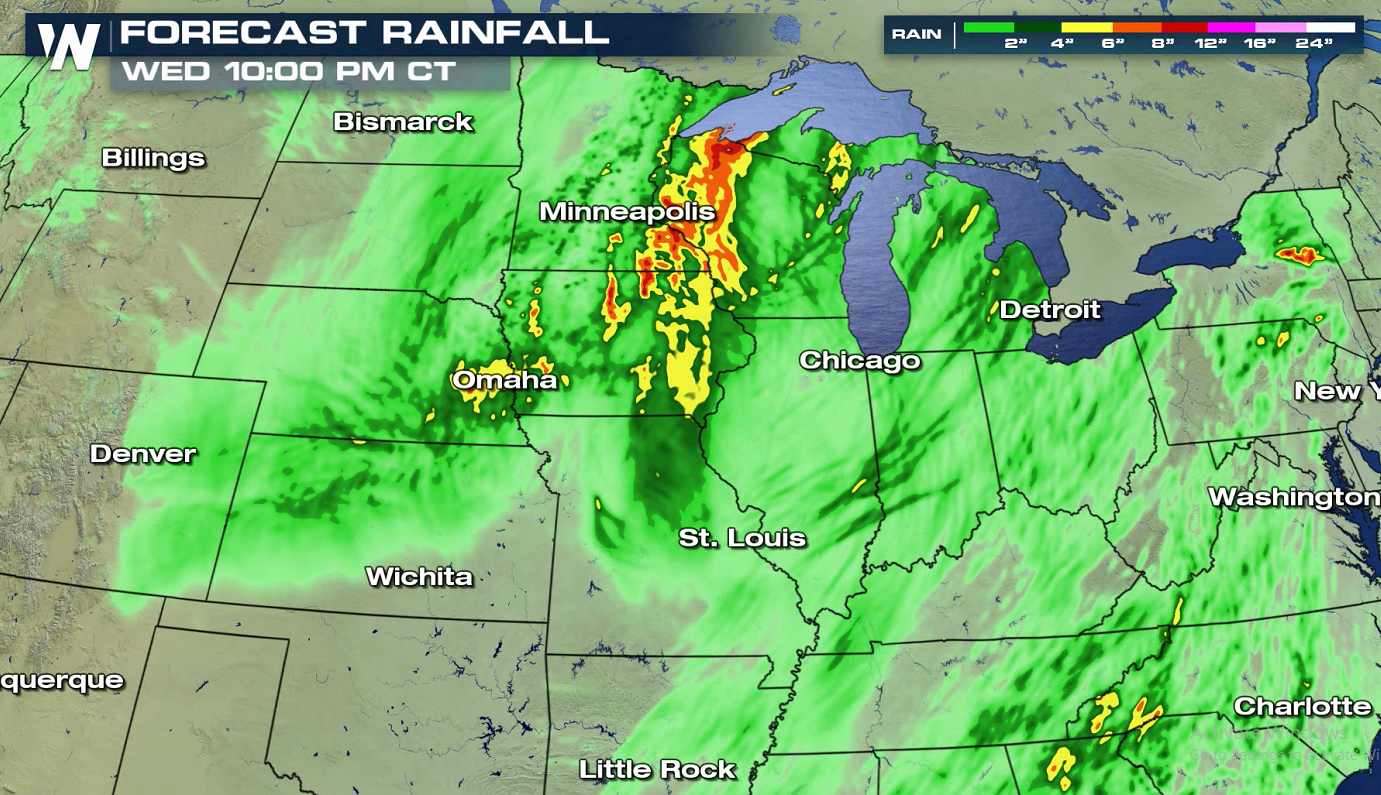
 Cristobal will track through the Central Plains, across the western Great Lakes, and into Canada by the end of this week. This will bring heavy rain and the potential for flooding to the Mississippi Valley. Rainfall totals of 2 to 4 inches, with localized amounts to 6 inches, are possible from Arkansas to the western Great Lakes through Wednesday morning. This rainfall may produce flash flooding, and is forecast to produce new and renewed minor to moderate river flooding across portions of the lower Missouri and mid to upper Mississippi Valleys. Smaller streams and rivers across southeast Louisiana, southern Mississippi, and eastern Arkansas have already begun to rise.
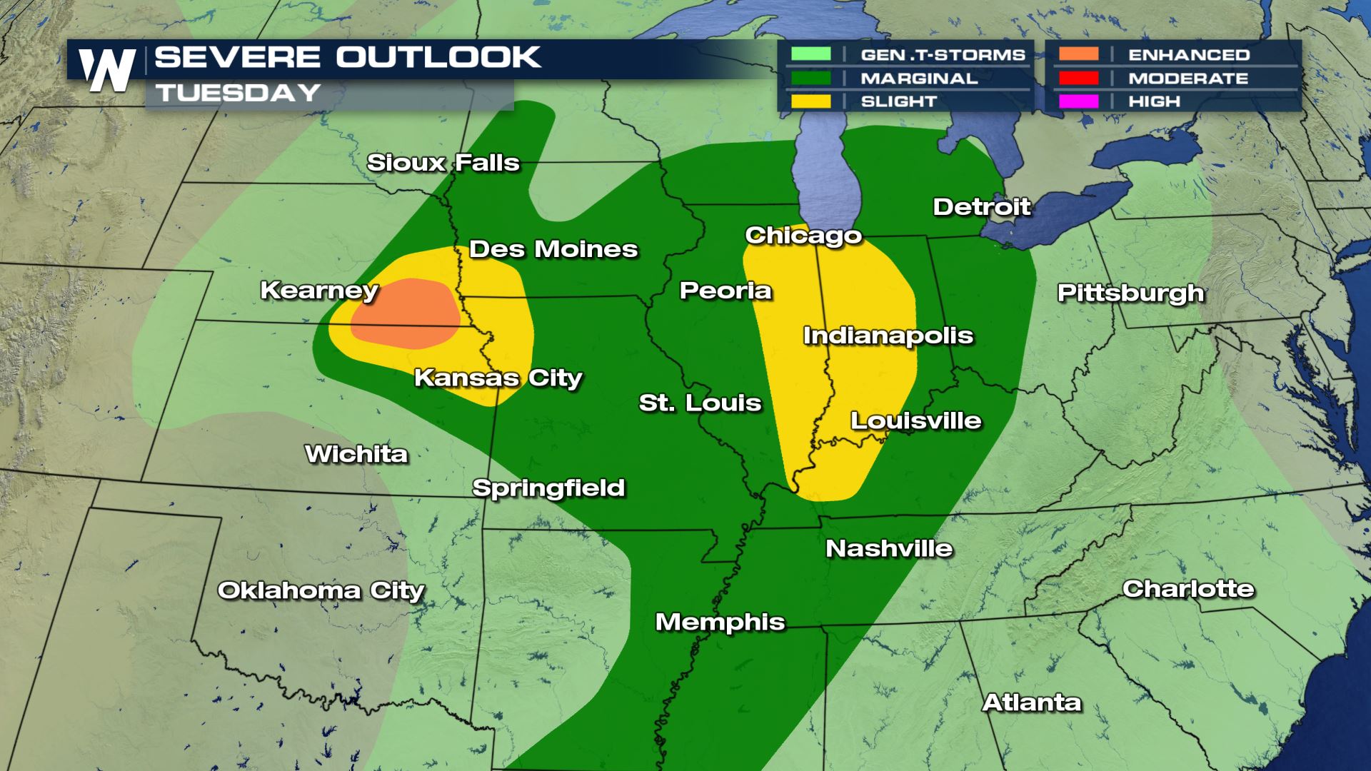
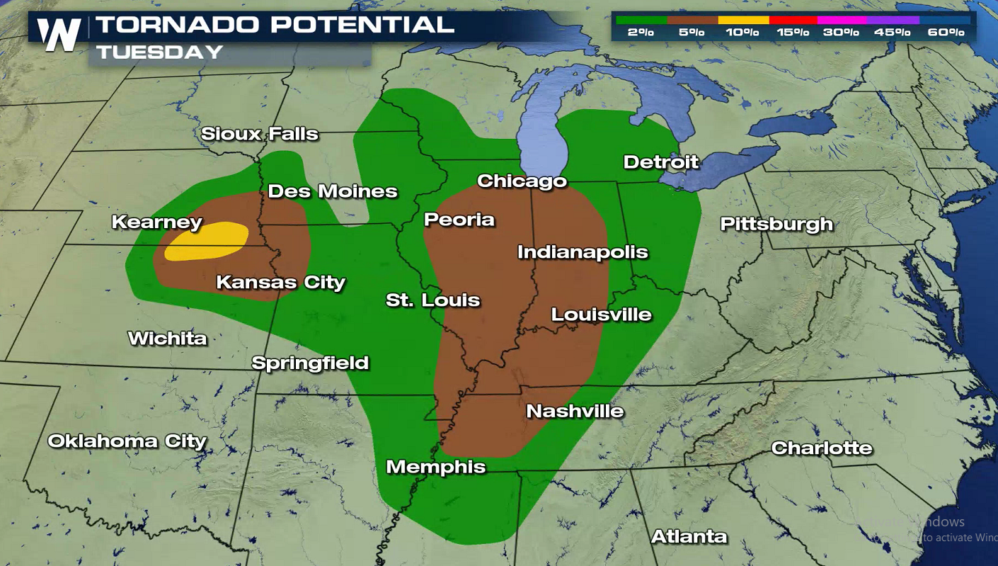
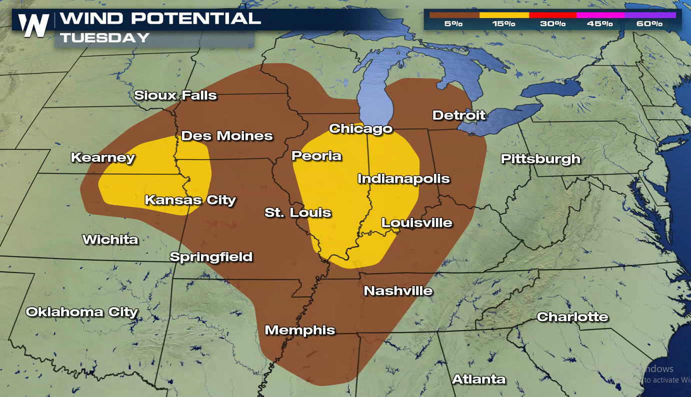
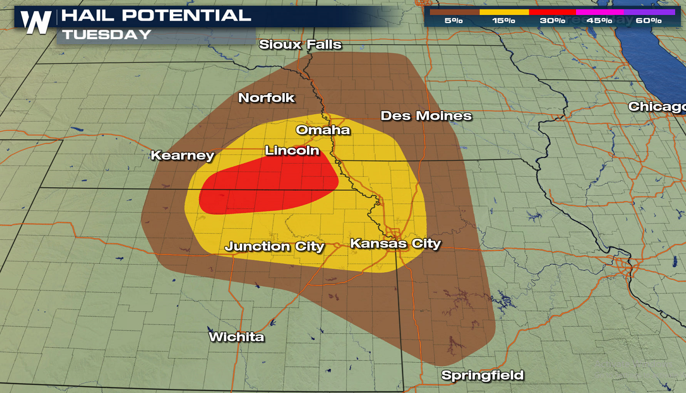
 Severe thunderstorms are also a concern for areas near the circulation of Cristobal. Isolated tornadoes and strong wind gusts are possible from the Central Plains into the Ohio Valley.
 WeatherNation will keep you updated on Cristobal as the storm moves northward. Check back with us on-air and online for the latest forecast and alerts.
Cristobal will track through the Central Plains, across the western Great Lakes, and into Canada by the end of this week. This will bring heavy rain and the potential for flooding to the Mississippi Valley. Rainfall totals of 2 to 4 inches, with localized amounts to 6 inches, are possible from Arkansas to the western Great Lakes through Wednesday morning. This rainfall may produce flash flooding, and is forecast to produce new and renewed minor to moderate river flooding across portions of the lower Missouri and mid to upper Mississippi Valleys. Smaller streams and rivers across southeast Louisiana, southern Mississippi, and eastern Arkansas have already begun to rise.
Severe thunderstorms are also a concern for areas near the circulation of Cristobal. Isolated tornadoes and strong wind gusts are possible from the Central Plains into the Ohio Valley.
WeatherNation will keep you updated on Cristobal as the storm moves northward. Check back with us on-air and online for the latest forecast and alerts.All Weather News
More
East Gears Up for Stormy, Wet Weekend
A low pressure system crashing through the Mi
1 Aug 2026 6:15 PM


Flooding, Severe Storms Target the Midwest Again
After an active week of storms across the nor
1 Aug 2026 1:40 AM

After Reaching Category 5, Genevieve Weakens in the Pacific
PacificFausto is now a post-tropical cyclone.
31 Jul 2026 1:30 AM

Flooding Risk Increases as Heavy Rain Targets the Tri-State Area
Tuesday, heavy rainfall moved across the Nort
30 Jul 2026 12:25 AM

Severe Weather: Energy From the Midwest Now in the Southeast
UPPER MIDWEST - Through Monday, dangerous tor
29 Jul 2026 10:30 PM