Monday's Dust Storm in Arizona Lasted for 200 Miles
Special Stories
12 Jul 2018 10:42 PM
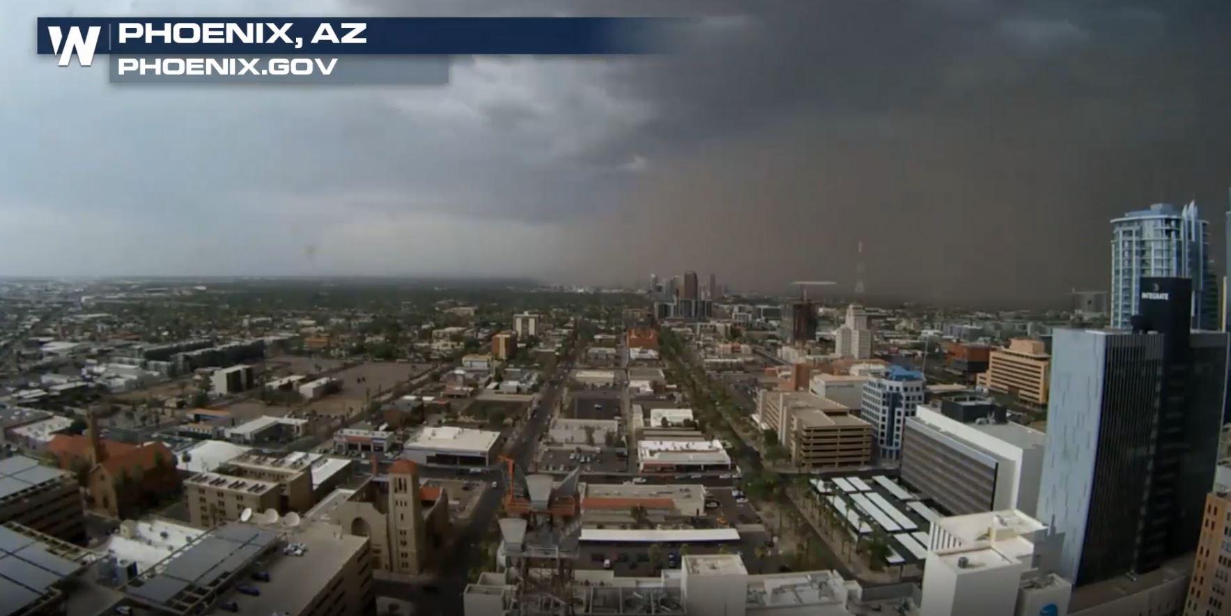
The dust storm that enveloped the Sonoran Desert of Arizona Monday was part of a "classic setup for severe weather" according to the National Weather Service office in Phoenix.
https://twitter.com/WeatherNation/status/1016603732090372096
Widespread thunderstorm activity flared up across Maricopa and Pinal Counties in Arizona Monday, July 9. The area was already muggy and very hot before the thunderstorms evolved. Meanwhile, a strong disturbance in the higher parts of the atmosphere was approaching. Together, high winds developed and quickly moved across a wide-stretching area.
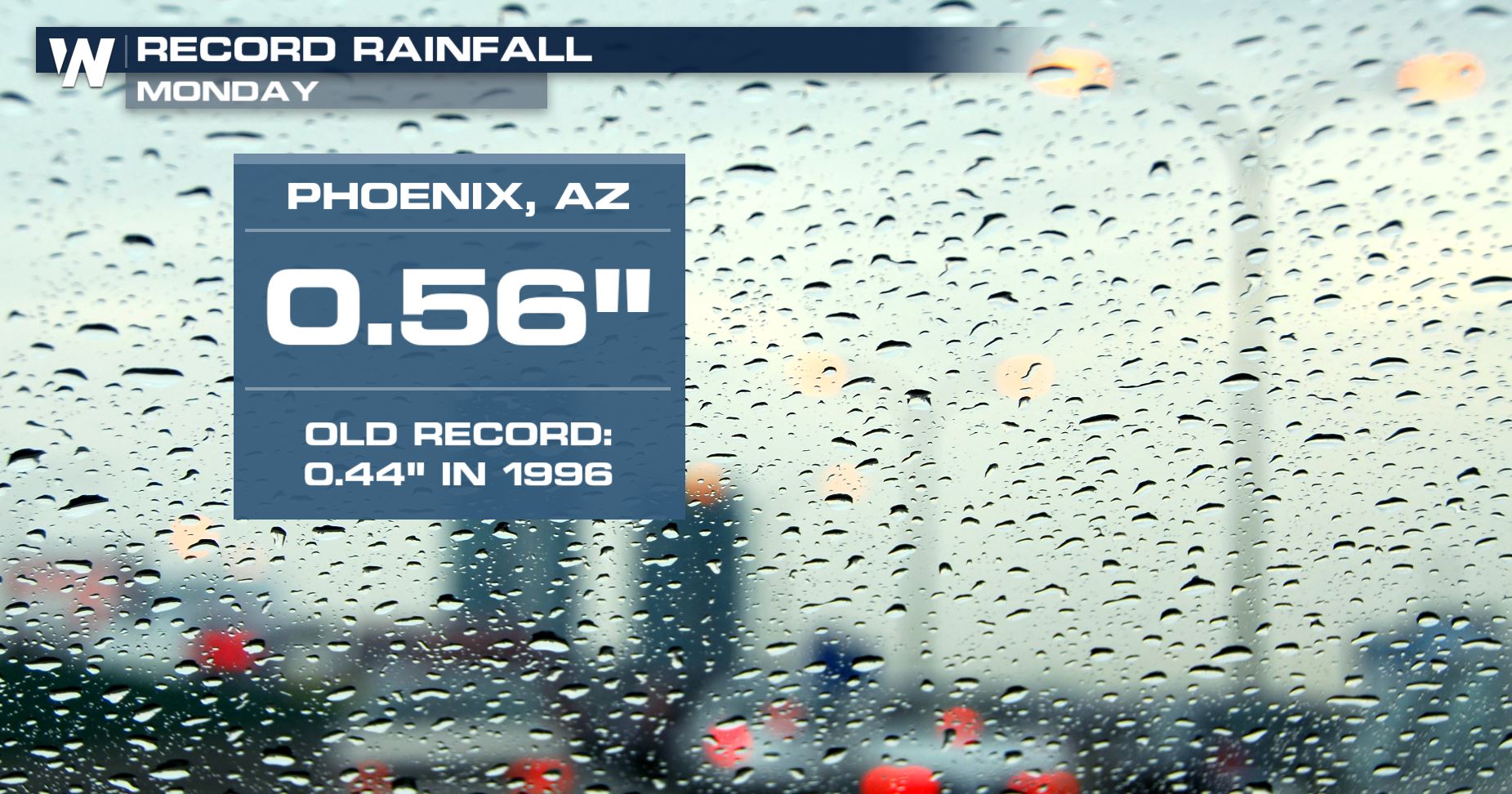
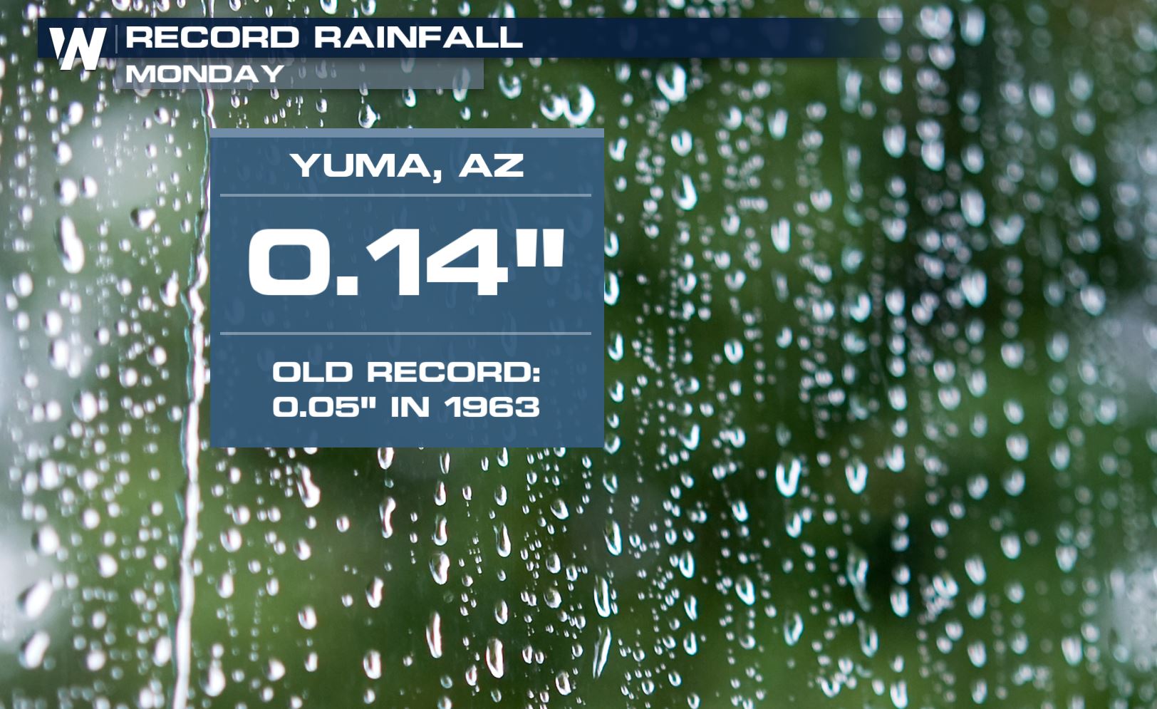
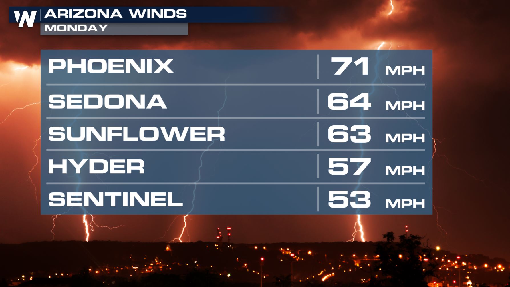 Wind gusts in isolated areas blew up to 80 miles per hour! This reduced visibility to a quarter-mile or less over a large part of the region, including portions of Interstate 8 and 10. The travel for drivers was very hazardous at the time. The thunderstorms also produced record rainfall for Phoenix and Yuma, two usually-dry areas.
 We caught up with the National Weather Service in Phoenix and spoke to Meteorologist Bianca Hernandez about the event. Listen to what she had to say below:
https://twitter.com/WeatherNation/status/1017552401149018112
The National Weather Service in Phoenix wrote a summary of the event, including statistics showing there were 8,000 cloud-to-ground lightning strikes and 45,000 in-cloud flashes from these storms, which you can read more about by clicking/tapping this sentence.
For WeatherNation, Meteorologist Steve Glazier
We caught up with the National Weather Service in Phoenix and spoke to Meteorologist Bianca Hernandez about the event. Listen to what she had to say below:
https://twitter.com/WeatherNation/status/1017552401149018112
The National Weather Service in Phoenix wrote a summary of the event, including statistics showing there were 8,000 cloud-to-ground lightning strikes and 45,000 in-cloud flashes from these storms, which you can read more about by clicking/tapping this sentence.
For WeatherNation, Meteorologist Steve Glazier
Wind gusts in isolated areas blew up to 80 miles per hour! This reduced visibility to a quarter-mile or less over a large part of the region, including portions of Interstate 8 and 10. The travel for drivers was very hazardous at the time. The thunderstorms also produced record rainfall for Phoenix and Yuma, two usually-dry areas.
We caught up with the National Weather Service in Phoenix and spoke to Meteorologist Bianca Hernandez about the event. Listen to what she had to say below:
https://twitter.com/WeatherNation/status/1017552401149018112
The National Weather Service in Phoenix wrote a summary of the event, including statistics showing there were 8,000 cloud-to-ground lightning strikes and 45,000 in-cloud flashes from these storms, which you can read more about by clicking/tapping this sentence.
For WeatherNation, Meteorologist Steve GlazierAll Weather News
More


After Reaching Category 5, Genevieve Weakens in the Pacific
PacificFausto is now a post-tropical cyclone.
30 Jul 2026 12:00 PM

Flooding Risk Increases as Heavy Rain Targets the Tri-State Area
Tuesday, heavy rainfall moved across the Nort
30 Jul 2026 12:25 AM

Severe Weather: Energy From the Midwest Now in the Southeast
UPPER MIDWEST - Through Monday, dangerous tor
29 Jul 2026 10:30 PM

Southeast Flood Risk Lingers Near Stalled Front
A stalled boundary over the Southeast will ke
25 Jul 2026 10:55 AM

Another Round of Storms Targets the Northeast
Tuesday brought severe weather again across p
23 Jul 2026 1:15 AM