Monsoon Moisture Invades the Southwest
Special Stories
31 Jul 2019 11:44 AM
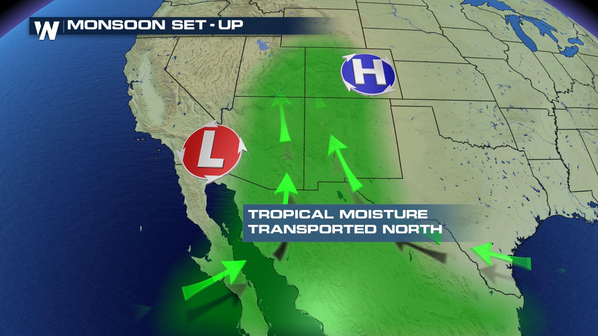
As a trough of low pressure and a ridge of high pressure work together to transport tropical moisture from the south, areas in the desert southwest will continue to tap into wet weather through the extended forecast. The monsoon is characterized by a seasonal shift in the wind direction, affecting atmospheric precipitation totals throughout the southwest. Typically the rainy months begin in July and last through late September, when we typically see a cooler and drier airmass begin to set up.
 Here are the most common threats associated with the monsoon season.
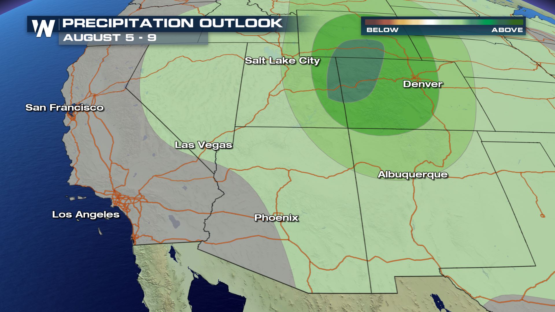
 This is the extended precipitation outlook for days 6 - 10 from the Climate Prediction Center, or the CPC. Here is the link for your weather curiosity; https://www.cpc.ncep.noaa.gov/
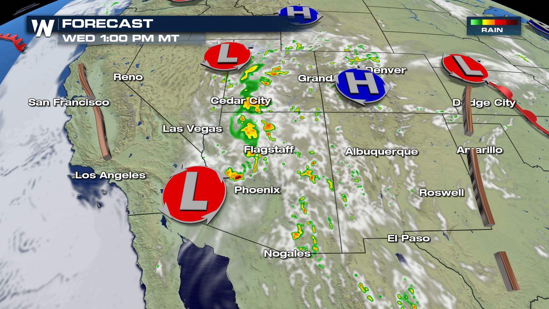
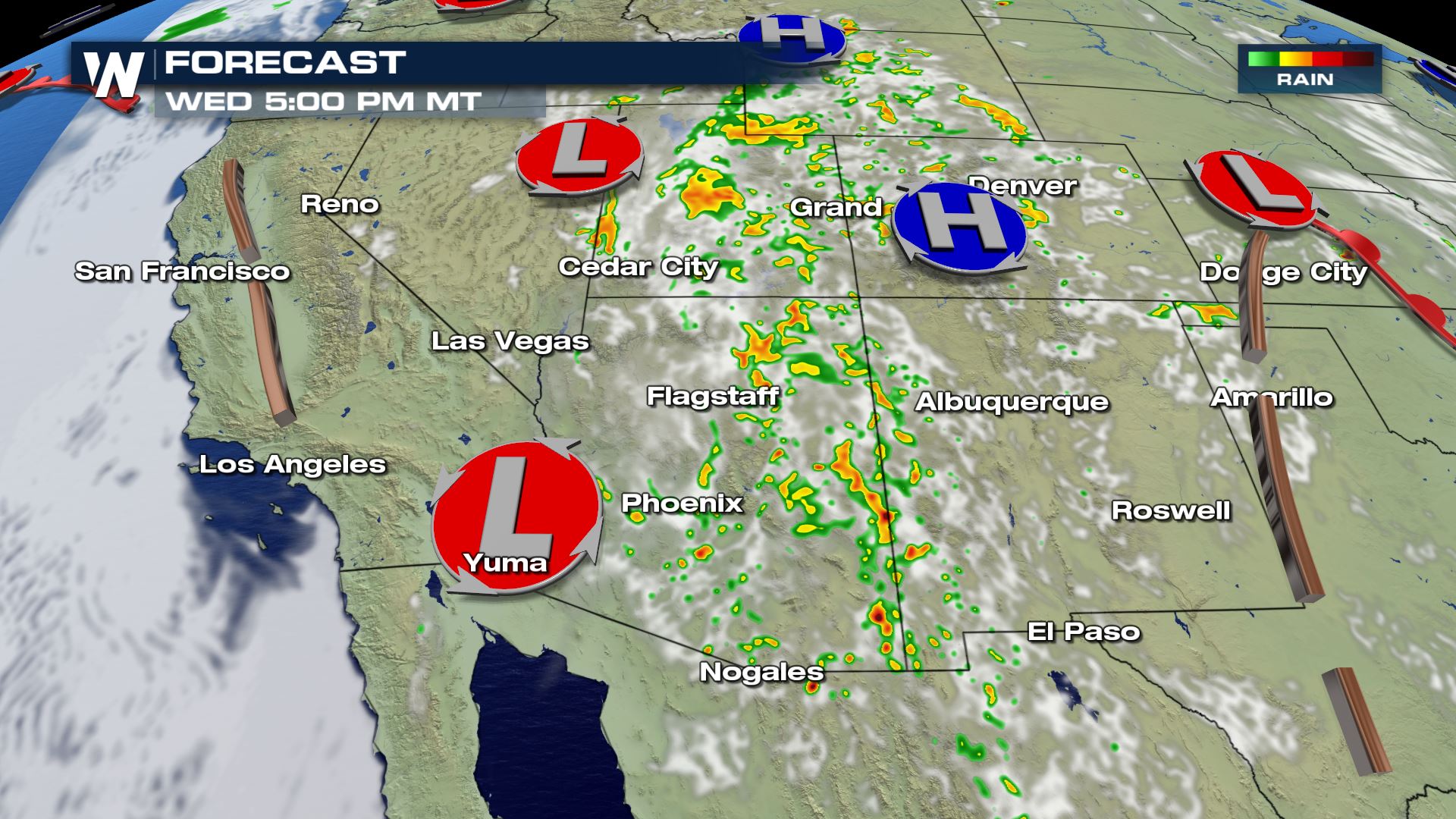
 Showers and thunderstorms typically spark up near noon each day, with daytime heating and available moisture, and usually continues through the late evening hours. Like clockwork, the cycle repeats itself through the season.
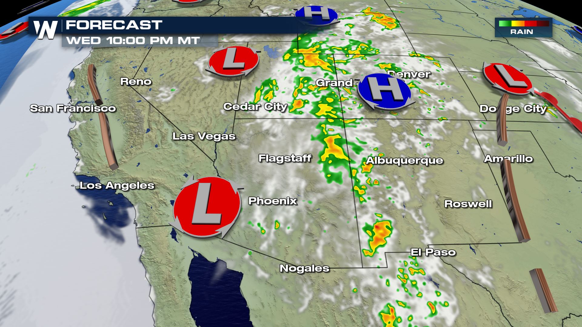
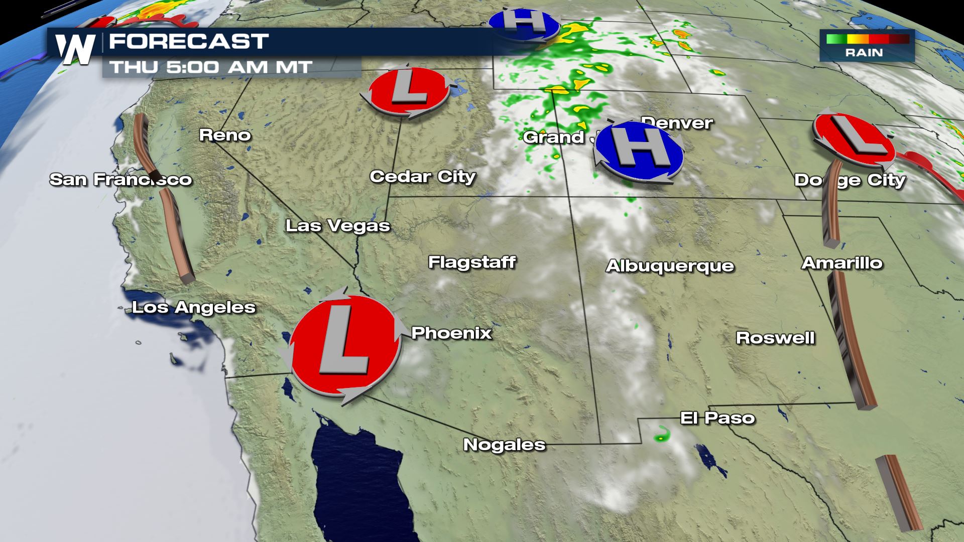
Here is the timing of shower and thunderstorm development through the next 24 hours.
Showers and thunderstorms typically spark up near noon each day, with daytime heating and available moisture, and usually continues through the late evening hours. Like clockwork, the cycle repeats itself through the season.
Here is the timing of shower and thunderstorm development through the next 24 hours.
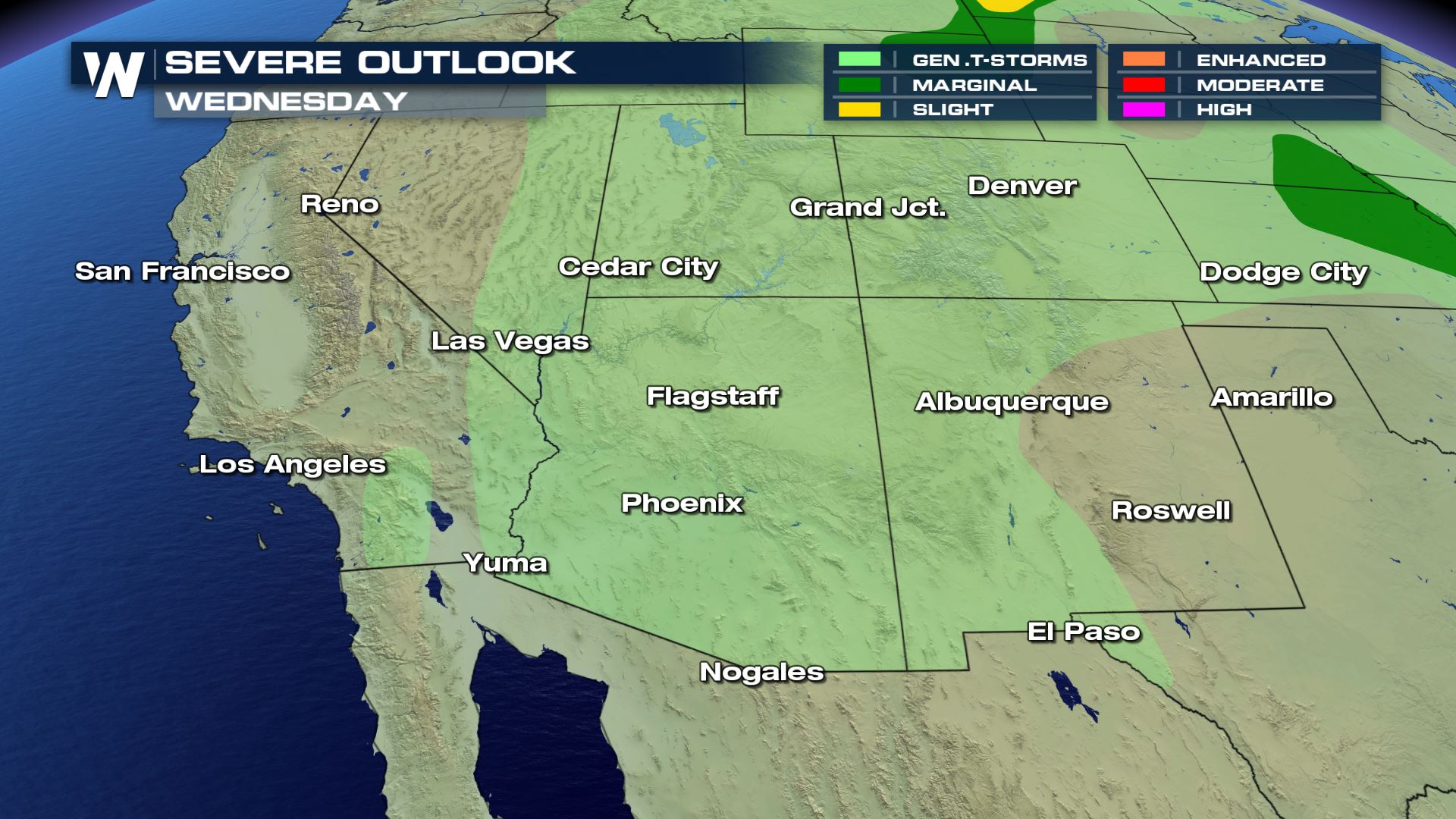
 The Storm Prediction Center, or SPC, has the area under a General Thunderstorm risk for Wednesday. This forecast will likely continue through the foreseeable future, as the dominate mid and upper features remain in place through the next month or so.
 For all things weather stay tuned to WeatherNation. I'm Meteorologist Greg Rule.
Here are the most common threats associated with the monsoon season.
This is the extended precipitation outlook for days 6 - 10 from the Climate Prediction Center, or the CPC. Here is the link for your weather curiosity; https://www.cpc.ncep.noaa.gov/
Showers and thunderstorms typically spark up near noon each day, with daytime heating and available moisture, and usually continues through the late evening hours. Like clockwork, the cycle repeats itself through the season.
Here is the timing of shower and thunderstorm development through the next 24 hours.
The Storm Prediction Center, or SPC, has the area under a General Thunderstorm risk for Wednesday. This forecast will likely continue through the foreseeable future, as the dominate mid and upper features remain in place through the next month or so.
For all things weather stay tuned to WeatherNation. I'm Meteorologist Greg Rule.
All Weather News
More

More Storms for the East Through Monday
A low-pressure system that moved through the
3 Aug 2026 12:20 PM


After Reaching Category 5, Genevieve Weakens in the Pacific
PacificGenevieve formed last Friday south of
3 Aug 2026 12:30 AM

Flooding, Severe Storms Target the Midwest Again
After an active week of storms across the nor
1 Aug 2026 1:40 AM

Flooding Risk Increases as Heavy Rain Targets the Tri-State Area
Tuesday, heavy rainfall moved across the Nort
30 Jul 2026 12:25 AM