Monsoonal Moisture Dominates Four Corners
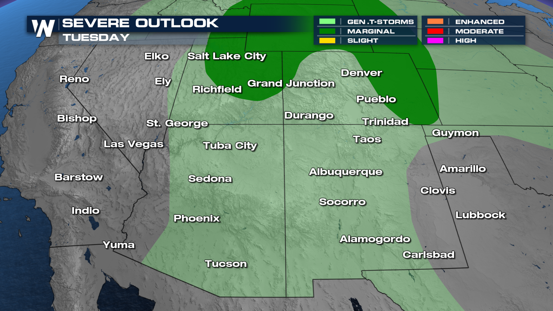
Monsoonal moisture continues to keep the desert southwest and four corners active as we start a new week. The Storm Prediction Center (SPC) added a marginal risk (level 1 out of 5) from northern Utah and southeastern Idaho. There is also a second risk for severe weather on the lee side of the Rockies and into the High Plains. The main threat for the risk over Utah and Idaho is strong winds and pockets of large hail (see above).
After showers and storms pushed through Monday, additional scattered showers and storms will be abundant across Utah, Colorado, New Mexico, and Arizona on Tuesday.
On Tuesday, the Storm Prediction Center issued a MARGINAL risk (level 1 out of 5) for portions of Utah and Colorado, meanwhile, where the more traditionally monsoonal storms are expected to happen, we have a general thunderstorm risk for Arizona and New Mexico.

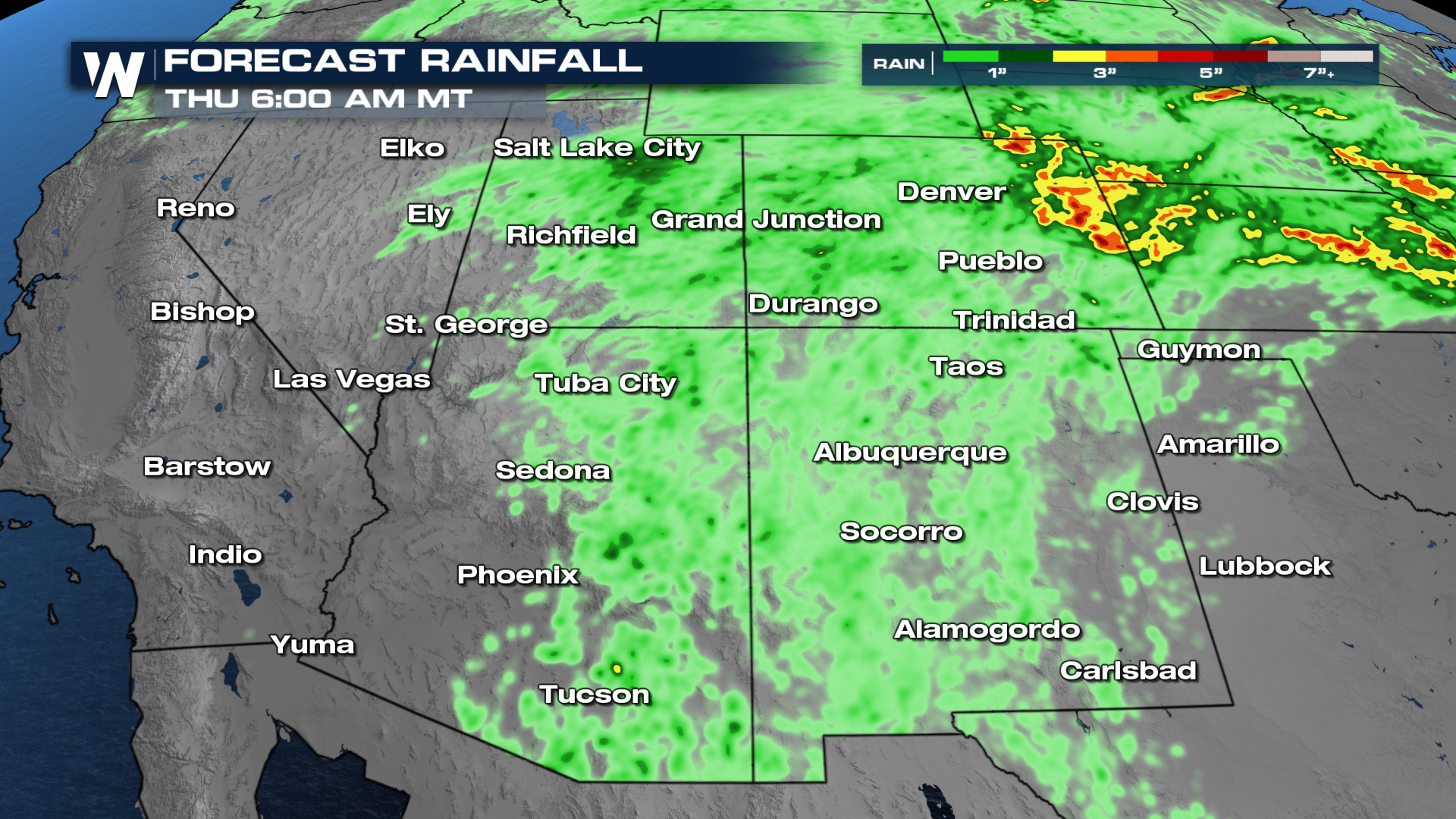
With these ongoing storms and rain showers, the flood threat is a prominent part of this forecast. We run the risk of seeing over 1-3" of rain in multiple different places. Use extra caution if you plan on spending some time along trails in south-central Utah. Some of the trails there are notorious for flash-flooding. So, make sure you read the cautionary signs at the start of each trailhead closely.
