More Active Weather Ahead for the Northwest
Top Stories
27 May 2021 1:50 PM
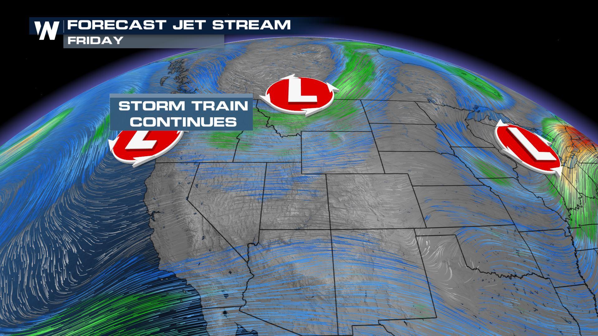
Another round of active weather is headed to the Northwest as a strong front will move onshore Thursday night into Friday, bringing widespread showers & the thunderstorm possibility before the weekend.
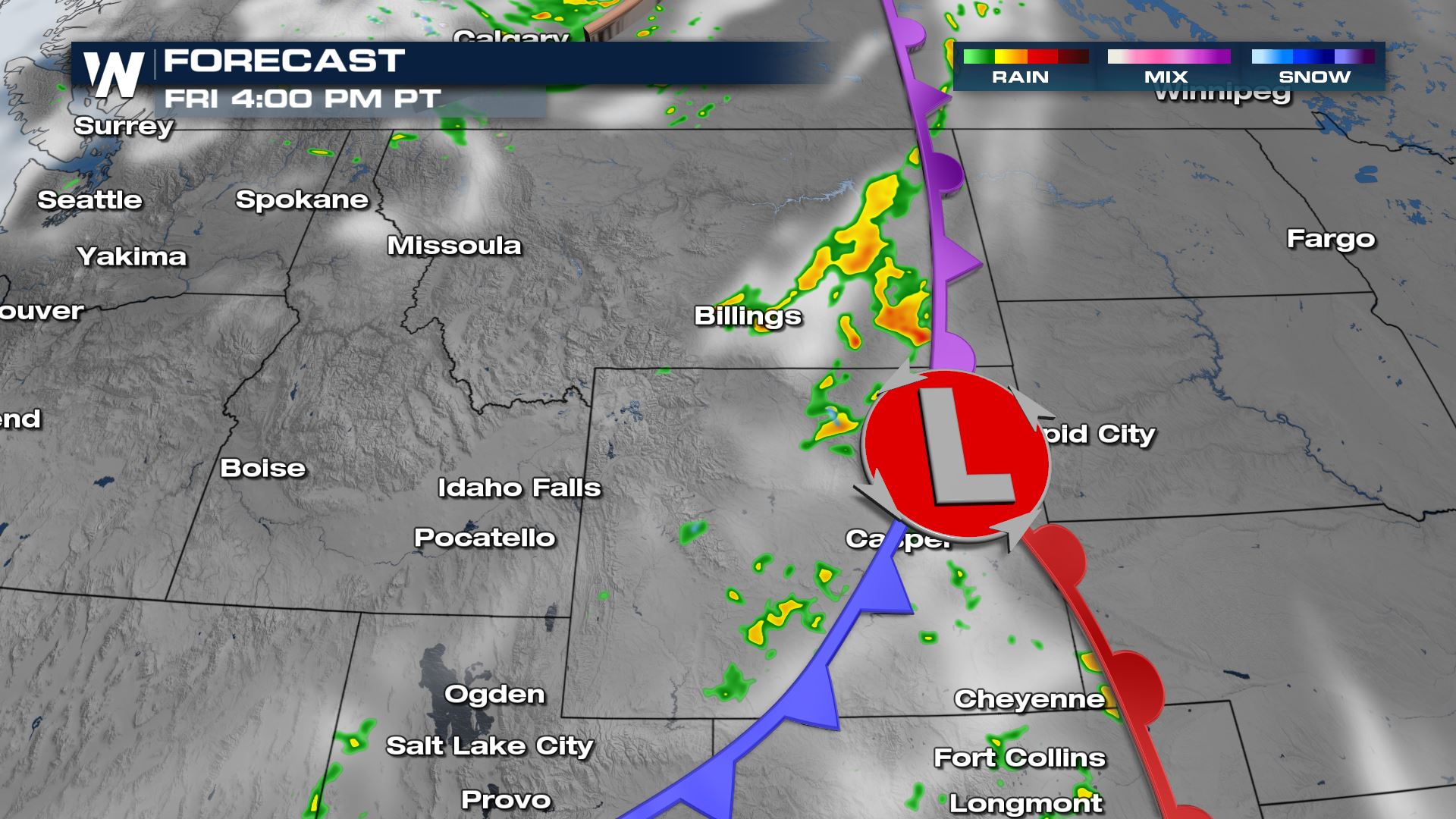
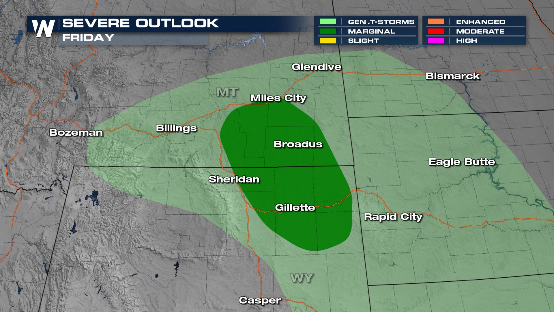
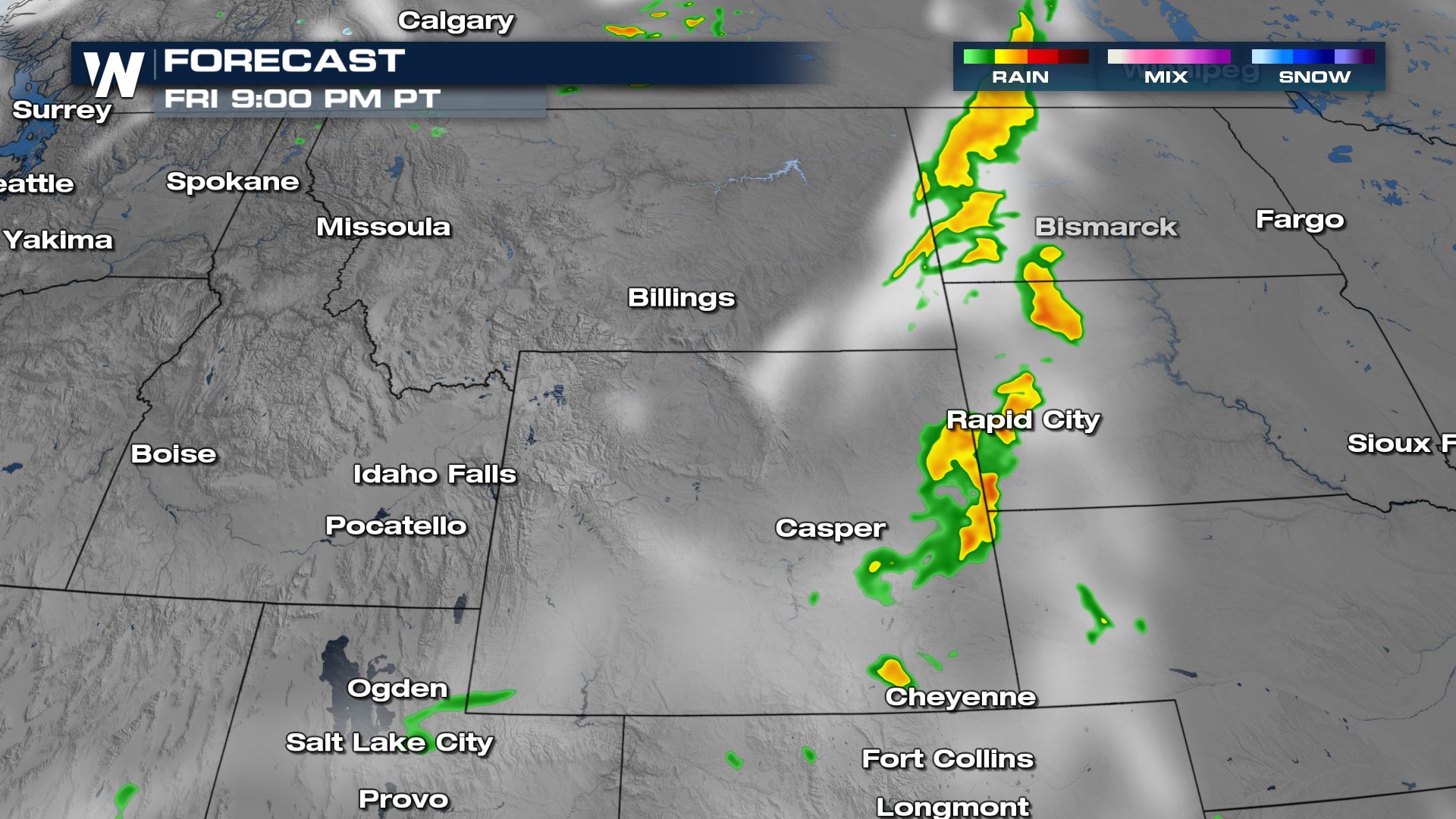 As the front pushes inland, more thunderstorms will develop east of the Rocky Mountains, with a marginal risk (level 1 out of 5 on the severe weather scale) for Montana and northern Wyoming on Friday. Severe weather threats include gusty winds and large hail.
 We are covering the unsettled weather in the Northwest as one of our top weather headlines on WeatherNation but also in your West Regional Forecast, :50 after the hour, every hour!
Alerts
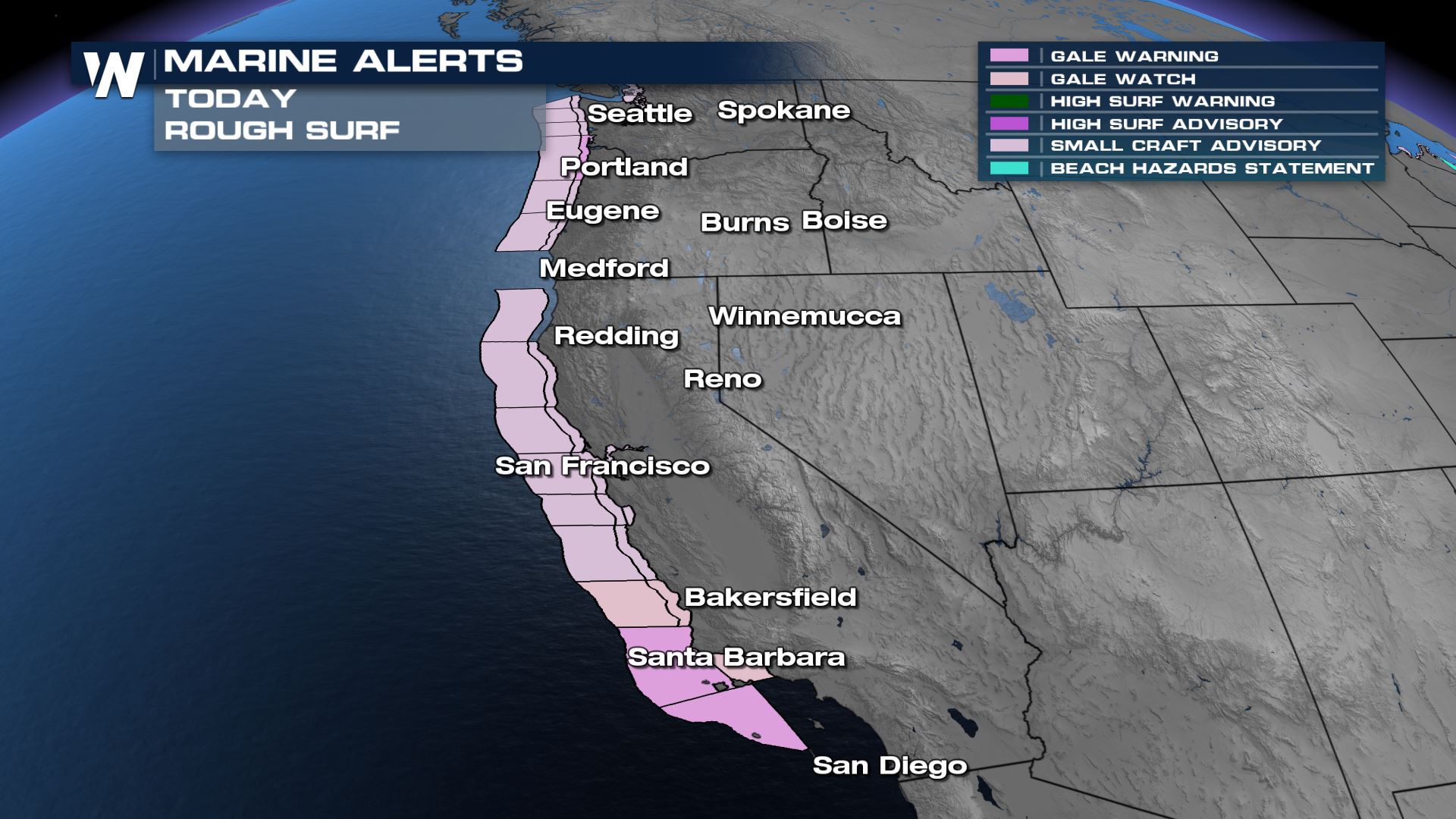
High surf is anticipated along the Pacific coastline through Thursday, with wave heights between 6-10 ft and gusts up to 35kts. If you are headed to the water, make sure you're at a life-guarded beach or staying out of the water!
Forecast
Lingering shower activity is anticipated through the afternoon and evening on Thursday, with the potential for a little snow mixing in for the higher terrain of the Cascades. Rain & snow showers should diminish as we head into Friday morning with drier air & sunshine returning for the weekend.
As the front pushes inland, more thunderstorms will develop east of the Rocky Mountains, with a marginal risk (level 1 out of 5 on the severe weather scale) for Montana and northern Wyoming on Friday. Severe weather threats include gusty winds and large hail.
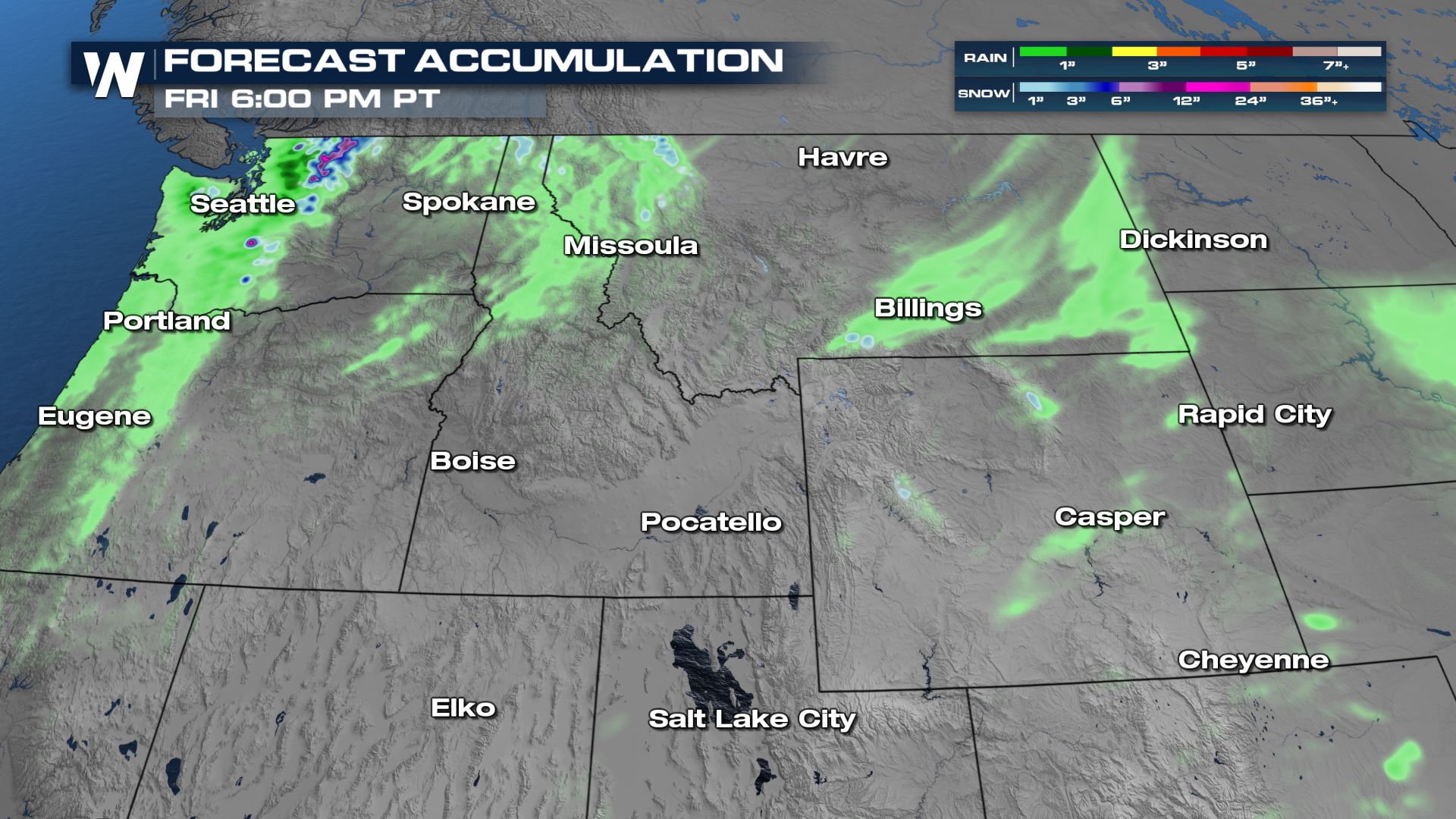
Forecast Accumulation
With shower & thunderstorm activity we could see a few pockets of rainfall across western Washington in the range of 2-4", but generally rainfall accumulation will be less than 1" in many locations. Snow accumulation will also be limited to the high peaks and will be in the range of 1-2".
We are covering the unsettled weather in the Northwest as one of our top weather headlines on WeatherNation but also in your West Regional Forecast, :50 after the hour, every hour!All Weather News
More
Fronts Continue To Spark Severe Weather Across the Plains
A cold front that brought record lows to the
18 Jul 2025 10:40 PM

Extreme Heat Impacts for the East Coast & South
Extreme heat continues to impact several area
18 Jul 2025 10:05 PM

Flooding Threat Remains Elevated in the East
A cold front pushing through the Eastern Seab
18 Jul 2025 9:10 PM

EF-2 Firenado from the Deer Creek Fire in Utah
A fire tornado was spotted near La Sal, Utah
18 Jul 2025 7:30 AM

Tropical System Brings Flood Risk to the Central Gulf
Time has run out for notable tropical develop
18 Jul 2025 3:05 AM

Heavy Rain, Flooding Threat Returns to Florida
Keep the rain boots handy in Florida - heavy
13 Jul 2025 12:50 PM

Severe Storm Risk Pushes into the Great Lakes, Ohio Valley
Friday was another busy day with severe weath
12 Jul 2025 8:00 PM