More Moisture for the PNW
The Northwestern United States has been hammered by wave after wave of rain and snowfall over the last few days, causing rivers to run high, flooding around cities and recent area burn scars. The Stillaguamish River reached MAJOR flood stage and set a new record for river height in northern Washington, which caused the river to overflow its banks into the city of Arlington and a state of emergency issued in Oregon following heavy rain that washed out roadways.
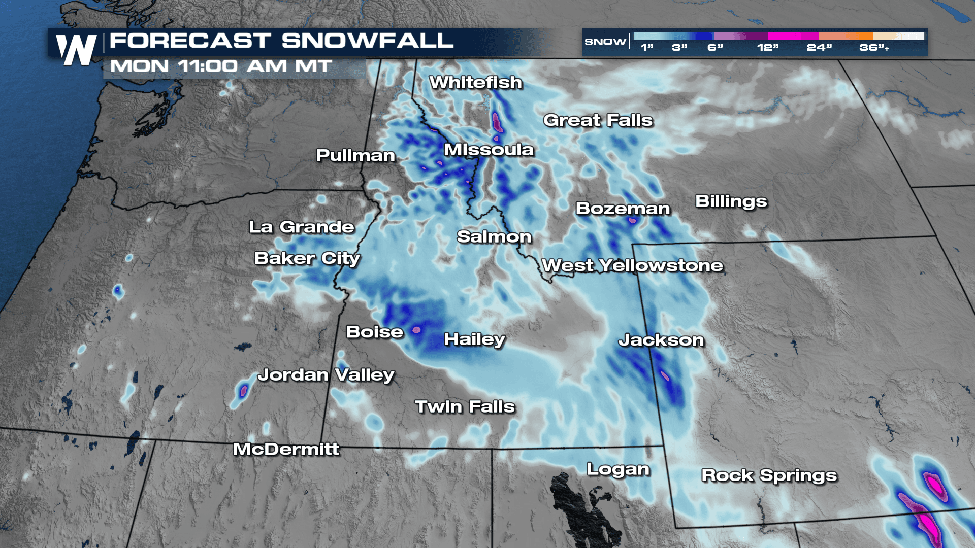
The heavy rainfall across the PNW is mainly responsible for the high-running rivers. Secondly, the PNW also saw record warm temperatures, which caused a rapid melt of recent snowfall in the Cascades into rivers, creeks, and streams. Snow chances continue across the Rockies for the first half of today. High pressure moves in for Tuesday, but another cold front arrives on Wednesday.
As additional snow continues for the weekend there could be upwards of 6" depending on elevation. The snowfall is good news, especially for the Cascades, where snowpack has significantly melted due to recent warm temperatures and rainfall.
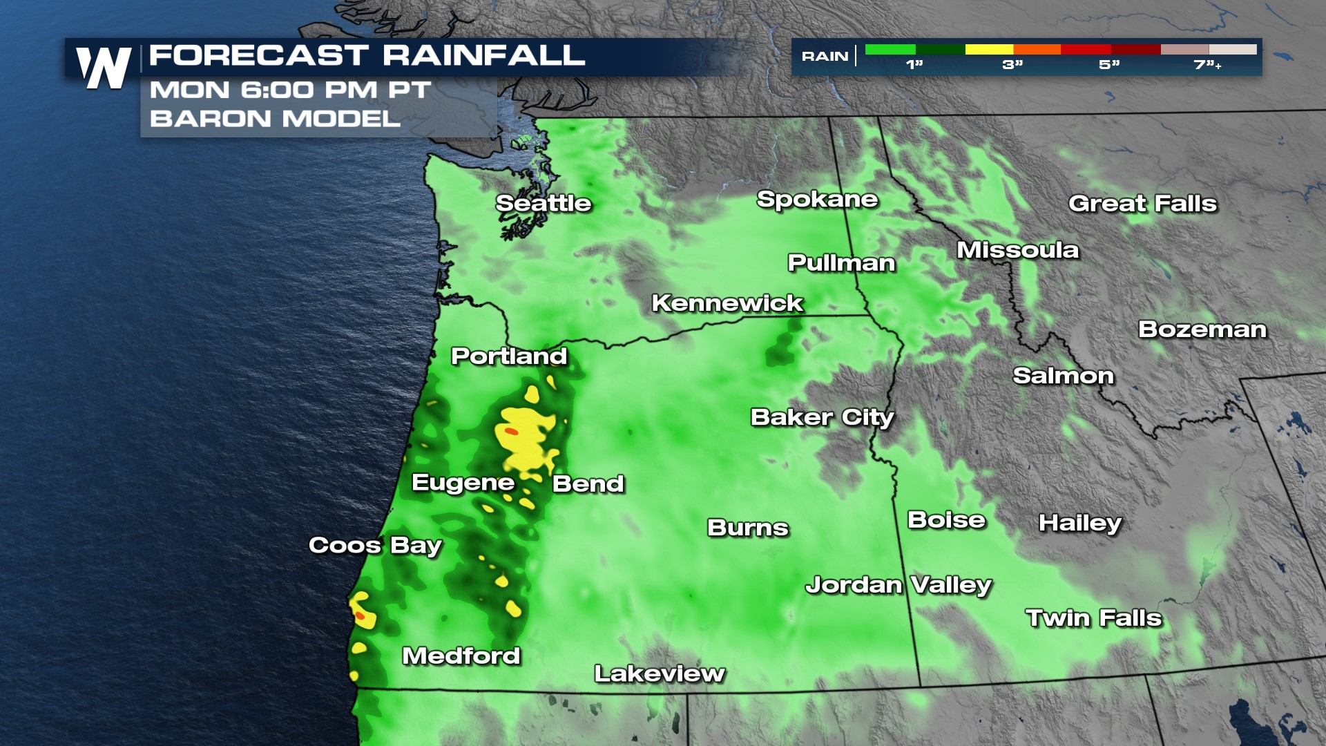
 Rainfall totals will not be as impressive as this past week, but still a couple inches of new rainfall will be possible for the spine of the Cascades, which will elevate the flood threat given how saturated soils are in the area. Please avoid rivers, creeks and streams and be aware of any mountain roadways for mudslides and debris flow.