NYC Sees First 1" of Snow in Almost 2 Years
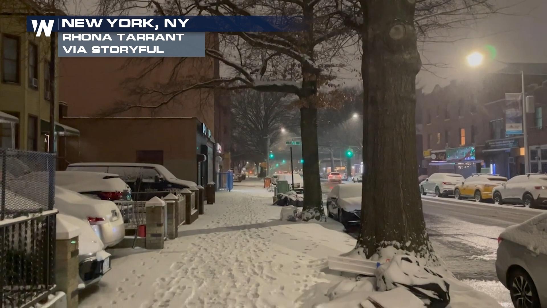
Multiple systems over the last few weeks have brought rain, snow, and flooding to the Northeast. The current system is bringing snow to some spots that haven't seen snow in quite some time! The snow drought has finally ended for cities like Washington D.C, which has finally seen over an inch of snow for the first time in 728 days. Baltimore also broke its snow drought, with over an inch of snow reported Monday evening. This was the first time Baltimore has seen an inch or more of snow in 716 days.
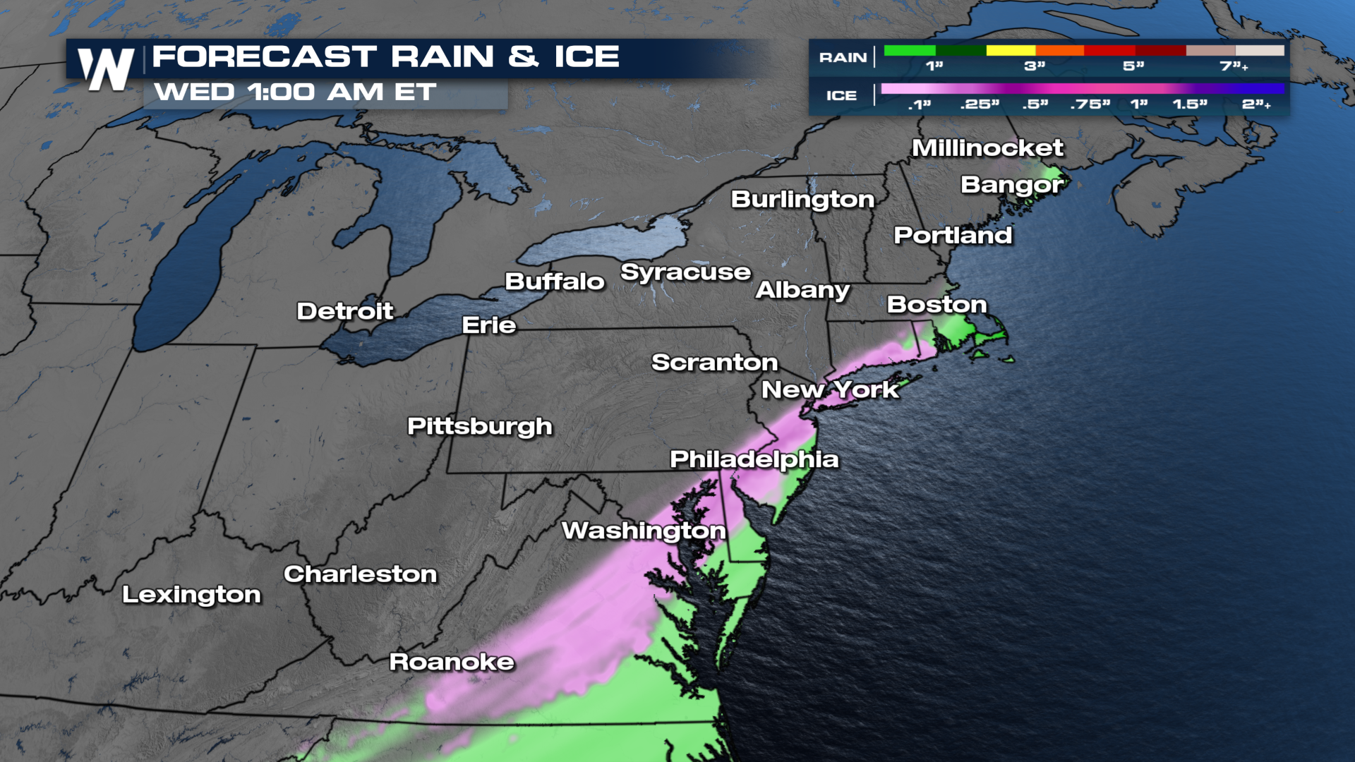
 Cities to include Boston, Hartford, Pittsburgh, and Syracuse will be impacted by the snowfall through midday and early afternoon. This will continue north through New England seeing most of its impacts on Tuesday afternoon. Most snow will wrap up by sundown tonight, departing Maine and New Hampshire last. Winter weather alerts remain in effect through Tuesday evening for much of the Mid-Atlantic and the Northeast.
As this system continues to move up the coast, it will make commutes on Tuesday difficult with snow for many locations, and freezing rain for the immediate coast. On average folks can see 1 to 3 inches of snow, but some isolated snowfall totals of up to 6 inches will be possible in far northern Maine. Not only will the snowfall impact the morning commute but there's a possibility of freezing rain in areas like Roanoke, Washington D.C., Philadelphia, and New Haven, CT. Keep this in mind as you don't need to see a lot of ice accumulate on the roads to make them slick.