Wet Weather in the Northeast Today & Saturday
Another wet start to the weekend is ahead for the Northeast, but thankfully Sunday looks dry for most. An upper-level low and cold front working in tandem with a coastal low will will produce rain and mountain snowfall, which could impact folks traveling early for the Thanksgiving holiday. Our in-house forecast model pushes the coastal low away from the Atlantic U.S. as the front moves through, keeping the worst of the impacts out to sea. Still, gusty winds and rough surf are likely to be felt late Friday into Saturday in southeast New England north through Downeast Maine.
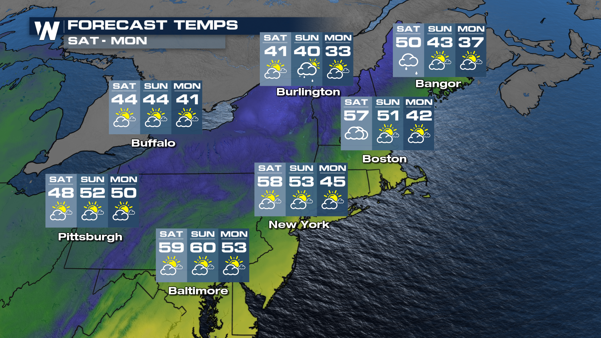
Temperatures will be cooler by the end of the weekend, dropping under the influence of cloud cover and intrusion of cold air from Canada. Highs will struggle to make it out of the 40s for the I-95 corridor on Sunday and Monday of next week.
