Morning Severe Storm Risk for the Mississippi Valley Today

Top Stories
11 Mar 2020 6:33 AM
A very active morning is on the way for the lower Mississippi Valley with a risk for large hail, damaging winds and a few tornadoes. Here is the latest severe forecast.
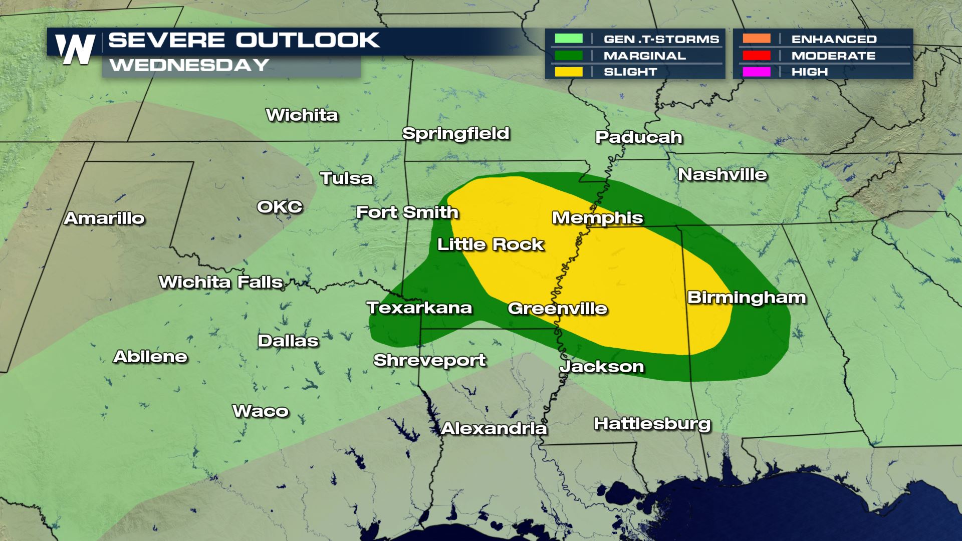 Areas from Texas to the Central Gulf Coast States will see that potential for strong to severe storms. After the morning storms move out of these areas, we could see some more development during the peak heating hours of the afternoon.
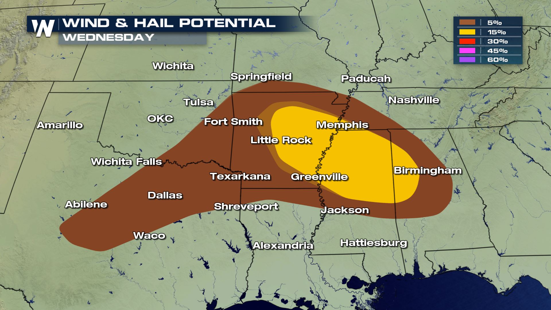
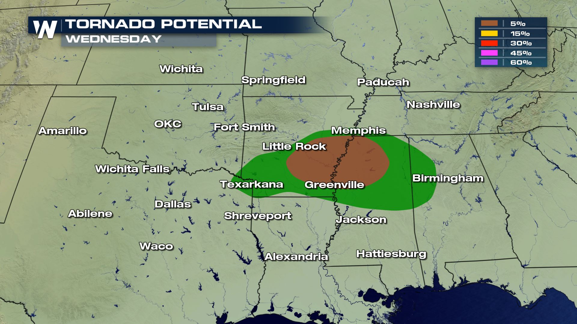 All modes of severe weather will be in the forecast today and all these severe risks will be on the higher side. A severe t'storm watch or a tornado watch could be issued in these areas later today.
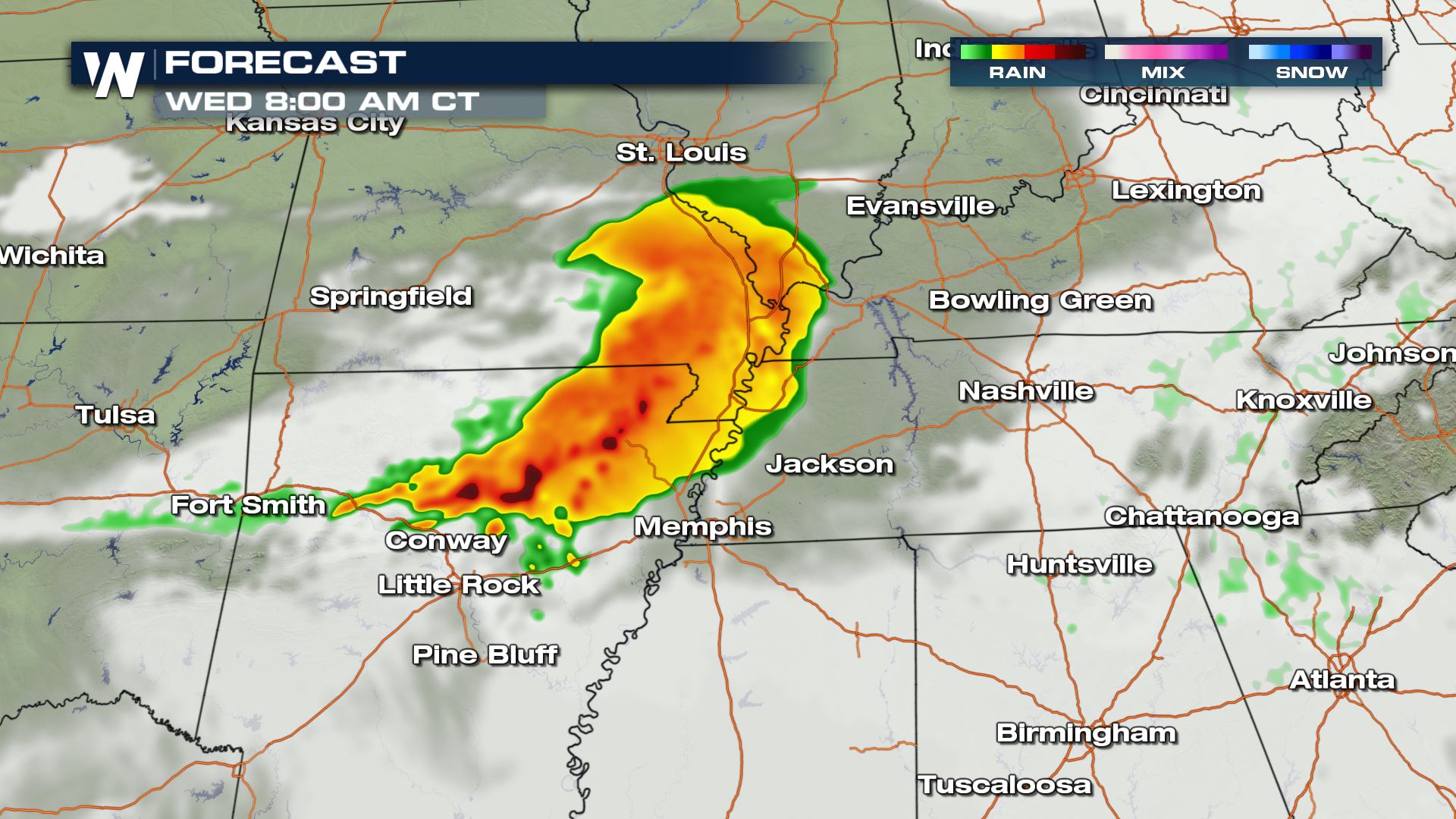
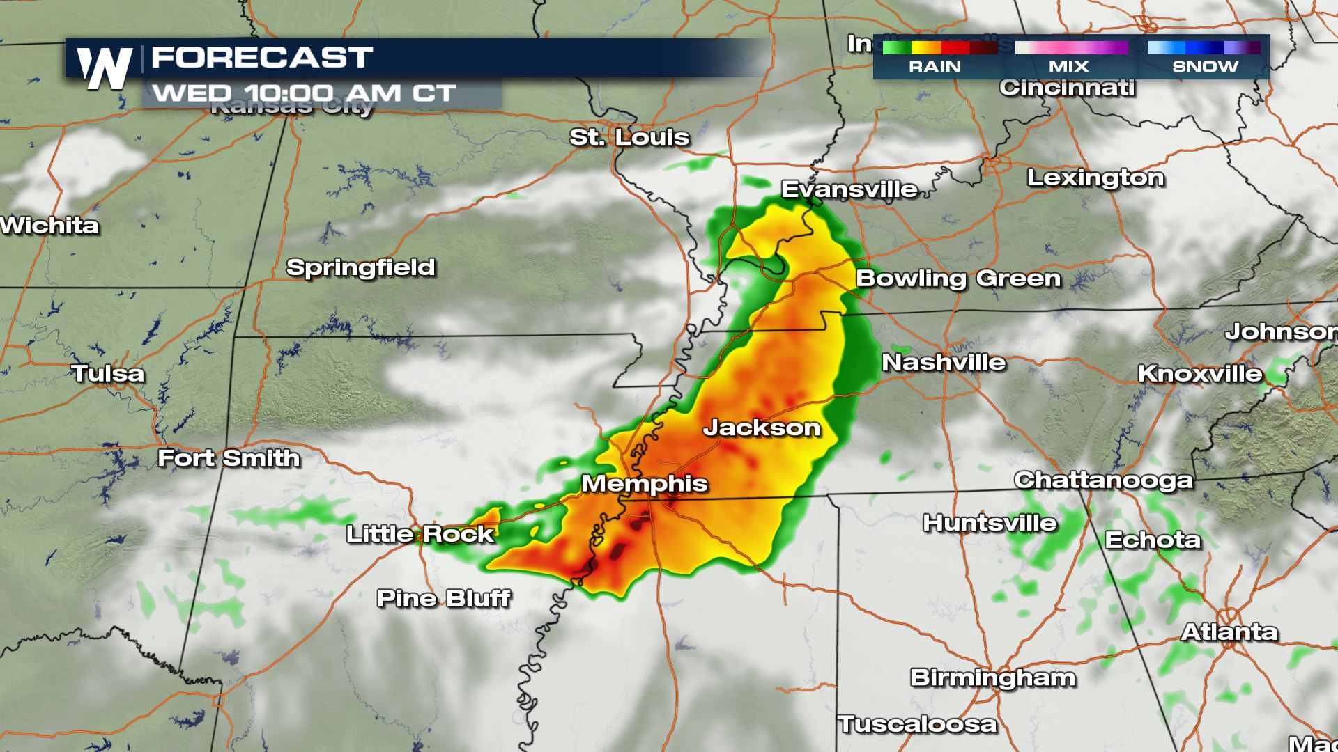
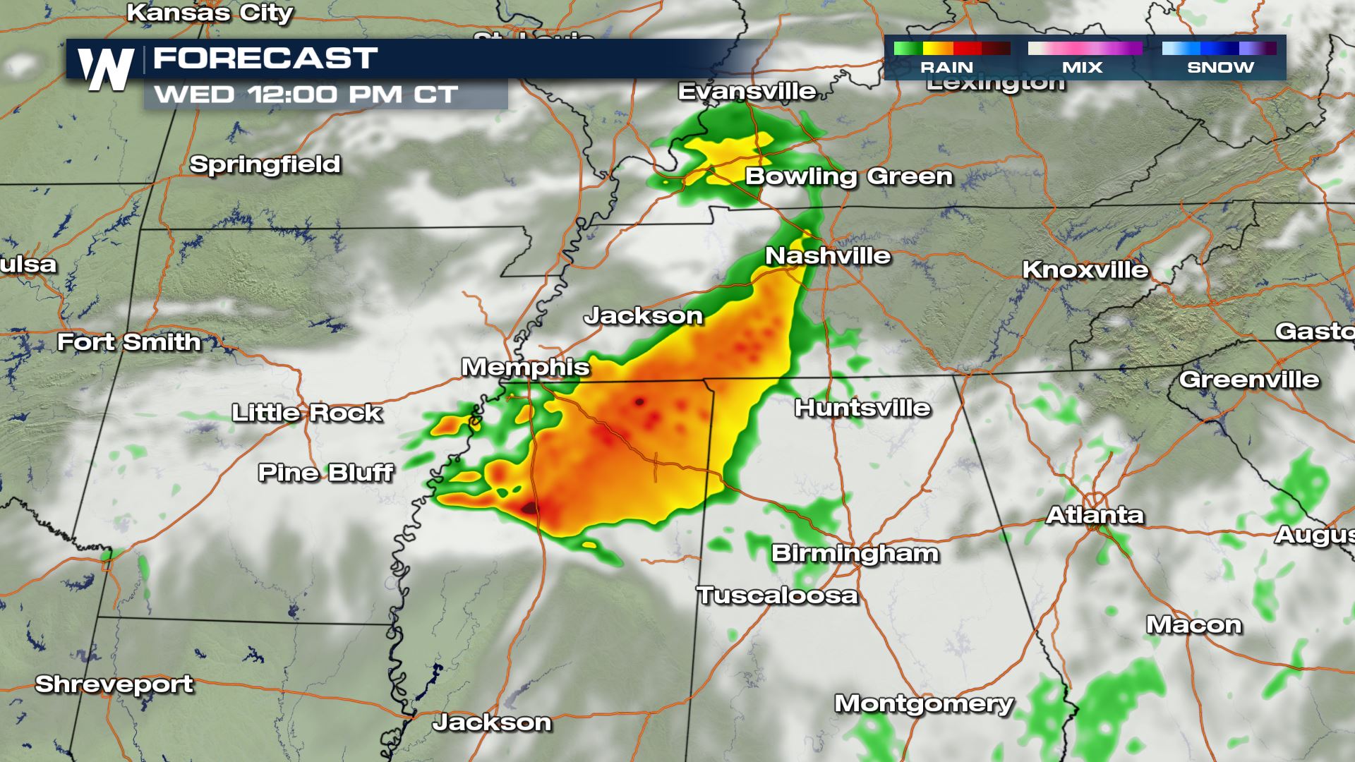 There is the latest timing of the complex heading South. The storms will be impacting Middle Tennessee and Mississippi by lunch time. Keep checking with WeatherNation for more updates on today's storms.
Severe Outlook
Areas from Texas to the Central Gulf Coast States will see that potential for strong to severe storms. After the morning storms move out of these areas, we could see some more development during the peak heating hours of the afternoon.
Severe Risks
All modes of severe weather will be in the forecast today and all these severe risks will be on the higher side. A severe t'storm watch or a tornado watch could be issued in these areas later today.
Forecast
There is the latest timing of the complex heading South. The storms will be impacting Middle Tennessee and Mississippi by lunch time. Keep checking with WeatherNation for more updates on today's storms.
All Weather News
More
More Storms for the East Through Monday
A low-pressure system that moved through the
3 Aug 2026 12:20 PM


After Reaching Category 5, Genevieve Weakens in the Pacific
PacificGenevieve formed last Friday south of
3 Aug 2026 12:30 AM

Flooding, Severe Storms Target the Midwest Again
After an active week of storms across the nor
1 Aug 2026 1:40 AM

Flooding Risk Increases as Heavy Rain Targets the Tri-State Area
Tuesday, heavy rainfall moved across the Nort
30 Jul 2026 12:25 AM

Severe Weather: Energy From the Midwest Now in the Southeast
UPPER MIDWEST - Through Monday, dangerous tor
29 Jul 2026 10:30 PM