Too Much Rain in the Southeast... Not Enough in the Southwest
Special Stories
13 Apr 2018 11:48 AM
When it comes to rainfall in the southern portion of the country, lately, it's been either feast or famine. And this trend will certainly hold true right through the weekend.
There is a major storm system coming out of the plains. The northern side of the storm will produce blizzard conditions in South Dakota and Nebraska. The southern side of the system will produce more spring-like storms, including severe storms. And rain totals in many areas of the southeast could be quite high.
Heavy rain will spread into Arkansas and Missouri today.
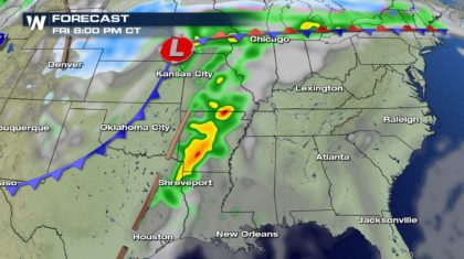 The rain will shift into Louisiana, Mississippi, Alabama, and Tennessee on Saturday.
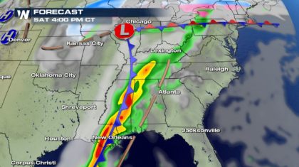 On Sunday, soaking rain will be possible in Georgia, Florida, and the Carolinas.
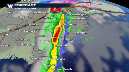 Rainfall accumulations will be significant in many areas. These are highlighted by the yellow, orange, and red shaded areas. Rainfall in these areas will range from two to four inches. Some spots could pick up five inches of rain!
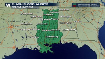
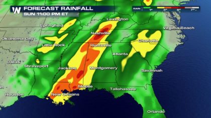 Too much rain may come down, too quickly, overwhelming streams, rivers, and creeks, which could lead to flash flooding. Flash Flood Watches are already in effect for Mississippi and surrounding areas through Saturday night.
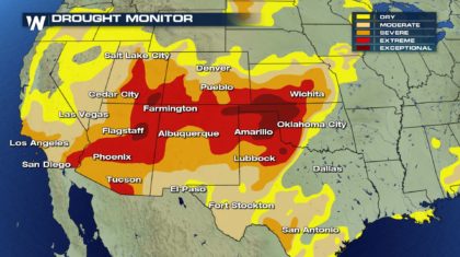
 It's pretty obvious that there's no shortage of rain in the southeast. But in the southwest, residents there would love to see that much rain. Take a look at the latest Drought Monitor. All of the red shaded areas are in Extreme or Exceptional Drought. Moisture is desperately needed there. Unfortunately, there is no rain in the near term forecast.
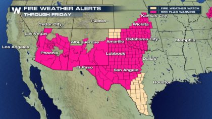
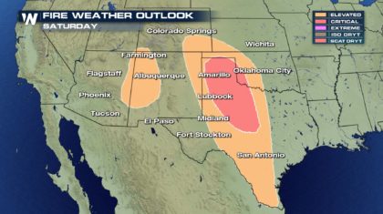
 It has been so dry and windy, Red Flag Warnings are up for an extensive area today, stretching from Arizona, all the way into Kansas and Oklahoma. Outdoor burning is highly discouraged.
 Wildfire danger is Extreme today in portions of Oklahoma, Texas, and New Mexico.
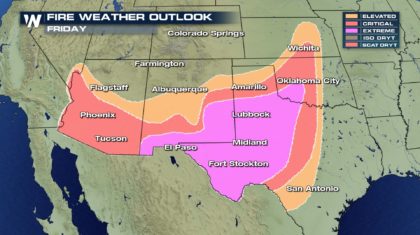 The fire danger will subside a little on Saturday due to lighter winds.
 Hopefully the southwest will have a healthy monsoon season, which usually begins in June. Soaking rains are not likely before then.
For WeatherNation: Meteorologist Matt Monroe
 The rain will shift into Louisiana, Mississippi, Alabama, and Tennessee on Saturday.
 On Sunday, soaking rain will be possible in Georgia, Florida, and the Carolinas.
 Rainfall accumulations will be significant in many areas. These are highlighted by the yellow, orange, and red shaded areas. Rainfall in these areas will range from two to four inches. Some spots could pick up five inches of rain!
 Too much rain may come down, too quickly, overwhelming streams, rivers, and creeks, which could lead to flash flooding. Flash Flood Watches are already in effect for Mississippi and surrounding areas through Saturday night.
 It's pretty obvious that there's no shortage of rain in the southeast. But in the southwest, residents there would love to see that much rain. Take a look at the latest Drought Monitor. All of the red shaded areas are in Extreme or Exceptional Drought. Moisture is desperately needed there. Unfortunately, there is no rain in the near term forecast.
 It has been so dry and windy, Red Flag Warnings are up for an extensive area today, stretching from Arizona, all the way into Kansas and Oklahoma. Outdoor burning is highly discouraged.
 Wildfire danger is Extreme today in portions of Oklahoma, Texas, and New Mexico.
 The fire danger will subside a little on Saturday due to lighter winds.
 Hopefully the southwest will have a healthy monsoon season, which usually begins in June. Soaking rains are not likely before then.
For WeatherNation: Meteorologist Matt Monroe
Hopefully the southwest will have a healthy monsoon season, which usually begins in June. Soaking rains are not likely before then.
For WeatherNation: Meteorologist Matt MonroeAll Weather News
More