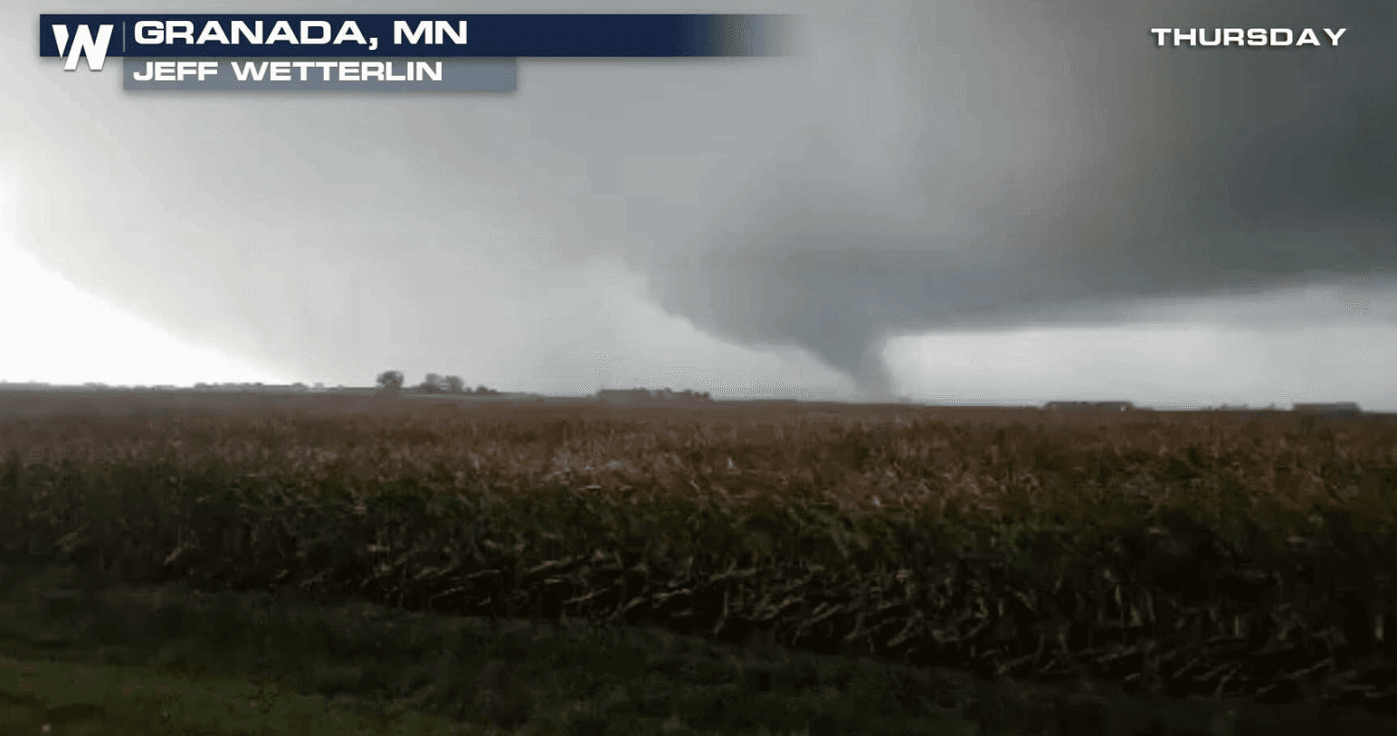
Multiple Tornadoes Reported in Minnesota Thursday
Special Stories
21 Sep 2018 8:52 PM
A line of severe thunderstorms moved through southern Minnesota into west central Wisconsin during Thursday. There were several tornadoes reported, producing extensive damage across multiple counties. So far, 10 tornadoes have been confirmed. The largest near Lake Elysian and Waterville was given a strength of EF-2 with wind speeds up to 135 mph.
https://twitter.com/LauraBetker/status/1043320658355265537
https://twitter.com/WeatherNation/status/1042991240935927809
https://twitter.com/kare11/status/1043182727640563712
A warm front in Iowa quickly surged north during the late afternoon as a strengthening low pressure system moved northeast from Nebraska toward southern Minnesota. A broken line of strong to severe storms developed from the low pressure system southward ahead of the attendant cold front. These storms raced northeast at up to 70 mph, and moved through the region around 4:30 to 8 p.m.
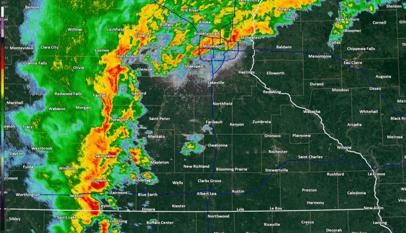 [MPX Radar loop from 5:31 p.m. to 7:49 p.m. CDT on Thursday, 9/20. From NWS Chanhassen]
https://twitter.com/NWSTwinCities/status/1043213270155501568
Strong wind gusts were also reported across the region, with speeds as high as 70 mph in Mankato.
https://twitter.com/NWSTwinCities/status/1043109406425145346
https://twitter.com/NWSTwinCities/status/1043096657473282049
National Weather Service storm surveys will continue on Saturday and we will provide more information to you once it becomes available.
Information from NWS Twin Cities/Chanhassen
For WeatherNation: Meteorologist Mace Michaels
[MPX Radar loop from 5:31 p.m. to 7:49 p.m. CDT on Thursday, 9/20. From NWS Chanhassen]
https://twitter.com/NWSTwinCities/status/1043213270155501568
Strong wind gusts were also reported across the region, with speeds as high as 70 mph in Mankato.
https://twitter.com/NWSTwinCities/status/1043109406425145346
https://twitter.com/NWSTwinCities/status/1043096657473282049
National Weather Service storm surveys will continue on Saturday and we will provide more information to you once it becomes available.
Information from NWS Twin Cities/Chanhassen
For WeatherNation: Meteorologist Mace MichaelsAll Weather News
More
Wildfire Outbreak in the Pacific Northwest
Conditions have been incredibly dry out west.
2 Aug 2026 1:30 PM

After Reaching Category 5, Genevieve Weakens in the Pacific
PacificGenevieve formed on last Friday south
2 Aug 2026 1:25 PM

More Storms for the East Sunday and Monday
A low-pressure system crashing through the Mi
2 Aug 2026 1:25 PM


Flooding, Severe Storms Target the Midwest Again
After an active week of storms across the nor
1 Aug 2026 1:40 AM

Flooding Risk Increases as Heavy Rain Targets the Tri-State Area
Tuesday, heavy rainfall moved across the Nort
30 Jul 2026 12:25 AM

Severe Weather: Energy From the Midwest Now in the Southeast
UPPER MIDWEST - Through Monday, dangerous tor
29 Jul 2026 10:30 PM