Narrow Band of Heavy Snow in the Upper Midwest & Great Lakes
Special Stories
18 Apr 2018 10:07 AM
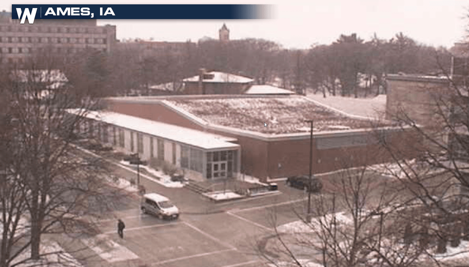
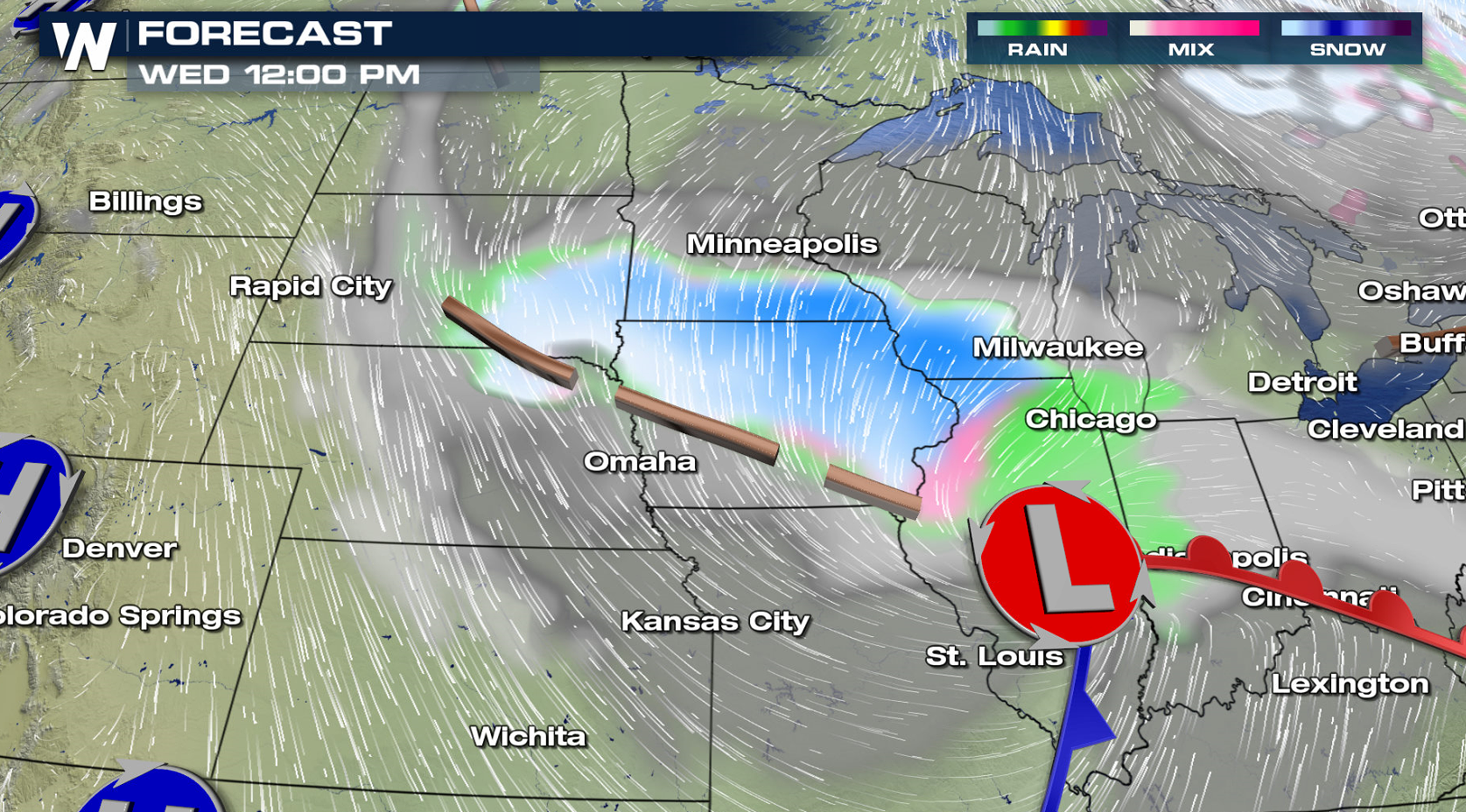
A narrow band of heavy snow has been falling in parts of central Iowa and eastern Nebraska and is expected to continue throughout the day. Winter Storm Warnings remain in effect over Iowa, Wisconsin, Minnesota and Illinois.
https://twitter.com/NWSSPC/status/986619903359713282
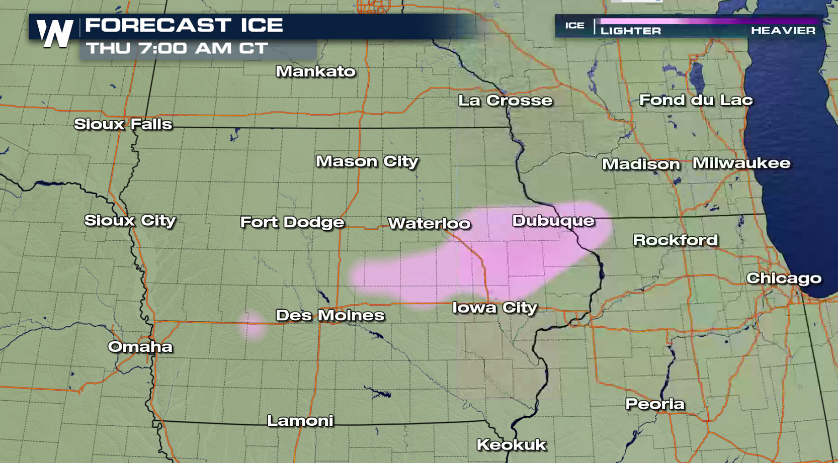
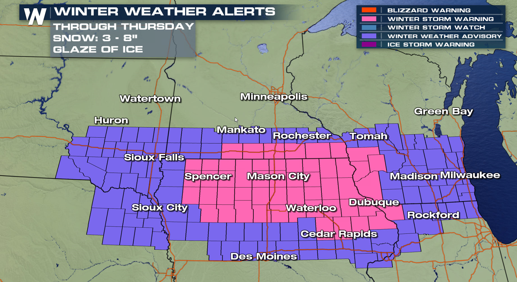 A few areas will see 6"+ of snow, with some sleet and freezing rain mixing near I-80. The heaviest accumulation will be in a narrow swath from northern Iowa to southern Wisconsin.
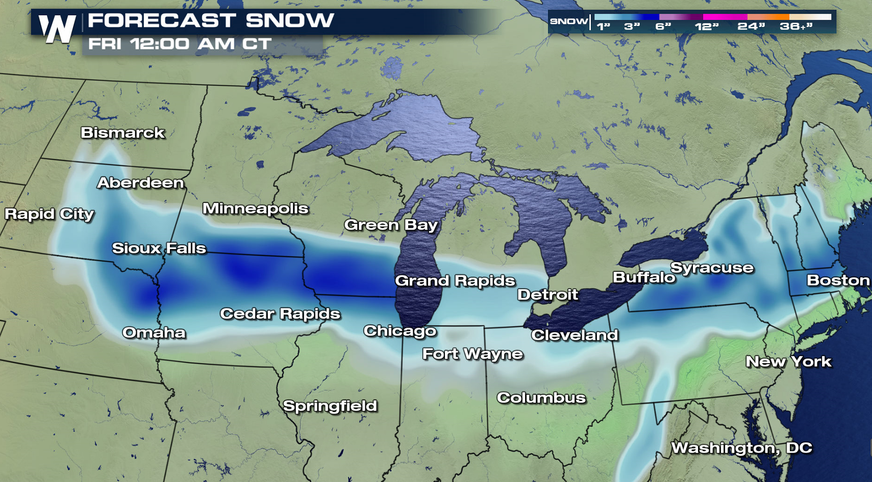
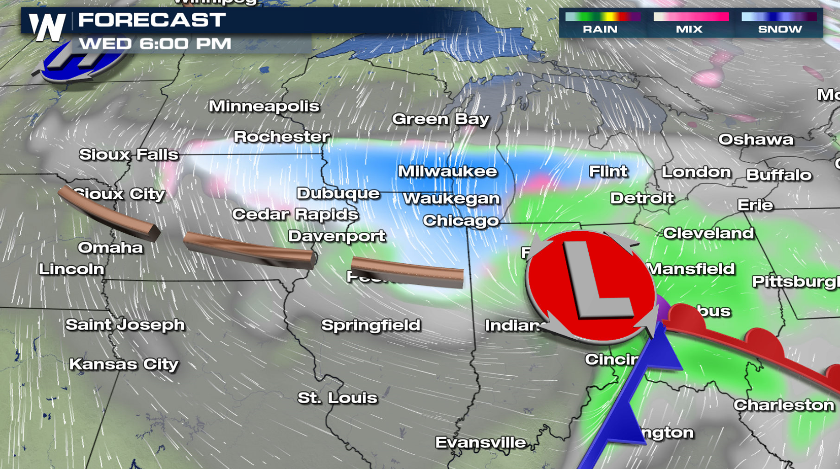
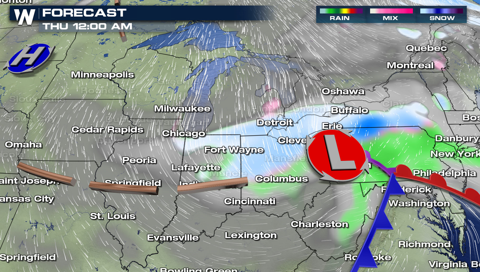
 The low pressure center will move out of the Plains and into the Ohio Valley. Behind the low in the colder air, slushy snow will accumulate into the evening. Snow will continue to fall into Thursday, although warm air is expected to mix into the storm. This will diminish intensity and accumulations as the system tracks to the east.
 For WeatherNation: Meteorologist Mace Michaels
A few areas will see 6"+ of snow, with some sleet and freezing rain mixing near I-80. The heaviest accumulation will be in a narrow swath from northern Iowa to southern Wisconsin.
The low pressure center will move out of the Plains and into the Ohio Valley. Behind the low in the colder air, slushy snow will accumulate into the evening. Snow will continue to fall into Thursday, although warm air is expected to mix into the storm. This will diminish intensity and accumulations as the system tracks to the east.
For WeatherNation: Meteorologist Mace MichaelsAll Weather News
More

Severe Storms Target the Midwest to the Northeast This Week
Extreme heat will be a big story this week ac
27 Jul 2026 1:50 AM


Tropics: Fausto Heads to Hawaii; Genevieve Rapidly Intensifying
Atlantic BasinBertha has dissipated after mov
27 Jul 2026 1:40 AM

Southeast Flood Risk Lingers Near Stalled Front
A stalled boundary over the Southeast will ke
25 Jul 2026 10:55 AM

Another Round of Storms Targets the Northeast
Tuesday brought severe weather again across p
23 Jul 2026 1:15 AM

Another Round of Severe Weather for the Upper Midwest and Great Lakes
The upper-level low train continues to keep t
21 Jul 2026 1:45 AM