NASA/NOAA: 2024 Warmest Year On Record

CREDIT: NASA/NOAA
ASSESSING THE GLOBAL CLIMATE IN 2024
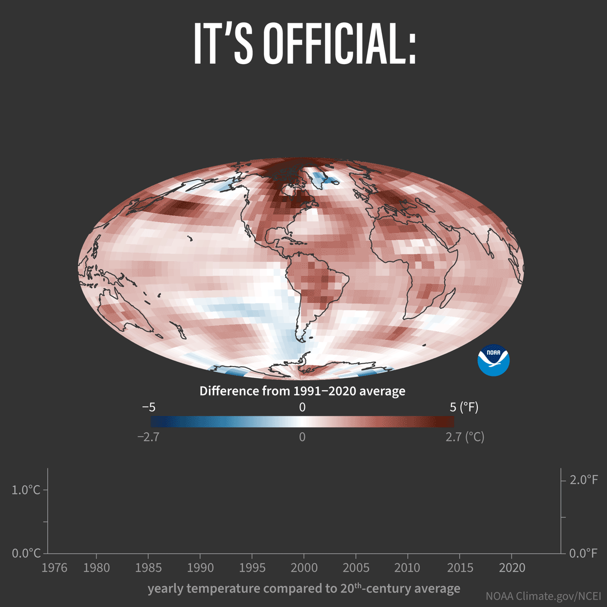
It’s official: 2024 was the planet’s warmest year on record, according to an analysis by scientists from NASA and NOAA’s National Centers for Environmental Information (NCEI).
Below are highlights from NOAA’s 2024 annual global climate report:
 CLIMATE BY THE NUMBERS
Earth’s average land and ocean surface temperature in 2024 was 2.32 degrees F (1.29 degrees C) above the 20th-century average — the highest global temperature among all years in NOAA’s 1850-2024 climate record. It was 0.18 of a degree F (0.10 of a degree C) warmer than 2023, which was previously the warmest year on record.
Regionally, Africa, Europe, North America, Oceania and South America (tied with 2023) had their warmest year on record. Asia and the Arctic had their second-warmest year on record.
The planet’s 10 warmest years since 1850 have all occurred in the past decade. In 2024, global temperature exceeded the pre-industrial (1850–1900) average by 2.63 degrees F (1.46 degrees C).
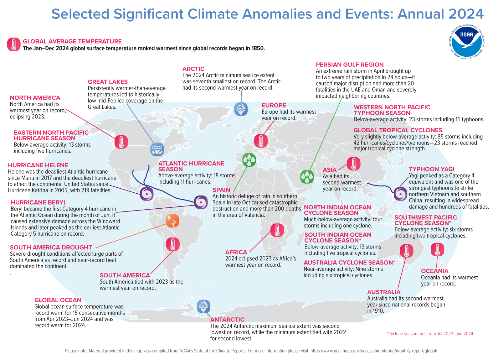 TROPICAL CYCLONES
Eighty-five named storms occurred across the globe in 2024, which was slightly below the 1991–2020 average of 88. Forty-two of those reached tropical cyclone strength (≥74 mph), and 23 reached major tropical cyclone strength (≥111 mph). These also included four storms that reached Category 5 (≥157 mph) on the Saffir-Simpson hurricane wind scale. The global accumulated cyclone energy (ACE) was about 21% below the 1991–2020 average.
The North Atlantic had 18 named storms, which was above the 1991–2020 average of 14. Eleven of those were hurricanes, including five major hurricanes. The ACE was about 32% above normal. Most of the damage in the U.S. was attributable to two major hurricanes: Helene in September and Milton in October.
NASA assembles its temperature record using surface air temperature data collected from tens of thousands of meteorological stations, as well as sea surface temperature data acquired by ship- and buoy-based instruments. This data is analyzed using methods that account for the varied spacing of temperature stations around the globe and for urban heating effects that could skew the calculations.