New Doppler Radar Nearly Finished in Puerto Rico
Special Stories
25 Apr 2018 7:37 PM
Extensive work continues across Puerto Rico to restore what life was like before Hurricane Maria tore through the island. One of the restorative processes has been getting a permanent doppler radar system back up and running.
This tweet from NWS San Juan shows one of the final images the previous radar took before it was hit and damaged by Hurricane Maria.
https://twitter.com/NWSSanJuan/status/910411954346323968
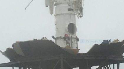
Maria's major hurricane-force winds tore the previous radar apart.
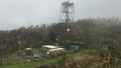 The San Juan WSR-88D doppler radar after Hurricane Maria. Courtesy NWS San Juan
 The San Juan WSR-88D doppler radar after Hurricane Maria. Courtesy NWS San Juan
The National Weather Service meteorologists had to rely on satellite data over Puerto Rico to get a sense of where the rains were. See the example of the satellite image with corresponding alert below:
https://twitter.com/NWSSanJuan/status/920678001997746176
A little over a month later, a temporary radar system was installed to help forecasters track rain and thunderstorms across the island. As you can imagine, it must have been incredibly difficult to issue weather alerts for the recently-struck communities without a solid weather system such as a doppler radar.
Related story: Doppler Radars up Again in Puerto Rico
Related story: How Does Radar Work?
Fast forward to this month where the new structure and radar dome are being assembled.
The San Juan WSR-88D doppler radar after Hurricane Maria. Courtesy NWS San Juan
The National Weather Service meteorologists had to rely on satellite data over Puerto Rico to get a sense of where the rains were. See the example of the satellite image with corresponding alert below:
https://twitter.com/NWSSanJuan/status/920678001997746176
A little over a month later, a temporary radar system was installed to help forecasters track rain and thunderstorms across the island. As you can imagine, it must have been incredibly difficult to issue weather alerts for the recently-struck communities without a solid weather system such as a doppler radar.
Related story: Doppler Radars up Again in Puerto Rico
Related story: How Does Radar Work?
Fast forward to this month where the new structure and radar dome are being assembled.
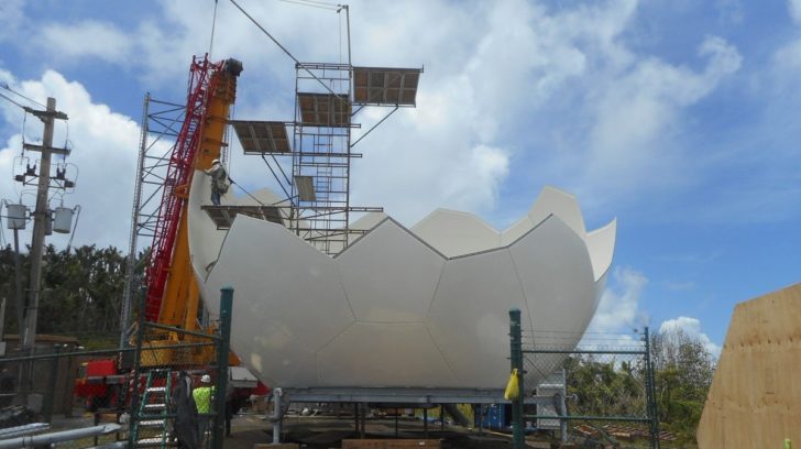 The surrounding structure of the actual radar, being assembled in mid-April 2018. Courtesy NEXRADROC
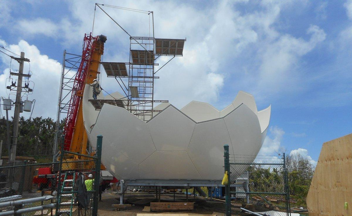
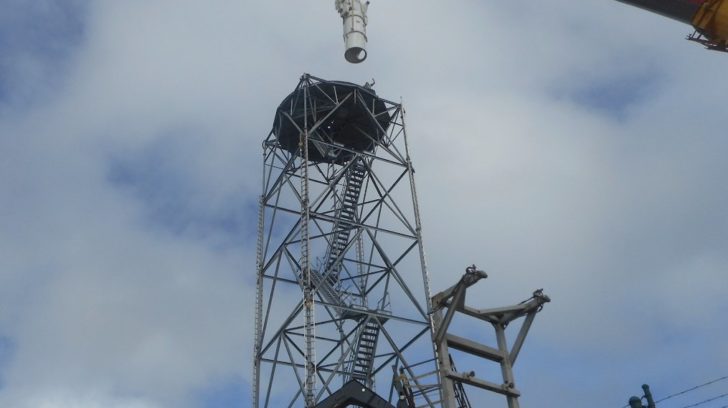 The new radar tower being assembled for San Juan and the rest of Puerto Rico in late-April 2018. Courtesy NEXRADROC
https://twitter.com/NEXRADROC/status/989127198236913664
The new radar system is expected to be completed in June, roughly nine months after Maria swept through.
For WeatherNation, Meteorologist Steve Glazier
The new radar tower being assembled for San Juan and the rest of Puerto Rico in late-April 2018. Courtesy NEXRADROC
https://twitter.com/NEXRADROC/status/989127198236913664
The new radar system is expected to be completed in June, roughly nine months after Maria swept through.
For WeatherNation, Meteorologist Steve Glazier
The San Juan WSR-88D doppler radar after Hurricane Maria. Courtesy NWS San Juan
The San Juan WSR-88D doppler radar after Hurricane Maria. Courtesy NWS San Juan
The National Weather Service meteorologists had to rely on satellite data over Puerto Rico to get a sense of where the rains were. See the example of the satellite image with corresponding alert below:
https://twitter.com/NWSSanJuan/status/920678001997746176
A little over a month later, a temporary radar system was installed to help forecasters track rain and thunderstorms across the island. As you can imagine, it must have been incredibly difficult to issue weather alerts for the recently-struck communities without a solid weather system such as a doppler radar.
Related story: Doppler Radars up Again in Puerto Rico
Related story: How Does Radar Work?
Fast forward to this month where the new structure and radar dome are being assembled.
The surrounding structure of the actual radar, being assembled in mid-April 2018. Courtesy NEXRADROC
The new radar tower being assembled for San Juan and the rest of Puerto Rico in late-April 2018. Courtesy NEXRADROC
https://twitter.com/NEXRADROC/status/989127198236913664
The new radar system is expected to be completed in June, roughly nine months after Maria swept through.
For WeatherNation, Meteorologist Steve GlazierAll Weather News
More
East Gears Up for Stormy, Wet Weekend
A low pressure system crashing through the Mi
1 Aug 2026 11:35 AM


Flooding, Severe Storms Target the Midwest Again
After an active week of storms across the nor
1 Aug 2026 1:40 AM


After Reaching Category 5, Genevieve Weakens in the Pacific
PacificFausto is now a post-tropical cyclone.
31 Jul 2026 1:30 AM

Flooding Risk Increases as Heavy Rain Targets the Tri-State Area
Tuesday, heavy rainfall moved across the Nort
30 Jul 2026 12:25 AM

Severe Weather: Energy From the Midwest Now in the Southeast
UPPER MIDWEST - Through Monday, dangerous tor
29 Jul 2026 10:30 PM