New Study Shows Promise of Forecasting Meteotsunamis
An atmospheric inertia-gravity wave is a wave of air that can run from 6 to 60 miles long that is created when a mass of stable air is displaced by an air mass with significantly different pressure. This sets in motion a wave of air with rising and falling pressure that can influence the water below, as it synchronizes with water movement on the lake’s surface like two singers harmonizing.
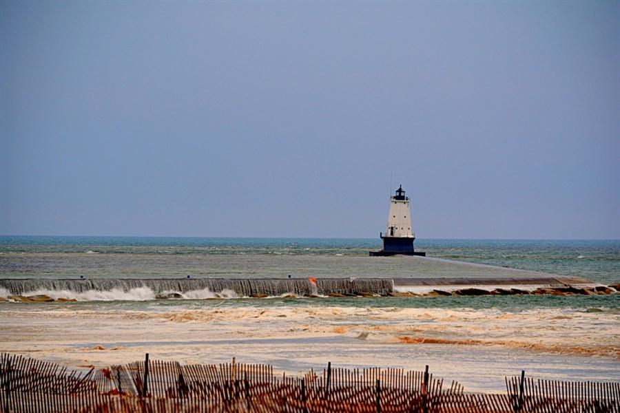
"That meteotsunami was hands down off the chart awesome," said Debbie Maglothin of Ludington who took photos of the event. "The water in between the breakwaters didn't go down like the water on the outside of them, so it created waterfalls that cascaded over the breakwaters. Had this event occurred during summer it could have washed people right off the breakwaters."
[video width="1920" height="1080" mp4="https://media.weathernationtv.com/app/uploads/2021/04/1080p.mp4"][/video] [This animation shows computer simulated meteotsunami waves generated on April 13, 2018 in Lake Michigan. The red colors represent wave crests (increased water level) and blue colors represent wave troughs (decreased water level). These waves were created by a series of atmospheric gravity pressure waves that contained large changes in barometric pressure.]Meteotsunamis generated from this type atmospheric condition are common around the globe, but in the Great Lakes, the few well documented meteotsunamis have been driven by sudden severe thunderstorms where both winds and air pressure changes have played significant roles.
Combining water and weather models
While there are currently no forecast models that effectively predict meteotsunamis in the U.S., new NOAA research based on the Ludington wave demonstrates that existing NOAA numerical weather prediction models and hydrodynamic forecast models may enable scientists to predict these meteotsunami-driving atmospheric waves minutes to hours in advance. The research is published in a special edition of the journal Natural Hazards about meteotsunamis. “The good news with this type of meteotsunami is that it is easier to predict than ones triggered by thunderstorms,” said Eric Anderson, an oceanographer at NOAA’s Great Lakes Environmental Research Laboratory and lead author of the study. “Our short-range weather models can pick up these atmospheric pressure waves, whereas predicting thunderstorms is more difficult.”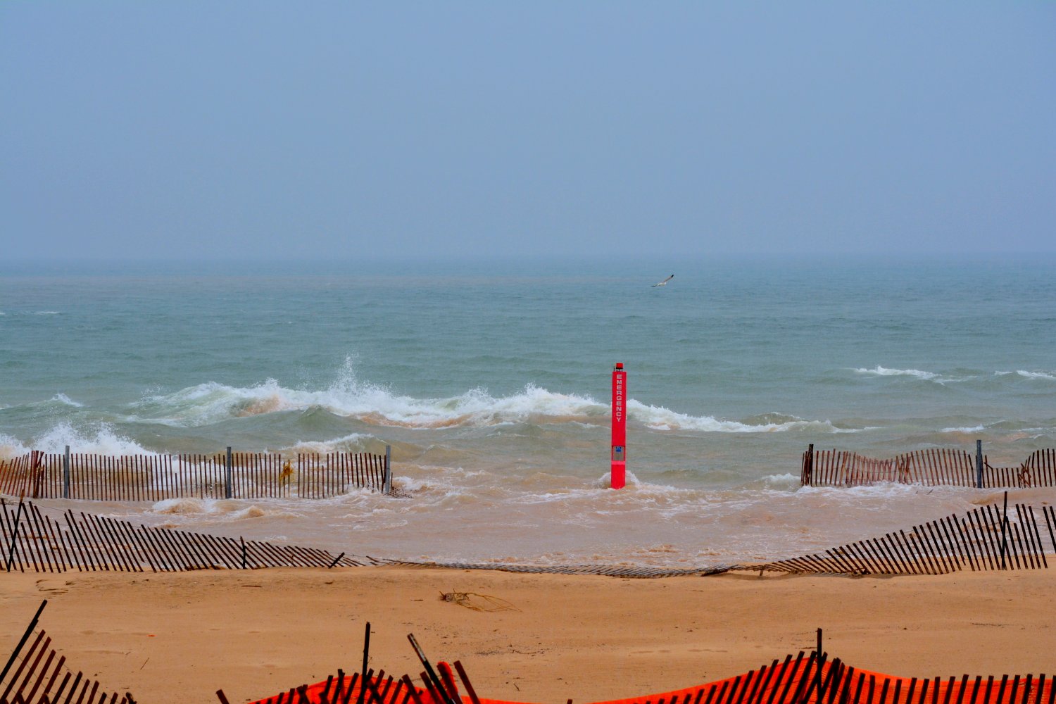
[The Lake Michigan meteotsunami reached high water marks and flooded beaches in Ludington, Michigan on April 13, 2018. Photo credit: Debbie Maglothin.]
Meteotsunamis are a lesser known category of tsunami. Unlike the more well known tsunami -- such as the catastrophic 2004 Boxing Day tsunami in Indonesia, which was caused by an earthquake on the seafloor, meteotsunamis are caused by weather, in particular some combination of changing air pressure, strong winds and thunderstorm activity.
“Because the lakes are relatively small, meteotsunamis typically need more than a jump in air pressure to drive them,” said Anderson. “That’s where the thunderstorms and wind come in to give them a push.”
Great Lakes have history of meteotsunamis
Meteotsunamis occur around the world, and are known to occur in the United States primarily on the Great Lakes and along the East and Gulf of Mexico coasts. Meteotsunami waves in the Great Lakes can be particularly insidious because they can bounce off the shoreline and come back again when the skies are clear. They are relatively rare and typically small, the largest producing three to six foot waves, which only occur about once every 10 years.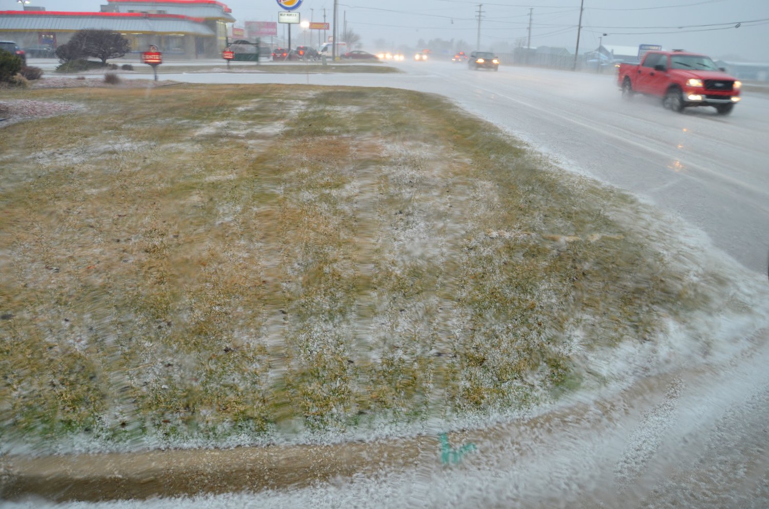
[Street flooding in Ludington, Michigan during the Lake Michigan meteotsunami event on April 13, 2018. Photo credit: Debbie Maglothin.]
Predicting these waves in advance would give communities potentially life-saving warnings and would allow residents and businesses to take measures to better protect property. The Ludington meteotsunami resulted in some property damage but no serious injuries. Had the meteotsunami struck in the summer when swimmers, anglers and vacationers flock to the lakeshore beaches, parks and waters, it might have been a different story, as was the case with a meteotsunami that took the lives of seven people in Chicago in June 1954.
“It’s a gap in our forecasting,” said Anderson. “With this study and other research we are getting closer to being able to predict them in advance.”
The new research is one of three papers authored by NOAA scientists appearing in the Natural Hazards special issue. Another research paper looks at the state of meteotsunami science in the United States and what will be needed to put in place effective operational forecast models for meteotsunamis in the Great Lakes and along the East Coast. A third paper demonstrates the potential of using real-time measurements and numerical models to forecast meteotsunami impacts on coastal areas.
https://www.youtube.com/watch?v=PXuG6JatD7g


