Eastern Pacific Remains Active

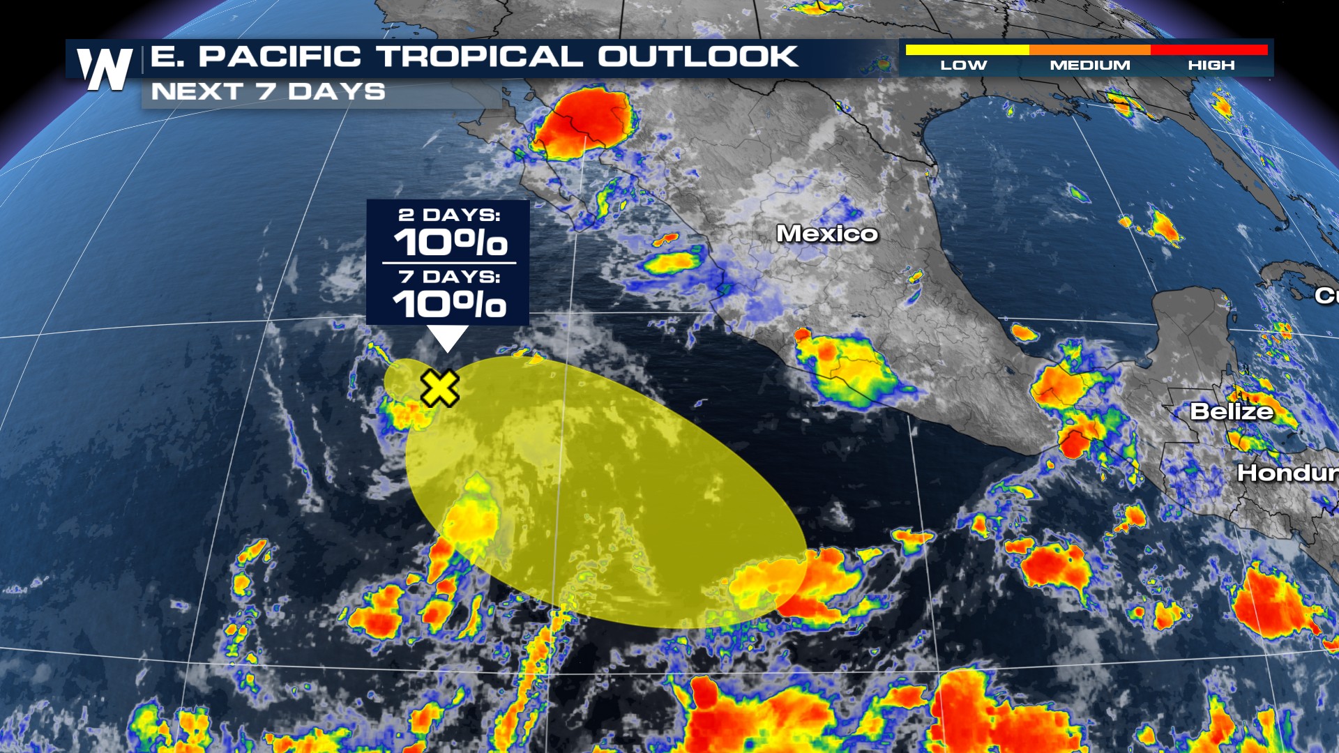
Following the prolific start to the season, the Eastern Pacific remains quite active as the National Hurricane Center is tracking two different areas of interest southwest of Mexico. Invest 96E or the orange highlighted area has a medium chance of development in the next couple of days. The chances have backed off as it appears less likely that something will come together. The region outlined in yellow is quickly falling apart with 0% chance of development.
The spaghetti plots show 96-E remaining well south of Mexico as it churns westward. This will limit impacts to the west coast of Mexico but interests in Hawaii should keep an eye on this system for the potential of increased rain chances next week.
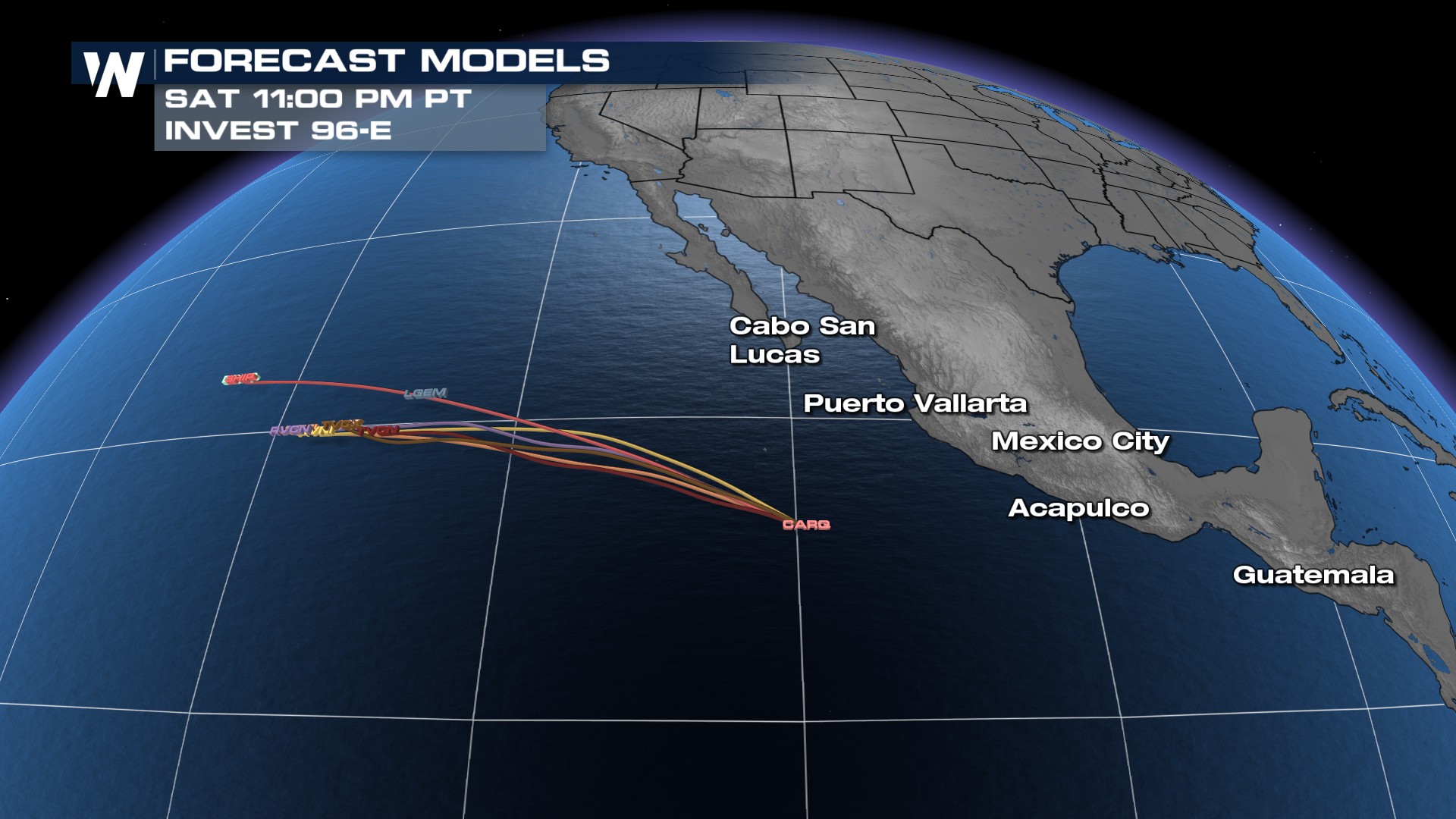
This system could bring stronger currents to Mexico's coast, but if it remains weak before moving farther west impacts should be minimal.
For more details on this forecast, be sure to check out the National Hurricane Center's website.


