Heavy Rain Wrapping Up Out West

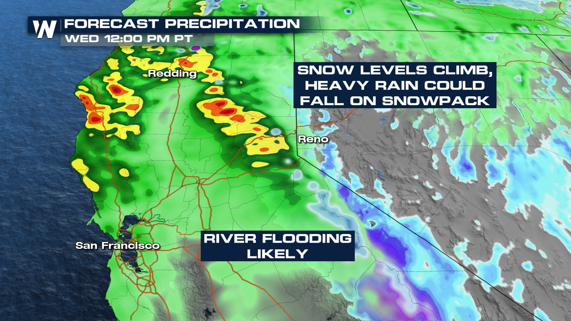
Inches of rain and feet of snow fell across the Western United States during the past week, thanks to a series of powerful low-pressure systems. The Pacific coast will stay active through Wednesday with a few additional systems behind to keep the stormy pattern going. However, this system has far warmer air to tap into across the West Coast.
Timing
The low-pressure system is moving through, bringing heavy mountain snow and rain. Snow levels are expected to be quite high, above 8,000 feet, leading to rain falling on top of the feet of snow California recorded last week.
Precipitation & Flood Potential
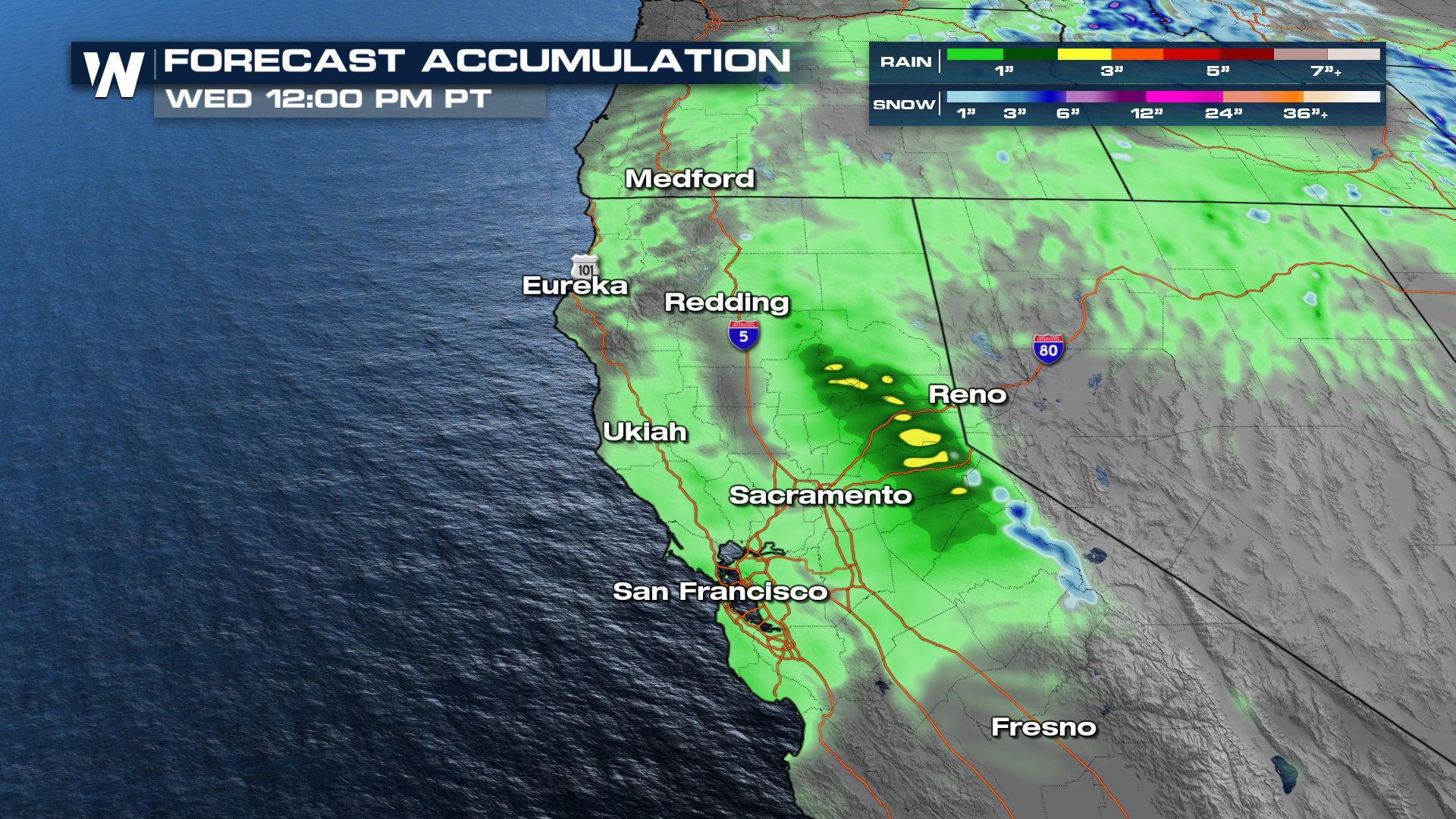
Rainfall totals in Northern California and Southern Oregon could surpass 4-5 inches in some locations, with snowfall totals in the NW topping a foot. Temperatures appear to be too warm for heavy snow in the Sierra, outside of the highest peaks.
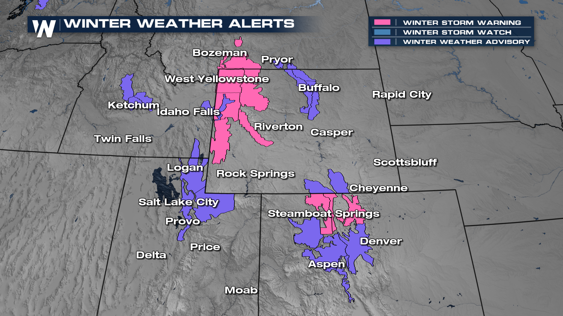
Winter storm warnings and advisories are in place across portions of the Northwest over the next few days. In the winter storm warnings, some of the heaviest snowfall totals can reach up to two feet of snow.