Next Plains Snowstorm: Here Come The Alerts
Top Stories
6 Dec 2019 6:15 PM
Winter alerts have already been issued for areas along the Canadian border, in advance of our next coast-to-coast storm.
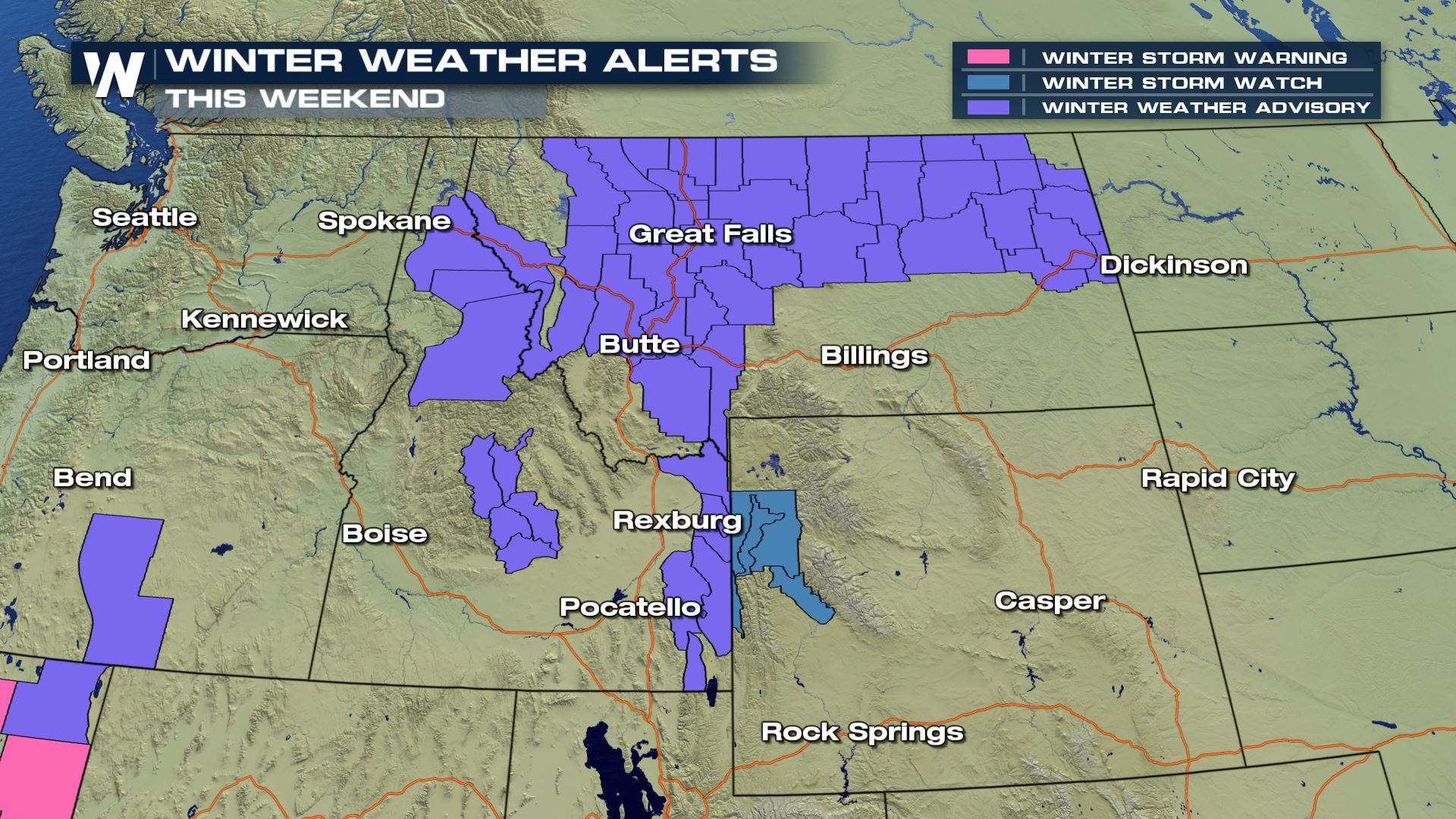 These alerts are winter weather advisories (so far) but there are a few watches embedded within. What does it mean to/for you? Well, if you'll be traveling through parts of Montana, Wyoming, the Dakotas and over to Minnesota, then you'll want to pay close attention to the weather (and forecast).
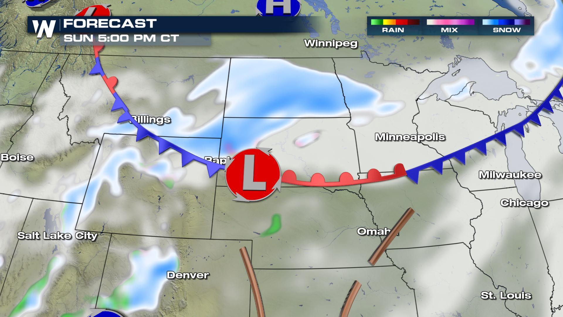
 A developing Canadian cold front will originate from Alberta on Sunday, moving east toward the Great Lakes. This will be the gateway to the very cold, Arctic air that will invade much of the eastern U.S. this week.
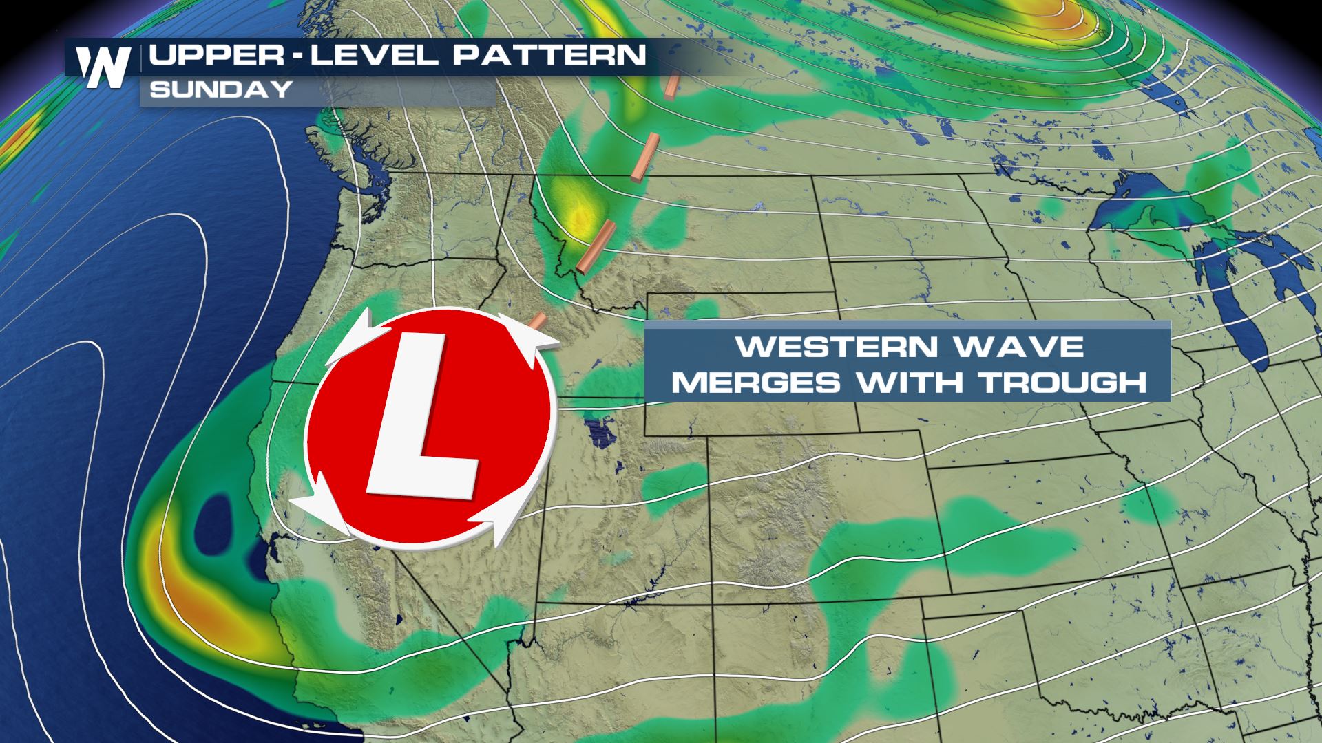
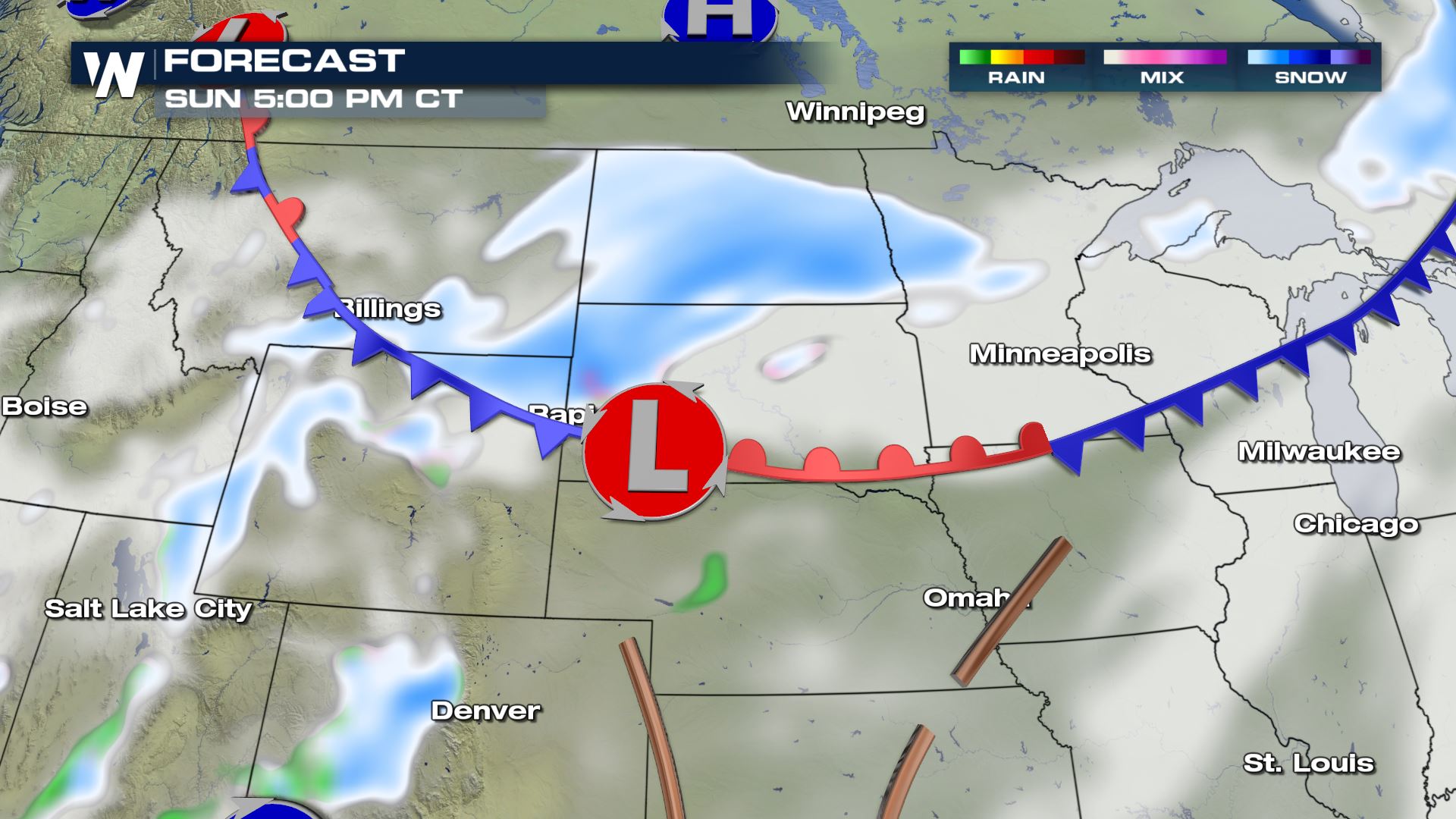 At the same time, another developing low pressure system giving California tons of rain and snow will meet up with this aforementioned front. The two will work together to produce moderate snow Sunday to early Monday.
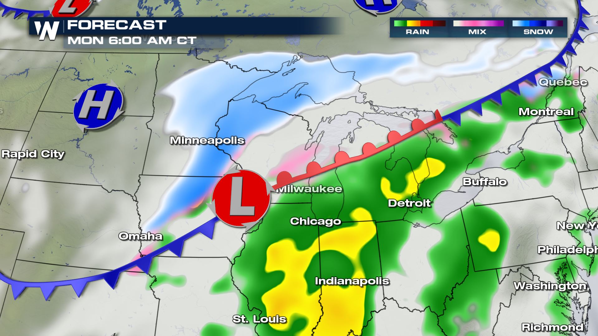 Take note, there will be heavy bands of snow embedded within the blue snowy areas you see above. Some of these heavy snow bands will hit during the Monday morning commute in parts of the Upper Midwest.
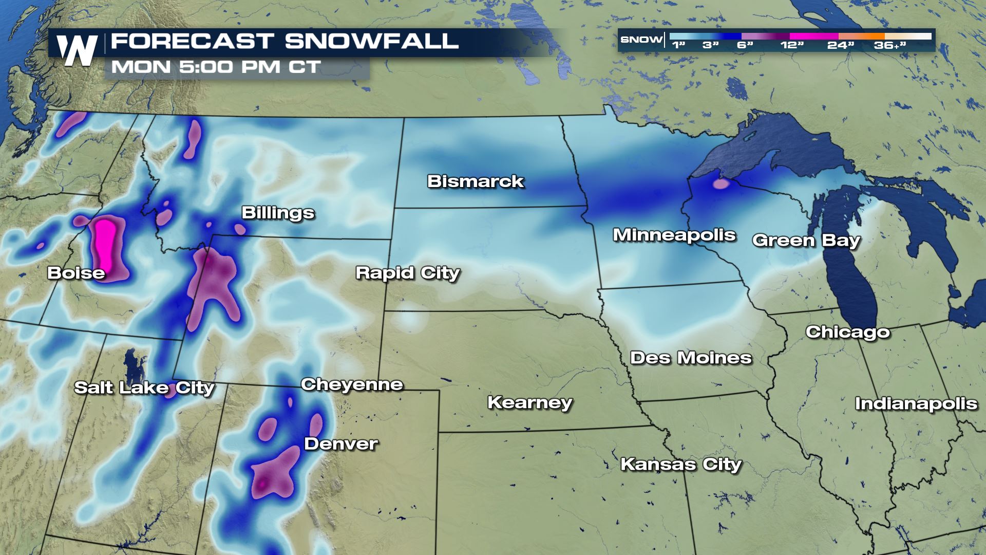 In total, 4-6" of snow will be likely from Montana to the Dakotas and parts of the Great Lakes. There will be a few higher totals here and there, especially in the higher mountains and within the heavier snow bands. As this next storm approaches, check back in with us here at WeatherNation. We'll update you with any major changes. For now, keep an eye on the weather forecast and when you have to travel, because it will be difficult at times!
These alerts are winter weather advisories (so far) but there are a few watches embedded within. What does it mean to/for you? Well, if you'll be traveling through parts of Montana, Wyoming, the Dakotas and over to Minnesota, then you'll want to pay close attention to the weather (and forecast).
A developing Canadian cold front will originate from Alberta on Sunday, moving east toward the Great Lakes. This will be the gateway to the very cold, Arctic air that will invade much of the eastern U.S. this week.
At the same time, another developing low pressure system giving California tons of rain and snow will meet up with this aforementioned front. The two will work together to produce moderate snow Sunday to early Monday.
Take note, there will be heavy bands of snow embedded within the blue snowy areas you see above. Some of these heavy snow bands will hit during the Monday morning commute in parts of the Upper Midwest.
In total, 4-6" of snow will be likely from Montana to the Dakotas and parts of the Great Lakes. There will be a few higher totals here and there, especially in the higher mountains and within the heavier snow bands. As this next storm approaches, check back in with us here at WeatherNation. We'll update you with any major changes. For now, keep an eye on the weather forecast and when you have to travel, because it will be difficult at times!All Weather News
More
Fronts Continue To Spark Severe Weather Across the Plains
A cold front that brought record lows to the
18 Jul 2025 10:40 PM

Extreme Heat Impacts for the East Coast & South
Extreme heat continues to impact several area
18 Jul 2025 10:05 PM

Flooding Threat Remains Elevated in the East
A cold front pushing through the Eastern Seab
18 Jul 2025 9:10 PM

EF-2 Firenado from the Deer Creek Fire in Utah
A fire tornado was spotted near La Sal, Utah
18 Jul 2025 7:30 AM

Tropical System Brings Flood Risk to the Central Gulf
Time has run out for notable tropical develop
18 Jul 2025 3:05 AM

Heavy Rain, Flooding Threat Returns to Florida
Keep the rain boots handy in Florida - heavy
13 Jul 2025 12:50 PM

Severe Storm Risk Pushes into the Great Lakes, Ohio Valley
Friday was another busy day with severe weath
12 Jul 2025 8:00 PM