Front Moves Through The Northeast

A severe threat earlier on Wednesday has since been dropped from the Storm Prediction Center. This same system will move to the east and offshore, taking the moisture with it. Most will be dry by Thursday and with winds out of the west, we see the lake-effect snow increase.
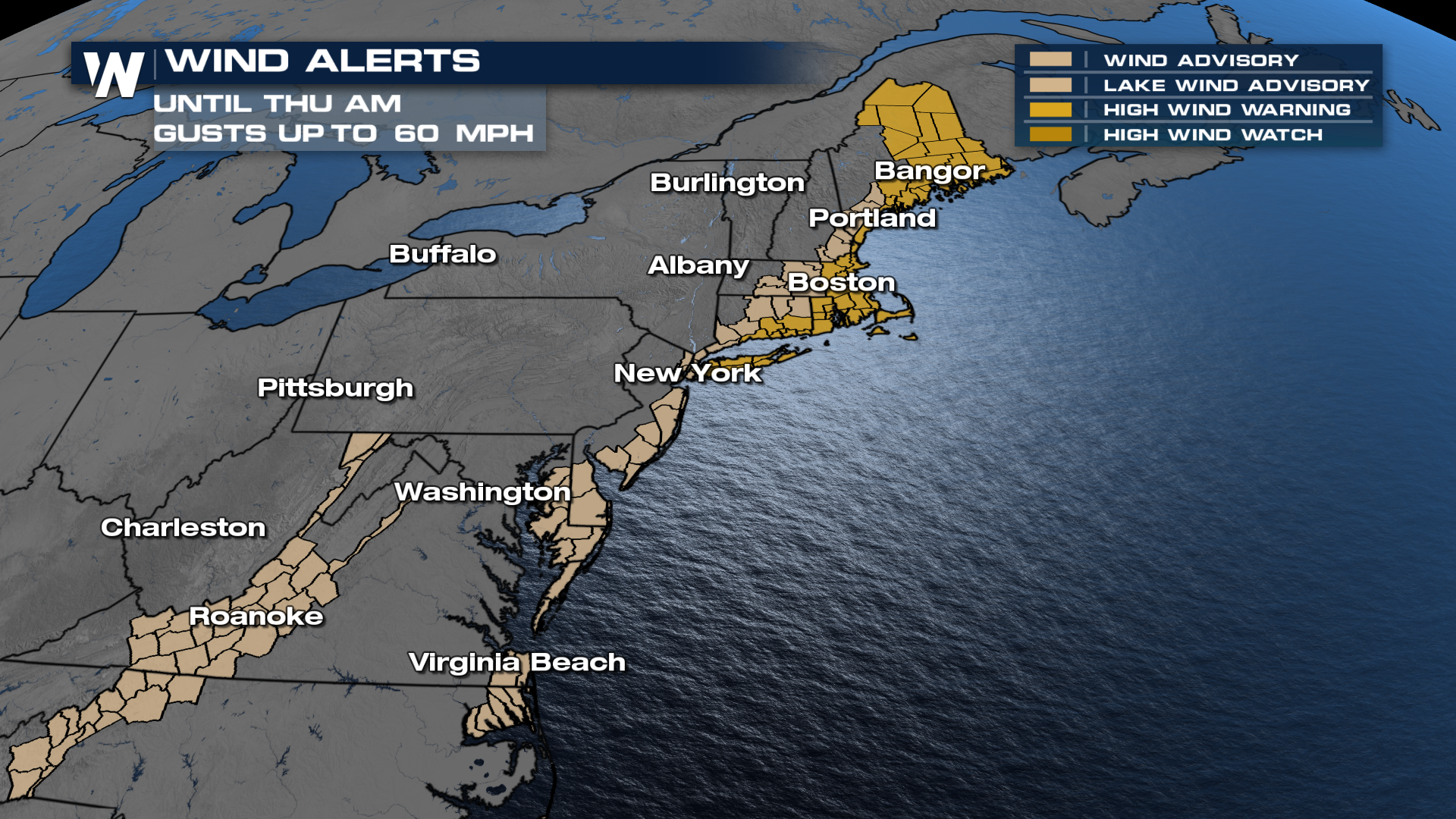
A widespread swath of 2-4 inches in New England will be more than enough to lead to flooding issues.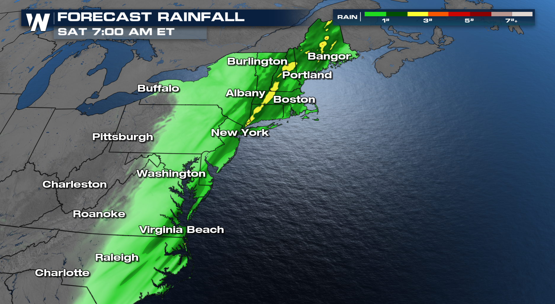 High winds will also be possible, with wind gusts up to 60 mph.
SNOWY SIDE
With a strong trough, there will be strong temperature changes. As temperatures plummet behind this front, the cold air will catch up to some of the moisture. That will turn some rain over to snow late Wednesday night into Thursday morning. Right now, this doesn't look like a big snow, until the lake effect machine ramps back up on Thursday and Friday. But an inch or two will be possible from eastern Kentucky up through New England.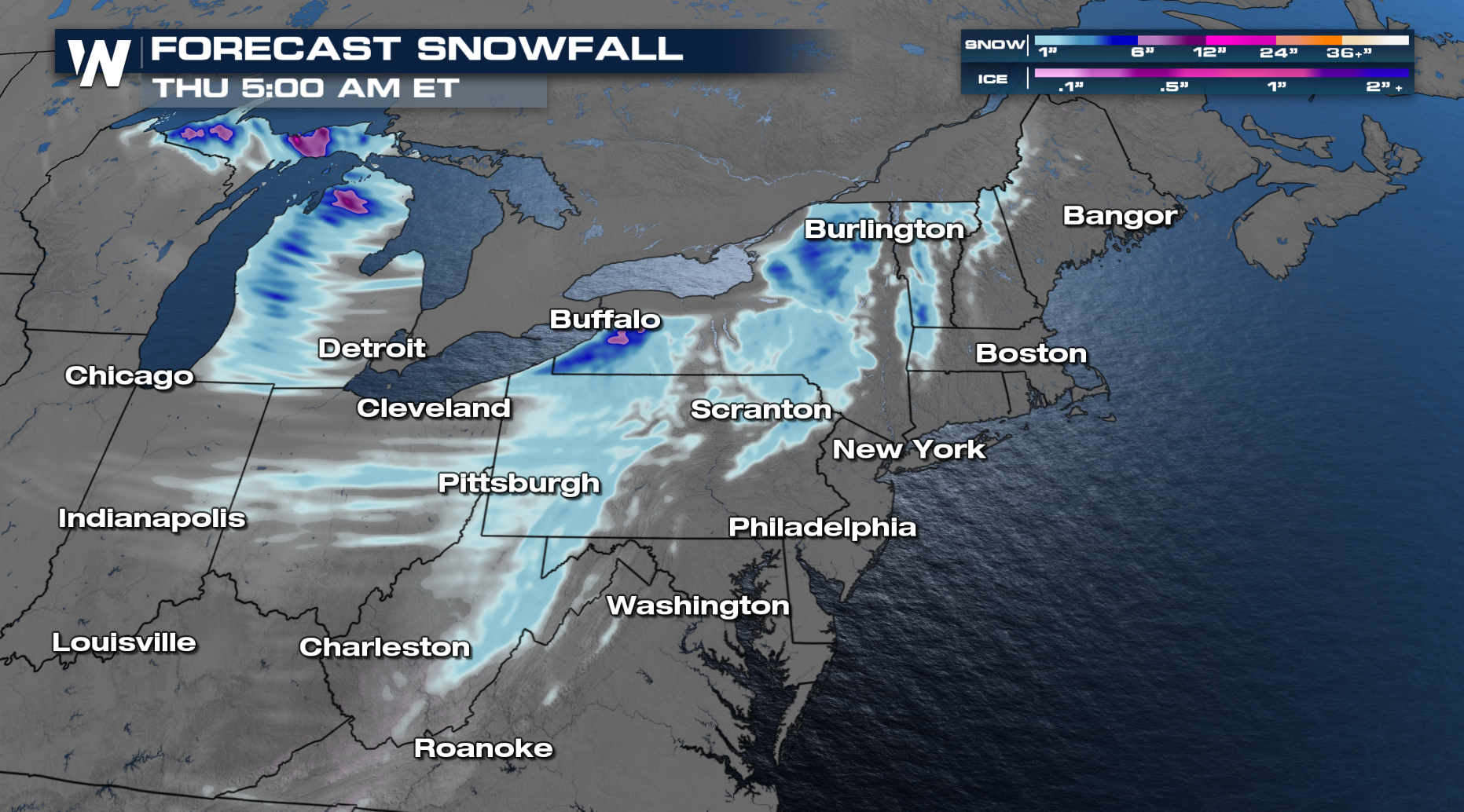 The latest forecast for the eastern region can be accessed anytime on the WeatherNation app, or streaming at :10 past the hour.


