NHC Reflects on Laura's Forecast Accuracy
Special Stories
28 Aug 2020 3:36 PM
The National Hurricane Center follows tropical systems from beginning to end. Hurricane Laura was no exception. Much of their work deals with probability, because they rely on imperfect computer model analysis to forecast what is expected to happen. That's why they rely on years of forecaster experience to work through countless data sets to come up with the most likely forecast scenario.
https://twitter.com/jaycordeira/status/1298971268092497922?ref_src=twsrc%5Etfw%7Ctwcamp%5Etweetembed%7Ctwterm%5E1298971268092497922%7Ctwgr%5E&ref_url=https%3A%2F%2Fwww.washingtonpost.com%2Fweather%2F2020%2F08%2F27%2Fnational-hurricane-center-forecast-laura%2F
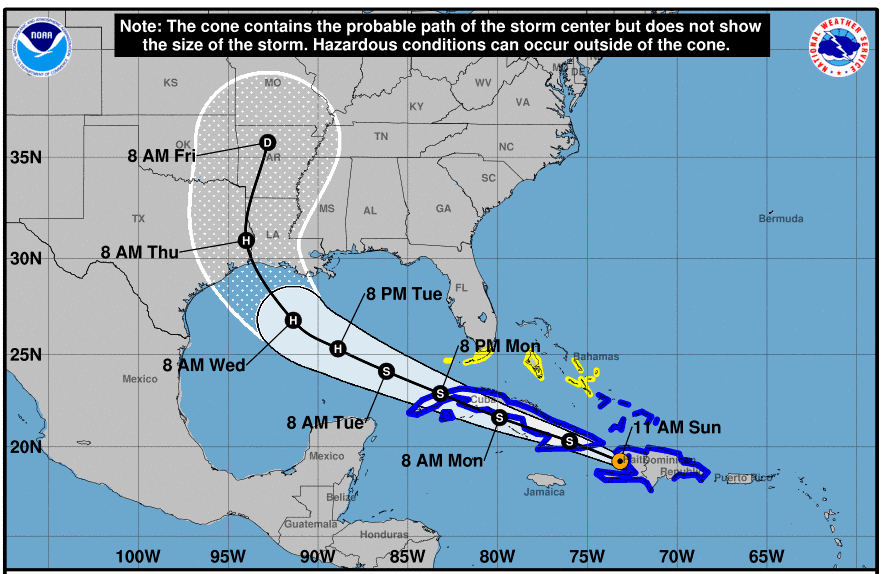
Hurricane Laura's forecast from the National Hurricane Center is one to be celebrated. More than three days out, they were able to accurately predict the location and timing of land fall with little to no error. In a statement from Dr. Michael Brennan, branch chief of NHC's hurricane specialist unit, he highlights the intricacies of their forecasting process and how Laura's forecast came to be so successful, with such advance notice.
"One of the things NHC prides itself on is the consistency of our track forecasts. We try not to follow short-term trends of any one model from one cycle to the next, but typically rely on a consensus or blend of the best 5 or 6 models as guidance for track forecasting. This helps smooth out the differences and biases between the models as well as the cycle to cycle variability in the model track forecasts. When we do make adjustments to the NHC track, we try and do so gradually, and wait to make large adjustments until we're confident that a bigger shift in the models will hold over several model cycles. We haven't had a chance to look at the verification for Laura yet, but this philosophy allowed us to consistently show the threat of a hurricane making landfall from the upper Texas Coast to southwestern Louisiana for several days, even as the individual models shifted around from cycle to cycle.
On the intensity side, rapid intensification remains a significant forecast challenge. For Laura, NHC made several aggressive intensity forecasts (such as a 25-kt increase in 24 hours), but ultimately the storm strengthened even faster. While we are better able to recognize the environmental conditions that support rapid intensification, knowing when it will start and how long it will last before an eyewall replacement cycle occurs or some other factor stops the intensification trend is still quite difficult. This uncertainty is one reason why we have probabilistic products for the storm surge and wind hazards that account for intensity forecast uncertainty, as have representations of the storm that are stronger and weaker than the NHC forecast. In particular, the storm surge risk mapping NHC provides to help with evacuation decision making is based on a reasonable worst case scenario at any given location, which accounts for uncertainty in the track, intensity and structure of a hurricane."
After using words like "unsurvivable" to describe the potential storm surge with Hurricane Laura, officials are beginning to analyze the coast to see if it also verified. We spoke with National Hurricane Center Storm Surge Specialist Jamie Rhome about how they go about surveying the scene:
https://youtu.be/9FglTJpTvnE
The National Hurricane Center highlighted model analysis and forecaster expertise as one of the major lessons they learned from previous storms:
https://youtu.be/t6d67yc76Pk
All Weather News
More
Flooding, Severe Storms Target the Midwest Again
After an active week of storms across the nor
31 Jul 2026 8:05 PM


After Reaching Category 5, Genevieve Weakens in the Pacific
PacificFausto is now a post-tropical cyclone.
31 Jul 2026 1:30 AM

Flooding Risk Increases as Heavy Rain Targets the Tri-State Area
Tuesday, heavy rainfall moved across the Nort
30 Jul 2026 12:25 AM

Severe Weather: Energy From the Midwest Now in the Southeast
UPPER MIDWEST - Through Monday, dangerous tor
29 Jul 2026 10:30 PM