NOAA Satellites Work Together to Provide Critical Data for Weather Forecasts
Geostationary Satellites
Geostationary satellites orbit 22,236 miles above the equator at speeds equal to Earth’s rotation. This means they continuously view the same area. Because they stay above a fixed spot on the surface, they provide constant vigil to identify and track severe weather conditions and environmental hazards. Information from geostationary satellites is used for short-term (1-2 day) forecasts and also for tracking storm systems in real-time.
The Geostationary Operational Environmental Satellites – R Series (GOES-R) is NOAA’s newest generation of geostationary satellites. GOES-16, in operations as GOES-East, keeps watch over most of North America, including the contiguous United States and Mexico, as well as Central and South America, the Caribbean, and the Atlantic Ocean to the west coast of Africa. GOES-17, which serves as GOES-West, watches over the western continental United States, Alaska, Hawaii, and the Pacific Ocean to New Zealand.
https://www.youtube.com/watch?v=2lOUkJzhfXM&feature=emb_logo [This animation depicts the areas of the Earth viewed by GOES-East and GOES-West from their vantage point 22,236 miles above the equator. NOAA maintains a two-satellite Geostationary Operational Environmental Satellite (GOES) constellation to watch over the Western Hemisphere. Credit: NOAA/NASA]The GOES-R Series satellites also carry a lightning mapper that helps forecasters focus on intensifying severe storms before they produce damaging winds, hail or even tornadoes.
https://www.youtube.com/watch?v=k74PtXTfJhY&feature=emb_logo [This view of hurricane Dorian from GOES-16 on September 1, 2019, shows both the cloud structure of the hurricane and lightning activity within the storm. Credit: NOAA]Polar-Orbiting Satellites
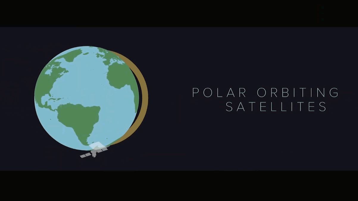
Polar-orbiting satellites circle the globe from the North Pole to the South Pole 14 times a day. They image the entire Earth at least twice daily, from 512 miles above its surface. Earth rotates counterclockwise underneath the path of the satellites, resulting in a different view with each orbit.
Global data from polar-orbiting satellites, including atmospheric temperature and moisture profiles, are used in numerical weather models to generate critical 0-7 day weather forecasts. Polar-orbiting satellites cover the whole world in higher resolution than GOES satellites, allowing for a broader and more detailed view of weather patterns and environmental conditions.
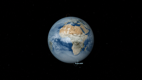 [This visualization shows the orbit of NOAA-20 along with Suomi NPP. The camera rotates to a view perpendicular to the orbit plan, showing the half-orbit separation between the two satellites. Credit: NASA's Scientific Visualization Studio]
NOAA’s polar-orbiting satellites, the Joint Polar Satellite System’s (JPSS) NOAA-20 and NOAA/NASA Suomi-NPP, carry instruments not available on GOES, including a microwave instrument, which allows scientists to see through clouds to what lies beneath. The polar satellites also carry the Day-Night Band, which enables scientists and forecasters to see cloud patterns at night, thanks to reflected moonlight.
[This visualization shows the orbit of NOAA-20 along with Suomi NPP. The camera rotates to a view perpendicular to the orbit plan, showing the half-orbit separation between the two satellites. Credit: NASA's Scientific Visualization Studio]
NOAA’s polar-orbiting satellites, the Joint Polar Satellite System’s (JPSS) NOAA-20 and NOAA/NASA Suomi-NPP, carry instruments not available on GOES, including a microwave instrument, which allows scientists to see through clouds to what lies beneath. The polar satellites also carry the Day-Night Band, which enables scientists and forecasters to see cloud patterns at night, thanks to reflected moonlight.
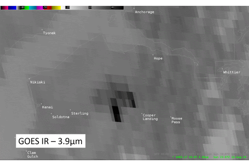 [Comparison of GOES-17 and Suomi NPP infrared imagery on August 18, 2019, and day land cloud fire imagery on August 19, 2019, of the Swan Lake Fire in Alaska. These comparisons show the finer detail polar-orbiting satellites provide, especially at high latitudes. This is important for identifying fire perimeters and detecting smaller fires. Credit: NOAA/CIRA.]
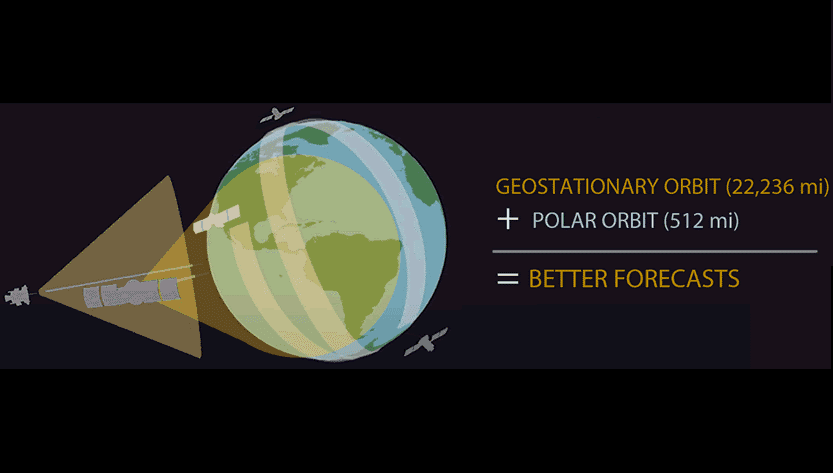
Two Orbits, One Mission
From their position closer to Earth, NOAA’s polar-orbiting satellites observe the entire planet in extremely fine detail. They provide global data on critical atmospheric conditions needed to provide forecasts several days in advance.
GOES satellites continuously monitor the same area and provide updates as often as every 30 seconds. Constant observations of cloud motion and storm properties allow for real-time decisions and short-term forecasts.
Together, they make a powerful team. Each provides critical information about severe storms, tornadoes, hurricanes, snowstorms, and flooding, as well as wildfires, smoke plumes, volcanic eruptions, and dust storms. Different vantage points, imaging frequency, and instrumentation provide complementary measurements for a complete picture of what’s happening on Earth.
Edited for WeatherNation by Mace Michaels


