Nor'Easter Developing Wednesday and Thursday
Top Stories
16 Oct 2019 4:34 AM
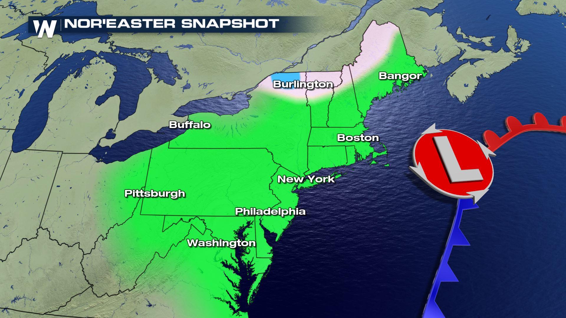
The Northeastern United States can expect a developing coastal low to impact the region beginning Wednesday and lingering through much of Thursday.
This system will develop after an Alberta Clipper system moves through the Midwest, and merges with another storm system bringing soaking rain to the South. These two systems merge and strengthen off the northeast coastline Wednesday and Thursday. Rain, mountain snow, wind, high surf, and coastal erosion will make for a messy midweek in the Mid-Atlantic and New England regions.
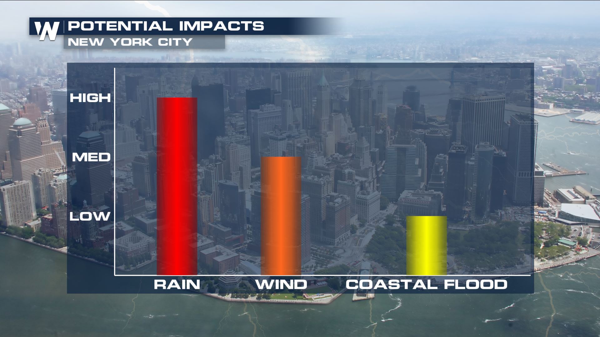
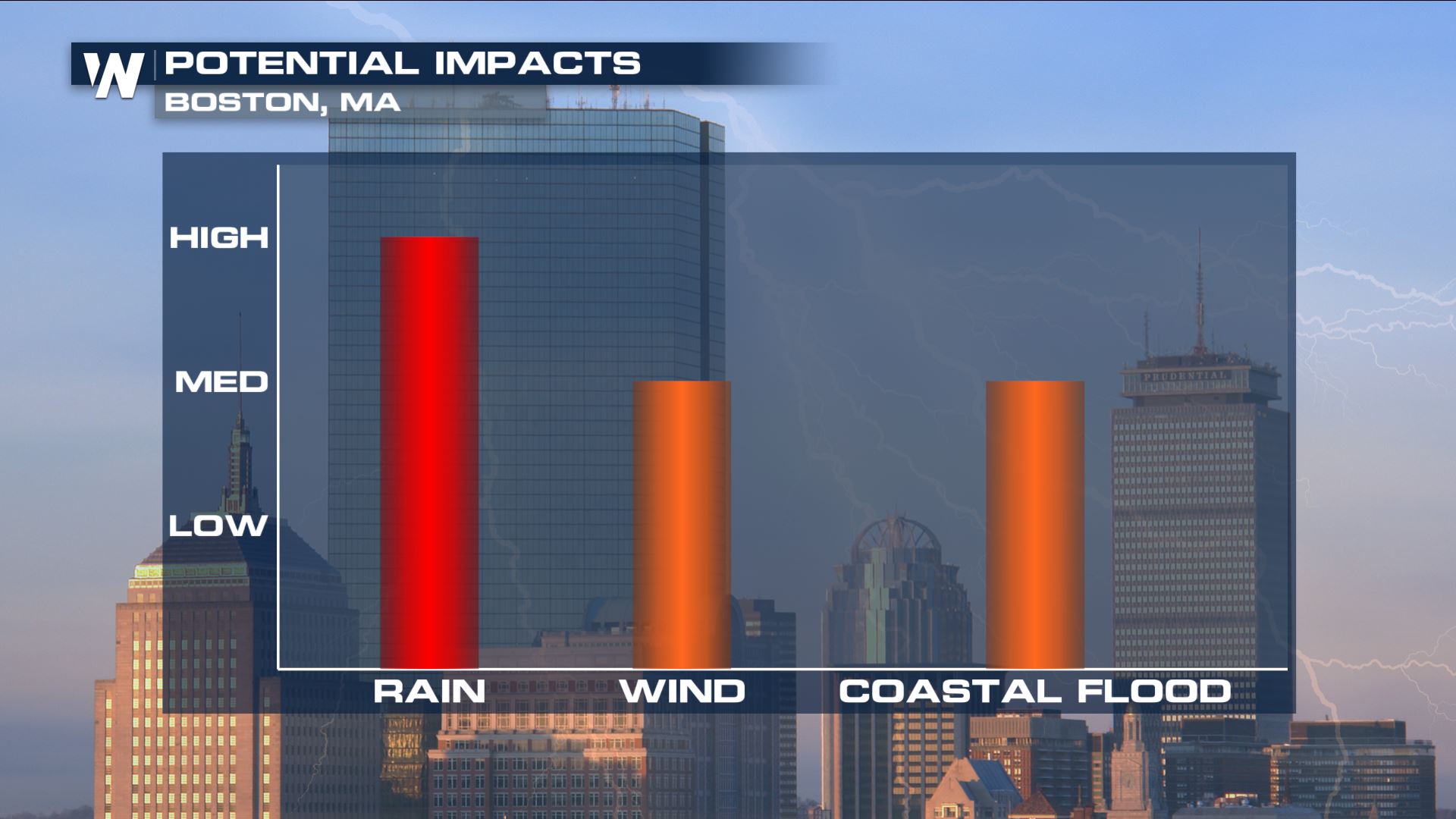 The heaviest rain is expected to occur late Wednesday into the first half of Thursday. Some locations may witness 1 to 3 inches of rainfall. Excessive rainfall and flooding concerns will be confined to New York's Hudson Valley and a good portion of New England, although heavy downpours will be possible as far south as the Delmarva Peninsula. While the primary mode of precipitation will be rainfall, enough cold air will filter in on the backside of the system that snow will be possible.
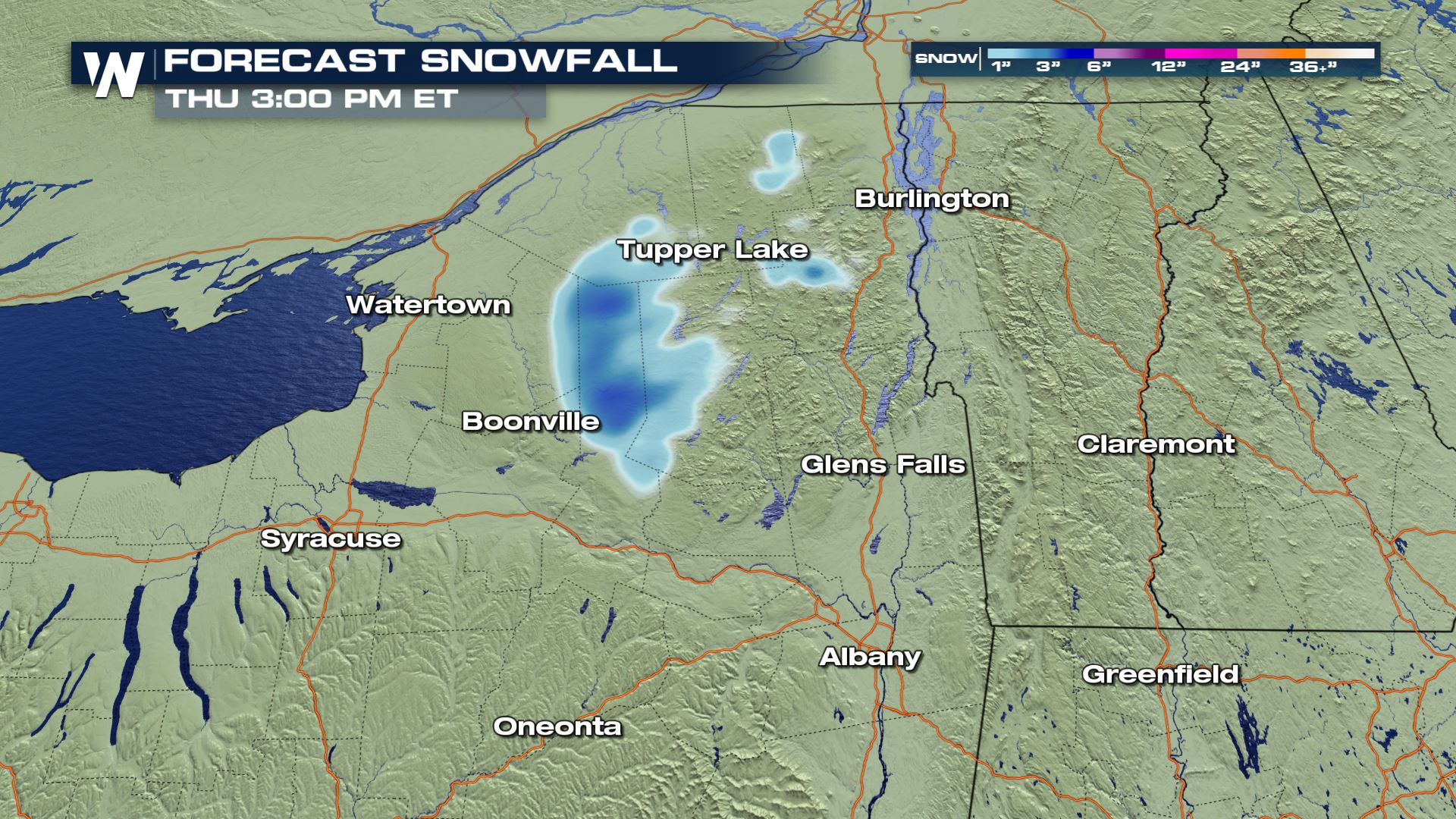
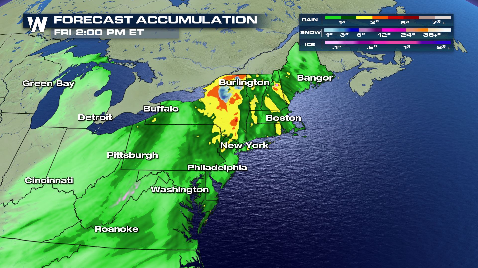 The best chance for accumulating snowfall will be in the mountainous terrain of northern New England as well as New York's Adirondack mountains. In the central Appalachian mountains, the highest elevations of eastern West Virginia, western Maryland, and southwestern Pennsylvania may see some light accumulations.
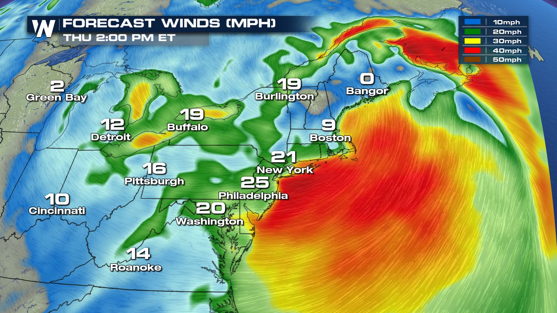
 As is often the case with a low pressure near the coast, gusty wind will be a concern. Sustained winds out of the northeast on Thursday morning may lead to some minor coastal flooding and beach erosion in New England. High waves will make for dangerous boating conditions.
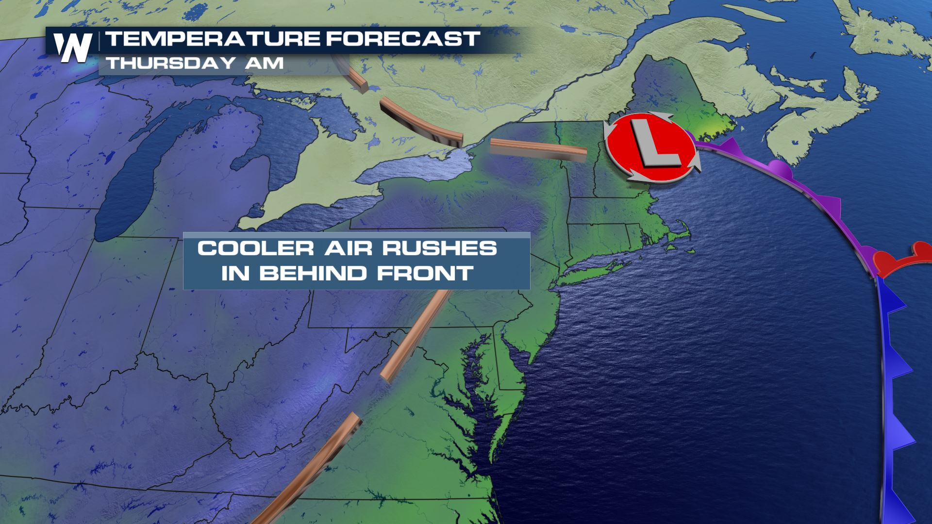
 Behind the front, a cool and brisk northwest wind will keep temperatures a bit below average for a large swath of the northern United States.
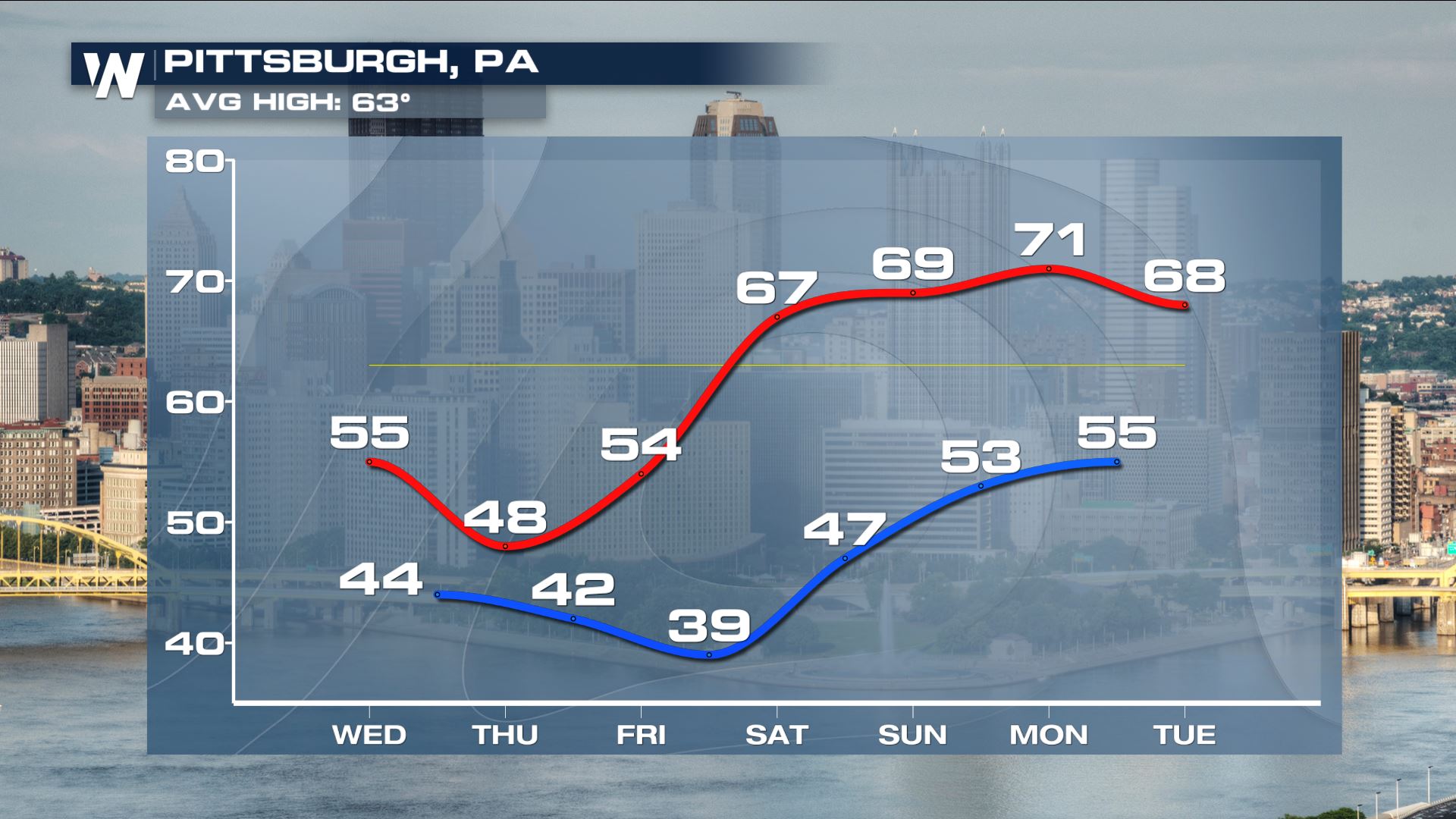
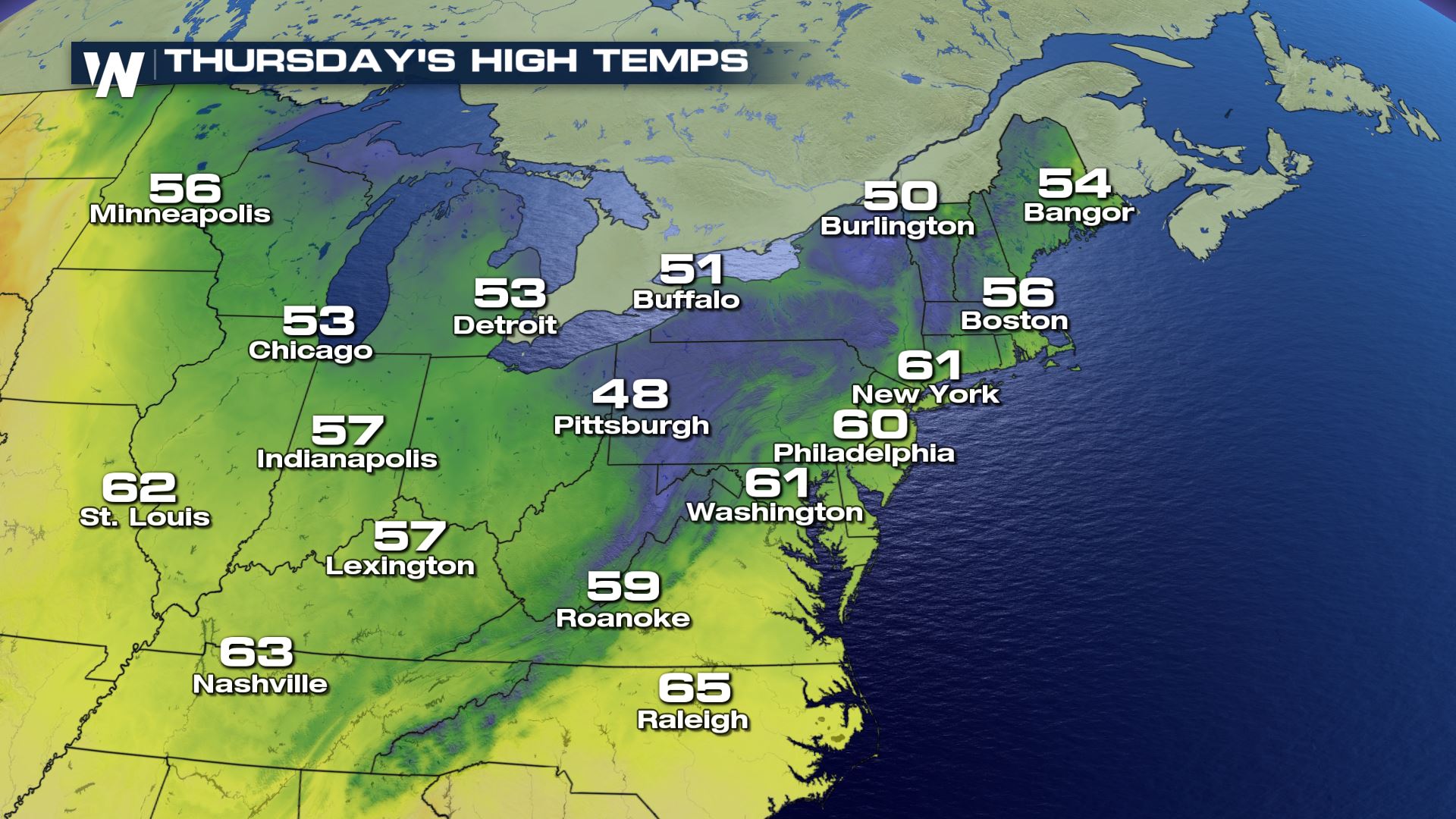 Cities from the East Coast to the Great Lakes will certainly feel like Fall! High temperatures will only top out in the 50s and 60s before another warm-up over the weekend.
 Be sure to stay up to date with the very latest forecast information with WeatherNation in the days ahead.
The heaviest rain is expected to occur late Wednesday into the first half of Thursday. Some locations may witness 1 to 3 inches of rainfall. Excessive rainfall and flooding concerns will be confined to New York's Hudson Valley and a good portion of New England, although heavy downpours will be possible as far south as the Delmarva Peninsula. While the primary mode of precipitation will be rainfall, enough cold air will filter in on the backside of the system that snow will be possible.
The best chance for accumulating snowfall will be in the mountainous terrain of northern New England as well as New York's Adirondack mountains. In the central Appalachian mountains, the highest elevations of eastern West Virginia, western Maryland, and southwestern Pennsylvania may see some light accumulations.
As is often the case with a low pressure near the coast, gusty wind will be a concern. Sustained winds out of the northeast on Thursday morning may lead to some minor coastal flooding and beach erosion in New England. High waves will make for dangerous boating conditions.
Behind the front, a cool and brisk northwest wind will keep temperatures a bit below average for a large swath of the northern United States.
Cities from the East Coast to the Great Lakes will certainly feel like Fall! High temperatures will only top out in the 50s and 60s before another warm-up over the weekend.
Be sure to stay up to date with the very latest forecast information with WeatherNation in the days ahead.All Weather News
More
Wildfire Outbreak in the Pacific Northwest
SPOKANE, WA - On Saturday, August 1st, the Ol
3 Aug 2026 1:55 AM

More Storms for the East Through Monday
A low-pressure system that moved through the
3 Aug 2026 1:50 AM


After Reaching Category 5, Genevieve Weakens in the Pacific
PacificGenevieve formed last Friday south of
3 Aug 2026 12:30 AM

Flooding, Severe Storms Target the Midwest Again
After an active week of storms across the nor
1 Aug 2026 1:40 AM

Flooding Risk Increases as Heavy Rain Targets the Tri-State Area
Tuesday, heavy rainfall moved across the Nort
30 Jul 2026 12:25 AM

Severe Weather: Energy From the Midwest Now in the Southeast
UPPER MIDWEST - Through Monday, dangerous tor
29 Jul 2026 10:30 PM