Northern Arkansas Icing Over as the Winter Storm Moves East
Special Stories
8 Dec 2018 3:27 PM
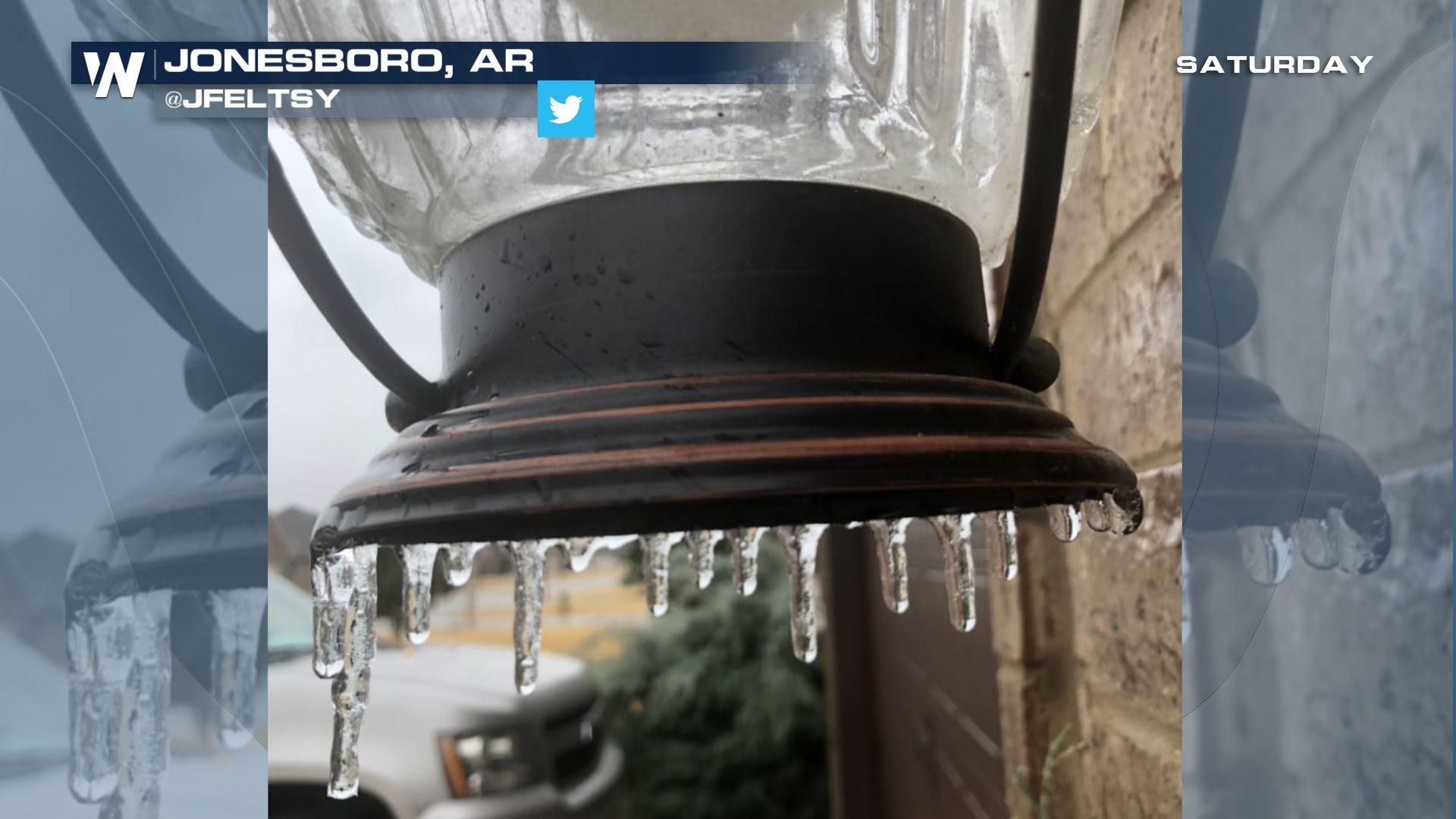
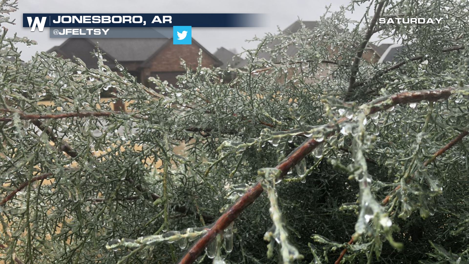
Several cities and towns were iced over Saturday when freezing rain accumulated on trees, power lines, street signs and sidewalks.
 Courtesy JFeltsy on Twitter
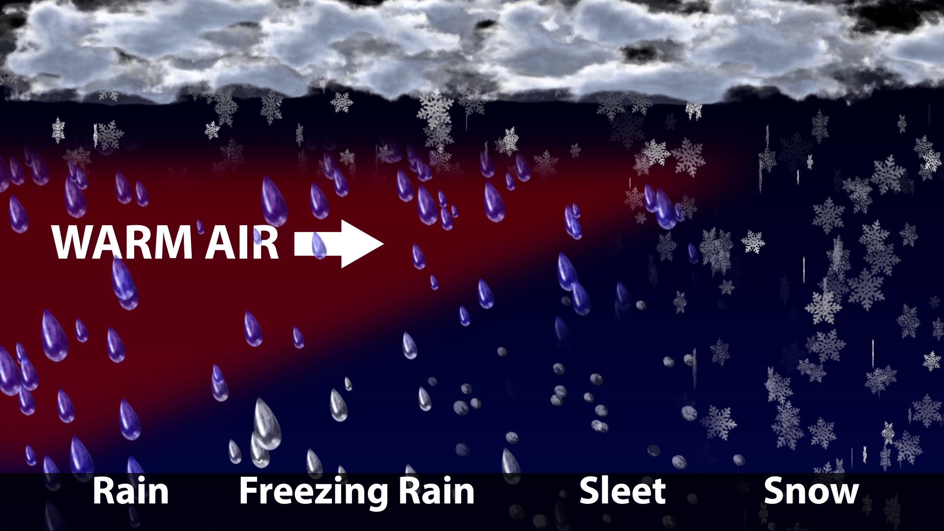
Freezing rain occurs when a warm layer of air moves in above you. If you have temperatures at or below freezing where you are standing, then the rain above is likely to freeze on contact when it reaches the ground. Depending on how thick the cold air mass is and the warm air mass is, you may see freezing rain or sleet.
Courtesy JFeltsy on Twitter
Freezing rain occurs when a warm layer of air moves in above you. If you have temperatures at or below freezing where you are standing, then the rain above is likely to freeze on contact when it reaches the ground. Depending on how thick the cold air mass is and the warm air mass is, you may see freezing rain or sleet.
 Pictures on social media from other parts of the state showed the same thing! Icing had occurred in Batesville, Arkansas as well.
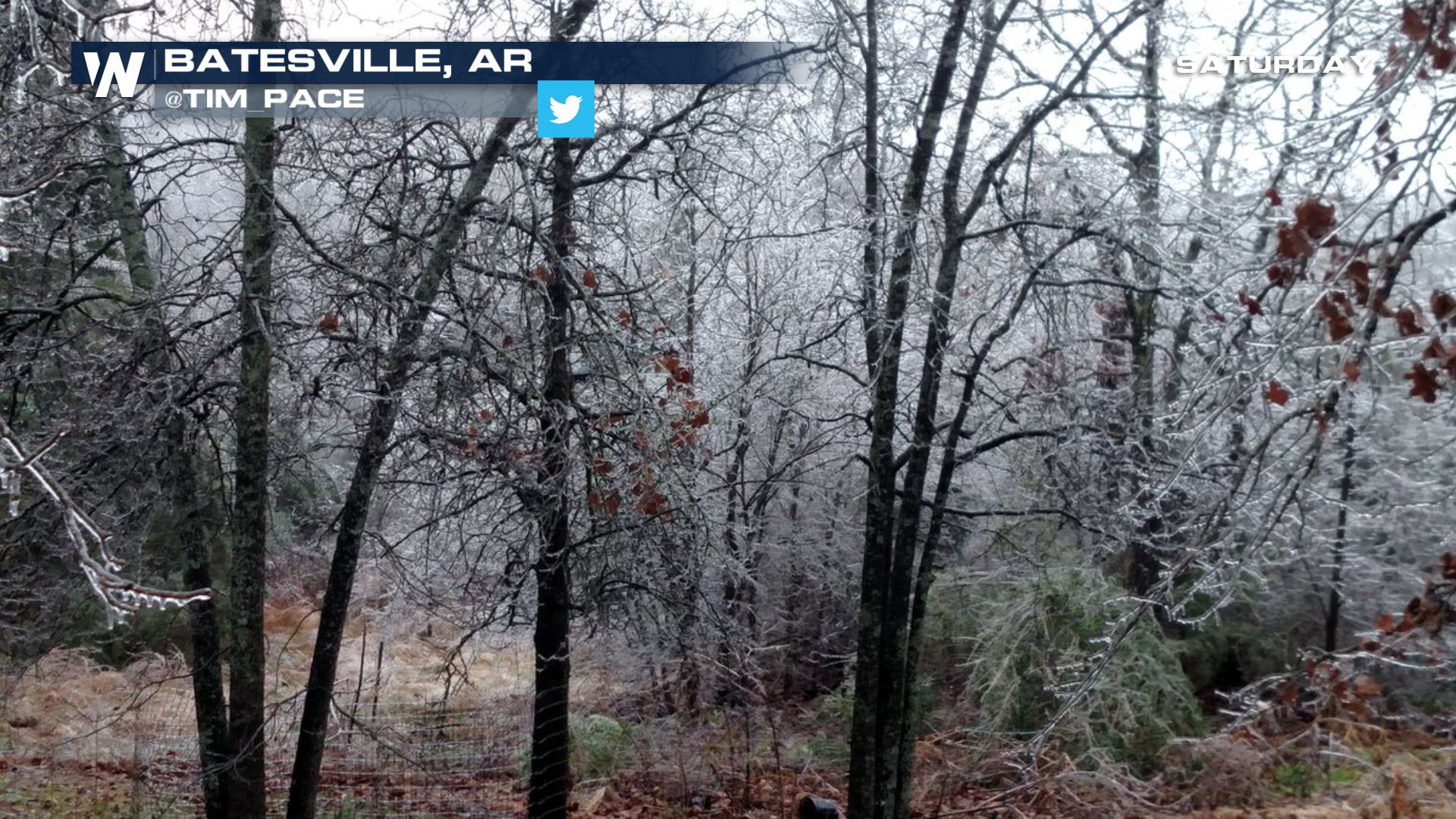 Image courtesy @Tim_Pace on Twitter
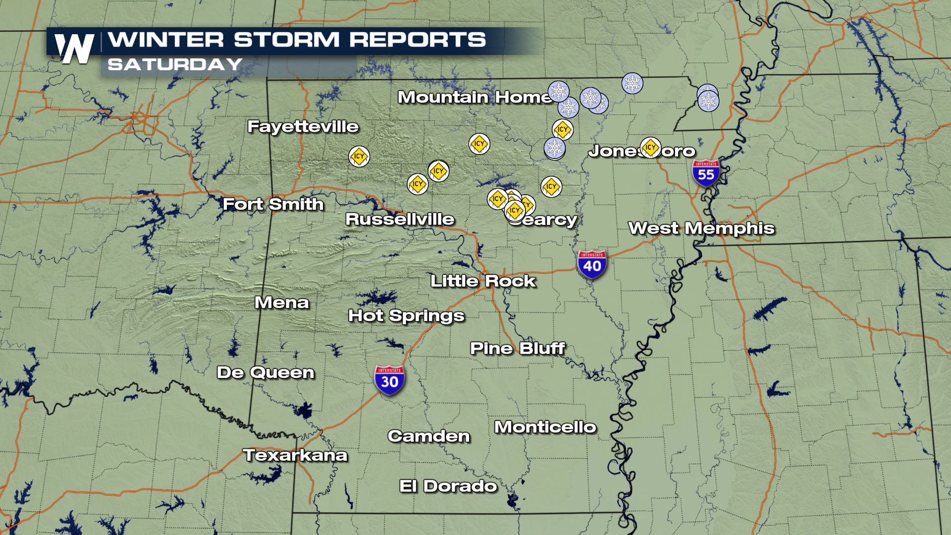
The storm report map showed that most of the icing was concentrated across the northern part of the state on Saturday.
Image courtesy @Tim_Pace on Twitter
The storm report map showed that most of the icing was concentrated across the northern part of the state on Saturday.
 A wintry mix is forecast to continue Saturday night and into early Sunday morning. Improving weather conditions are forecast to be likely through the daylight hours Sunday. If you must travel, do so with extreme caution! These icy conditions can be some of the most dangerous out on the roads. Take it slow with two hands on the wheel as you cross bridges and overpasses, which tend to become icy first.
Do you have any cool videos or pictures? We'd love to see them! As long as you can do so safely, share your videos/pictures with us on Facebook or Twitter!
For WeatherNation, Meteorologist Steve Glazier
A wintry mix is forecast to continue Saturday night and into early Sunday morning. Improving weather conditions are forecast to be likely through the daylight hours Sunday. If you must travel, do so with extreme caution! These icy conditions can be some of the most dangerous out on the roads. Take it slow with two hands on the wheel as you cross bridges and overpasses, which tend to become icy first.
Do you have any cool videos or pictures? We'd love to see them! As long as you can do so safely, share your videos/pictures with us on Facebook or Twitter!
For WeatherNation, Meteorologist Steve Glazier
Courtesy JFeltsy on Twitter
Freezing rain occurs when a warm layer of air moves in above you. If you have temperatures at or below freezing where you are standing, then the rain above is likely to freeze on contact when it reaches the ground. Depending on how thick the cold air mass is and the warm air mass is, you may see freezing rain or sleet.
Pictures on social media from other parts of the state showed the same thing! Icing had occurred in Batesville, Arkansas as well.
Image courtesy @Tim_Pace on Twitter
The storm report map showed that most of the icing was concentrated across the northern part of the state on Saturday.
A wintry mix is forecast to continue Saturday night and into early Sunday morning. Improving weather conditions are forecast to be likely through the daylight hours Sunday. If you must travel, do so with extreme caution! These icy conditions can be some of the most dangerous out on the roads. Take it slow with two hands on the wheel as you cross bridges and overpasses, which tend to become icy first.
Do you have any cool videos or pictures? We'd love to see them! As long as you can do so safely, share your videos/pictures with us on Facebook or Twitter!
For WeatherNation, Meteorologist Steve GlazierAll Weather News
More

East Gears Up for Stormy, Wet Weekend
A low pressure system crashing through the Mi
1 Aug 2026 9:15 PM


Flooding, Severe Storms Target the Midwest Again
After an active week of storms across the nor
1 Aug 2026 1:40 AM

After Reaching Category 5, Genevieve Weakens in the Pacific
PacificFausto is now a post-tropical cyclone.
31 Jul 2026 1:30 AM

Flooding Risk Increases as Heavy Rain Targets the Tri-State Area
Tuesday, heavy rainfall moved across the Nort
30 Jul 2026 12:25 AM

Severe Weather: Energy From the Midwest Now in the Southeast
UPPER MIDWEST - Through Monday, dangerous tor
29 Jul 2026 10:30 PM