Northern High Plains and Upper Midwest Severe Storm Chances Tuesday
Top Stories
17 Sep 2019 4:49 AM
A shortwave of energy and a surface cold front over South Dakota be the focus for strong to severe storms today and tonight for the High Plains and Upper Midwest. Today's set-up will have isolated severe storms over the Northern High Plains this afternoon and evening with these storms moving into the Upper Midwest for the overnight. Here is the very latest.
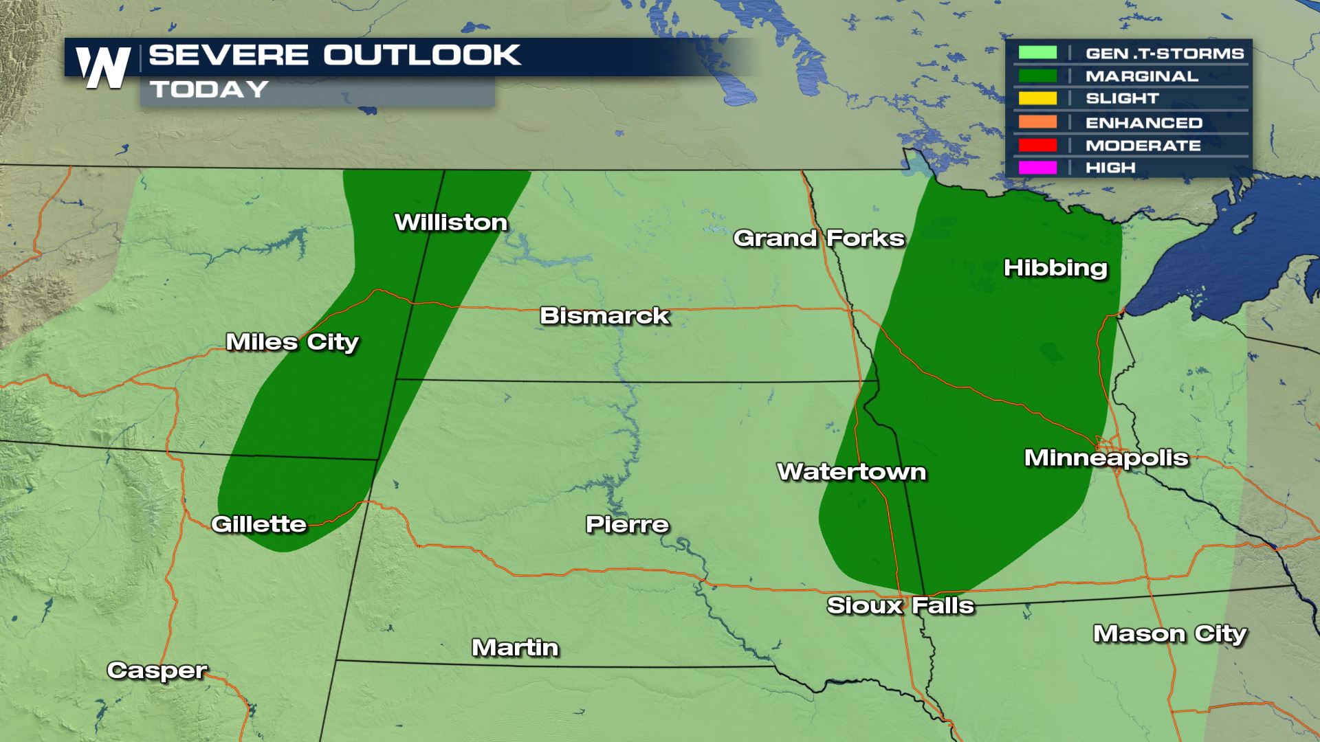
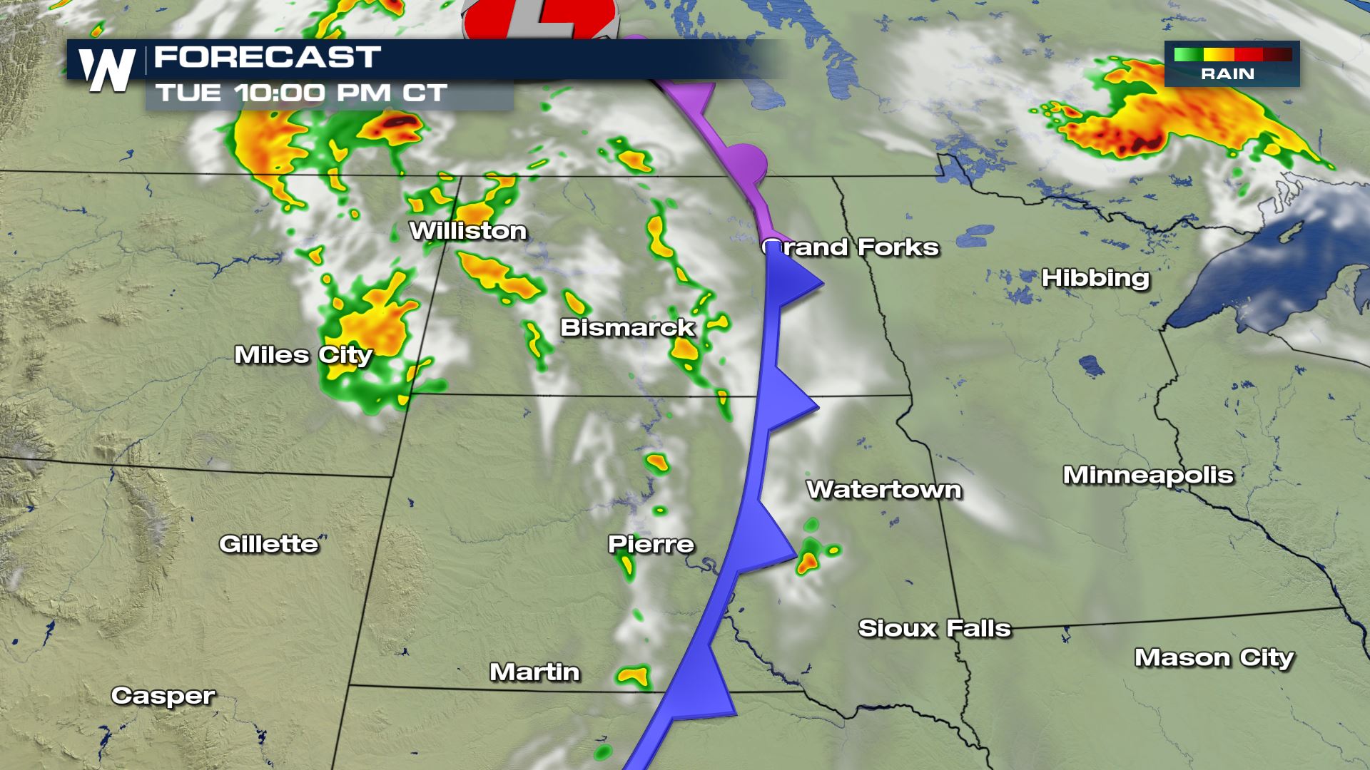
 You can see 2 separate areas for severe weather for today and tonight. This will be based on the track of the cold front. Montana, Wyoming and the Dakotas will have the risk during the afternoon and evening. Then Minnesota will see the risk increase for the overnight.
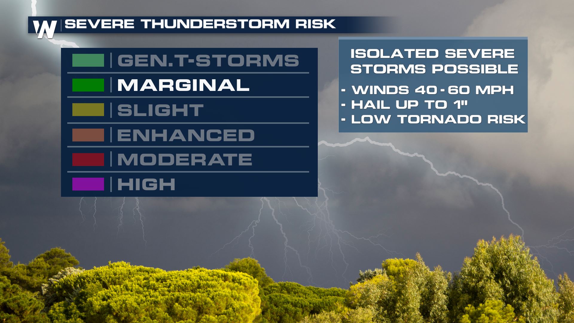
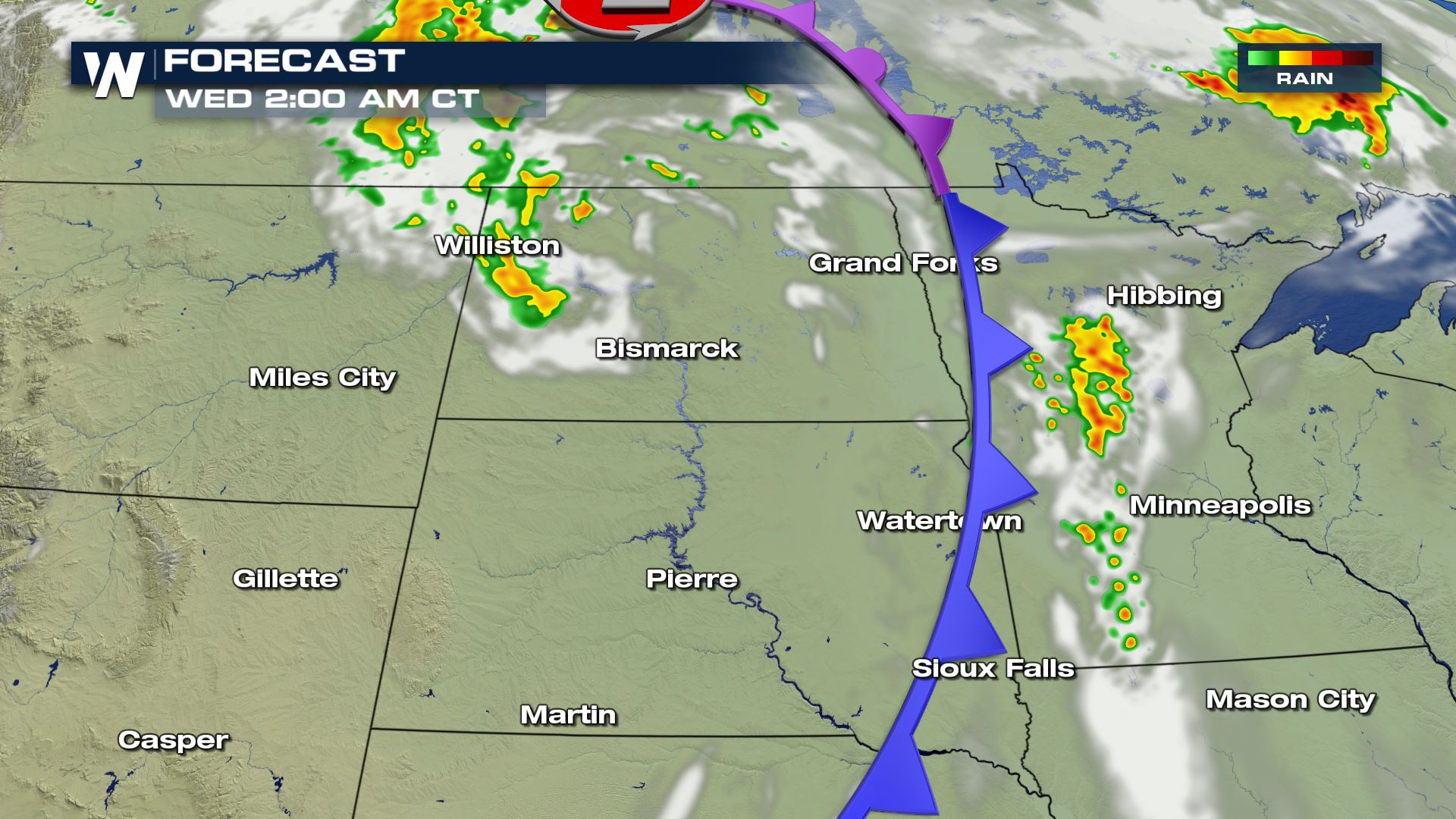
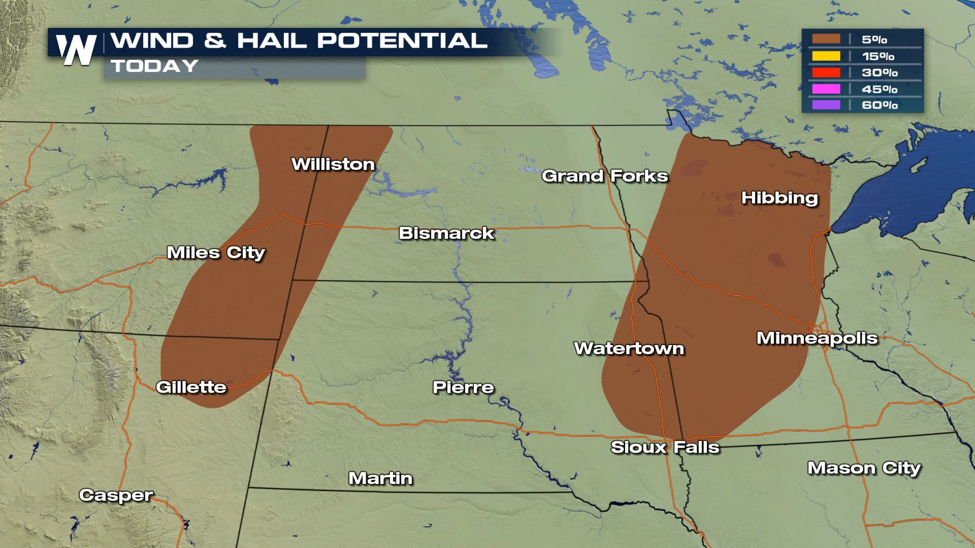 The main risks will be damaging winds and large hail. Wind gusts over 58 MPH and hail up to 1" in diameter will be the risks to be concerned about.
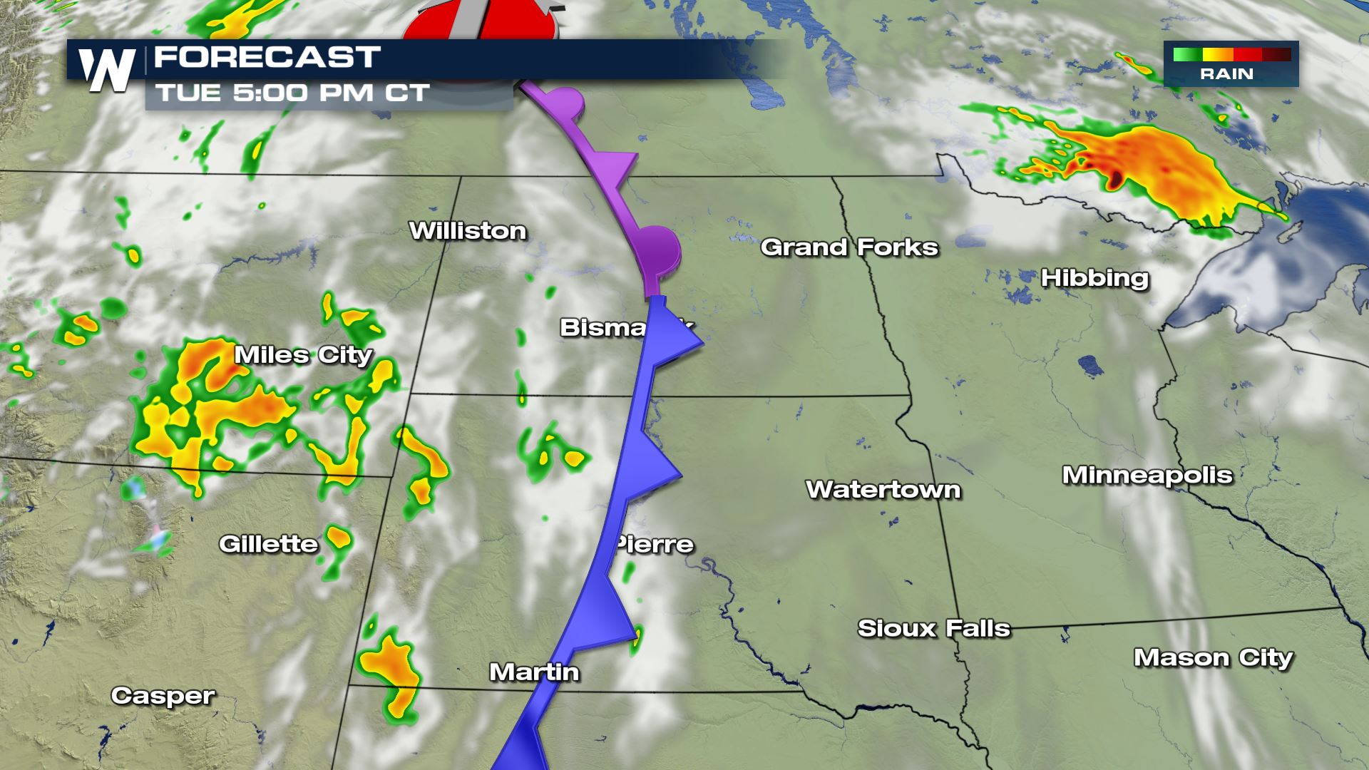

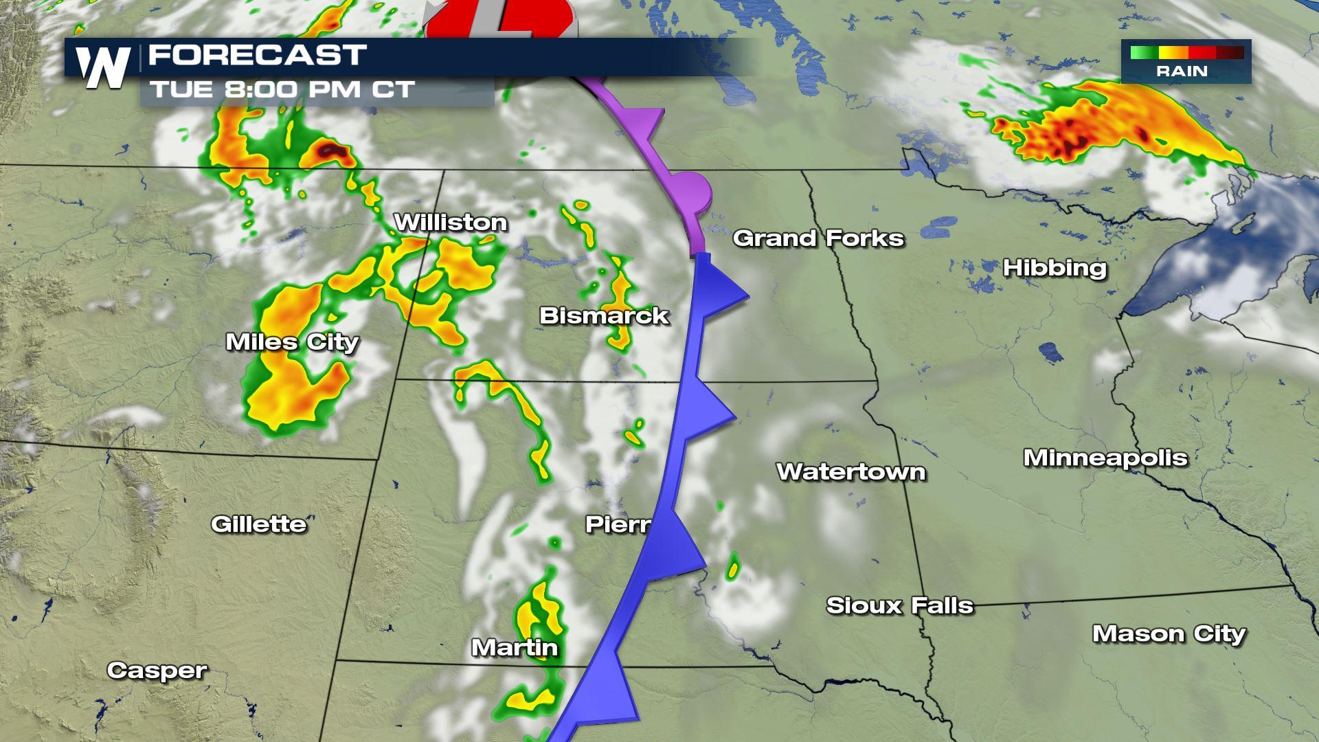
 You can see the latest timing for these storms will be from the afternoon and evening through the early morning hours of Thursday. Keep checking with WeatherNation for the very latest updates on today's severe weather chances.
Severe Outlook
You can see 2 separate areas for severe weather for today and tonight. This will be based on the track of the cold front. Montana, Wyoming and the Dakotas will have the risk during the afternoon and evening. Then Minnesota will see the risk increase for the overnight.
Severe Risks
The main risks will be damaging winds and large hail. Wind gusts over 58 MPH and hail up to 1" in diameter will be the risks to be concerned about.
Forecast
You can see the latest timing for these storms will be from the afternoon and evening through the early morning hours of Thursday. Keep checking with WeatherNation for the very latest updates on today's severe weather chances.All Weather News
More
Flooding Risk Increases as Heavy Rain Targets the Tri-State Area
Tuesday, heavy rainfall moved across the Nort
30 Jul 2026 12:25 AM


Genevieve Down to a Category 2 Hurricane
PacificFausto is now a post-tropical cyclone.
30 Jul 2026 12:00 AM

Severe Weather: Energy From the Midwest Now in the Southeast
UPPER MIDWEST - Through Monday, dangerous tor
29 Jul 2026 10:30 PM


Southeast Flood Risk Lingers Near Stalled Front
A stalled boundary over the Southeast will ke
25 Jul 2026 10:55 AM

Another Round of Storms Targets the Northeast
Tuesday brought severe weather again across p
23 Jul 2026 1:15 AM