Northern High Plains Severe Chances Sunday
Top Stories
29 Sep 2019 4:29 AM
An upper-level trough moving across the Plains will be the focus for severe storms today and tonight. Areas across the Northern High Plains will have the strongest chance for severe storms. Here is the very latest on today's severe weather.
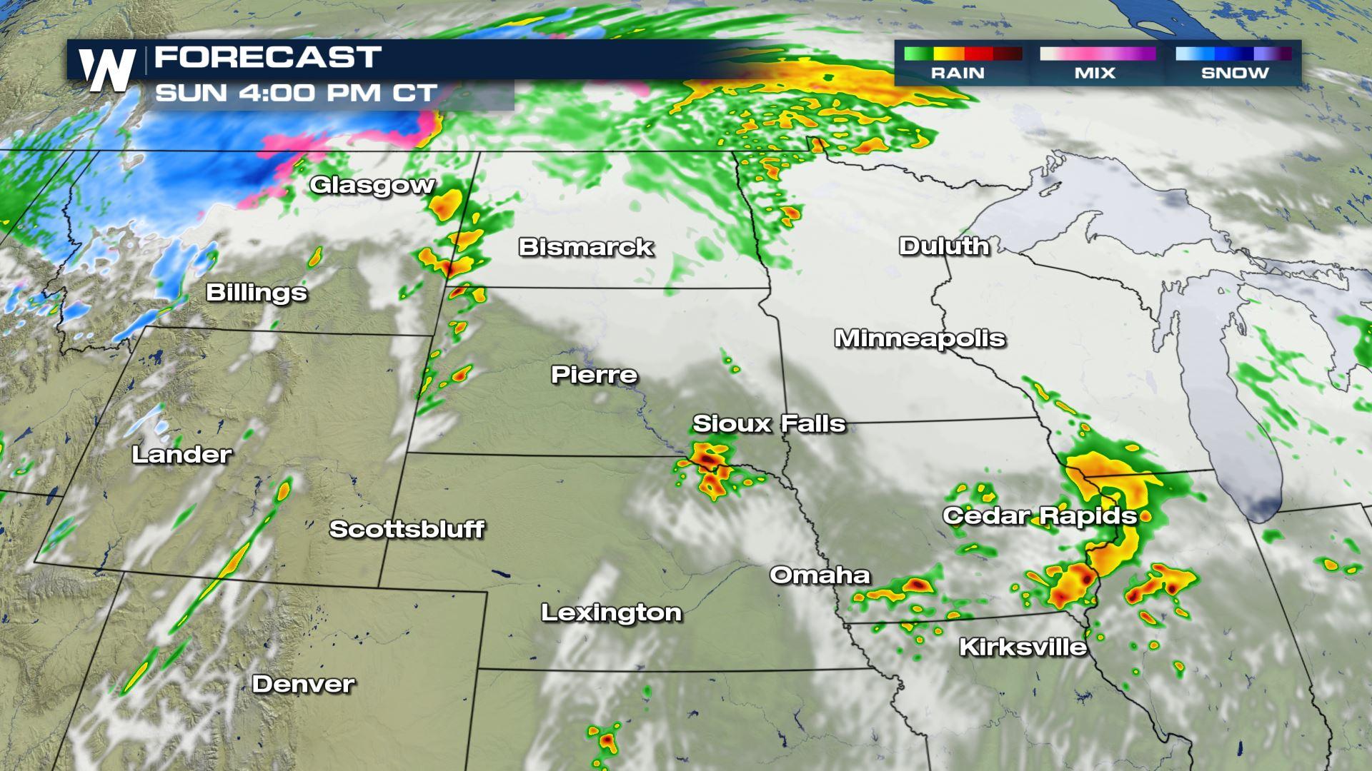
 Isolated to scattered severe storms are in the forecast today from the Southern Plains to the Upper-Mississippi Valley. These storms will be developing from the same weather system that has brought the heavy snow to areas of the Northwest.
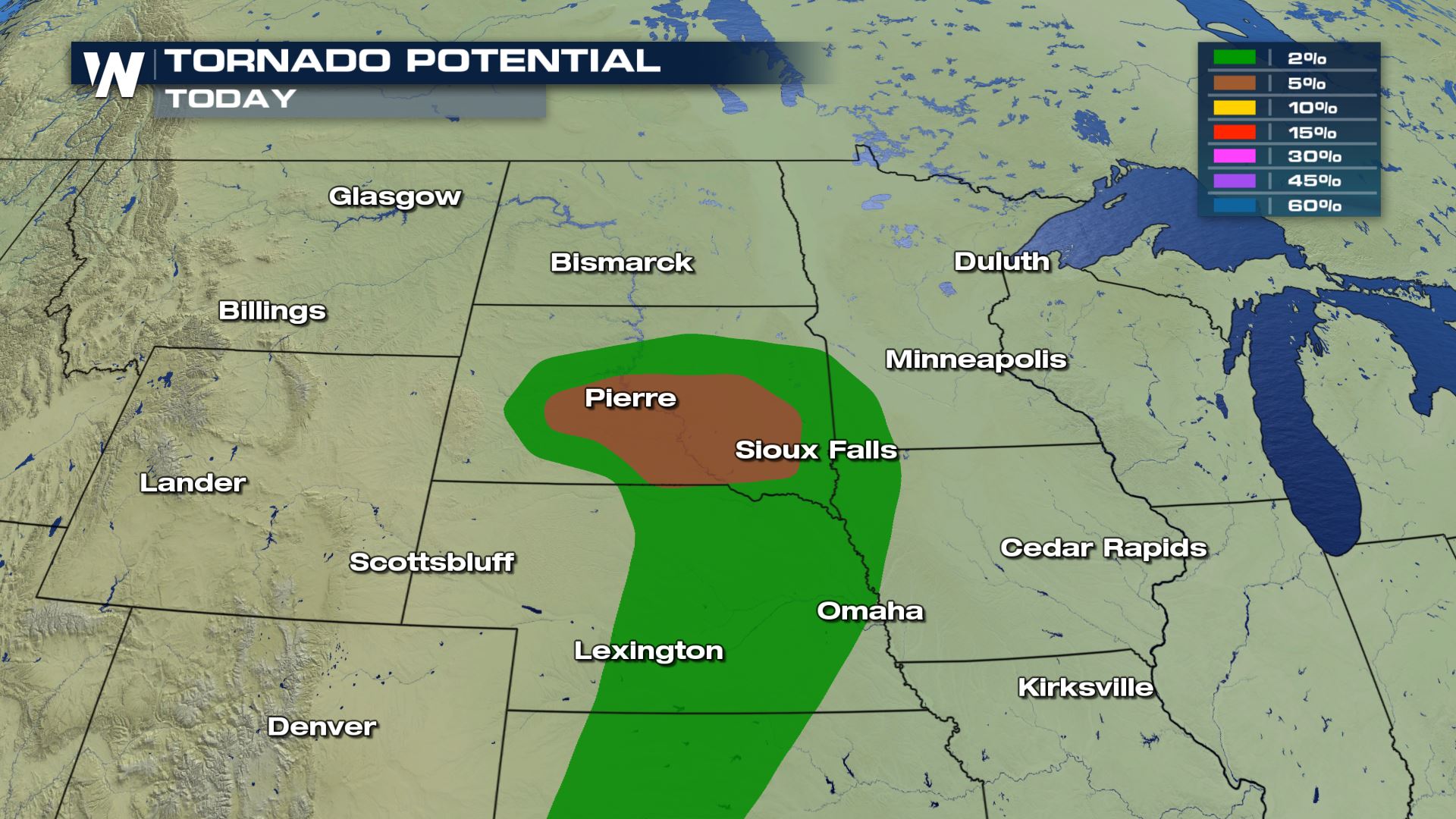
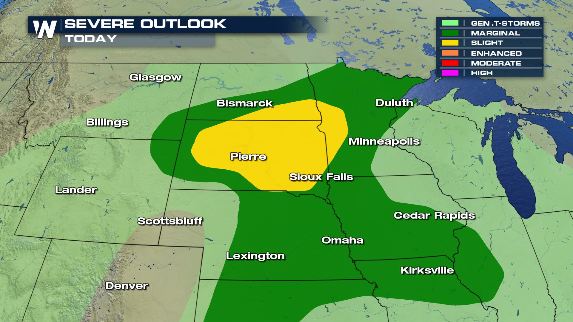
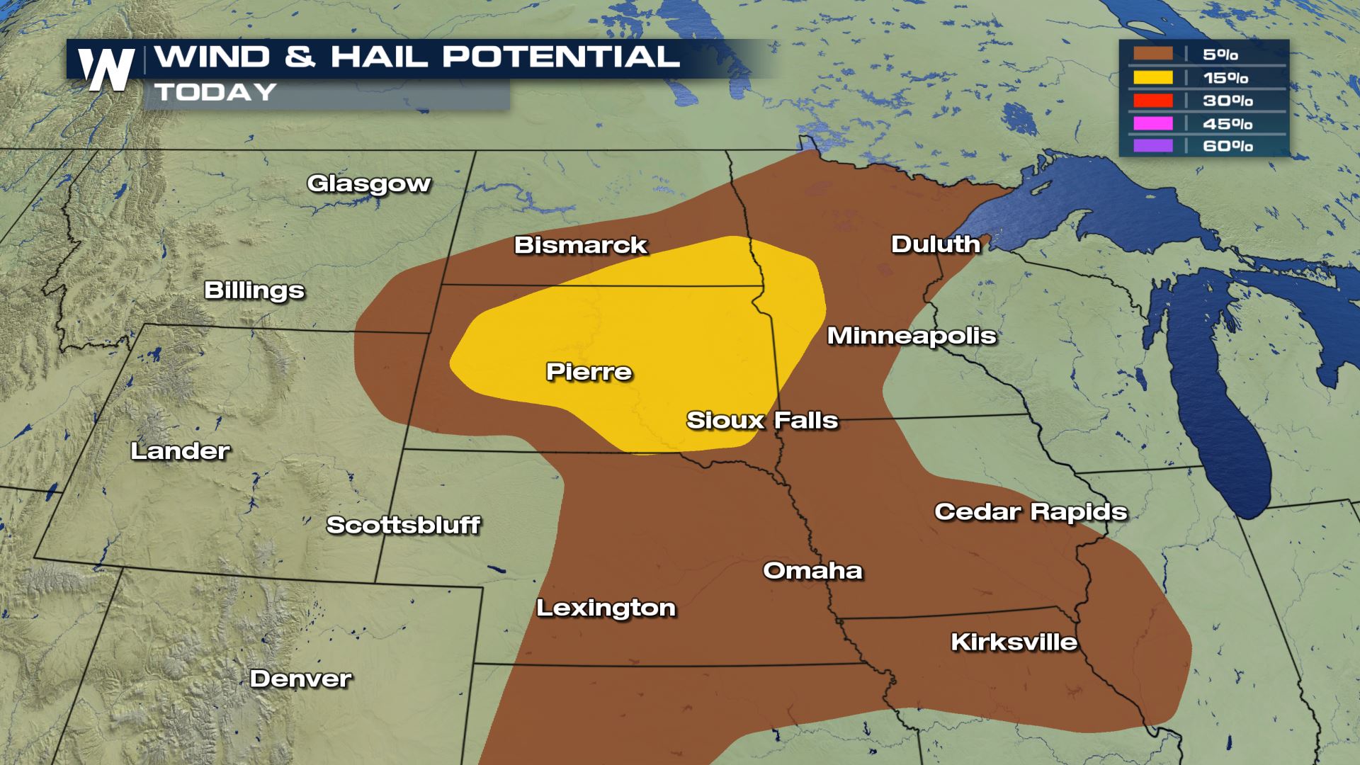 All modes of severe weather are in the forecast today including the risk of tornadoes. The tornado risk will be highest over South Dakota for cities like Pierre and Sioux Falls.

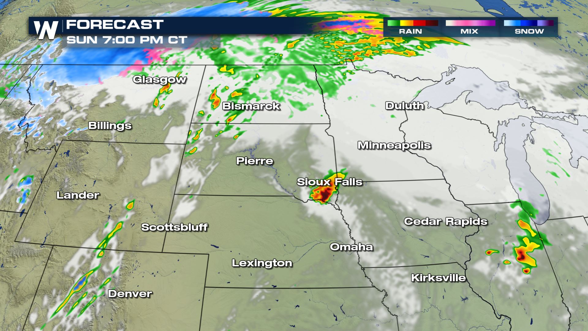
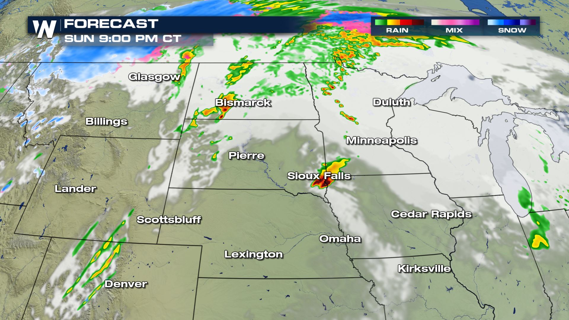 Here you can see the timing for today's storms. During the afternoon and evening is when the risk of severe weather will likely take place. Keep checking with WeatherNation for the very latest severe weather updates.
Severe Outlook
Isolated to scattered severe storms are in the forecast today from the Southern Plains to the Upper-Mississippi Valley. These storms will be developing from the same weather system that has brought the heavy snow to areas of the Northwest.
Severe Risks
All modes of severe weather are in the forecast today including the risk of tornadoes. The tornado risk will be highest over South Dakota for cities like Pierre and Sioux Falls.
Forecast
Here you can see the timing for today's storms. During the afternoon and evening is when the risk of severe weather will likely take place. Keep checking with WeatherNation for the very latest severe weather updates.
All Weather News
More
Wildfire Outbreak in the Pacific Northwest
SPOKANE, WA - On Saturday, August 1st, the Ol
3 Aug 2026 1:55 AM

More Storms for the East Through Monday
A low-pressure system that moved through the
3 Aug 2026 1:50 AM


After Reaching Category 5, Genevieve Weakens in the Pacific
PacificGenevieve formed last Friday south of
3 Aug 2026 12:30 AM

Flooding, Severe Storms Target the Midwest Again
After an active week of storms across the nor
1 Aug 2026 1:40 AM

Flooding Risk Increases as Heavy Rain Targets the Tri-State Area
Tuesday, heavy rainfall moved across the Nort
30 Jul 2026 12:25 AM

Severe Weather: Energy From the Midwest Now in the Southeast
UPPER MIDWEST - Through Monday, dangerous tor
29 Jul 2026 10:30 PM