Upper Midwest and Plains Severe Weather Risk into This Weekend
Special Stories
26 Jul 2019 8:00 AM
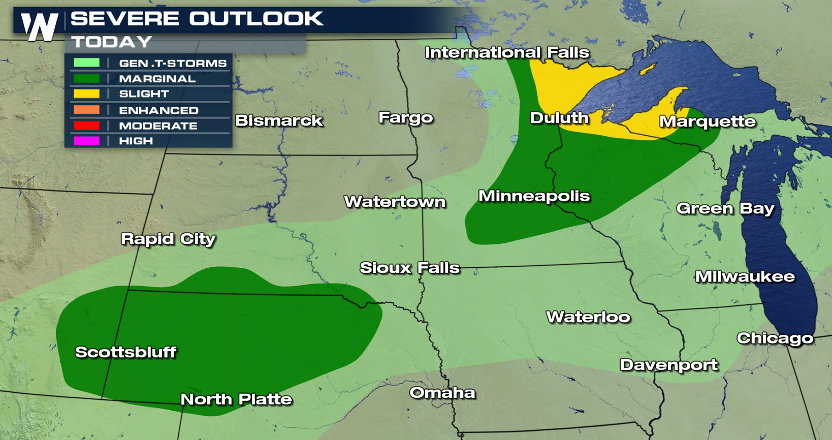
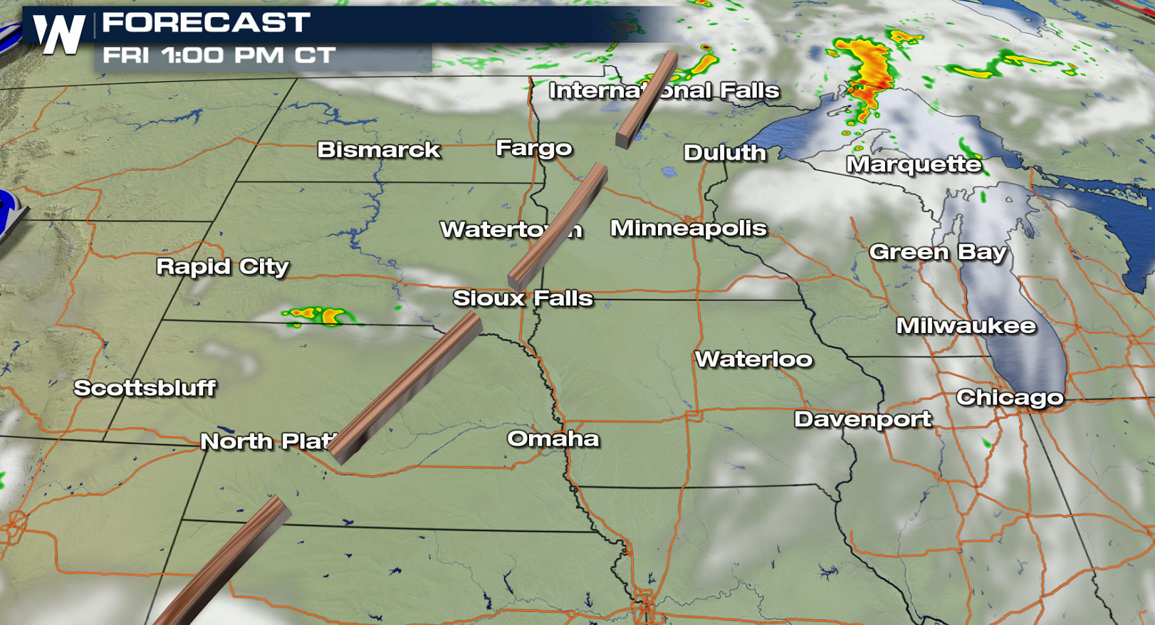
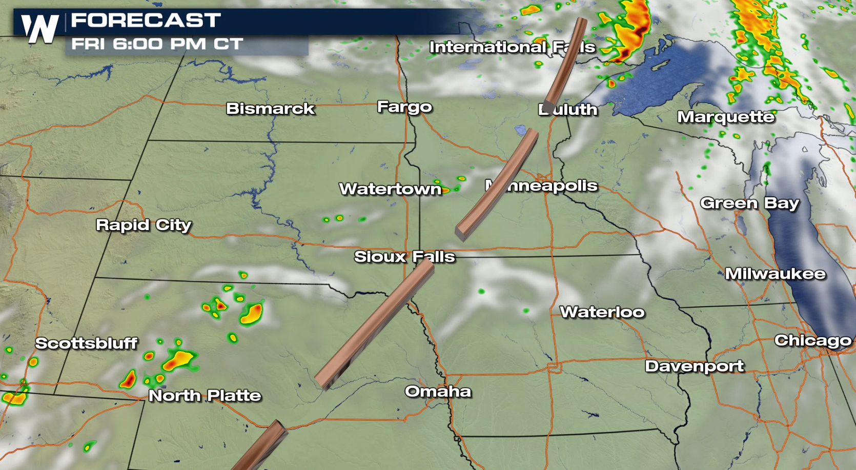
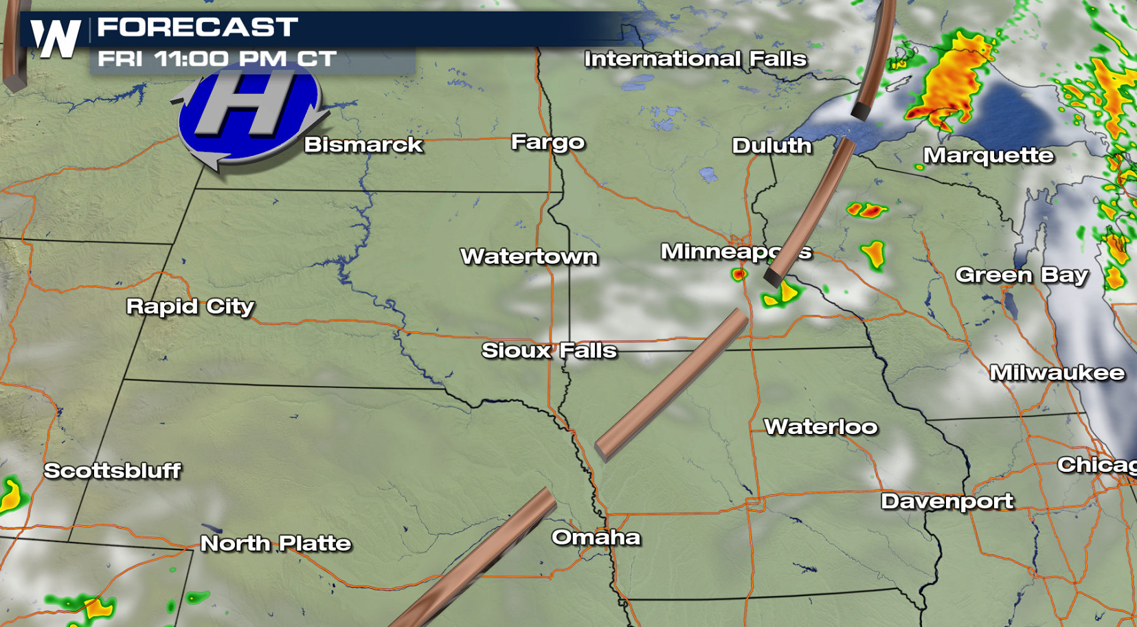
After a short break, the threat for severe thunderstorms has returned to the Plains and Upper Midwest into this weekend. There is a slight risk for severe thunderstorms in Minnesota, Wisconsin, the Upper Peninsula of Michigan today (Friday).
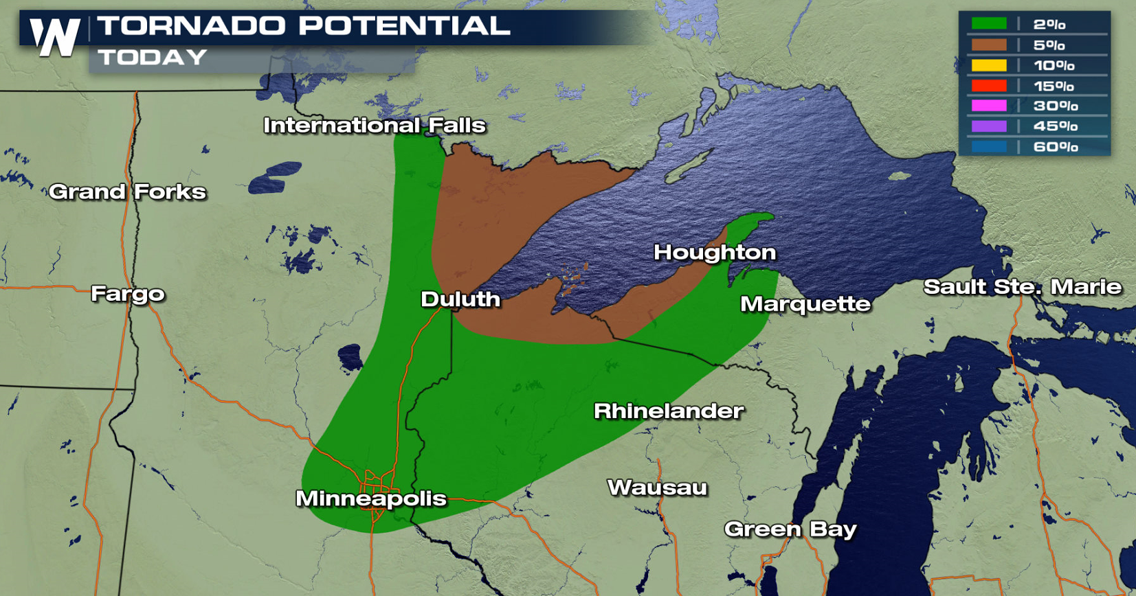
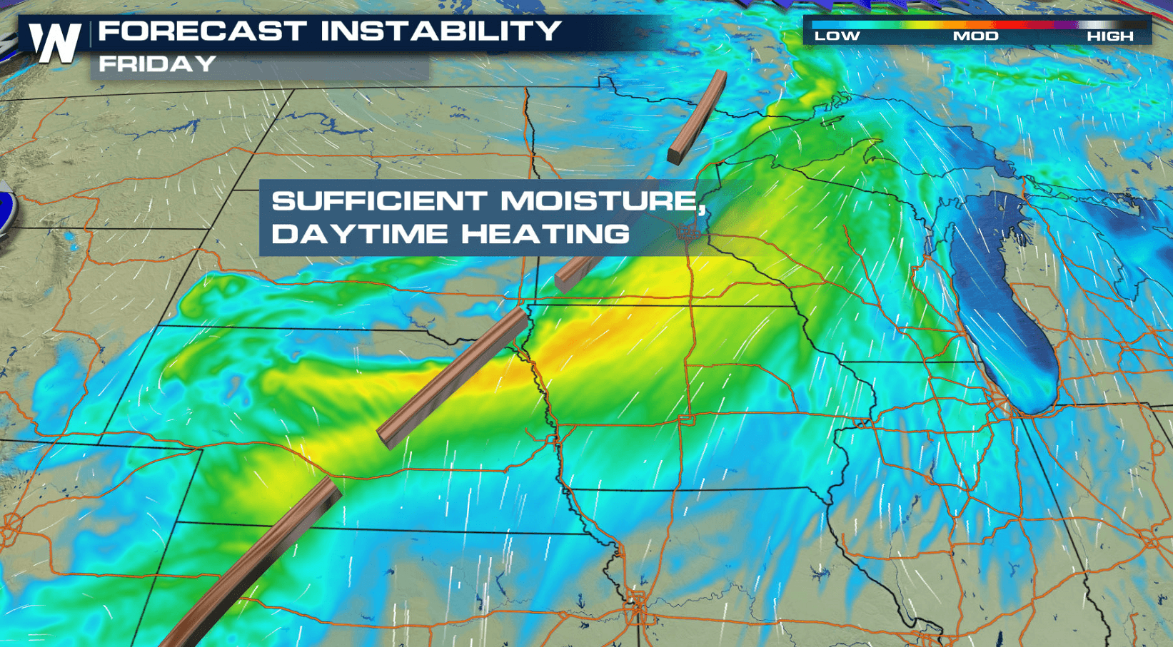
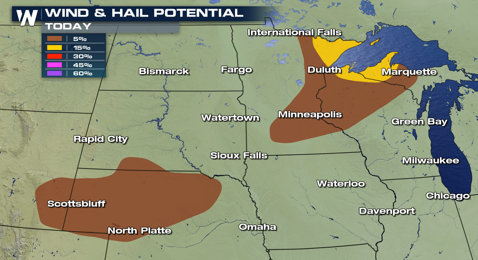 Instability will be climbing ahead of a weak trough and nearby low pressure center and warm front in Canada. Storms will be slow to form in the late afternoon, but will increase in intensity into the evening. Large hail and damaging wind gusts are the biggest concern through the overnight.
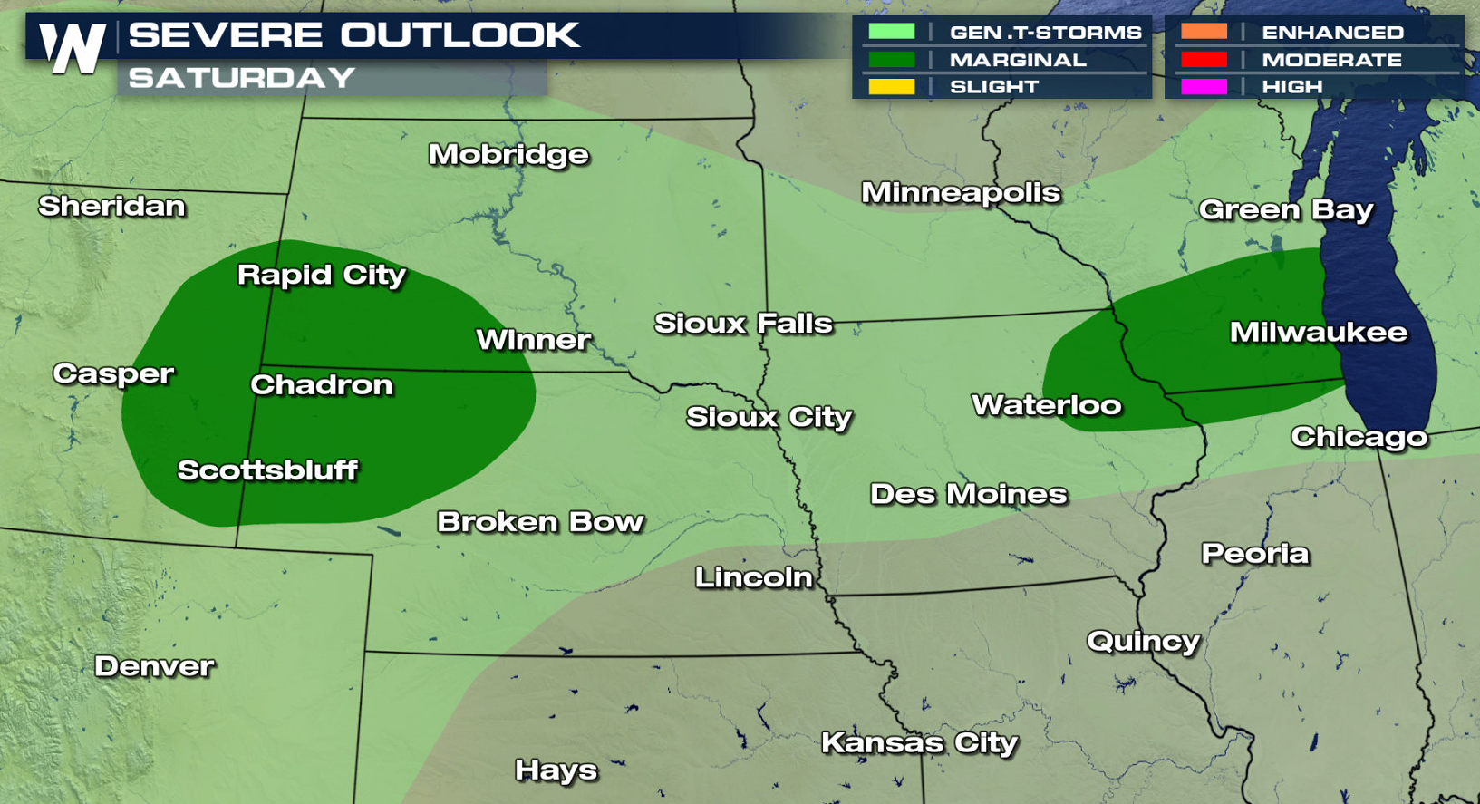
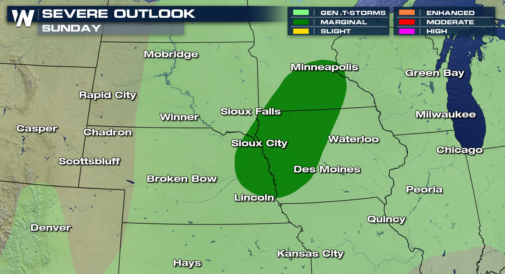
 The storm system will weaken as it moves slowly to the south and east Saturday and Sunday. Overall coverage will be less, but some storms will still be severe. A marginal risk has been posted from Milwaukee to Cheyenne Saturday, and from Minneapolis to Omaha Sunday.
 For WeatherNation: Meteorologist Mace Michaels
Instability will be climbing ahead of a weak trough and nearby low pressure center and warm front in Canada. Storms will be slow to form in the late afternoon, but will increase in intensity into the evening. Large hail and damaging wind gusts are the biggest concern through the overnight.
The storm system will weaken as it moves slowly to the south and east Saturday and Sunday. Overall coverage will be less, but some storms will still be severe. A marginal risk has been posted from Milwaukee to Cheyenne Saturday, and from Minneapolis to Omaha Sunday.
For WeatherNation: Meteorologist Mace MichaelsAll Weather News
More
Wildfire Outbreak in the Pacific Northwest
SPOKANE, WA - On Saturday, August 1st, the Ol
2 Aug 2026 7:20 PM

More Storms for the East Through Monday
A low-pressure system that moved through the
2 Aug 2026 7:20 PM


After Reaching Category 5, Genevieve Weakens in the Pacific
PacificGenevieve formed on last Friday south
2 Aug 2026 6:25 PM

Flooding, Severe Storms Target the Midwest Again
After an active week of storms across the nor
1 Aug 2026 1:40 AM

Flooding Risk Increases as Heavy Rain Targets the Tri-State Area
Tuesday, heavy rainfall moved across the Nort
30 Jul 2026 12:25 AM

Severe Weather: Energy From the Midwest Now in the Southeast
UPPER MIDWEST - Through Monday, dangerous tor
29 Jul 2026 10:30 PM