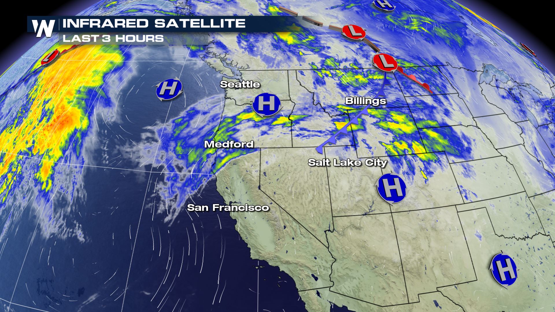
Northern Rockies/Plains Snow Tonight
Special Stories
17 Jan 2021 8:15 PM
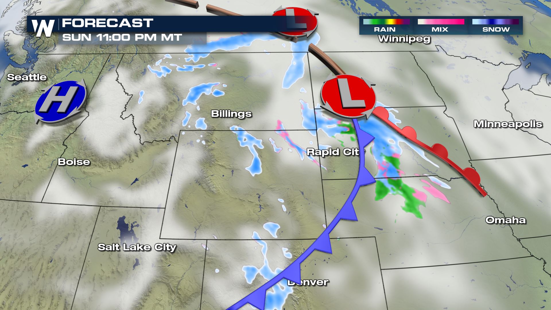
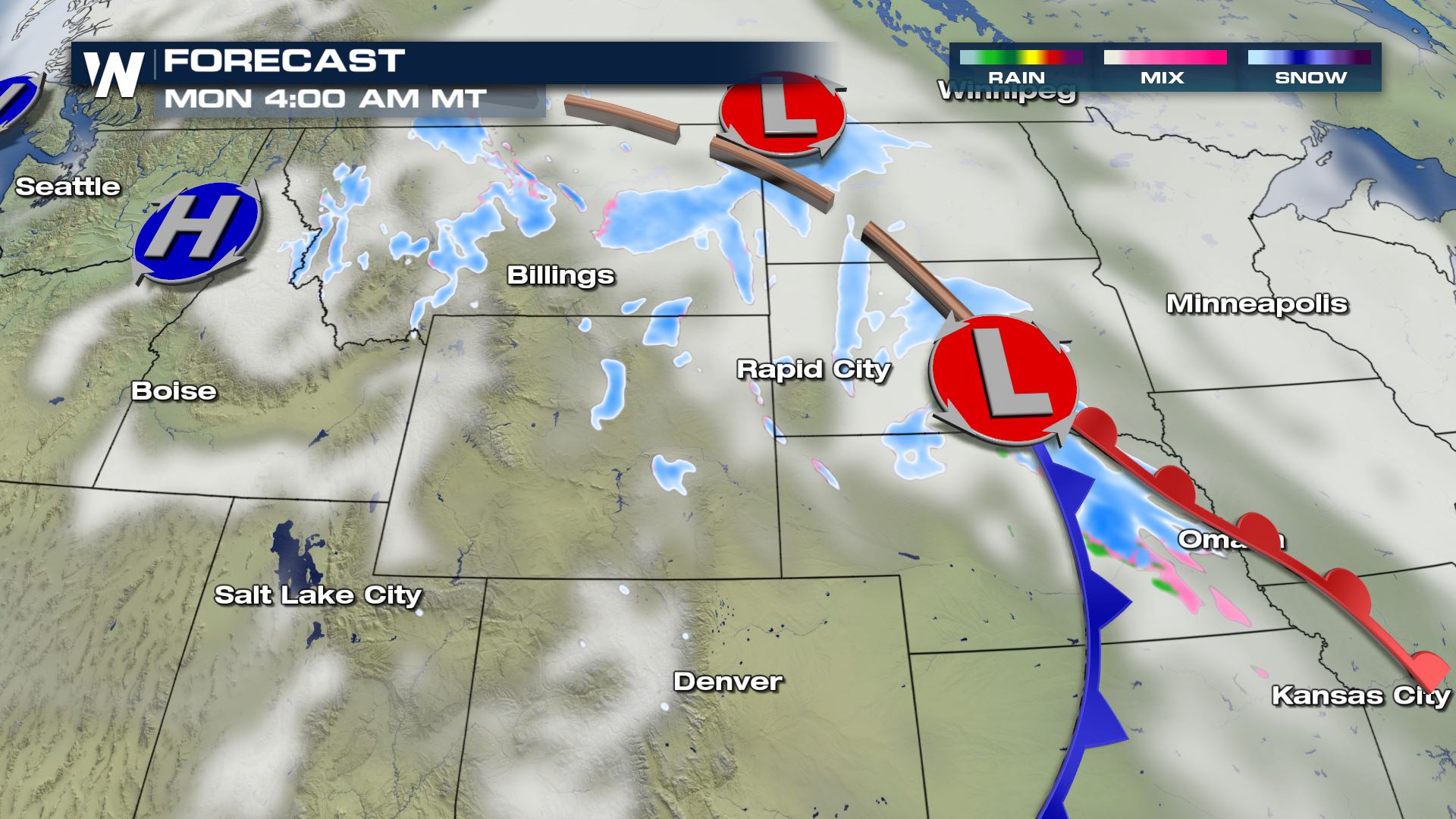
A weaker variety system will drop southward through the Northern Rockies and Northern Plains tonight (Sunday night) and put down some snow in its track.
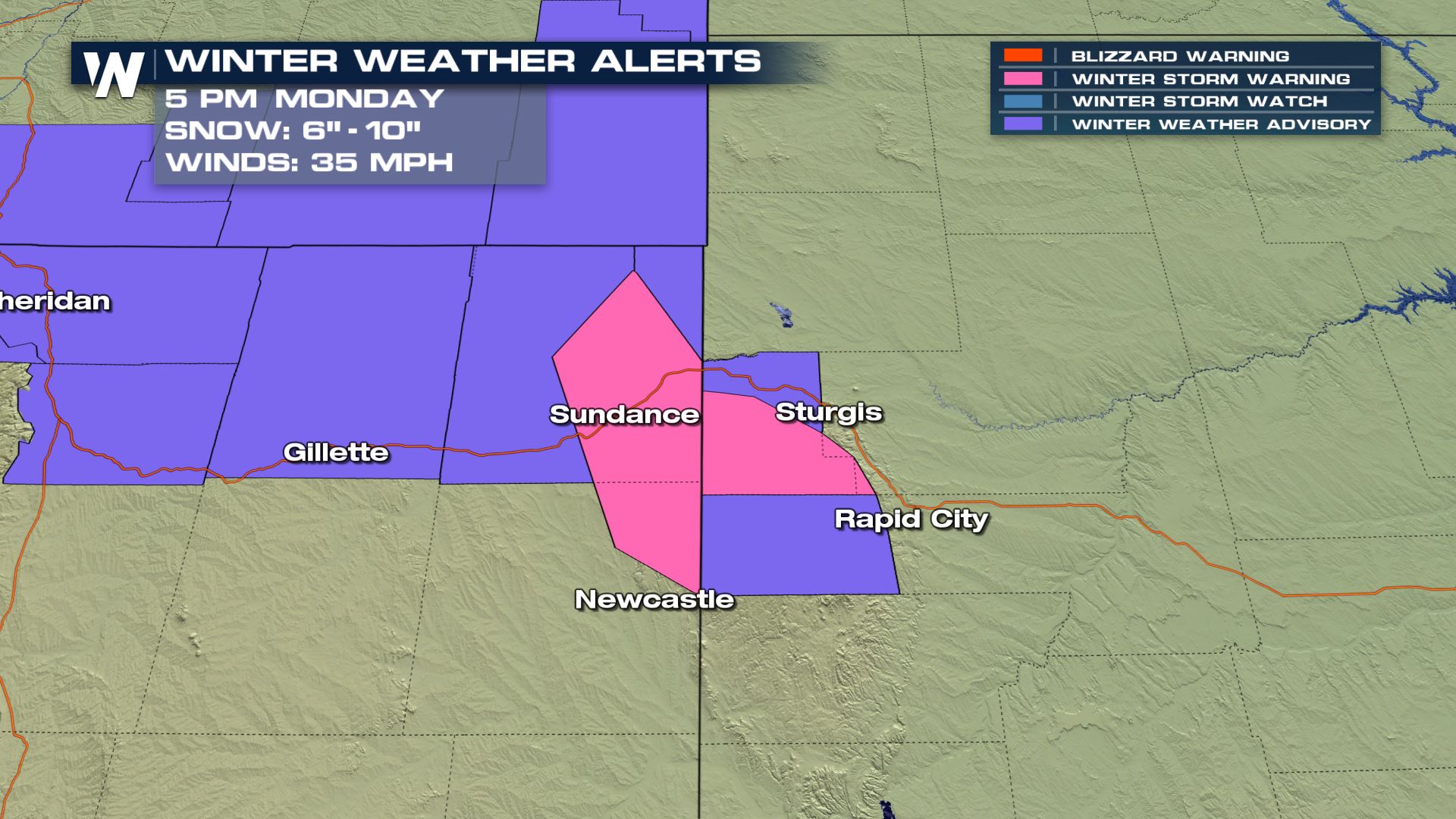
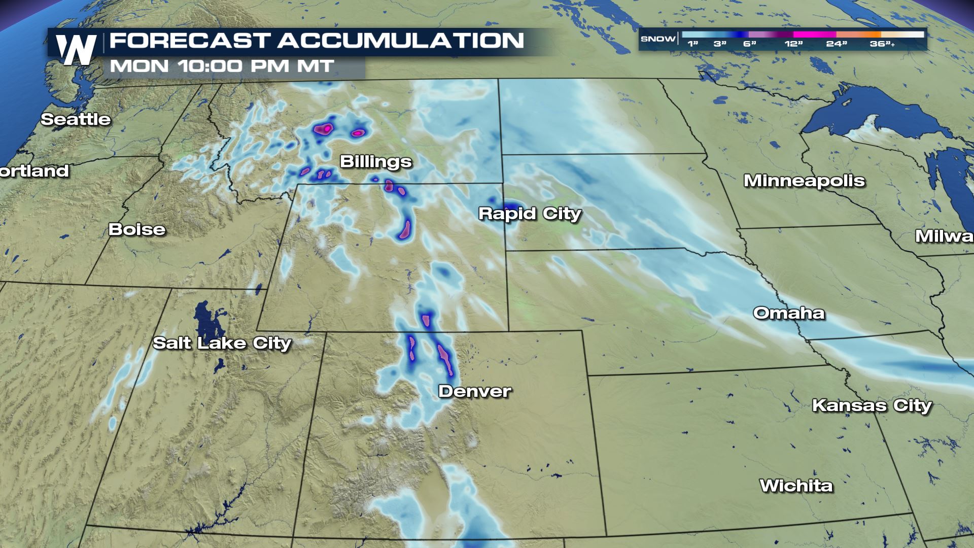
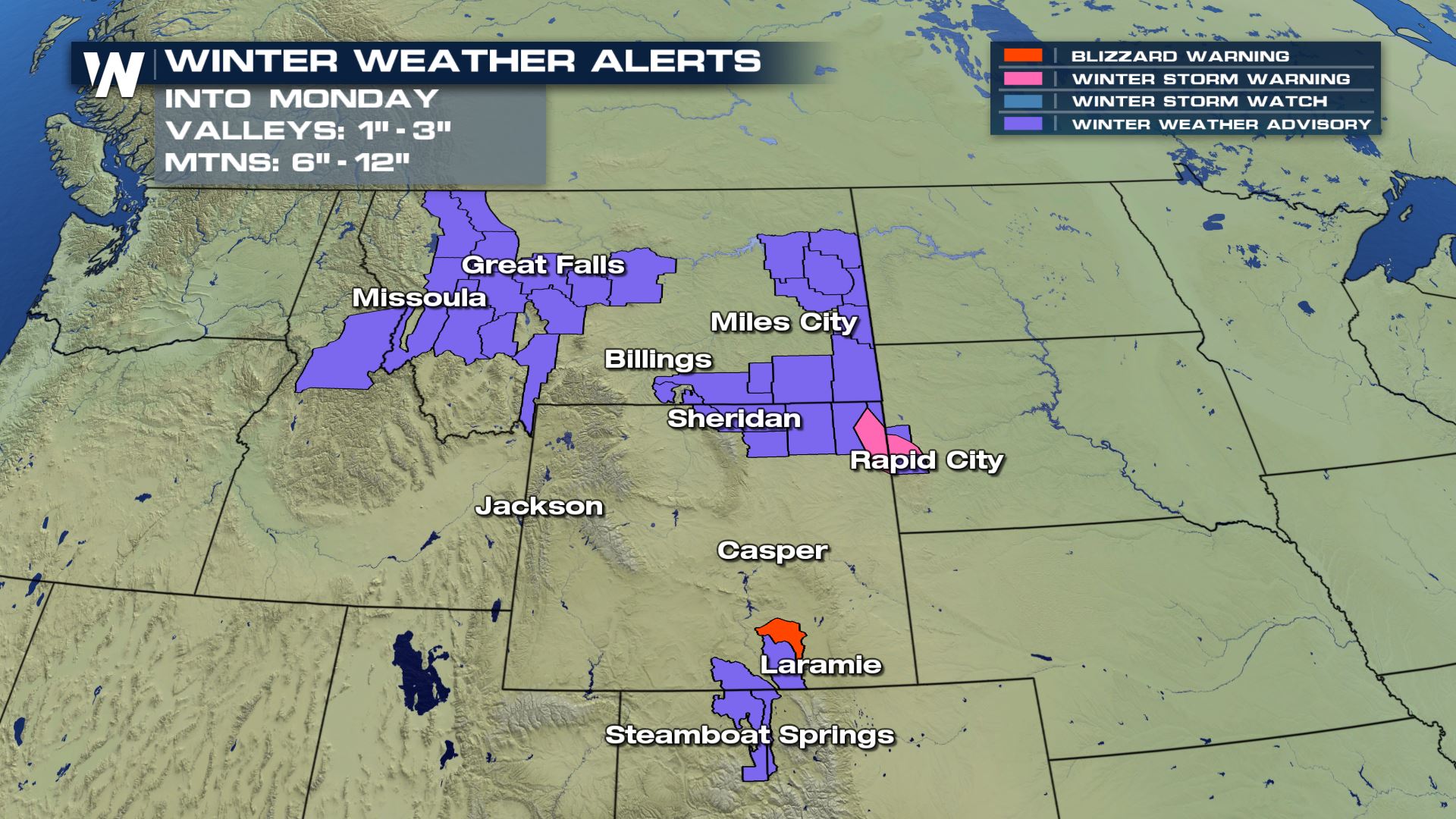 The Black Hills of South Dakota and locations into Wyoming could find over a 1/2 a foot of snow by Monday night. Those spots are under a winter storm warning into Monday night.
 Outside of Laramie, Wyoming a blizzard warning is in effect where the snow may not be quite as much as forecast for the winter storm warned areas, but for winds frequently at or gusting to 35 mph, reduced visibility of 1/4 mile or less, and where both are experienced for 3 hours or longer.
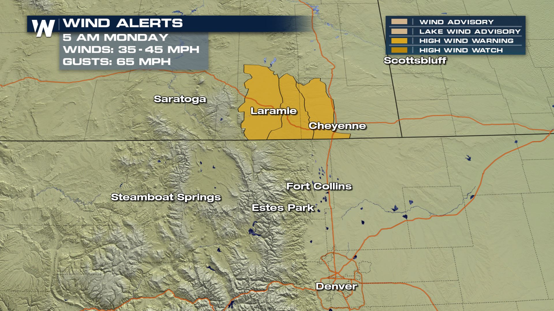
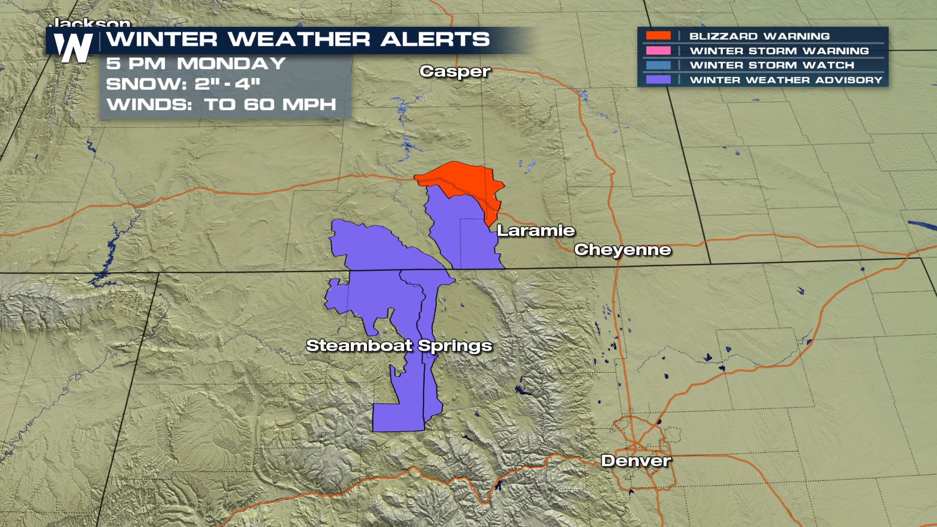 A high wind warning is also in effect for the areas around the blizzard warning in Wyoming for sustained winds of 35 -45 mph and possible gusts up to 65 mph.

The most snow should be found on the tallest peaks within the Rockies, but the Black Hills and parts of Northeast Wyoming could find nearly a foot of snow too.
 We'll have updates on this snow forecast into the nighttime hours tonight (Sunday) and track the snow through the day on Monday.
Stay with WeatherNation for all of your weather information!
Alerts
A number of winter weather advisories are in effect into Monday while a winter storm warning and blizzard warning are in effect for some very specific locations. The Black Hills of South Dakota and locations into Wyoming could find over a 1/2 a foot of snow by Monday night. Those spots are under a winter storm warning into Monday night.
 Outside of Laramie, Wyoming a blizzard warning is in effect where the snow may not be quite as much as forecast for the winter storm warned areas, but for winds frequently at or gusting to 35 mph, reduced visibility of 1/4 mile or less, and where both are experienced for 3 hours or longer.
 A high wind warning is also in effect for the areas around the blizzard warning in Wyoming for sustained winds of 35 -45 mph and possible gusts up to 65 mph.

Timing
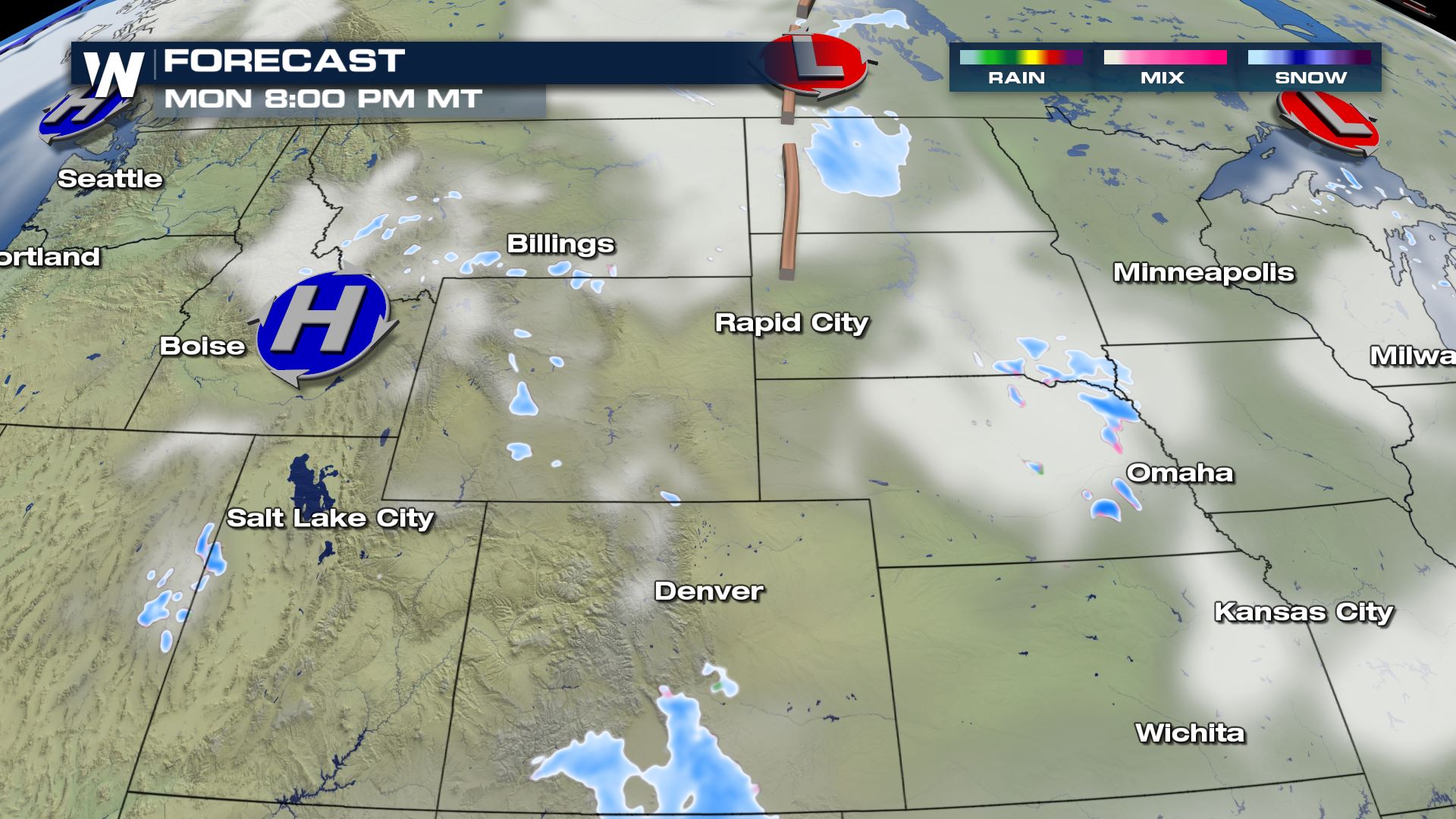
The snow has already started outside of Rapid City, SD tonight. The snow will make its way south overnight and eventually end up in Southern Colorado and Northern New Mexico by Monday night.


 Totals
The most snow should be found on the tallest peaks within the Rockies, but the Black Hills and parts of Northeast Wyoming could find nearly a foot of snow too.
 We'll have updates on this snow forecast into the nighttime hours tonight (Sunday) and track the snow through the day on Monday.
Stay with WeatherNation for all of your weather information!
We'll have updates on this snow forecast into the nighttime hours tonight (Sunday) and track the snow through the day on Monday.
Stay with WeatherNation for all of your weather information!All Weather News
More