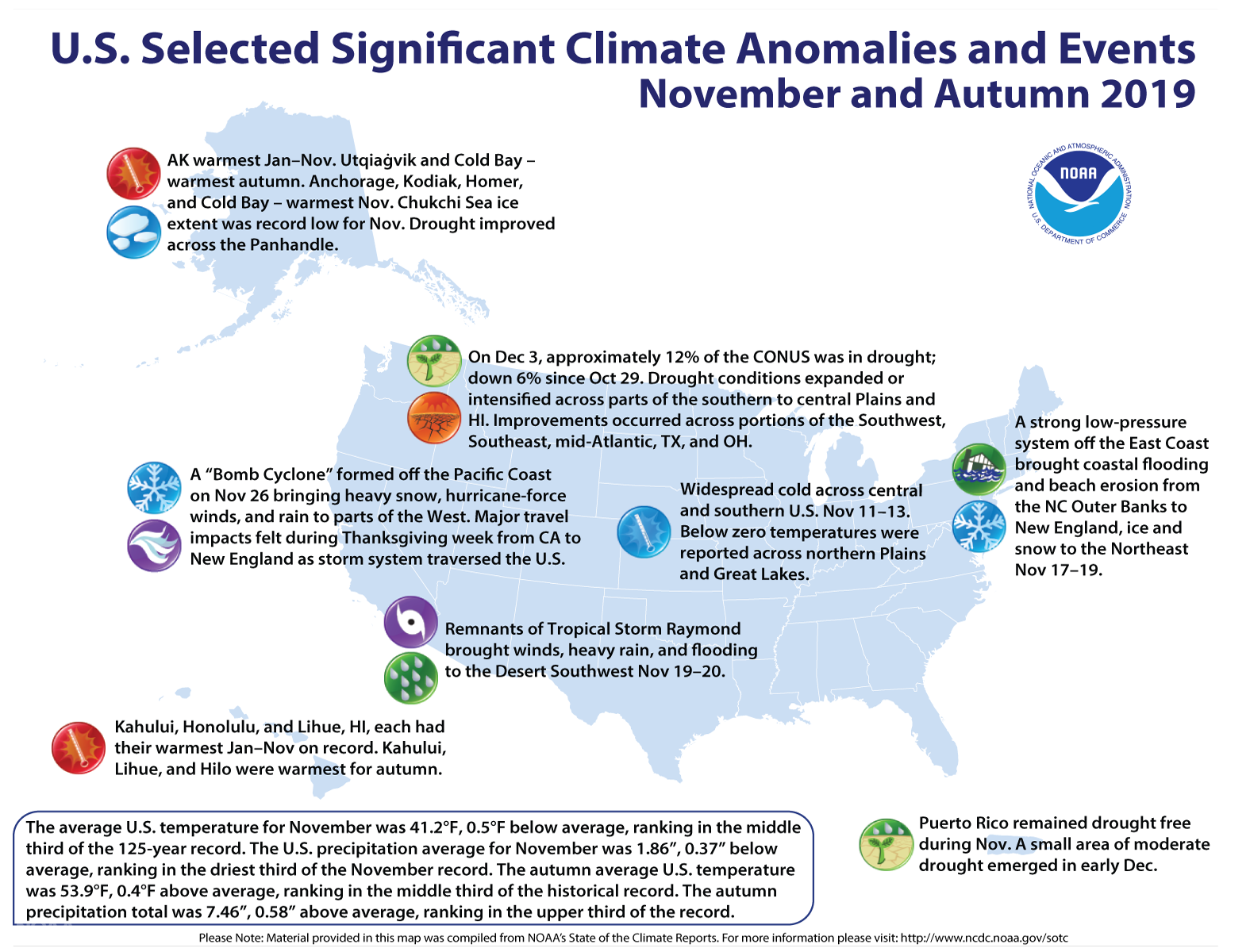
November Recap - Cooler and Drier North, Warmer and Wetter West
Here are more highlights from NOAA’s latest monthly U.S. climate report:
Climate by the numbers
November 2019
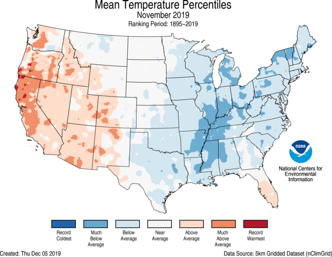
The average November temperature across the contiguous U.S. was 41.2 degrees F (0.5 of a degree below average) and ranked in the middle third of the 125-year record.
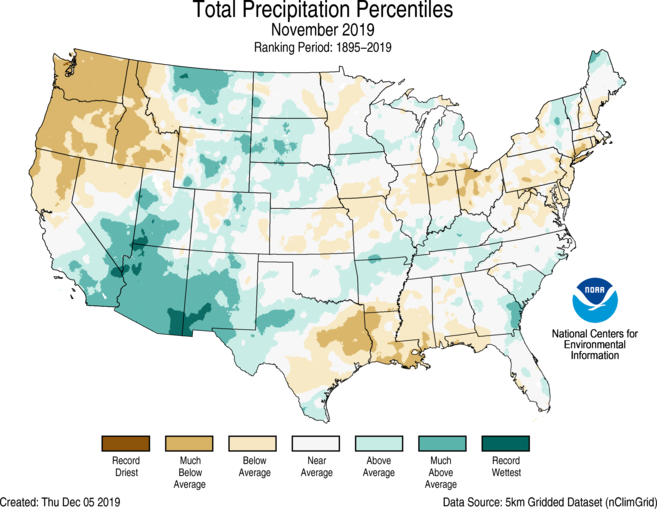
The average precipitation last month across the contiguous U.S was 1.86 inches (0.37 of an inch below average) and ranked in the driest third of the November record.
Above-average precipitation fell across the Southwest, parts of the Rockies and Great Plains, as Arizona had its third-wettest November on record.
Below-average precipitation fell across the Pacific Northwest, the deep South, and parts of the Central Plains, Great Lakes and Mid-Atlantic.
Year to date and meteorological autumn
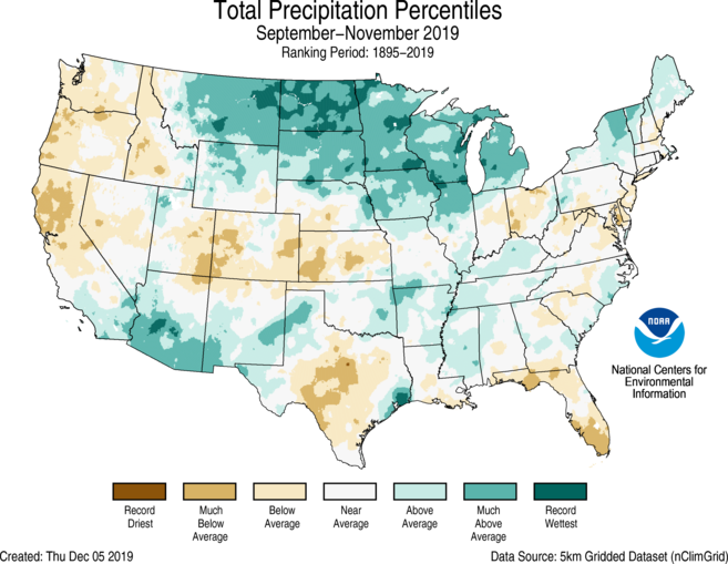
It was a relatively wet and warm meteorological autumn (September through November) across the contiguous U.S. The total autumn precipitation was 7.46 inches — 0.58 inch above average — ranking in the upper third of the historical record.
The average autumn temperature was 53.9 degrees F (0.4 of a degree above average), which ranked in the middle third of the historical record for the season.
The wet autumn extended the year’s soggy stretch, as the U.S. continued its wettest year to date (January through November) on record, with a precipitation total of 32.14 inches (4.55 inches above average).
For the year to date, the average temperature was 54.2 degrees F (0.4 of a degree above average). This ranked in the middle third of the record.
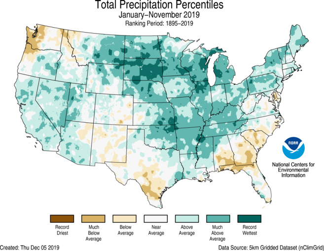
More notable climate events
-
A hot month, season and year for Alaska: Anchorage, Kodiak, Homer and Cold Bay experienced their warmest November on record. Alaska, on the whole, had its fourth-warmest autumn on record. The state also continued its record-warm year to date, which narrowly eclipsed 2016.
-
Raymond brought record rainfall: The remnants of Tropical Storm Raymond in the eastern Pacific Ocean helped set new rainfall records across southeastern Arizona in November.
-
Drought continued to improve: By the end of November, approximately 12% of the contiguous U.S. was in drought, down 6% from the end of last month.
