Four Corners Expecting More Flooding Rain, Mountain Snow

A cut-off low will be moving out of southern California, bringing a surge of deep moisture to the Four Corners this weekend through next week. This low will bring rounds of showers and thunderstorms. Communities across northwest New Mexico, southeast Utah, southwest Colorado, and northeast Arizona could an abundant amount of rain, with some areas picking up over an inch of rain by the end of the weekend.
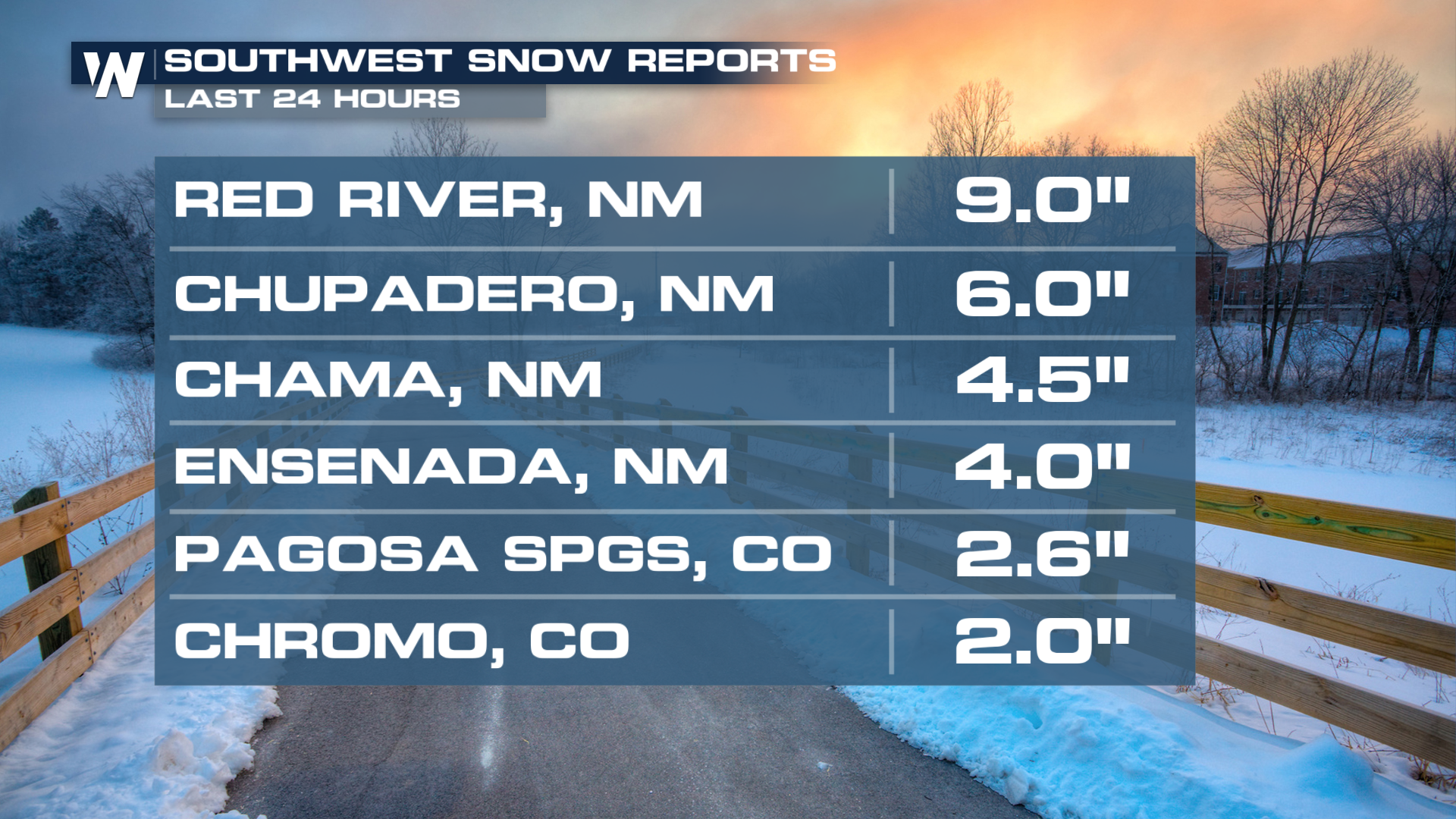
In the mountains, snow has been piling up with 2-9" of snow reported across multiple states on Friday. Higher elevations are cold enough for accumulating mountain snow once again, which may create tricky travel conditions over passes and high-country roadways throughout a busy week for travel.
Forecast
Rain and snow chances will persist throughout the weekend, as the system moves to the Northeast. Heavy snow will return to the mountains, with difficult travel, especially on I-70 in Colorado. The rain and snow will mostly clear out by the beginning of next week.
Isolated rain totals through Sunday could top an inch or two in some areas of Arizona. Some ponding on the roadways and street flooding will be possible. Expect heavy snow in the mountains, upwards of 6"+ in many locations. Ski resorts in Colorado could see more than a foot.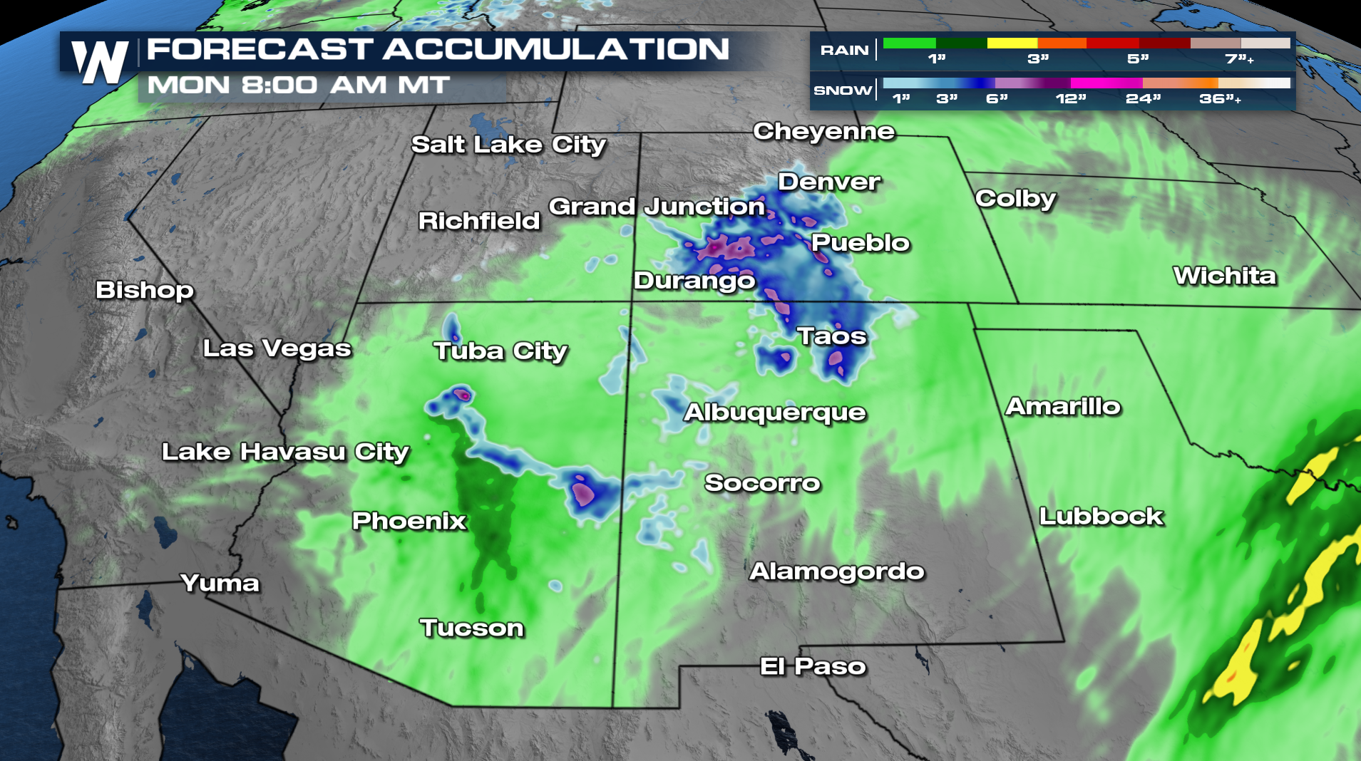
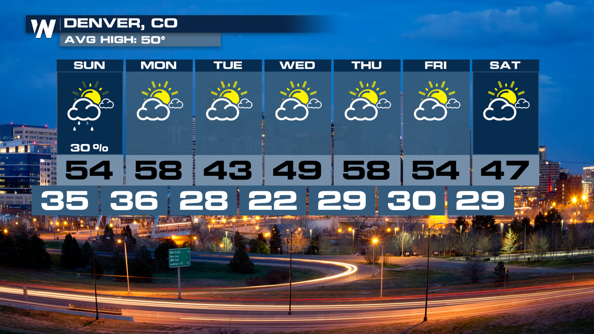
Denver is preparing for a noticeably colder and more unsettled stretch of weather. a flurry might fall down in the Denver metro Saturday into Sunday as a stronger push of colder air drops into the Front Range.
While totals will depend on how quickly temperatures fall and how long the moisture stays in place, it just might be too warm in the metro to see snow.