Weekend System Brings Snow, Ice, & Storms to the Northeast

Top Stories
17 Nov 2025 10:35 AM
OVERNIGHT
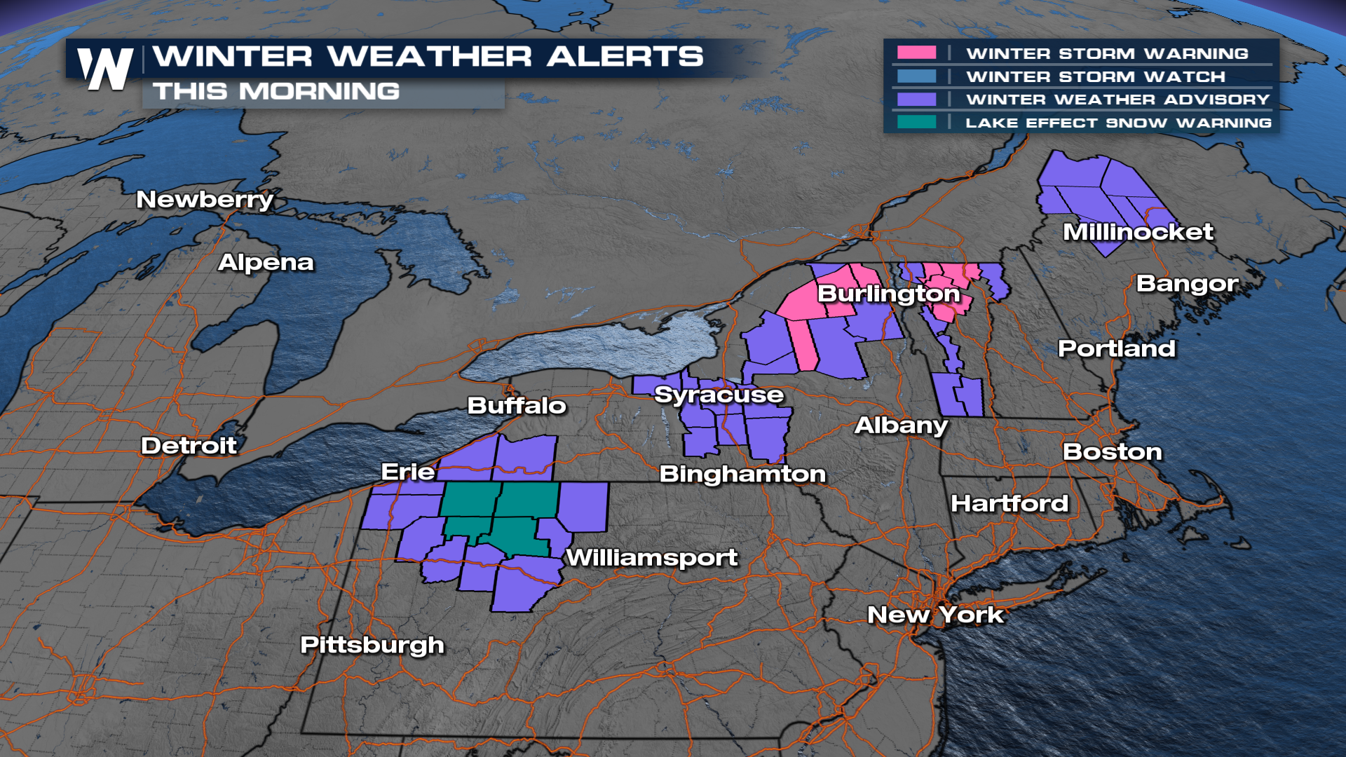
Winter weather alerts remain in place for heavy snow in northern Maine, mixed snow and ice from northern New York through New Hampshire, and even lake effect snow warnings for western Pennsylvania. These alerts will remain in place through Monday.
Snow will be possible overnight and into Monday, with a few lake-effect bands possible. Things will be mostly clear by Monday night.
An additional 3"- 6" will be possible before this system exits.
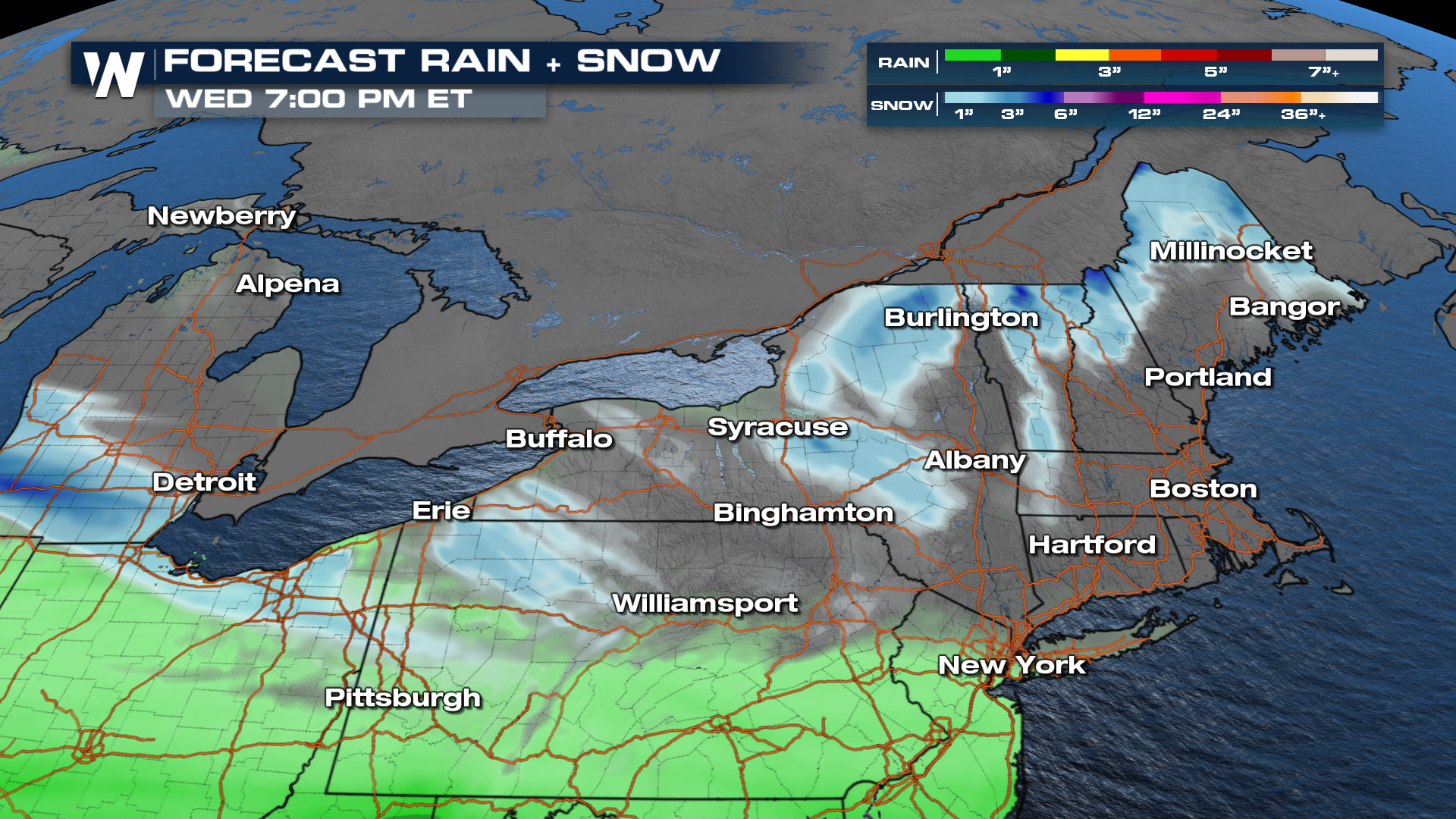
Another system will follow in the footsteps of this one, closer to the middle of the week. Keep up with your East regional forecast as we inch closer to then.
All Weather News
More

Severe Storms, Flash Flooding Overnight In Midwest
WHAT TO EXPECTIt was a very active day across
22 Jun 2026 1:50 AM


Summer Solstice Kicks Off Father's Day Sunday
Fathers across the country will have to share
21 Jun 2026 5:20 PM

Flood Risk Continues This Weekend for the Gulf Coast States
Numerous flash flood warnings were issued as
21 Jun 2026 1:15 PM

Dry T-Storms & Fire Danger in the West
A weak low-pressure system moving through the
20 Jun 2026 1:40 PM

Tornadoes Tear Through The Midwest, Isolated Severe Storms in the South
EARLIER THIS WEEKMONTROSE, IL - A dangerous t
20 Jun 2026 1:30 AM