Hail Storms Moving Through the Ohio Valley

OHIO RIVER VALLEY - We have had multiple reports of hail across Illinois and Indiana.(above) Bellair, IL, saw 2.50" hail as of Tuesday afternoon. The severe threat remains in place through this Wednesday morning.
Ohio Valley
The SPC has maintained a SLIGHT risk for severe weather along the same warm front across parts of Illinois, Indiana, Kentucky, and Tennessee. Most storms should be hail-producers, but an isolated tornado cannot be ruled out.
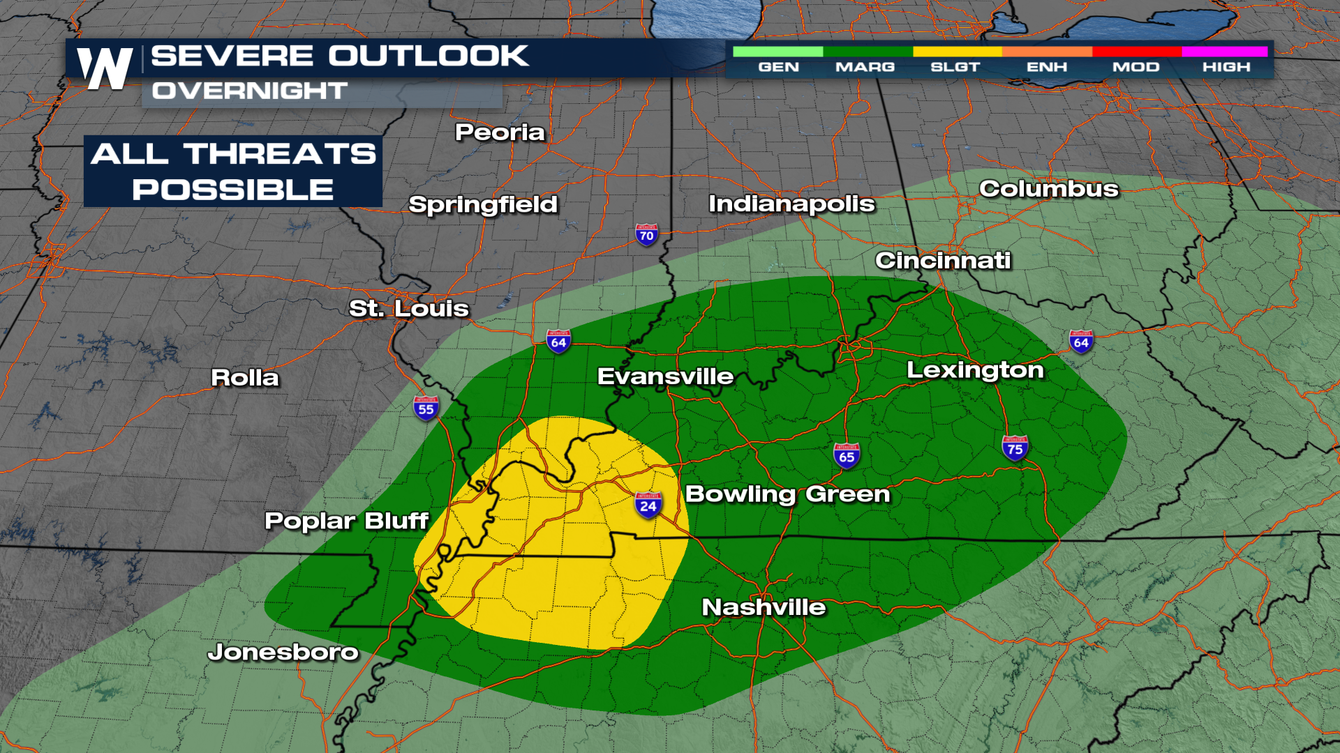 Storms will continue to ride along a low-pressure system through Wednesday morning. Make sure to have multiple ways to get alerts. There may be pockets of heavy rain as this system moves through as well.
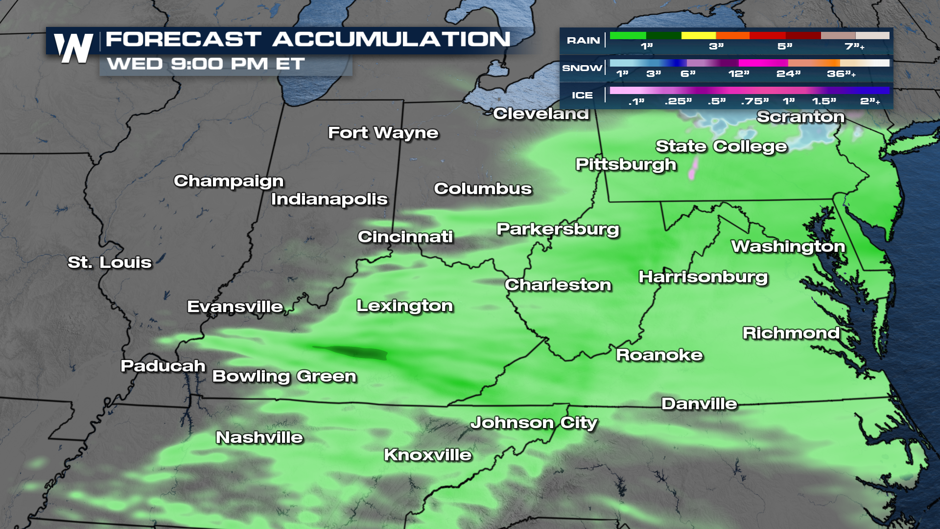
Here's a look at forecast accumulation through Wednesday morning. Most folks will see around a quarter of an inch to an inch of rain. There will be some localised heavy rain of multiple inches possible across portions of Indiana and Ohio.
 For more on this story, join us on WeatherNation for the latest!


