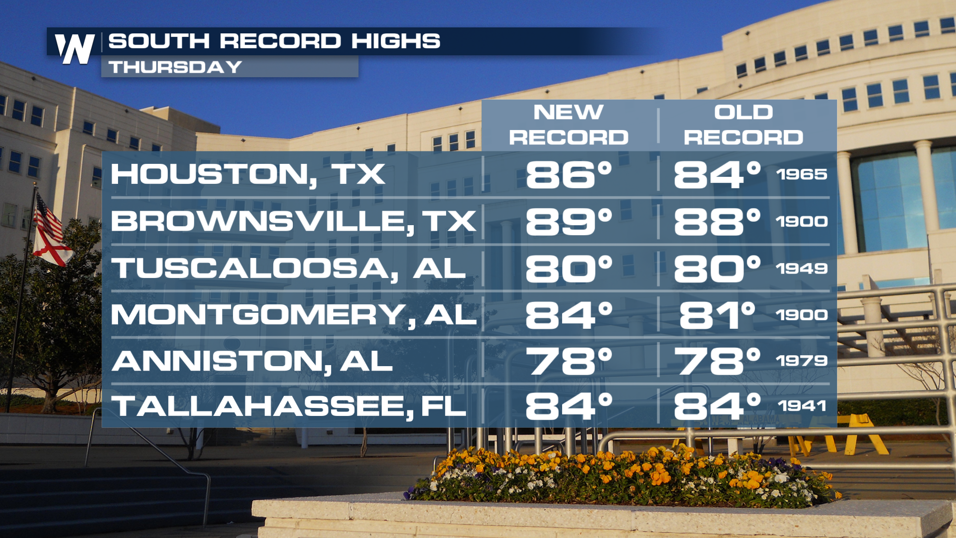
Multiple High Temperature Records Tumbling Again Thursday

Another November day in the south and another day of more record warmth! The high-pressure system bringing the record temperatures continues to dominate the pattern and will stick around through the weekend.
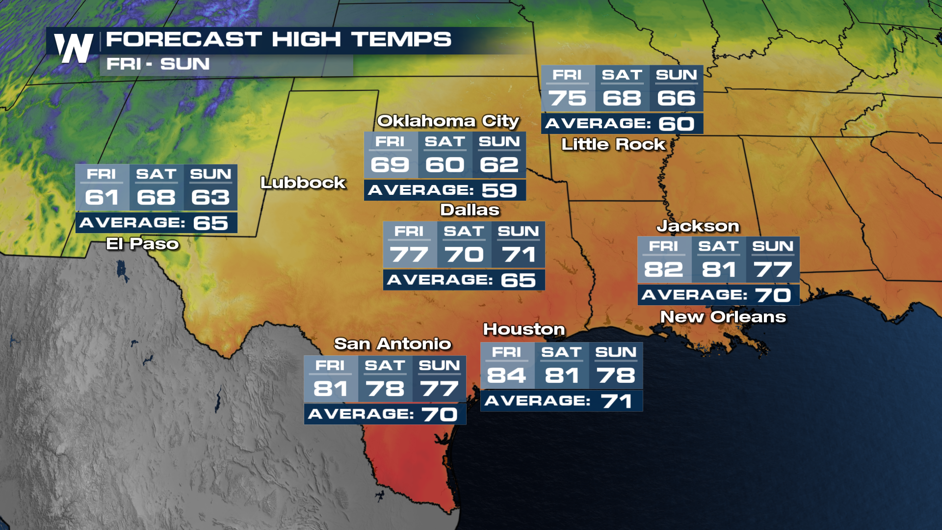
Southern Plains
As a cold front sweeps through, it'll bring temperatures back to seasonal norms for the weekend. However, the front will not push down into the Gulf, allowing these areas to remain much warmer than average into next week.
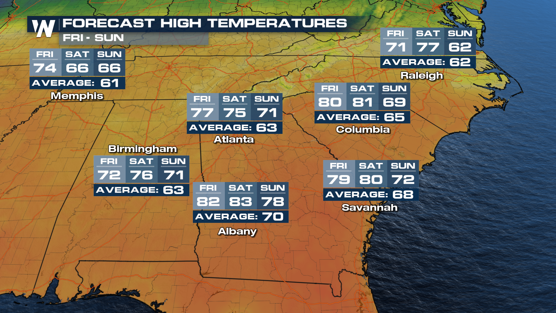
Southeast
Areas out ahead of the front, like much of the Southeast, will continue to see high temperatures push more than 15° above-average in some locales. While it might not be reaching dangerous levels, it's hard to remember to make Thanksgiving travel plans when it's this warm!
 For more information on the central heat, tune into your central regional forecast at :30 past the hour on WeatherNation.


