Flood Risk Elevated in Southern California

CALIFORNIA - The middle of November has been active on the west coast, with multiple storm systems tracking into California over the last ten days. Another low is taking aim at the Golden State to start the weekend, with flash flood potential elevated around Los Angeles Thursday, before the heaviest rain moves into the mountains and deserts. Heavy snow is expected as well, prompting winter weather alerts into the Sierra Nevada Mountains and in Southern California.
Heavy rain will move down the coast from Central California into Southern California throughout the night into early Friday. As the low stalls just offshore, additional rounds of rain and snow linger in Southern California through midday Saturday before the low finally moves east, leading to clearing skies.
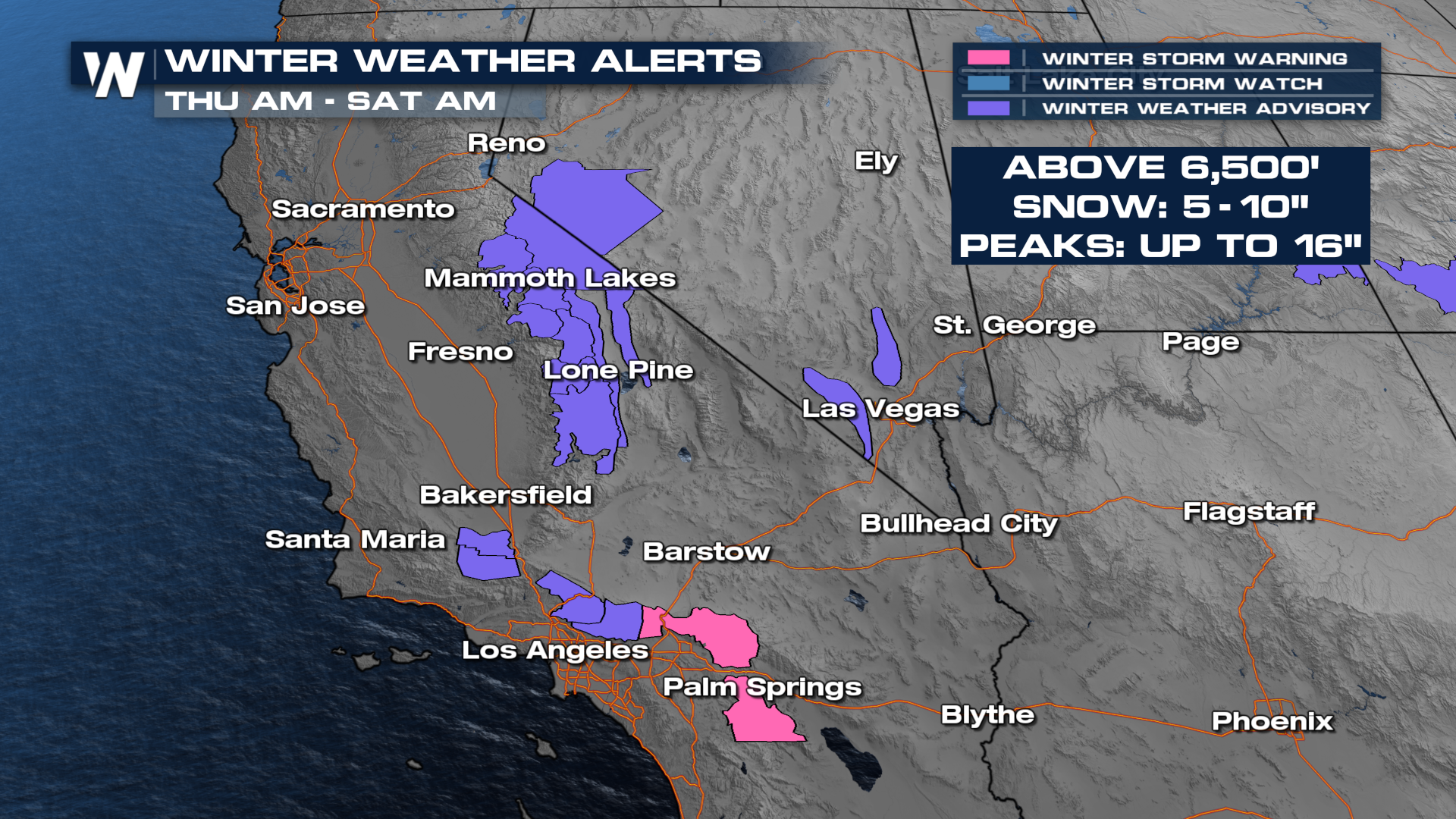
 Southern California could see several inches of heavy rainfall, which may lead to a flooding risk, especially because we have had a lot of recent rainfall. The higher elevations can expect up to five to ten with localized amounts of 16 inches of snowfall.
The Weather Prediction Center (WPC) has issued two slight (level 2 out of 4) threats for Southern California to see heavy rainfall and flooding Thursday through Friday.
The National Weather Service has also added winter storm warnings for the Riverside County Mountains and San Bernardino County mountains for Thursday through Saturday, with the heaviest snowfall expected Thursday night into Friday morning. Totals of 5-10" will be possible over 6000 feet, with up to 16 inches at the mountain peaks.
 You can also watch the regional forecast on demand with the WeatherNation app!


