Severe Threat Ending With Florida

Top Stories
10 Nov 2025 12:50 AM
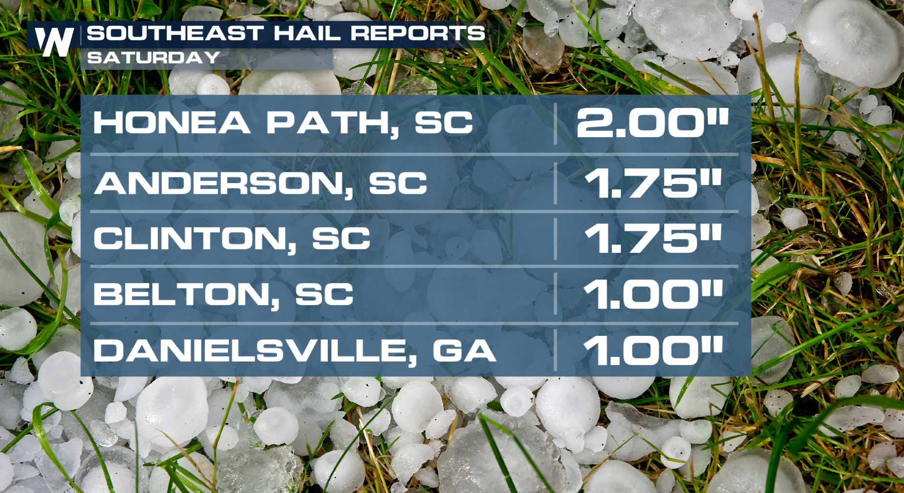 The much-anticipated cold front that will slash temperatures has been moving through the Southeast. Ahead of the front, warm temperatures and plenty of moisture has kept the severe threat going overnight.
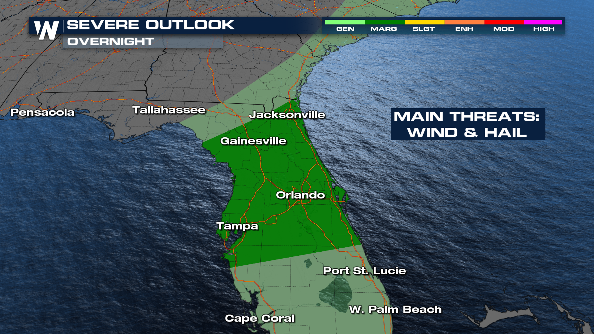
The Storm Prediction Center has kept a severe weather threat at a MARGINAL (level 1 out of 5) risk for Florida into the overnight and dies down into Monday morning to be met with cold cold air behind.
All Weather News
More

Severe Storms, Flash Flooding Overnight In Midwest
WHAT TO EXPECTIt was a very active day across
22 Jun 2026 1:50 AM


Summer Solstice Kicks Off Father's Day Sunday
Fathers across the country will have to share
21 Jun 2026 5:20 PM

Flood Risk Continues This Weekend for the Gulf Coast States
Numerous flash flood warnings were issued as
21 Jun 2026 1:15 PM

Dry T-Storms & Fire Danger in the West
A weak low-pressure system moving through the
20 Jun 2026 1:40 PM

Tornadoes Tear Through The Midwest, Isolated Severe Storms in the South
EARLIER THIS WEEKMONTROSE, IL - A dangerous t
20 Jun 2026 1:30 AM