Midwest Clipper Brings Light Snow, Gusty Winds

A system has been bringing snow across the Plains and Midwest on Saturday. This same system will continue to push through the Great Lakes into Sunday morning. Some areas have already seen some snow accumulation in the last 24 hours.
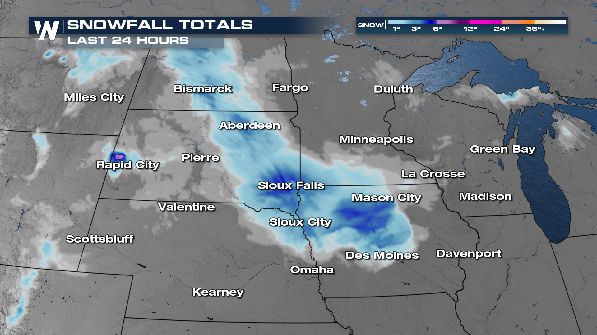 Moderate rainfall and lighter snow will continue to drift east with the low-pressure system into Saturday night and Sunday morning.
Winds & Temperatures
Afternoon highs will struggle to warm out of the 30s for most areas impacted by the precipitation. Keep in mind, another feature of quick systems like these is gusty winds. With wind gusts 20-30mph, it's going to feel even cooler.
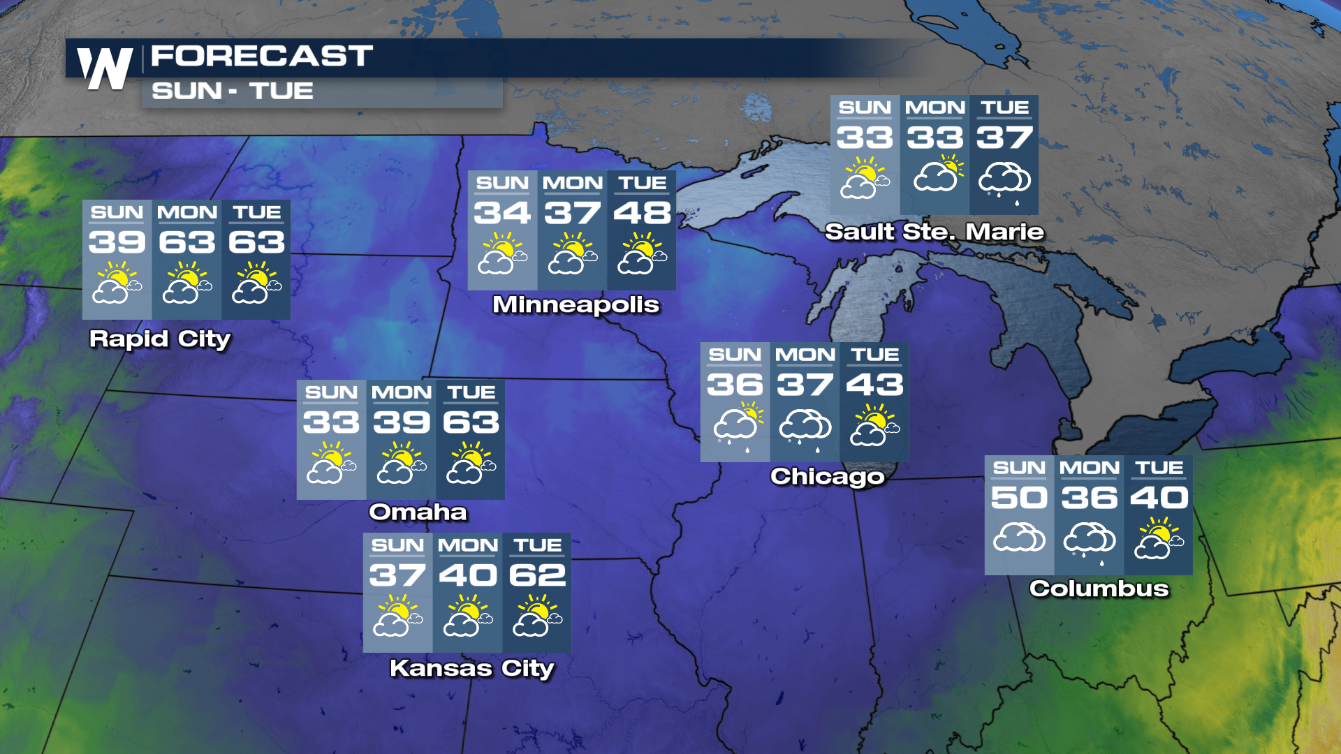
Much colder air is expected Sunday into next week as an arctic blast brings the coldest air of the season to many parts of the south central and southeastern U.S.
For more information, be sure to join us on WeatherNation at :30 past the hour for your Central Regional Forecast.


