Lake Effect Snow Wraps Up Today

The lake effect snow season has arrived, with heavy snow expected now through Tuesday. Places in the Upper Peninsula of Michigan have already received a foot of snow!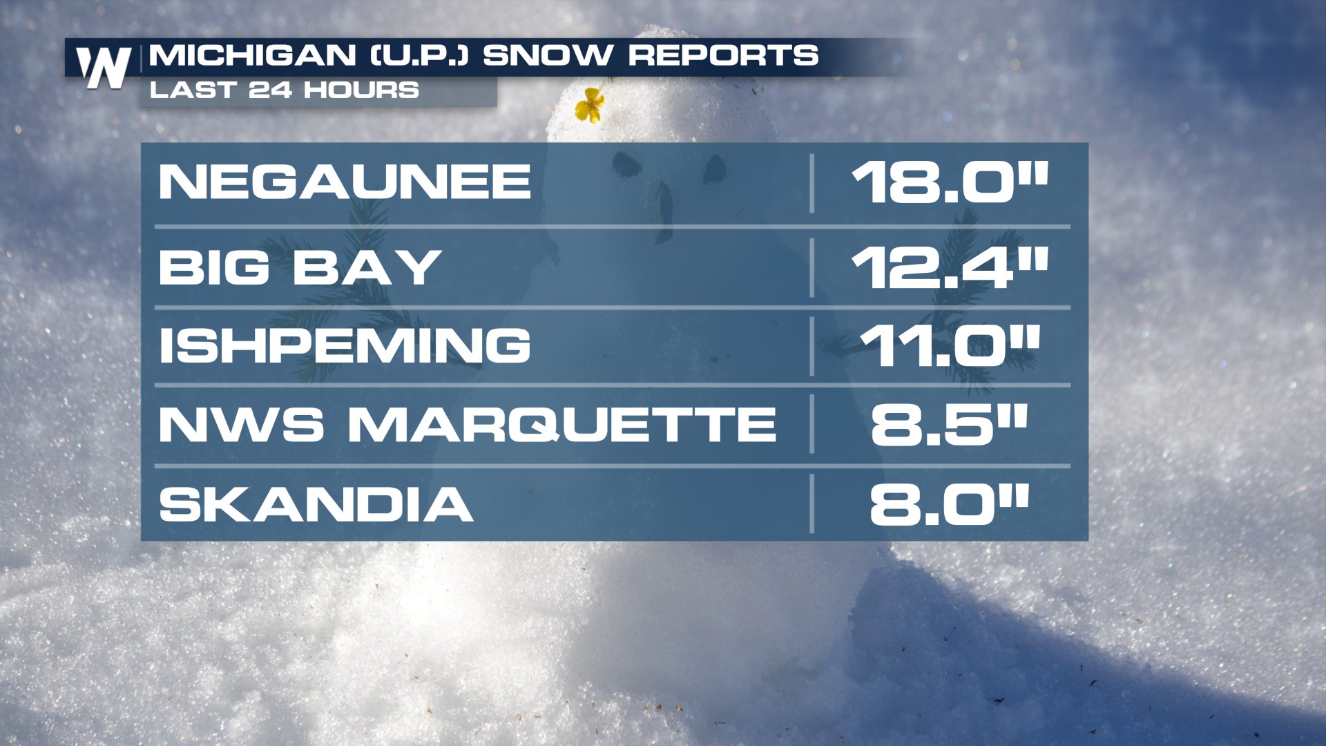
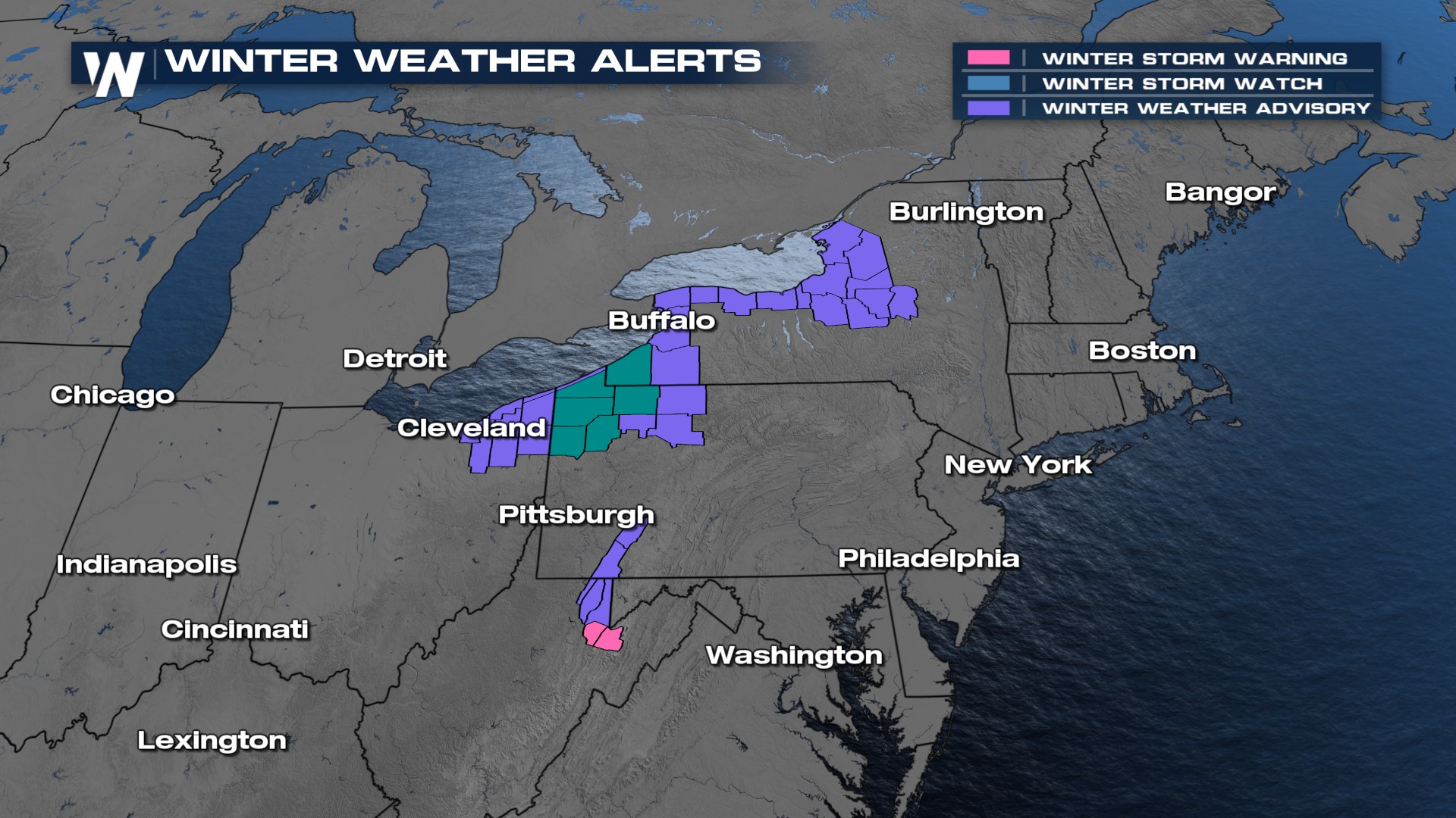
Winter weather alerts remain in place all across the shores of the Great Lakes through Tuesday. An additional 6-12" in some locations, with heavy snowfall rates likely reducing visibility at times, will make travel very difficult.
How Lake Effect Works
Water has a much higher heat capacity than air, meaning it takes more time to warm up and cool down. This leads to "mild" water temperatures in the Great Lakes while the air overhead can be much cooler. As the cold, dry air moves over these areas, it's able to evaporate moisture from the lakes until it condenses into clouds and precipitation before falling out over land. Typically, we need at least a 13° F difference between the lake water and the air aloft (around 1500 m, or 4500-5000 ft) for lake effect snow to form.
Forecast
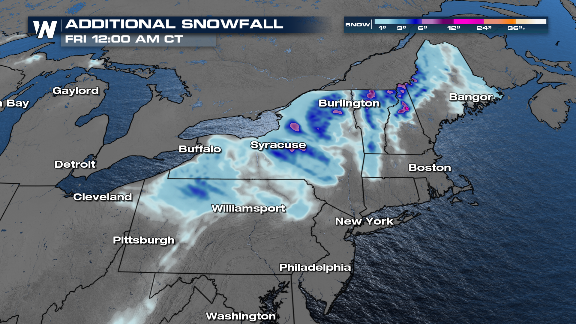
With winds coming over the Great Lakes, we can still anticipate lake effect snowfall to continue. Next, a quick-moving clipper will move through to bring a few wintry bands to the snowbelt.
Take this snow event as an example for the next one, make sure your vehicle is ready for winter travel with some good tread on your tires and a winter driving kit. You can catch the latest forecast for the Great Lakes anytime by using the WeatherNation app to view the Central Regional Forecast. You can also tune in to WeatherNationTV at :30 past the hour!


