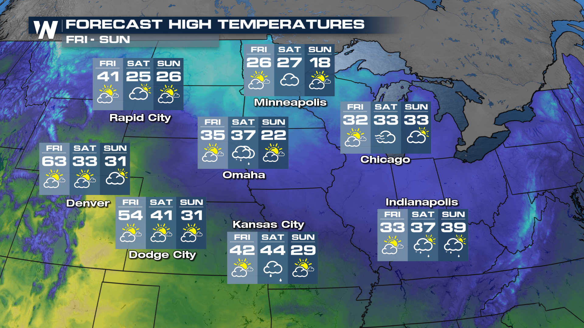
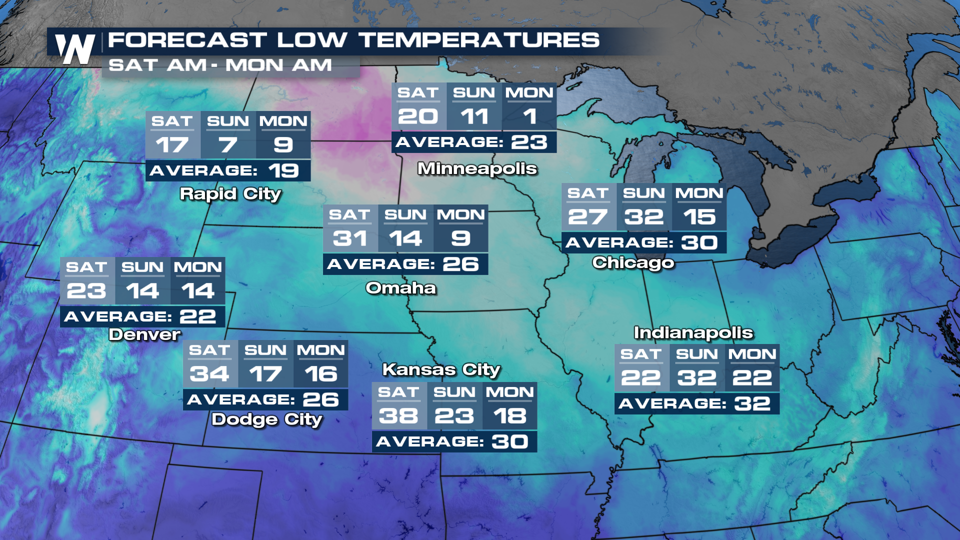
Powerful System To Disrupt Travel After Thanksgiving

While travel conditions before Thanksgiving across much of the country haven't been too terrible, the other side of the timeline may be a different story! A strong wave in the atmosphere will rotate around an upper-level low dropping south, increasing precipitation chances while allowing cold polar air to spill south. This will lead to multiple impacts across the country by Black Friday (see above).
North Side
Fresh off the heels of the last system, heavy snow will accumulate across Montana and the Dakotas by Friday. Into the weekend, the storm will continue to strengthen, with models bringing shoveable snow totals across the Upper Midwest and Great Lakes.
This system will also bring the coldest air of the season so far, as temperatures will struggle to warm above freezing for some throughout the weekend.
South Side
Farther south, instability will grow during the afternoons as warm and humid air is pulled north from the Gulf. With strong upper-level winds and shear increasing by the weekend, strong storms will be possible out ahead of and along an advancing cold front.
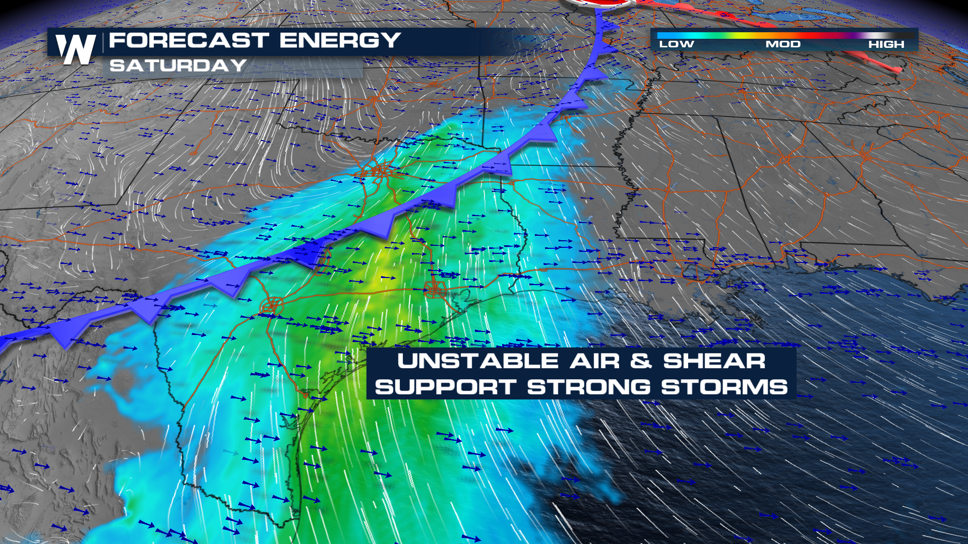
A few storms may be possible on Friday, but models for Saturday depict the potential of strong storms, particularly across East Texas and into northern Louisiana in the afternoon hours.
We'll continue to update this developing story over the following days on WeatherNation!


