Ocean Gliders Head to Sea to Improve Hurricane Forecasts
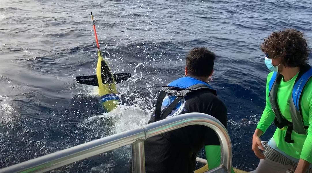
NOAA and partner scientists will deploy unmanned gliders equipped with sensors to measure temperature and salinity down to a half mile below the ocean surface. These sturdy gliders can operate in hurricane conditions and have survived shark attacks as they collect data and transmit it via satellite for use in hurricane forecast models.
For the 2020 hurricane season, NOAA, the U.S. Navy, the U.S. Integrated Ocean Observing System (IOOS®), and academic partners are deploying 30 gliders, which are expected to transmit 50% more data points from the ocean, called ocean observations, compared to previous years. This is possible with more gliders as well as increased collaboration among the partners.
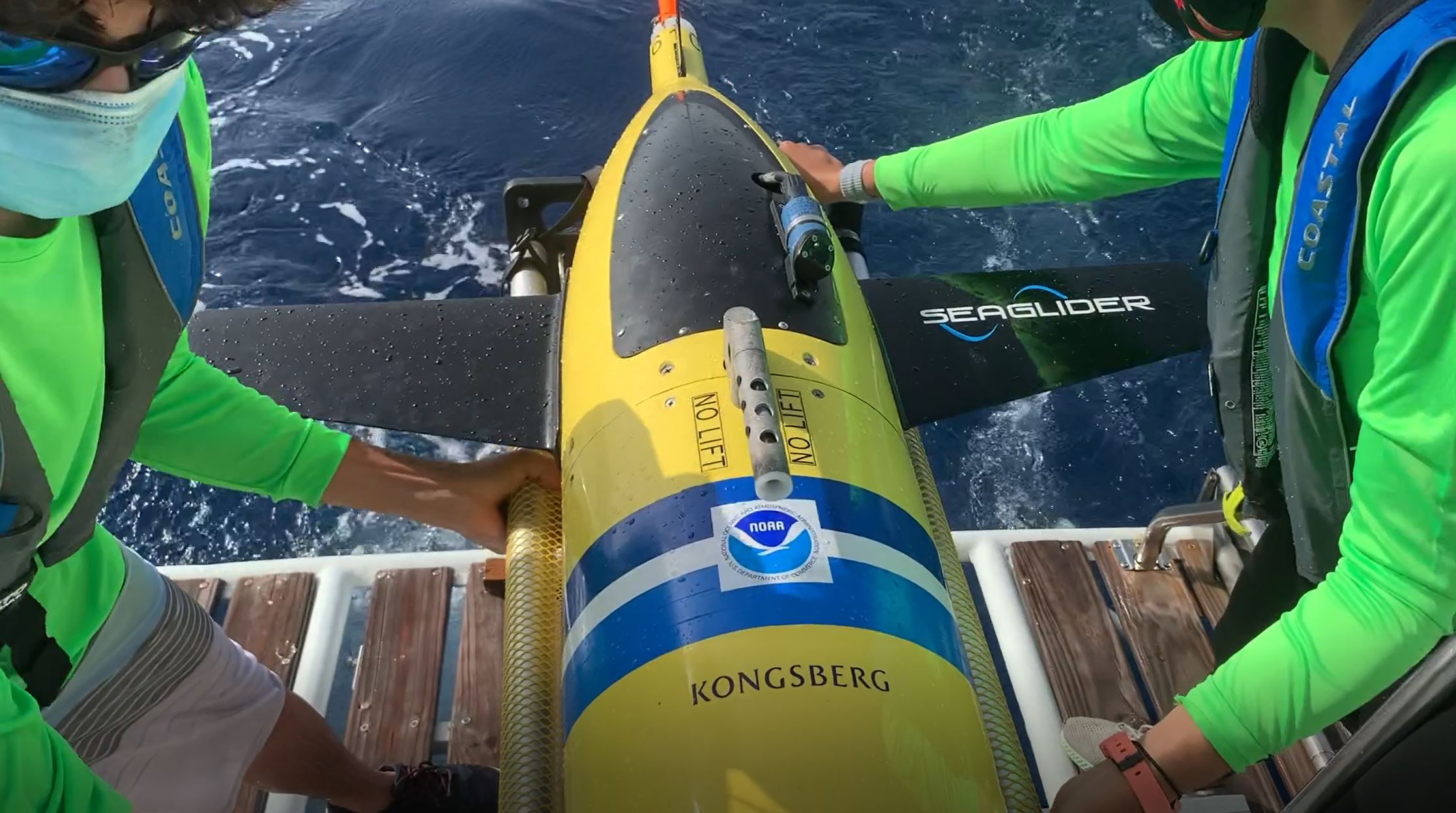
[NOAA and partners from its Cooperative Institute for Marine and Atmospheric Studies at University of Miami and CARICOOS launch 11 ocean gliders that will collect data this hurricane season to improve prediction. Credit: NOAA/CIMAS/ CARICOOS]
To prepare, NOAA’s Atlantic Oceanographic and Meteorological Lab scientists trained new glider pilots and technicians from partner institutions in Puerto Rico and the Dominican Republic and they then prepped members of the CARICOOS and ANAMAR ocean glider teams. In April, NOAA and IOOS hosted an online workshop with the partners to plan glider deployments in the tropical North Atlantic Ocean, Caribbean Sea, South and Mid- Atlantic Ocean, and Gulf of Mexico, for tropical cyclone studies and forecasts. This preparation is helping NOAA and its partners continue the hurricane glider project despite uncertainties related to COVID-19.
The hurricane gliders will collect data in the upper ocean where the Gulf Stream, Loop Current, inflowing fresh water from rivers, and other features can play a role in the strengthening or weakening of hurricanes. The gliders are significantly increasing the observations from these key areas where hurricanes form. Last year, ocean gliders collected approximately 100,000 ocean profiles. This year, scientists expect to collect up to 50% more observations.
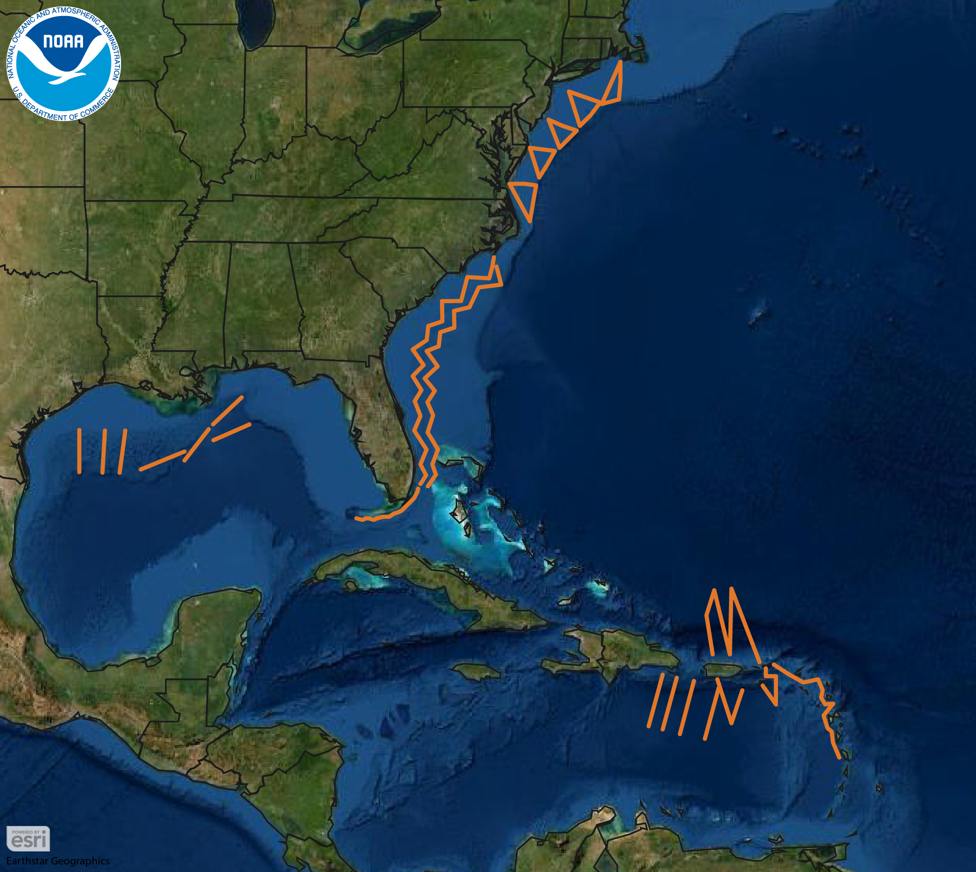
[Orange lines show the planned paths for the 30 unmanned gliders to travel this summer, where they will record temperature and salinity data from the surface to a half mile below. Once launched, gliders will make regular dives along a set course and surface several times a day to send collected data to an available satellite. Warm water has the potential to strengthen storms while cool waters may weaken them, so knowing if a storm will pass over only warm water or areas where cold water may be stirred up from below helps scientists and forecasters predict whether a storm will intensify or weaken as it travels. Credit: NOAA]
Recent research at AOML is showing that this data from gliders and floats are key to improving the accuracy of hurricane intensity forecasts. The data pinpoints where warm water pools at the surface can feed and increase the intensity of passing tropical storms or where cool, saltier water churned up from the deeper ocean may help weaken a passing storm.
This hurricane glider project will also help meet the objectives of the Commercial Engagement Through Ocean Technology Act of 2018, which requires NOAA to coordinate research, assessment, and acquisition of unmanned maritime systems with the U.S. Navy, other federal agencies, industry and academia.
Edited for WeatherNation by Mace Michaels


