Ohio Valley to Mid-Atlantic Severe Outlook
Special Stories
27 Sep 2020 2:01 PM
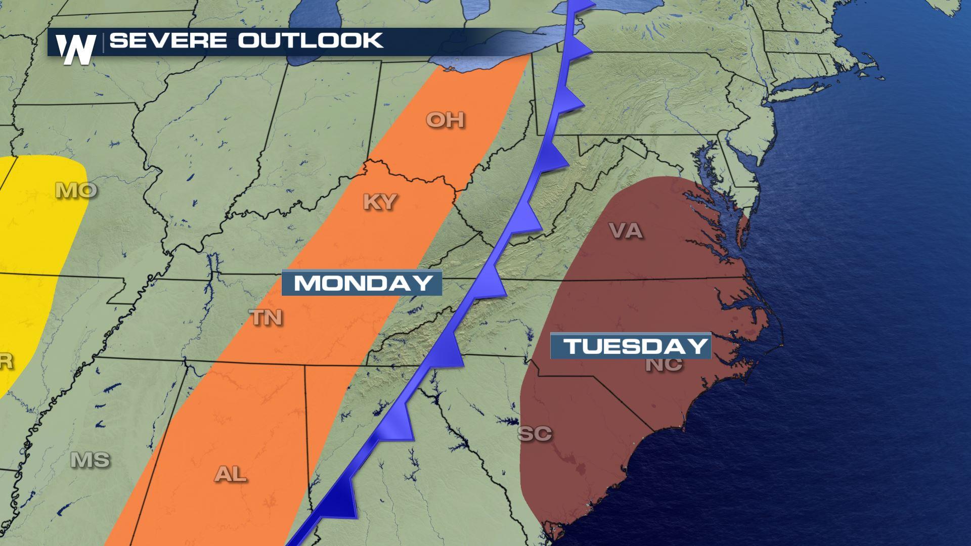
The same cold front that has been responsible for severe weather in the upper Midwest/Great Lakes region this past weekend will bring the threat for more storms extending from the Ohio Valley through the southeastern states to start off the work week on Monday. These marginally-severe thunderstorms (level 1 out of 5) bring the potential for isolated strong to damaging wind gusts along the cold front.
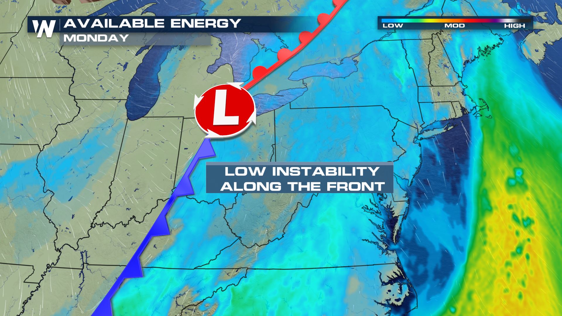
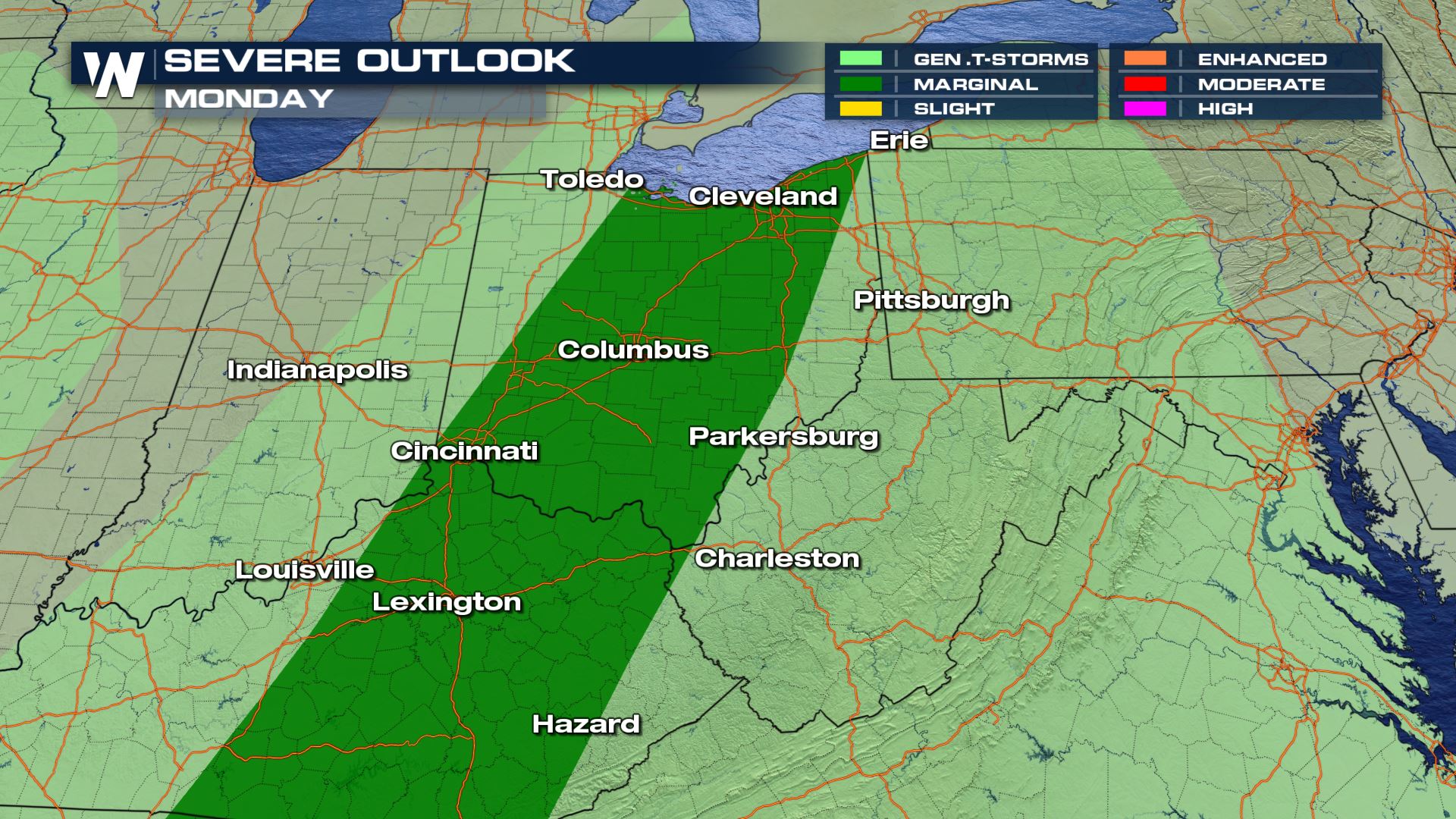 From the Ohio Valley extending all the way south along the front will have the highest chance for severe storms. There is not a lot of instability along this frontal axis, hence the reason a marginal risk (the lowest risk from the Storm Prediction Center Outlook) has been issued. Along the front this risk will account for isolated damaging wind gusts as our main severe weather threat.
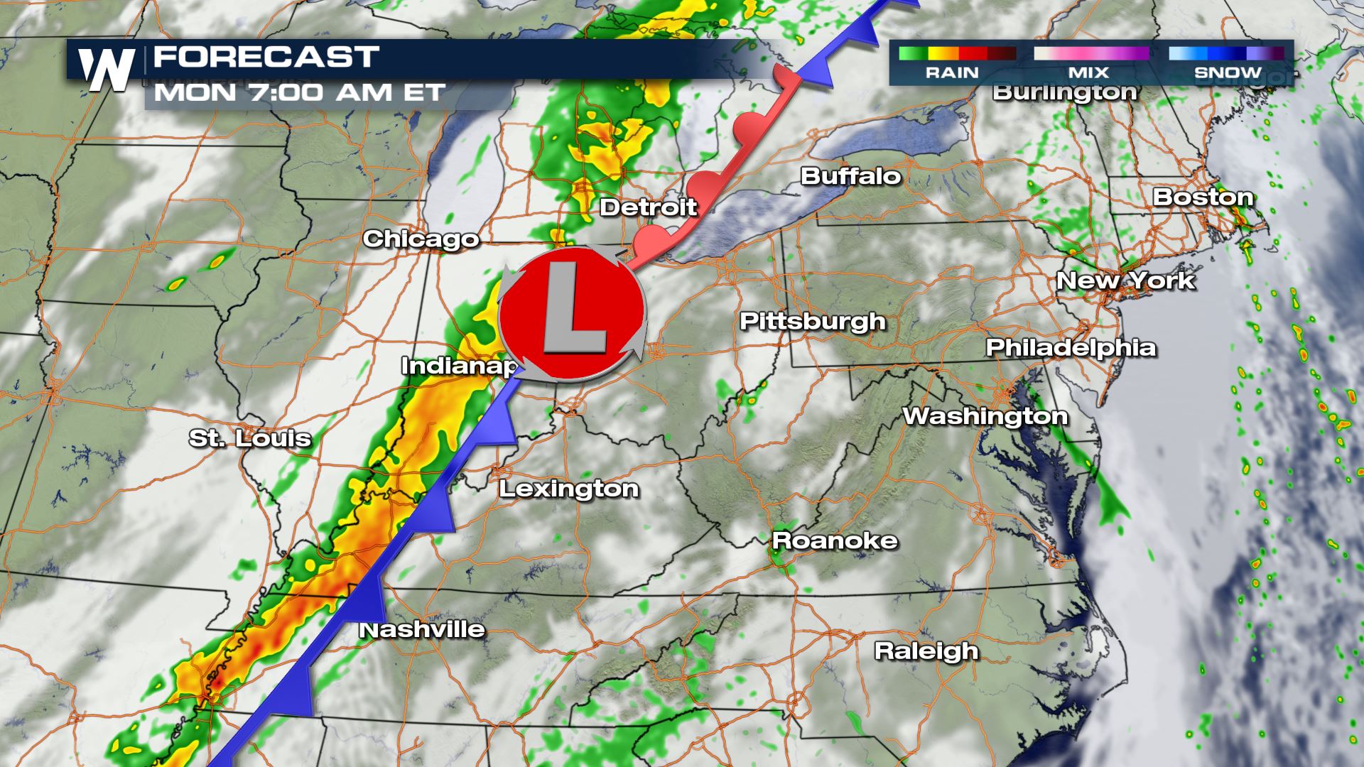
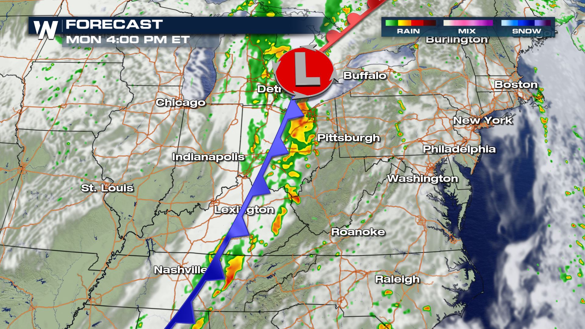 Storms will organize along cold front and track east into the overnight hours. As we follow these storms the Mid-Atlantic is next to see the severe weather potential as we head into Tuesday.
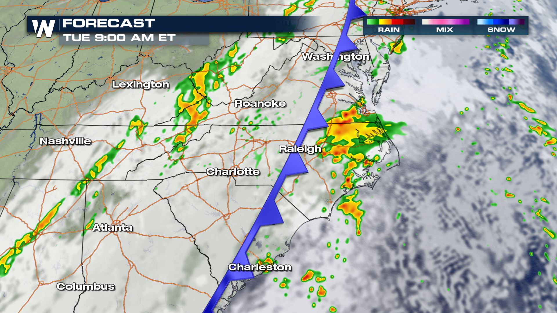
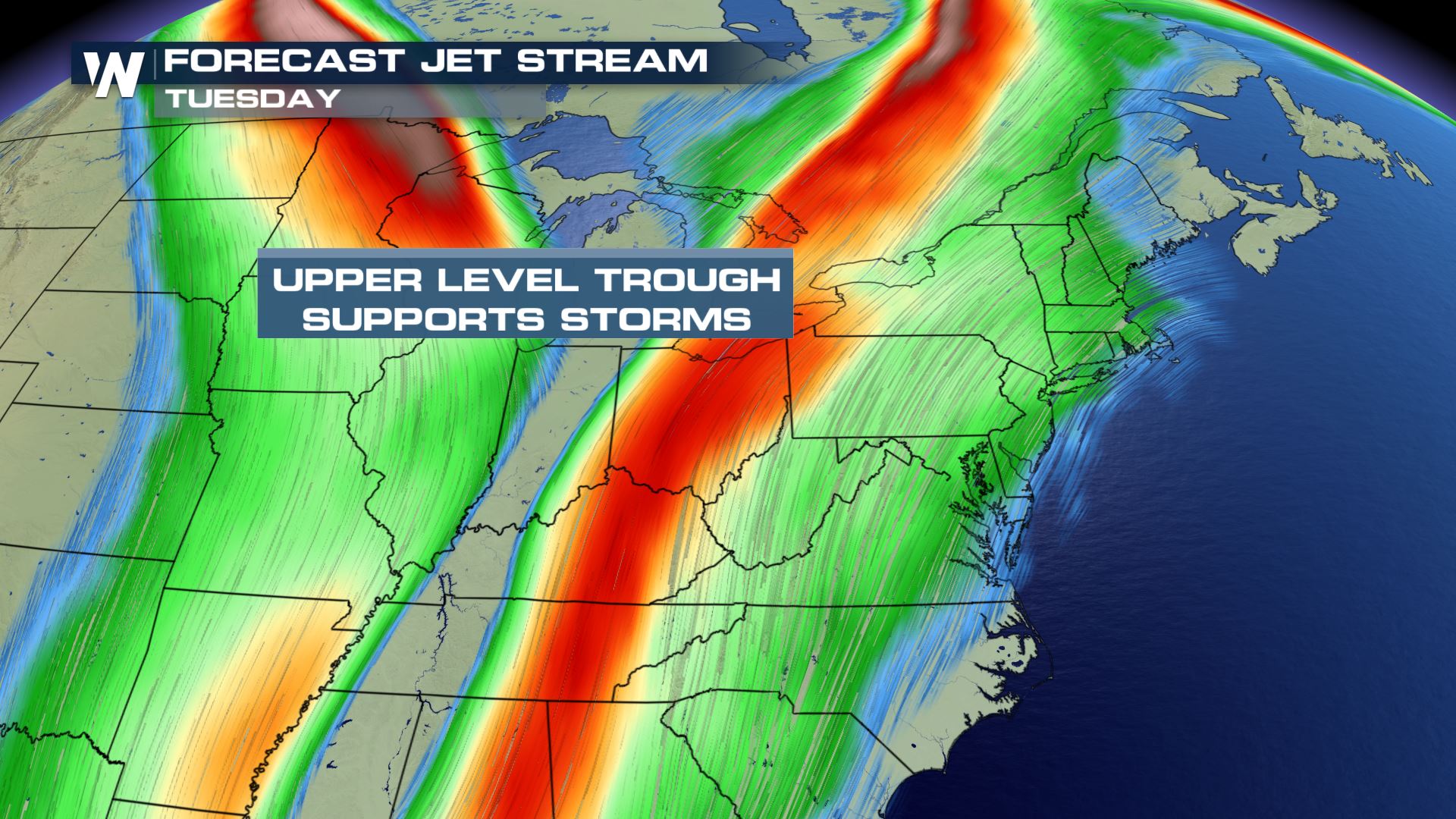
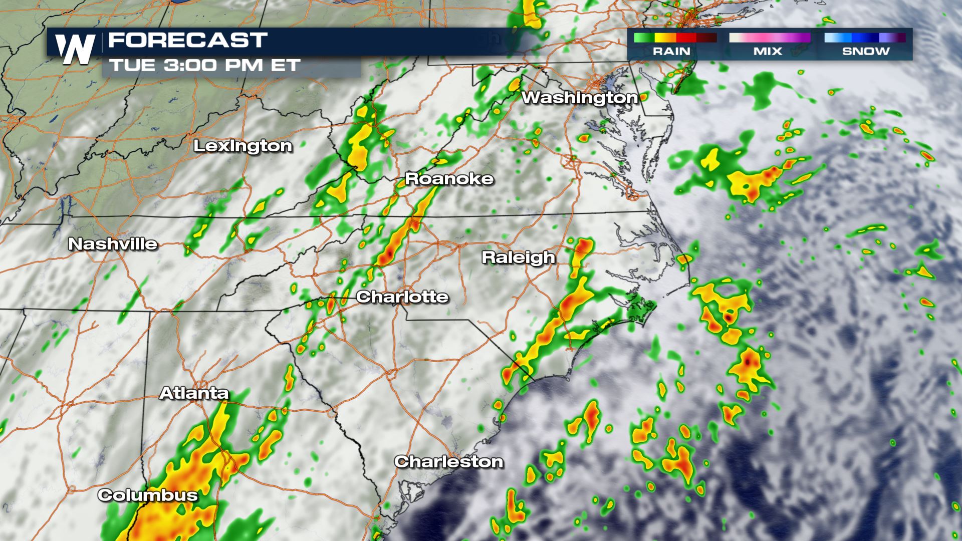 By Tuesday in the Mid-Atlantic states there will be a modest amount of moisture and instability ahead of the surface cold front and upper level trough. There may be some supper with moderate shear based on the position of the upper level trough but there are still some uncertainties in the forecast.
 The risk for excessive rain in the Mid-Atlantic increases by Tuesday with ample moisture available.
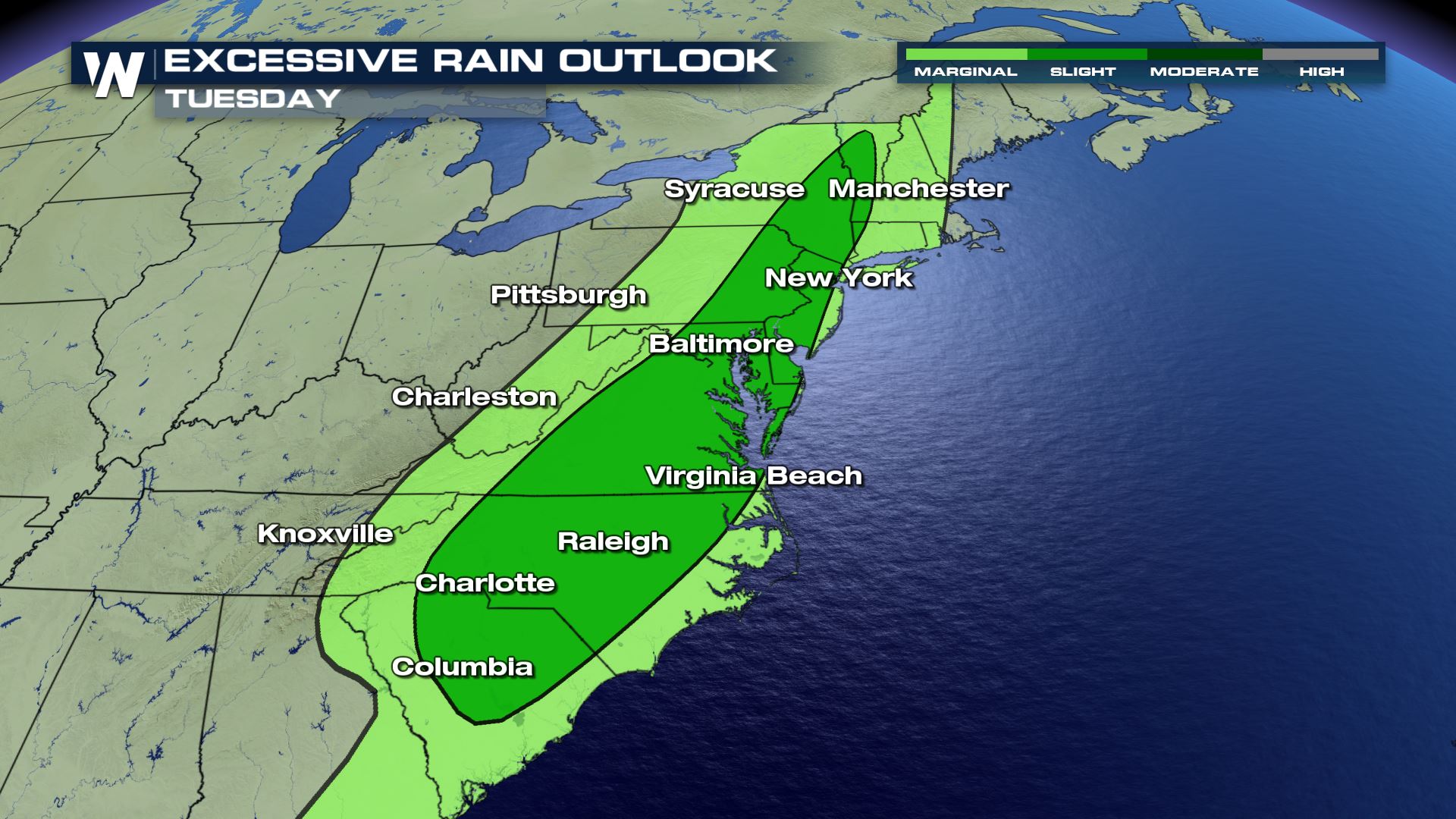 The Weather Prediction Center is responsible for issuing excessive rainfall outlooks and is forecasting for excessive rain along the I-95 corridor from Tuesday into Wednesday with up to 1-3" in some isolated areas.
[embed]https://twitter.com/NWSWPC/status/1310228750953590787[/embed]
For more information keep checking in with WeatherNation or stream us on any of our streaming platforms: DISH channel 215, Roku, AppleTV, PS4, Smart TVs, mobile devices, tablets, local digital channels and more!
The Weather Prediction Center is responsible for issuing excessive rainfall outlooks and is forecasting for excessive rain along the I-95 corridor from Tuesday into Wednesday with up to 1-3" in some isolated areas.
[embed]https://twitter.com/NWSWPC/status/1310228750953590787[/embed]
For more information keep checking in with WeatherNation or stream us on any of our streaming platforms: DISH channel 215, Roku, AppleTV, PS4, Smart TVs, mobile devices, tablets, local digital channels and more!
Severe Outlook - Monday
From the Ohio Valley extending all the way south along the front will have the highest chance for severe storms. There is not a lot of instability along this frontal axis, hence the reason a marginal risk (the lowest risk from the Storm Prediction Center Outlook) has been issued. Along the front this risk will account for isolated damaging wind gusts as our main severe weather threat.
Forecast
Storms will organize along cold front and track east into the overnight hours. As we follow these storms the Mid-Atlantic is next to see the severe weather potential as we head into Tuesday.
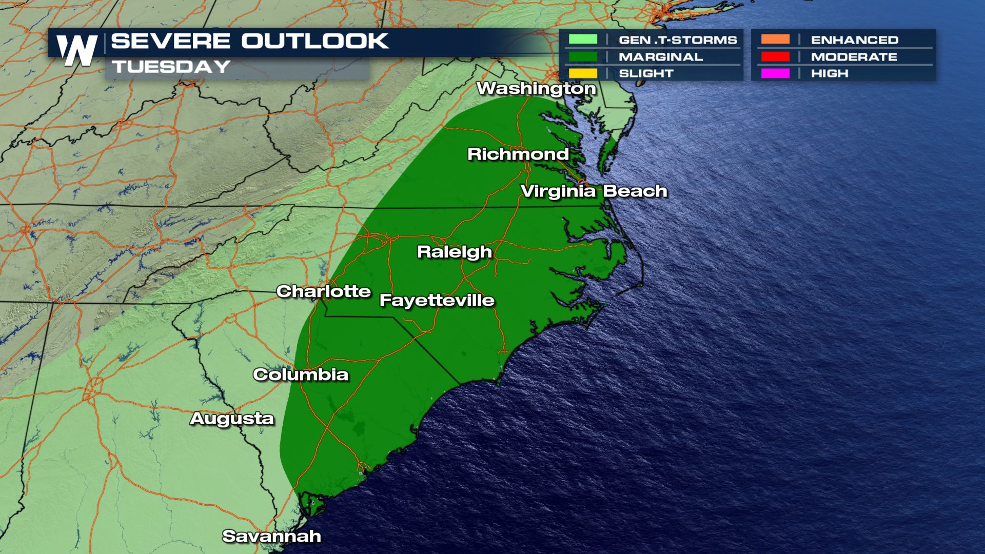
Severe Outlook - Tuesday
By Tuesday, the Mid-Atlantic states are next in line to see thunderstorms. Virginia, North Carolina and South Carolina are under a marginal risk for severe storms as seen below.
Forecast
By Tuesday in the Mid-Atlantic states there will be a modest amount of moisture and instability ahead of the surface cold front and upper level trough. There may be some supper with moderate shear based on the position of the upper level trough but there are still some uncertainties in the forecast.
The risk for excessive rain in the Mid-Atlantic increases by Tuesday with ample moisture available.
The Weather Prediction Center is responsible for issuing excessive rainfall outlooks and is forecasting for excessive rain along the I-95 corridor from Tuesday into Wednesday with up to 1-3" in some isolated areas.
[embed]https://twitter.com/NWSWPC/status/1310228750953590787[/embed]
For more information keep checking in with WeatherNation or stream us on any of our streaming platforms: DISH channel 215, Roku, AppleTV, PS4, Smart TVs, mobile devices, tablets, local digital channels and more!All Weather News
More
Wildfire Outbreak in the Pacific Northwest
SPOKANE, WA - On Saturday, August 1st, the Ol
3 Aug 2026 1:55 AM

More Storms for the East Through Monday
A low-pressure system that moved through the
3 Aug 2026 1:50 AM


After Reaching Category 5, Genevieve Weakens in the Pacific
PacificGenevieve formed last Friday south of
3 Aug 2026 12:30 AM

Flooding, Severe Storms Target the Midwest Again
After an active week of storms across the nor
1 Aug 2026 1:40 AM

Flooding Risk Increases as Heavy Rain Targets the Tri-State Area
Tuesday, heavy rainfall moved across the Nort
30 Jul 2026 12:25 AM

Severe Weather: Energy From the Midwest Now in the Southeast
UPPER MIDWEST - Through Monday, dangerous tor
29 Jul 2026 10:30 PM