Severe Threat Wednesday in the Plains

Top Stories
2 Apr 2026 1:05 AM
WHAT TO EXPECT
A severe weather threat is taking shape across the southern Plains this week as a stalled boundary, a sharpening dryline, and an upper-level disturbance come together over a record-breaking warm and increasingly humid central airmass.
OUTLOOK
An ENHANCED risk has been issued through the overnight hours. Damaging winds, large hail, and a few tornadoes will be possible.
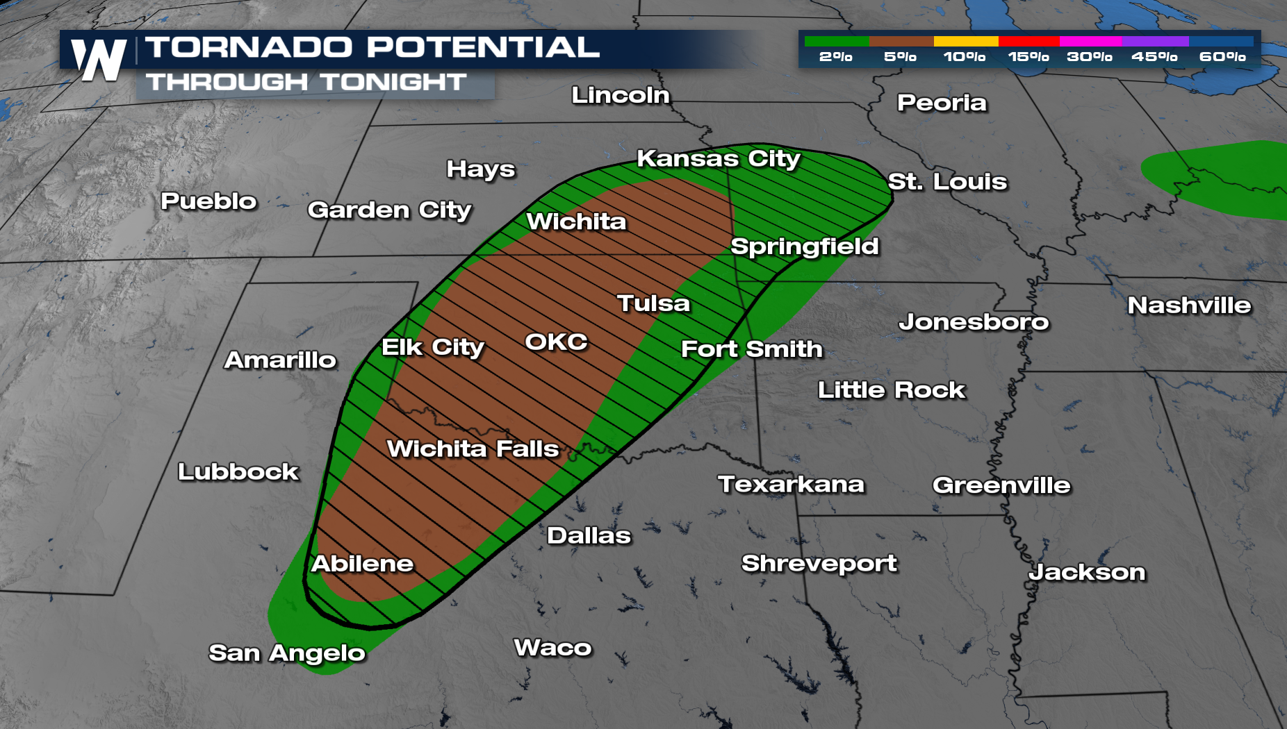
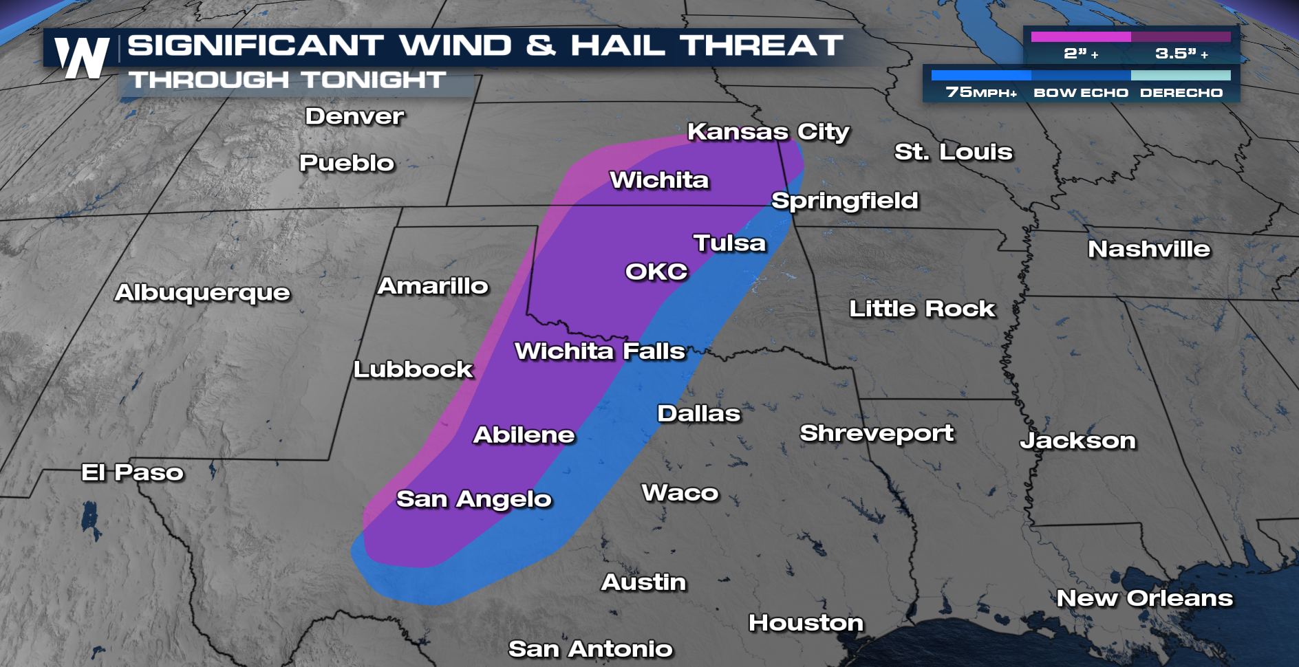
TIMING
Storms continue to fire along a dryline, producing gusty winds and large hail. These storms will continue to move to the east overnight, so have multiple ways to get alerts. Things will wind down midday Thursday.
All Weather News
More
Dangerous Stretch of Heat Shaping Up This Week
The hottest temperatures of the year are loom
30 Jun 2026 2:00 AM

Massive Fires Burn in the Four Corners
Photo: Iron Fire getting doused with a retard
30 Jun 2026 1:50 AM

Slow-Moving Front Could Turn Tropical This Week
Early in the season, we watch closer to the c
30 Jun 2026 12:50 AM

Severe Storms Keep Northern U.S. Active
Monday morning, one storm brought significant
30 Jun 2026 12:45 AM

Storms Spark up in the Northeast Ahead of Heatwave
Severe storms will be possible Tuesday and We
29 Jun 2026 10:30 PM

'MCS' Season Brings Severe and Flooding Threats Across the Southeast
As Summer settles in across the Central U.S.,
28 Jun 2026 2:10 AM

Severe Threat Tracks into the Northeast Friday
Another day, another Illinois tornado. That's
26 Jun 2026 2:25 AM