PA/NJ Tornado Thursday Rated An EF-3
Special Stories
30 Jul 2021 6:39 PM
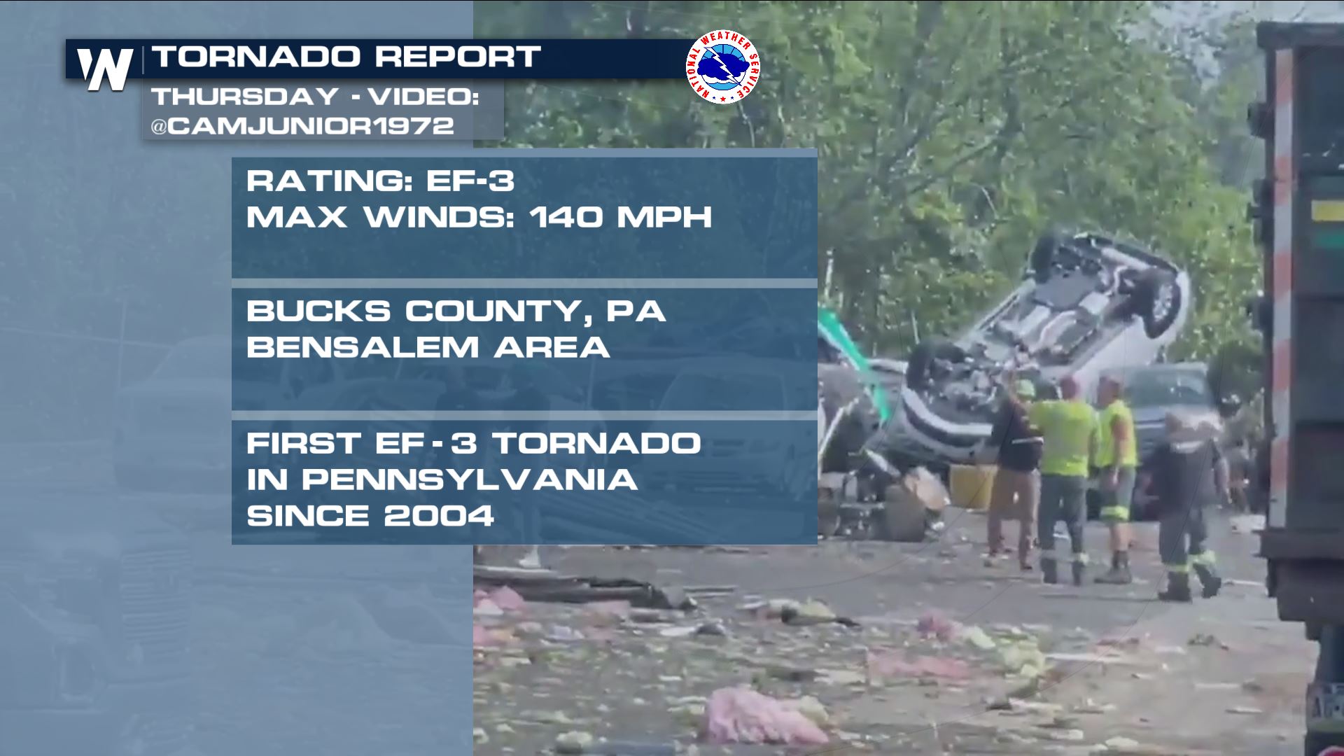
Meteorologists from the National Weather Service of Philadelphia - Mt. Holly say the tornado that hit communities along the Pennsylvania and New Jersey border was classified as an EF-3 tornado with maximum winds up to 140 mph.
 The tornado struck Thursday afternoon during a busy series of severe weather warnings for the Northeast United States.
https://twitter.com/WeatherNation/status/1420926558198509574
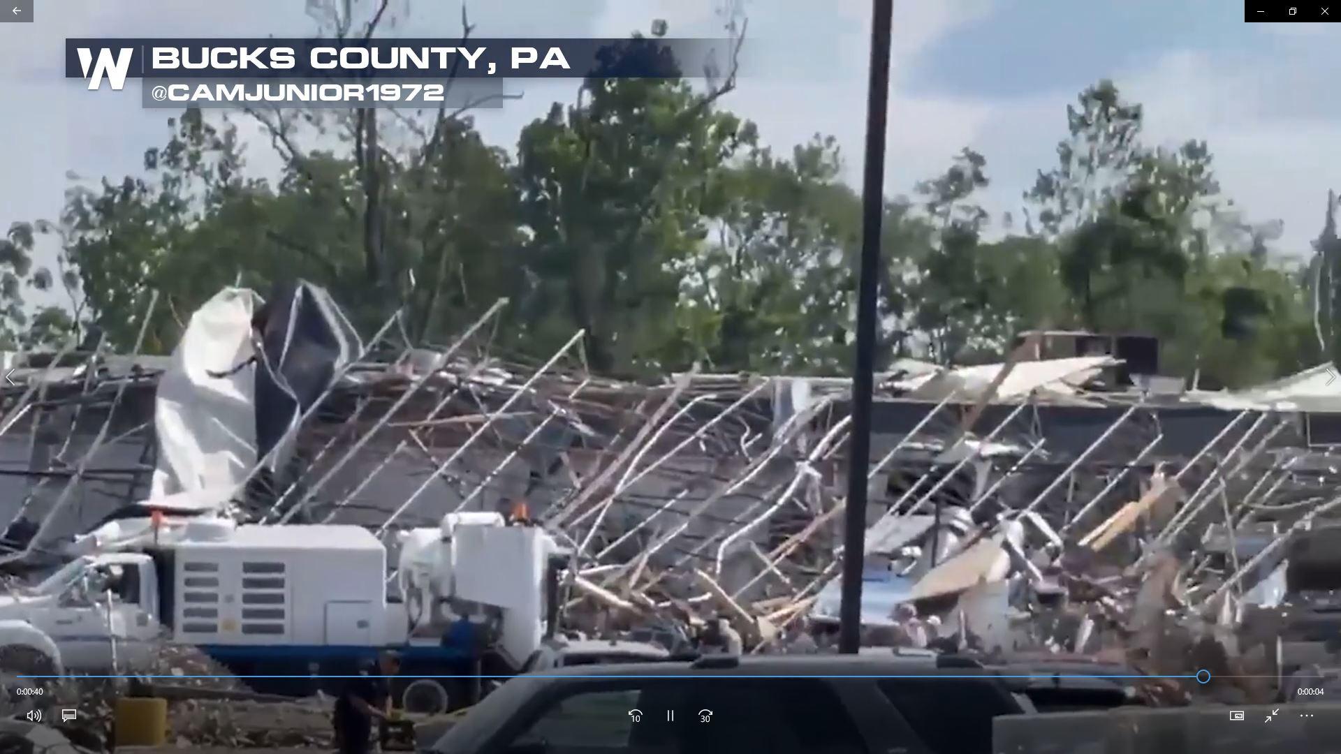
Debris could be seen falling from the sky in Bensalem and nearby communities after the tornado hit Thursday.
https://twitter.com/WeatherNation/status/1420877600944234506
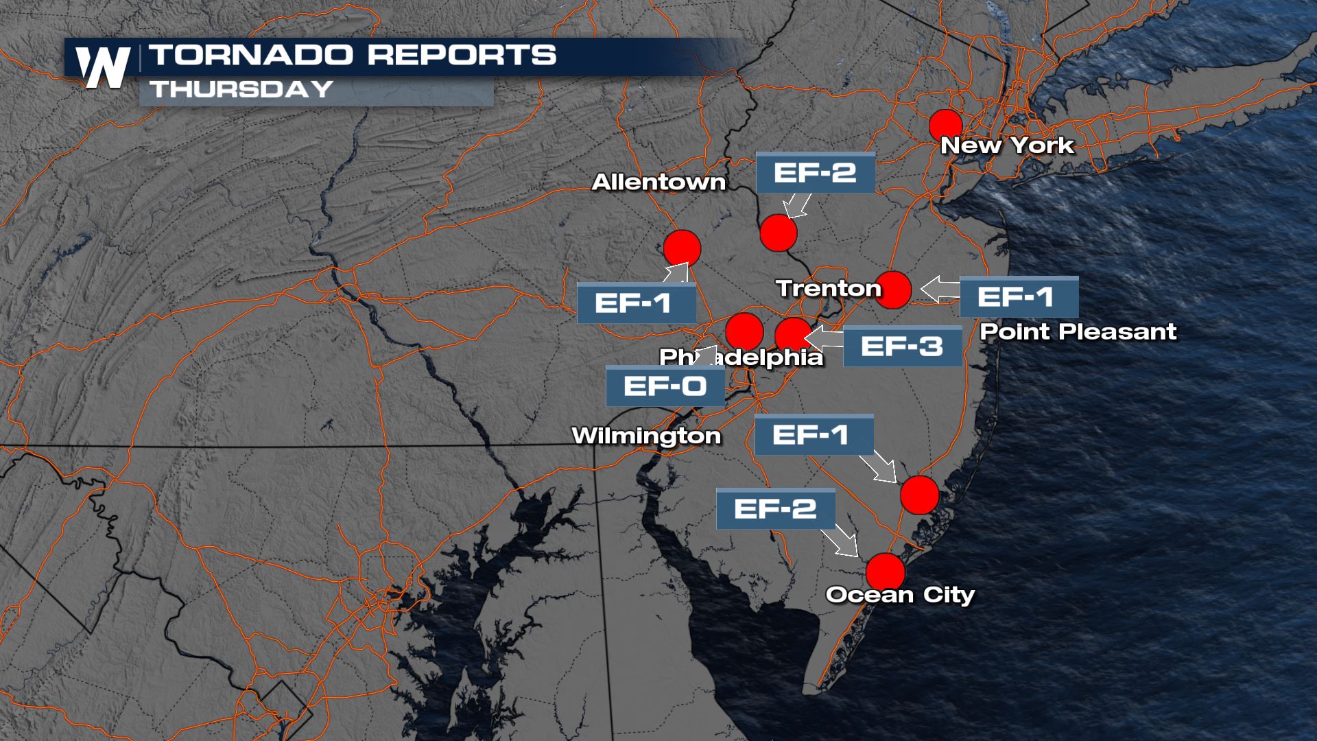
So far there have been about 20 tornadoes reported on Thursday across parts of the Northeast United States.
The tornado struck Thursday afternoon during a busy series of severe weather warnings for the Northeast United States.
https://twitter.com/WeatherNation/status/1420926558198509574
Debris could be seen falling from the sky in Bensalem and nearby communities after the tornado hit Thursday.
https://twitter.com/WeatherNation/status/1420877600944234506
So far there have been about 20 tornadoes reported on Thursday across parts of the Northeast United States.
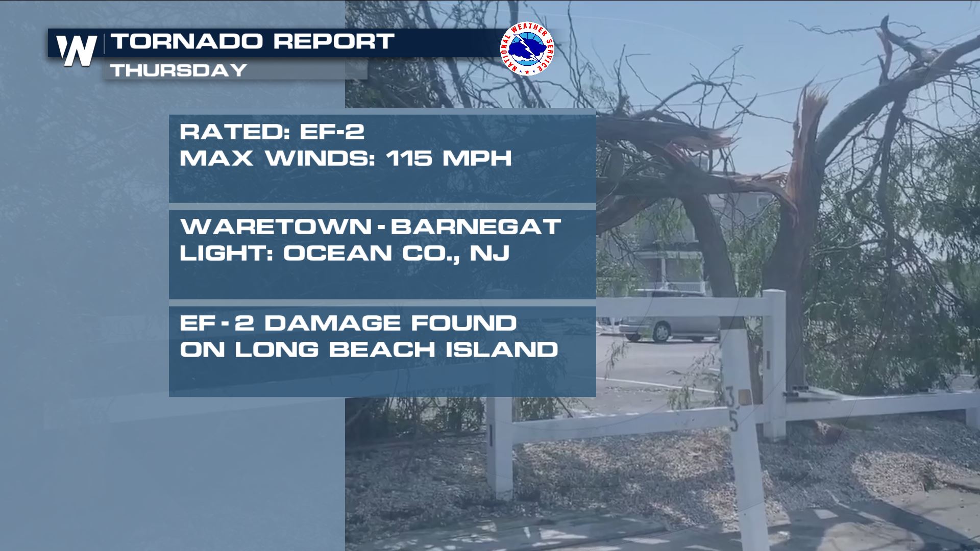 Another tornado then hit later in the evening in Ocean County, New Jersey. There were multiple areas of storm damage consistent with an EF-1 tornado but a few spots on Long Beach Island, NJ experienced EF-2 tornado damage.
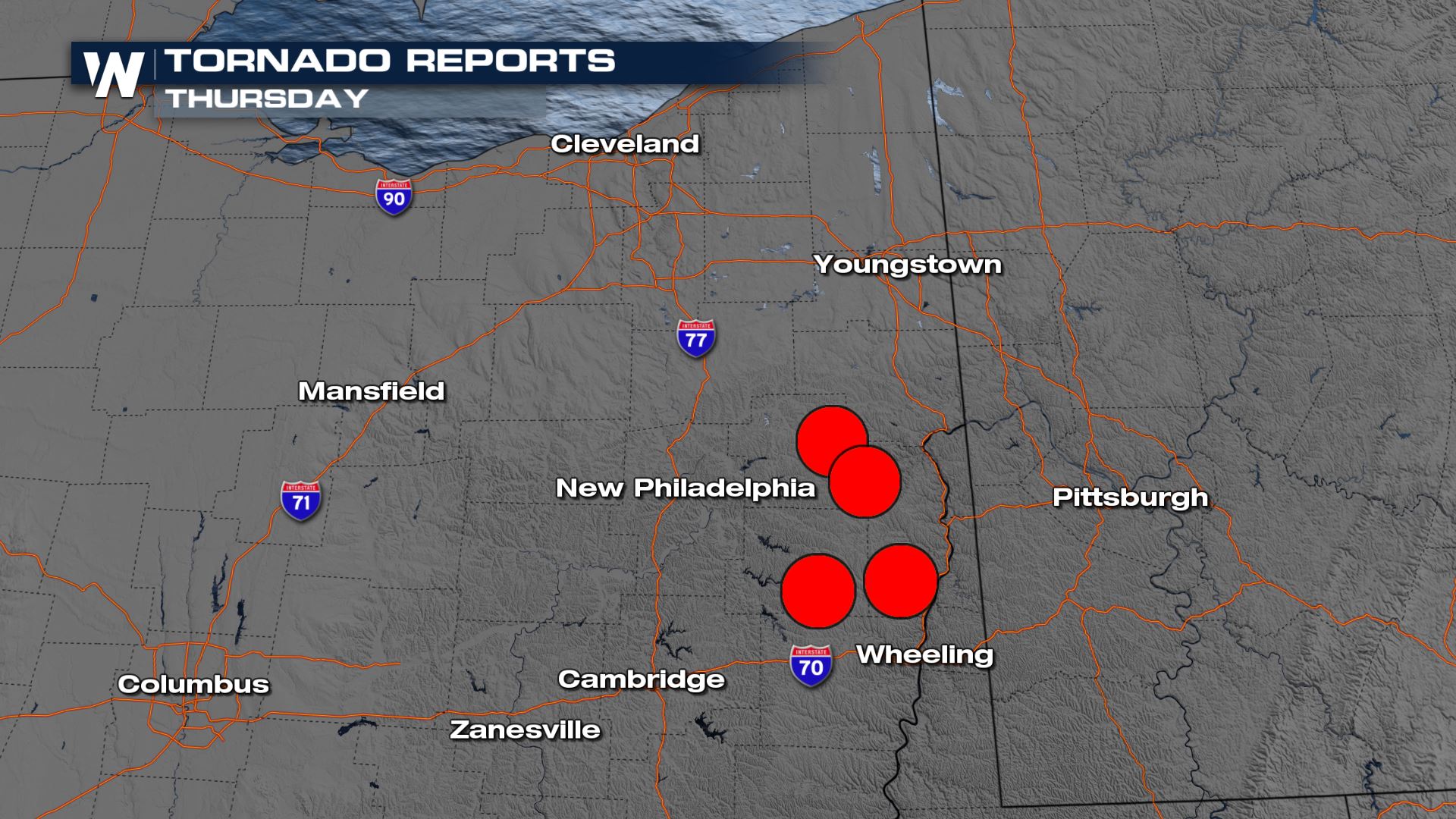
Here are a couple of maps showing you where some of the tornadoes hit Thursday.
Another tornado then hit later in the evening in Ocean County, New Jersey. There were multiple areas of storm damage consistent with an EF-1 tornado but a few spots on Long Beach Island, NJ experienced EF-2 tornado damage.
Here are a couple of maps showing you where some of the tornadoes hit Thursday.
 The EF tornado scale is short for Enhanced Fujita and ranges from 0 to 5, with 5 being the strongest
The tornado struck Thursday afternoon during a busy series of severe weather warnings for the Northeast United States.
https://twitter.com/WeatherNation/status/1420926558198509574
Debris could be seen falling from the sky in Bensalem and nearby communities after the tornado hit Thursday.
https://twitter.com/WeatherNation/status/1420877600944234506
So far there have been about 20 tornadoes reported on Thursday across parts of the Northeast United States.
Another tornado then hit later in the evening in Ocean County, New Jersey. There were multiple areas of storm damage consistent with an EF-1 tornado but a few spots on Long Beach Island, NJ experienced EF-2 tornado damage.
Here are a couple of maps showing you where some of the tornadoes hit Thursday.
The EF tornado scale is short for Enhanced Fujita and ranges from 0 to 5, with 5 being the strongest
- EF-0: Winds 65-85 mph
- EF-1: Winds 86-110 mph
- EF-2: Winds 111-135 mph
- EF-3: Winds 136-165 mph
- EF-4: Winds 166-200 mph
- EF-5: Winds 201 + mph
All Weather News
More
Fronts Continue To Spark Severe Weather Across the Plains
A cold front that brought record lows to the
18 Jul 2025 10:40 PM

Extreme Heat Impacts for the East Coast & South
Extreme heat continues to impact several area
18 Jul 2025 10:05 PM

Flooding Threat Remains Elevated in the East
A cold front pushing through the Eastern Seab
18 Jul 2025 9:10 PM

EF-2 Firenado from the Deer Creek Fire in Utah
A fire tornado was spotted near La Sal, Utah
18 Jul 2025 7:30 AM

Tropical System Brings Flood Risk to the Central Gulf
Time has run out for notable tropical develop
18 Jul 2025 3:05 AM

Heavy Rain, Flooding Threat Returns to Florida
Keep the rain boots handy in Florida - heavy
13 Jul 2025 12:50 PM

Severe Storm Risk Pushes into the Great Lakes, Ohio Valley
Friday was another busy day with severe weath
12 Jul 2025 8:00 PM