Pattern Shifts in Southern California

Top Stories
10 Feb 2018 5:10 PM
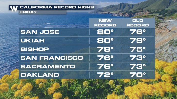
February started off very warm for Southern California, with many record highs tied or broken over the last week.
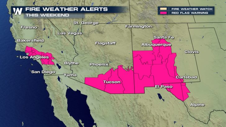
 We have also seen the typical set-up for warm, offshore winds known as Santa Ana winds, which heightened fire danger for the weekend. The Red Flag Warning for critical fire weather conditions continues through Sunday evening before we see a big pattern change to kick off the new workweek.
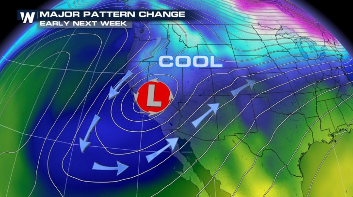
 Surface low pressure will be cut off or stalled as we get into the beginning of the week.
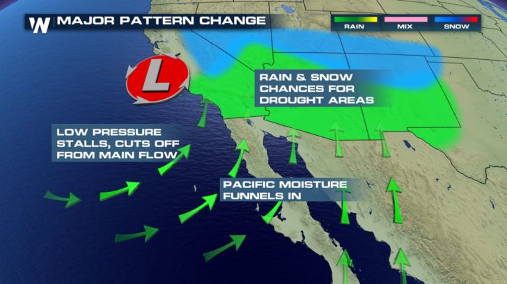 This will help bring in more moisture from the Pacific Ocean and much cooler air, which will drop temperatures during the week and lead to chances of rain back in the forecast during the week.
 For WeatherNation, I'm Meredith Garofalo.
We have also seen the typical set-up for warm, offshore winds known as Santa Ana winds, which heightened fire danger for the weekend. The Red Flag Warning for critical fire weather conditions continues through Sunday evening before we see a big pattern change to kick off the new workweek.
Surface low pressure will be cut off or stalled as we get into the beginning of the week.
This will help bring in more moisture from the Pacific Ocean and much cooler air, which will drop temperatures during the week and lead to chances of rain back in the forecast during the week.
For WeatherNation, I'm Meredith Garofalo.All Weather News
More

Flooding Risk Increases as Heavy Rain Targets the Tri-State Area
TRI-STATE AREA - Along with the threat of sev
29 Jul 2026 2:00 AM

Tropics: Fausto Heads towards Hawaii; Genevieve a Major Hurricane
PacificTropical Storm Fausto continues to tra
29 Jul 2026 1:35 AM


Southeast Flood Risk Lingers Near Stalled Front
A stalled boundary over the Southeast will ke
25 Jul 2026 10:55 AM

Another Round of Storms Targets the Northeast
Tuesday brought severe weather again across p
23 Jul 2026 1:15 AM