Possible Severe Storms for the Central U.S. into the Weekend
Special Stories
4 Oct 2019 3:27 PM
SEVERE OUTLOOK

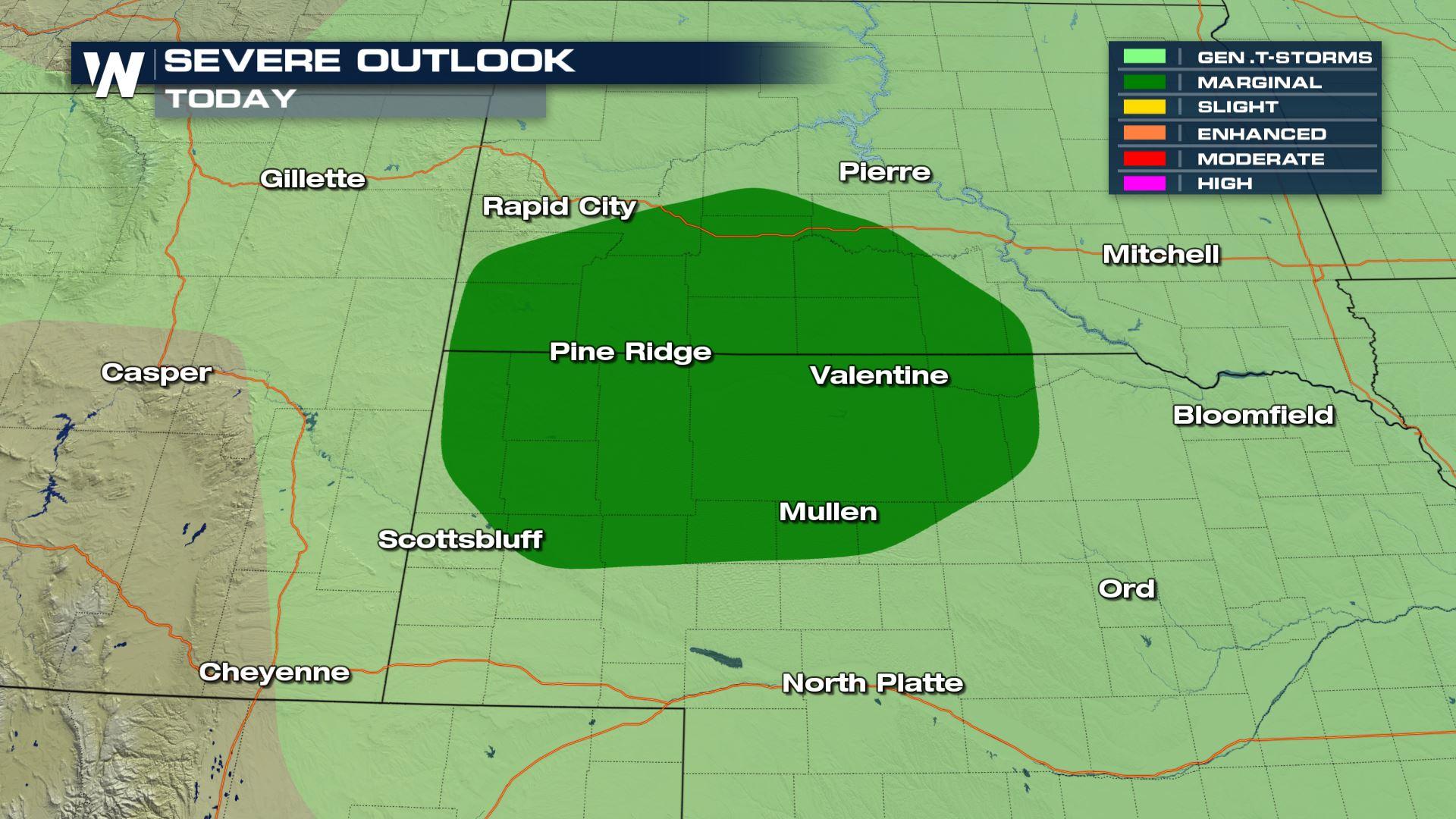
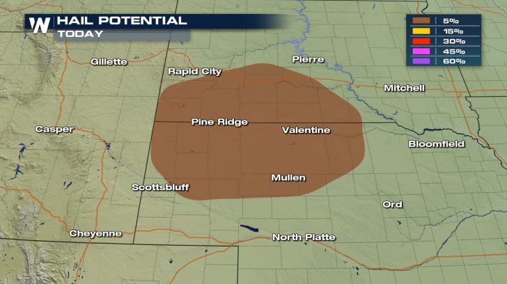 A risk of severe weather exists into parts of South Dakota and Nebraska, today. Isolated severe thunderstorms might be capable of producing small hail.
The good news is that we do not have the risk of damaging winds or tornadoes.
A risk of severe weather exists into parts of South Dakota and Nebraska, today. Isolated severe thunderstorms might be capable of producing small hail.
The good news is that we do not have the risk of damaging winds or tornadoes.
FORECAST
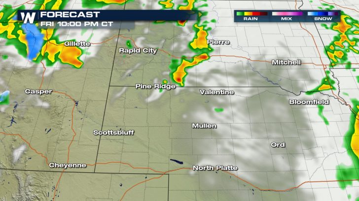 This event will be very short lived. Rain showers will start to pop up around 7 PM this evening. The severe chance happens around 9 PM to 11 PM.
Shortly after this, the severe risk should move out as we head into early Saturday morning.
Although, we will still be stuck with a few pockets of rain and possible snow showers.
This event will be very short lived. Rain showers will start to pop up around 7 PM this evening. The severe chance happens around 9 PM to 11 PM.
Shortly after this, the severe risk should move out as we head into early Saturday morning.
Although, we will still be stuck with a few pockets of rain and possible snow showers.
SATURDAY
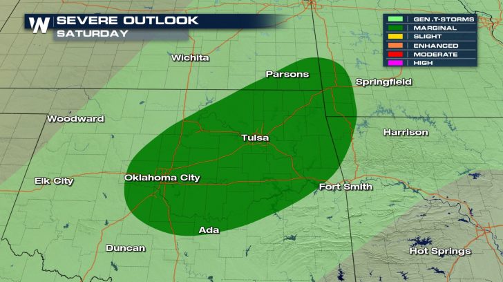 The severe threat shifts more to the south for our Saturday.
A marginal risk is in place for areas like Tulsa and Oklahoma City.
Isolated severe thunderstorms will be possible throughout the day.
The severe threat shifts more to the south for our Saturday.
A marginal risk is in place for areas like Tulsa and Oklahoma City.
Isolated severe thunderstorms will be possible throughout the day.All Weather News
More
More Storms for the East Through Monday
A low-pressure system that moved through the
2 Aug 2026 10:40 PM

Wildfire Outbreak in the Pacific Northwest
SPOKANE, WA - On Saturday, August 1st, the Ol
2 Aug 2026 10:35 PM


After Reaching Category 5, Genevieve Weakens in the Pacific
PacificGenevieve formed on last Friday south
2 Aug 2026 6:25 PM

Flooding, Severe Storms Target the Midwest Again
After an active week of storms across the nor
1 Aug 2026 1:40 AM

Flooding Risk Increases as Heavy Rain Targets the Tri-State Area
Tuesday, heavy rainfall moved across the Nort
30 Jul 2026 12:25 AM

Severe Weather: Energy From the Midwest Now in the Southeast
UPPER MIDWEST - Through Monday, dangerous tor
29 Jul 2026 10:30 PM