Possible Severe Weather for the High Plains

Special Stories
15 Aug 2018 6:23 AM
Possible Severe Weather for the High Plains
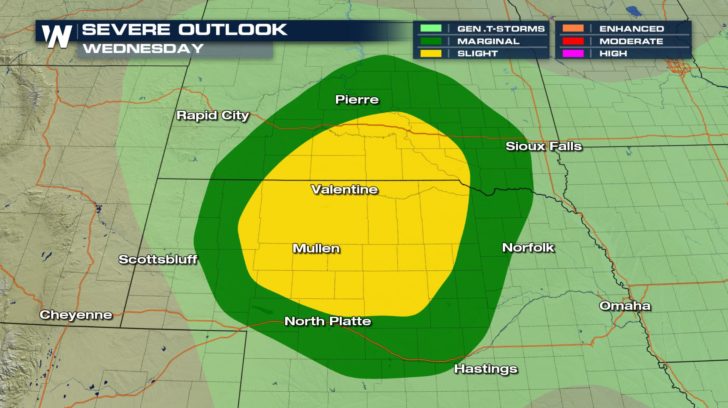 Severe thunderstorms, due to a upper level low, will be possible for the high plains. A slight risk of severe weather exists for southern areas of South Dakota and northern areas of Nebraska. This means numerous severe thunderstorms could be seen today. A marginal risk of severe weather exists right outside of the slight area. Cities in this region could see isolated severe thunderstorms for today.
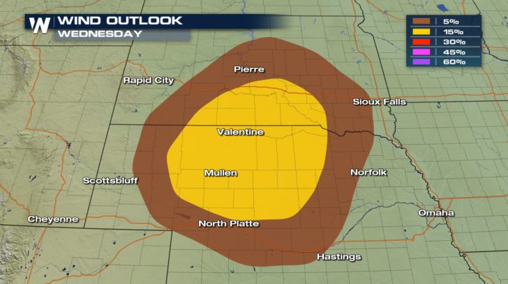 The cities in the 15 percent risk might see winds around 60-70 mph. The cities in the 5 percent risk could see winds around 58 mph.
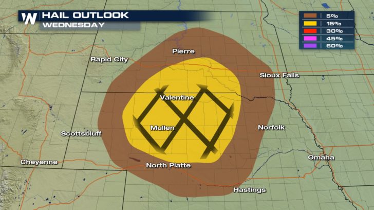 The cities in the 15 percent risk might see hail from 1-2 inches in diameter. In the hatched area, cities could see hail above 2 inches in diameter. The cities in the 5 percent risk could see hail up to 1 inch in diameter.
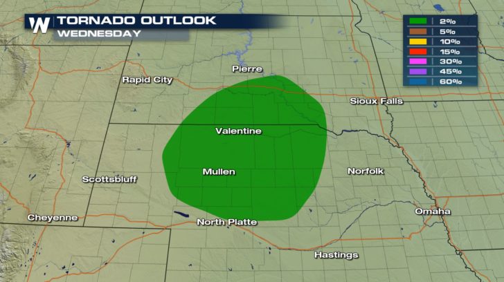 There is also a 2 percent tornado risk for today. Although the percentage is very low, it is still above zero percent. This means tornadoes are very possible today.
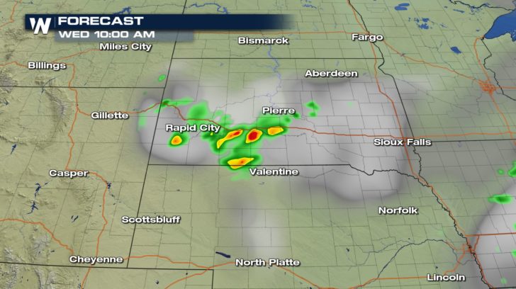
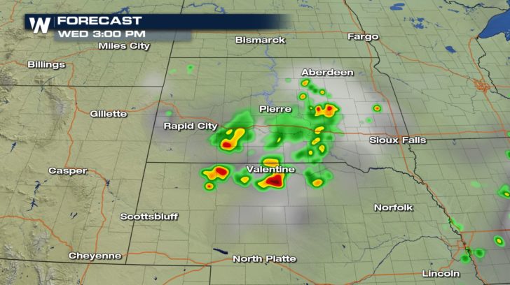
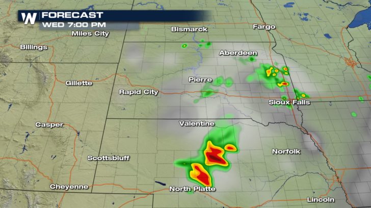 Strong storms will be pushing through South Dakota and Nebraska all day before slowly dissipating overnight.
For WeatherNation -Meteorologist Shelly Lindblade
Strong storms will be pushing through South Dakota and Nebraska all day before slowly dissipating overnight.
For WeatherNation -Meteorologist Shelly Lindblade
Severe thunderstorms, due to a upper level low, will be possible for the high plains. A slight risk of severe weather exists for southern areas of South Dakota and northern areas of Nebraska. This means numerous severe thunderstorms could be seen today. A marginal risk of severe weather exists right outside of the slight area. Cities in this region could see isolated severe thunderstorms for today.
The cities in the 15 percent risk might see winds around 60-70 mph. The cities in the 5 percent risk could see winds around 58 mph.
The cities in the 15 percent risk might see hail from 1-2 inches in diameter. In the hatched area, cities could see hail above 2 inches in diameter. The cities in the 5 percent risk could see hail up to 1 inch in diameter.
There is also a 2 percent tornado risk for today. Although the percentage is very low, it is still above zero percent. This means tornadoes are very possible today.
Strong storms will be pushing through South Dakota and Nebraska all day before slowly dissipating overnight.
For WeatherNation -Meteorologist Shelly LindbladeAll Weather News
More
'MCS' Season Brings Severe and Flooding Threats Across the Southeast
As Summer settles in across the Central U.S.,
27 Jun 2026 9:30 PM

Massive Fires Burn in Utah, Extreme Fire Danger Continues This Weekend
Photo: Iron Fire getting doused with a retard
27 Jun 2026 9:00 PM


Dangerous Stretch of Heat Shaping Up This Week
The hottest temperatures of the year are loom
27 Jun 2026 5:40 PM

Weekend System To Shake up Pattern Across the Country
A significant early-summer trough is expected
27 Jun 2026 3:50 PM

Severe Threat Tracks into the Northeast Friday
Another day, another Illinois tornado. That's
26 Jun 2026 2:25 AM
