Potential for Severe Storms in Texas This Week
Special Stories
23 Apr 2019 8:40 AM
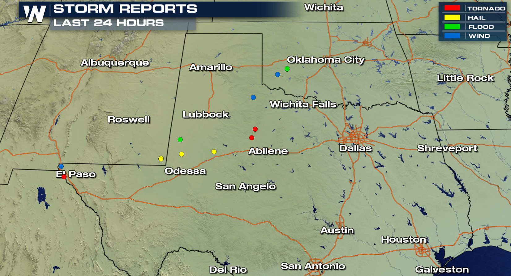
A slow moving storm system will continue to bring the potential for severe weather in Texas over the next few days. On Monday, severe storms affected the Texas Panhandle and western parts of the state. A few tornadoes were reported, along with damaging winds and large hail.
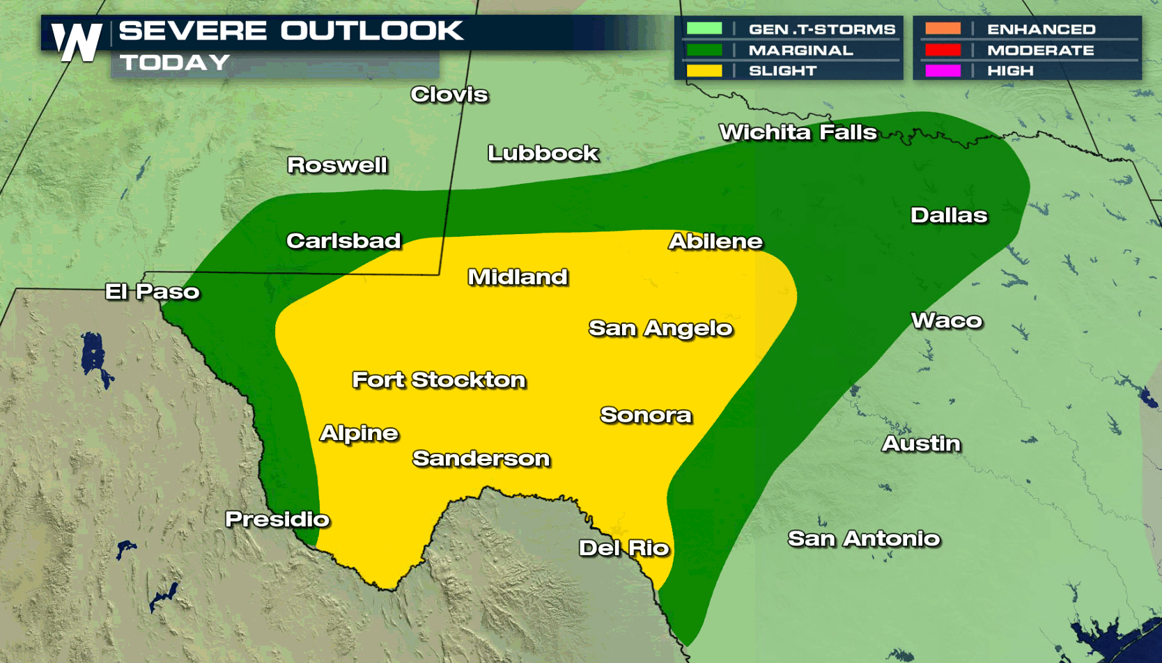
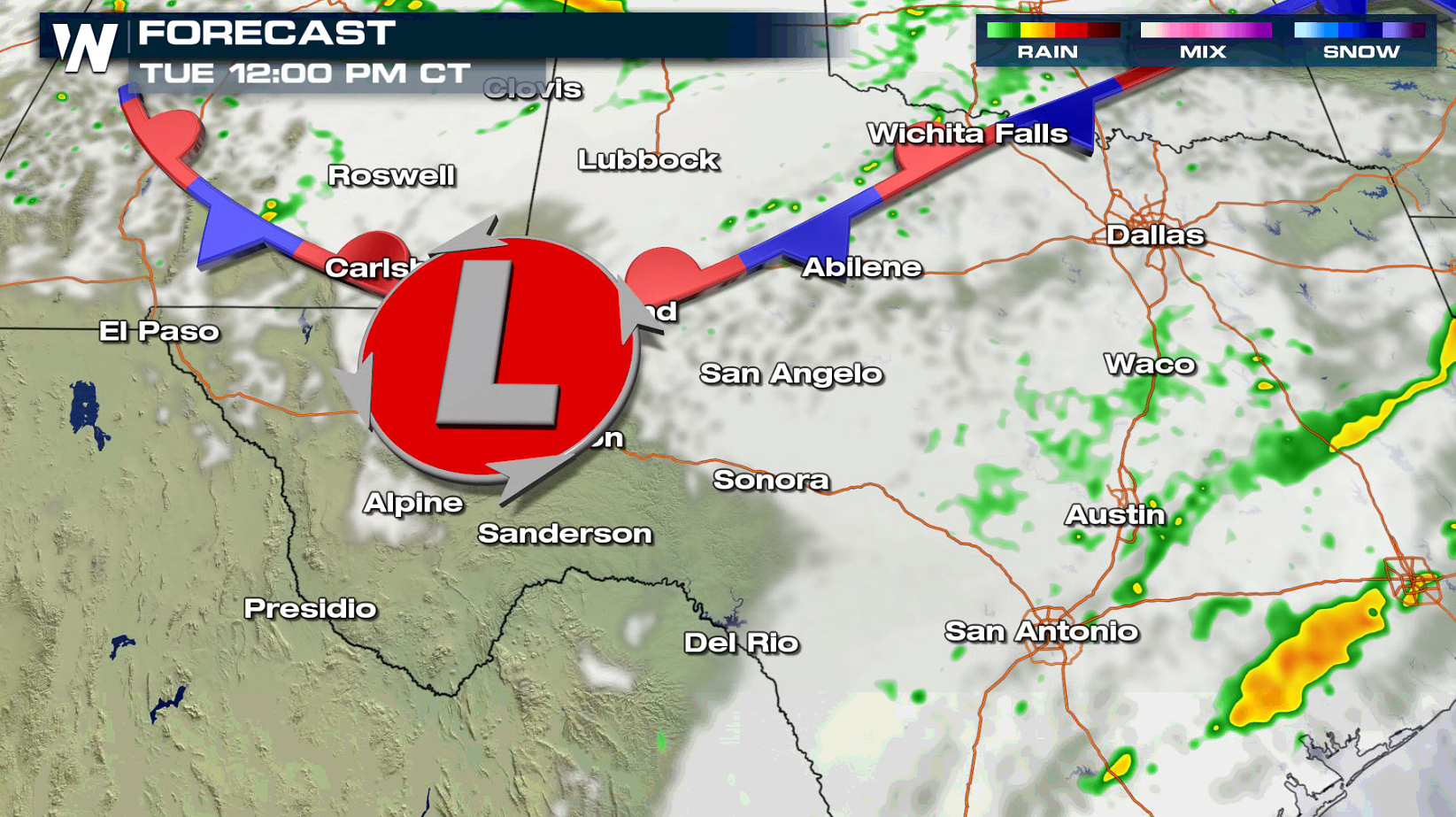
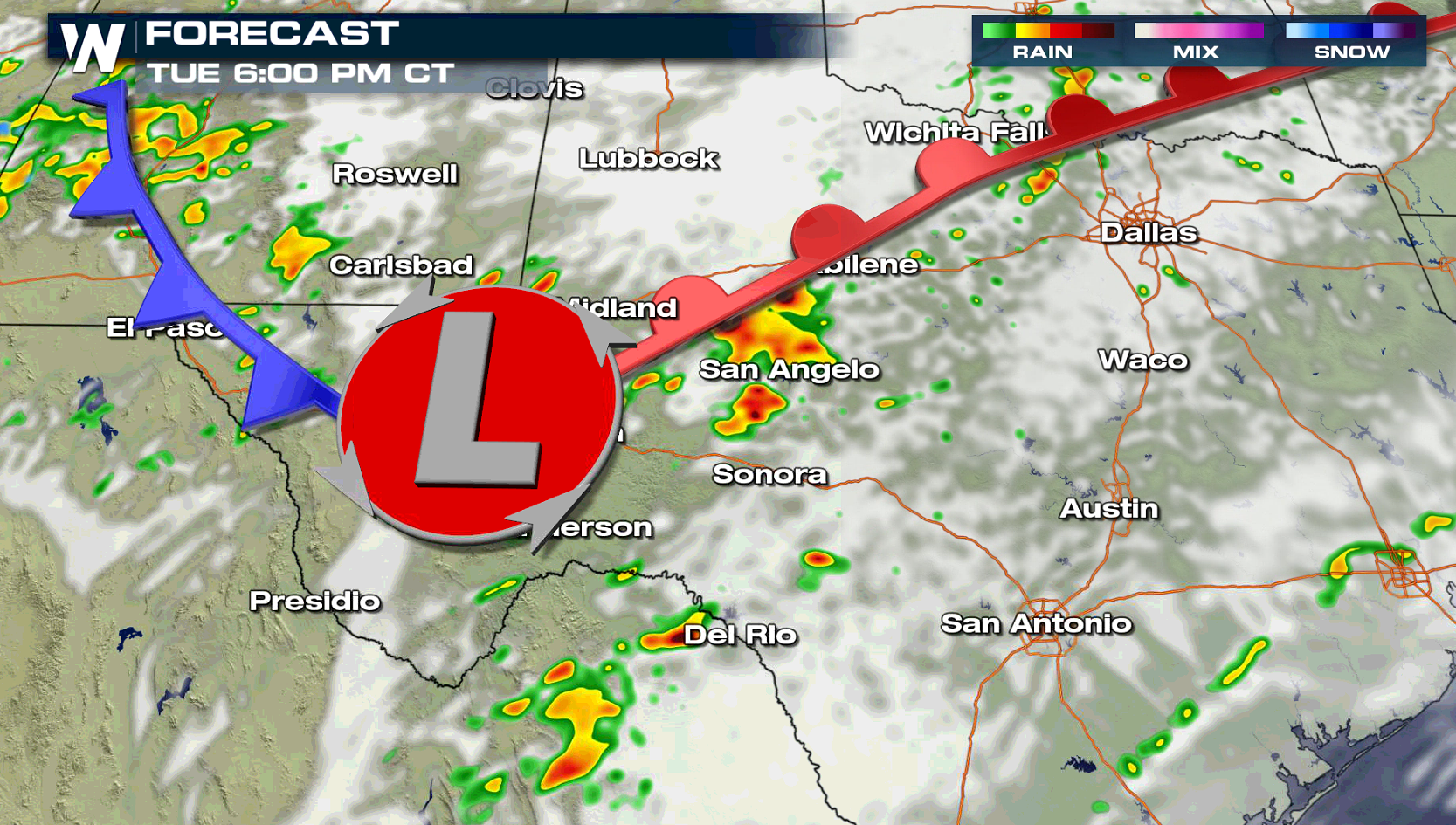
 For today (Tuesday), a cold front will push slightly southward into Central Texas. Areas from the Rio Grande to Dallas will be the focus area for severe thunderstorm development, especially in the late afternoon and evening.
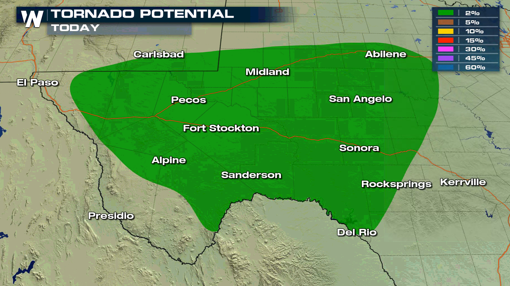
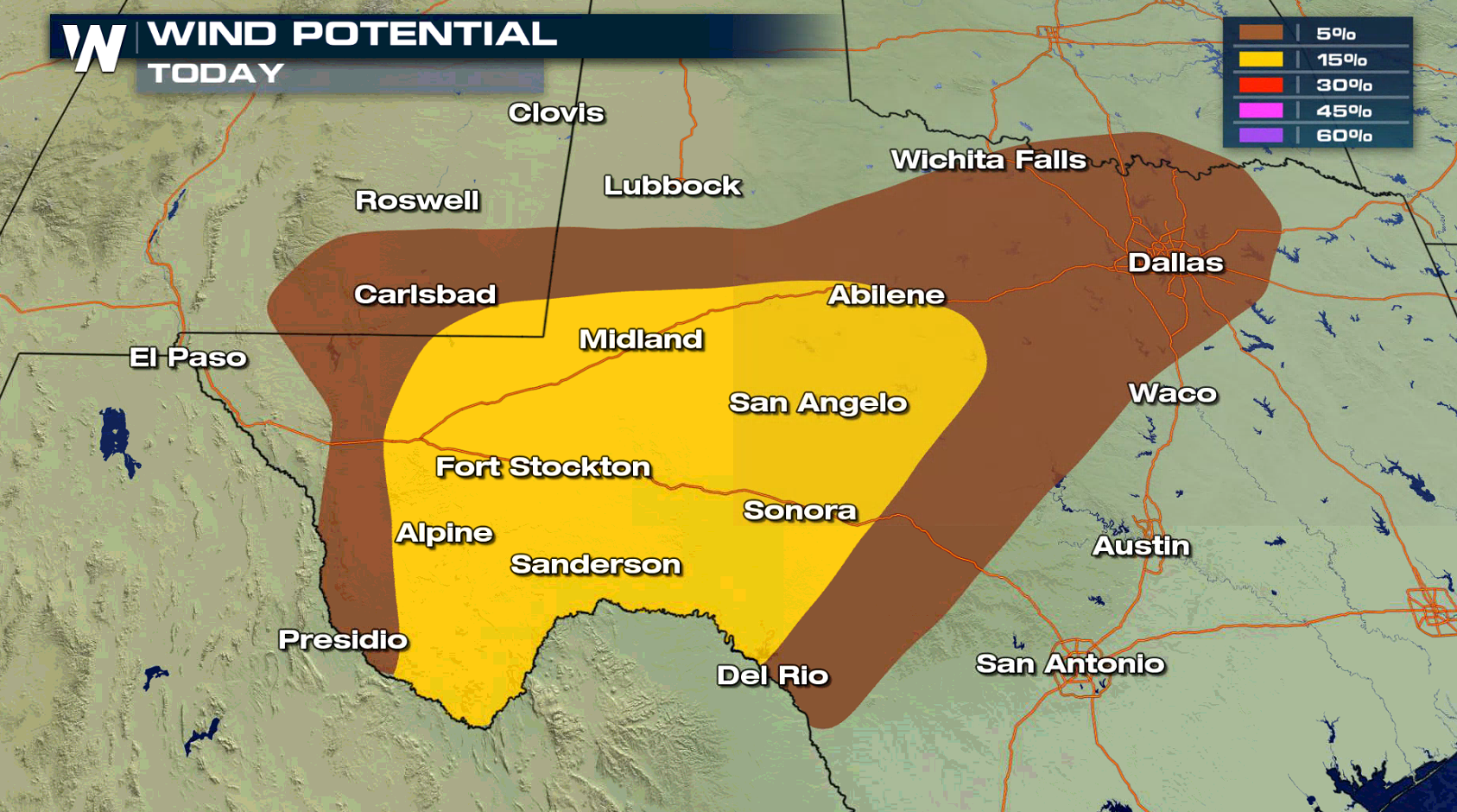
 A slow moving front and low pressure center will sink southward throughout the day. An upper level disturbance will move across the area aloft in the afternoon, creating thunderstorms. As heat and humidity builds throughout the day, severe storms are possible into the night.
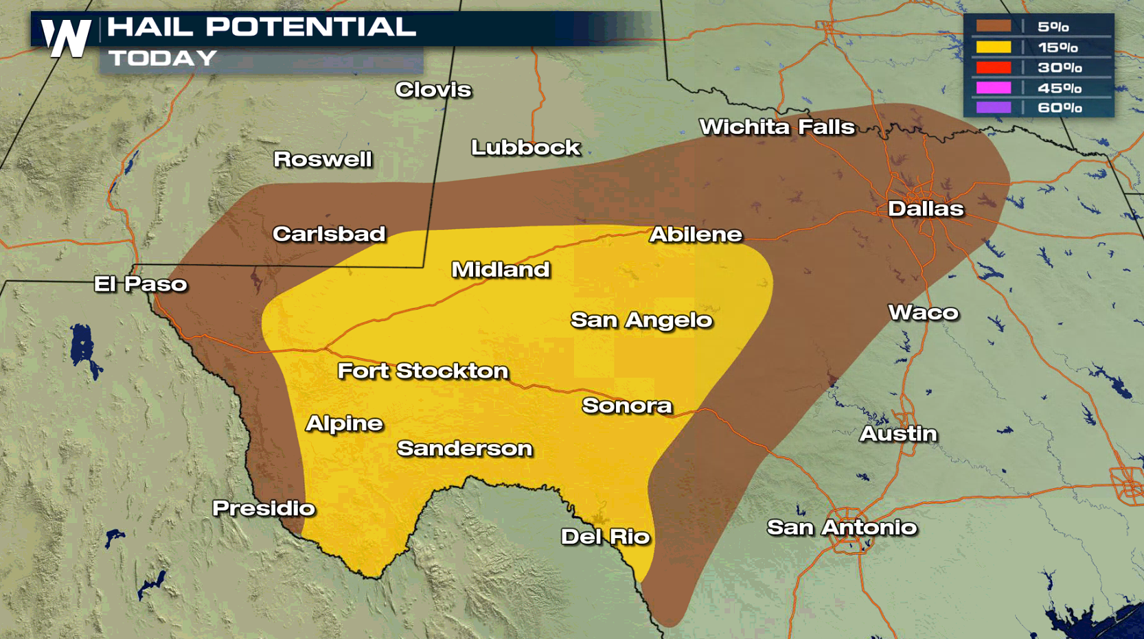
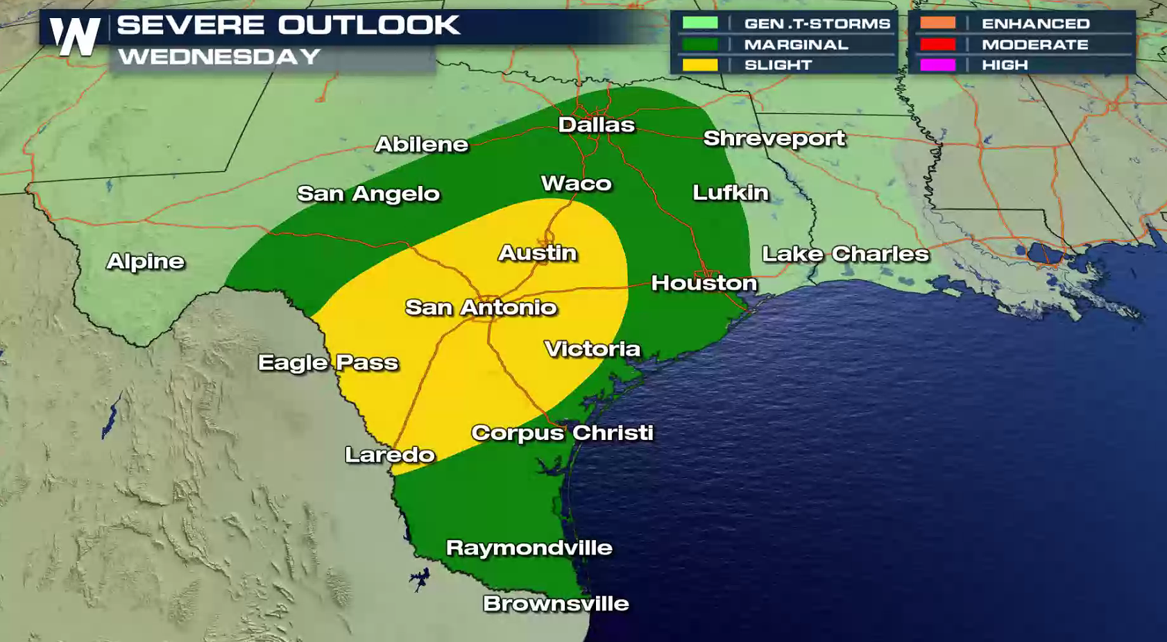
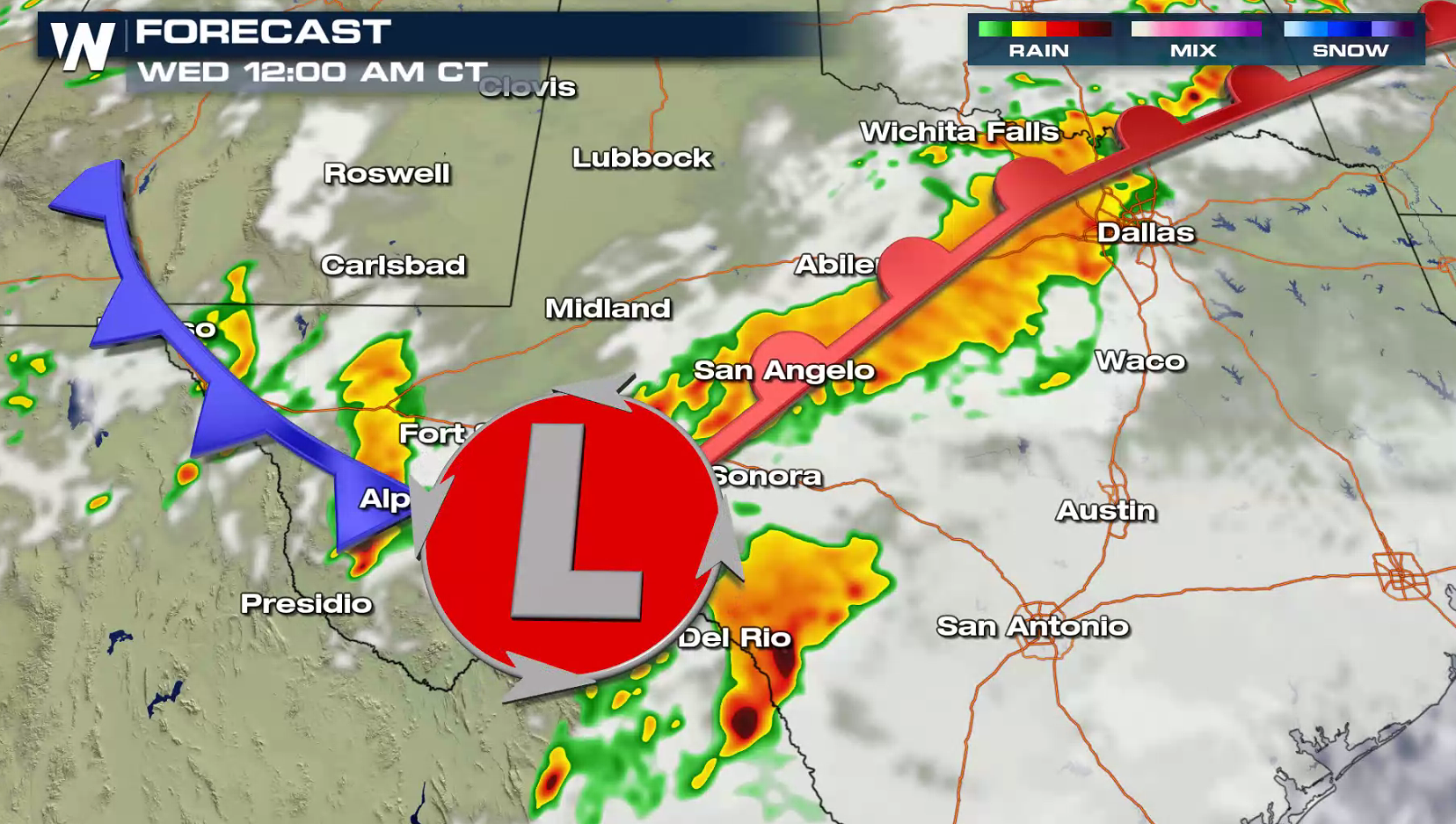 On Wednesday, southern Texas will have the potential to see severe weather. Large hail and strong wind gusts will be the biggest threat in the late afternoon and early evening. The risk area includes Austin, San Antonio, and Laredo.
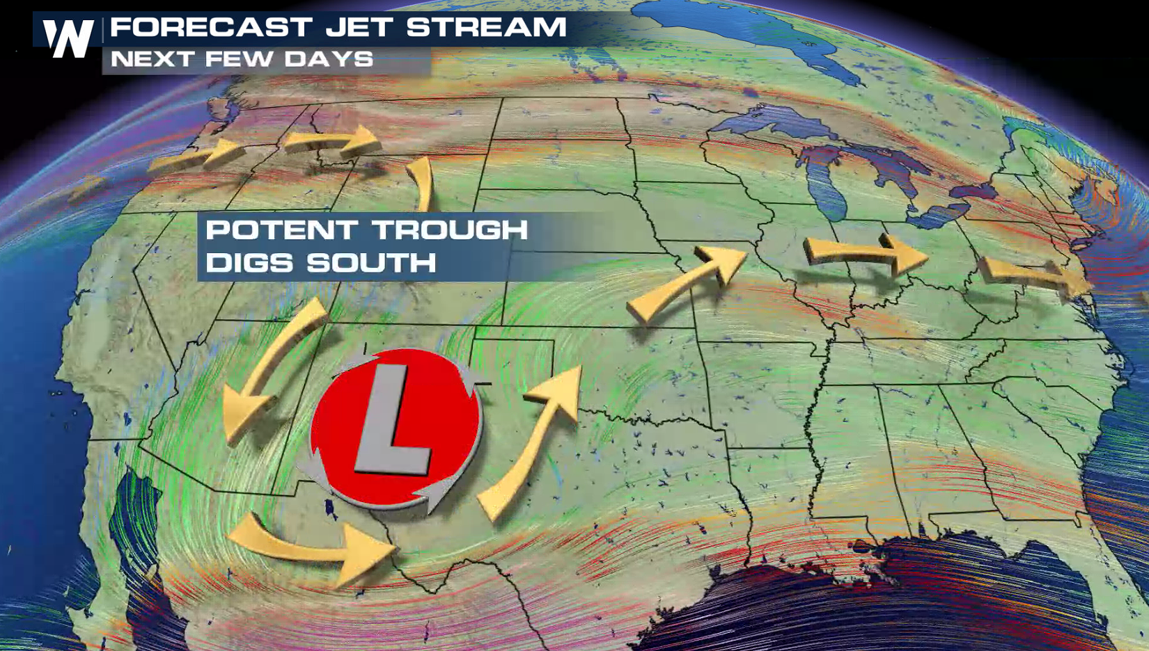
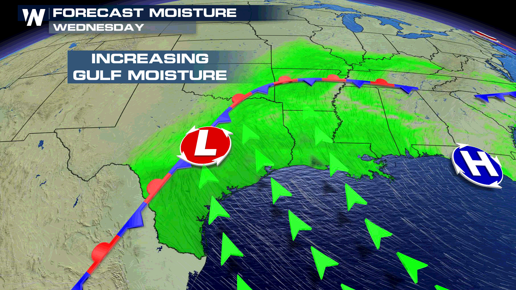
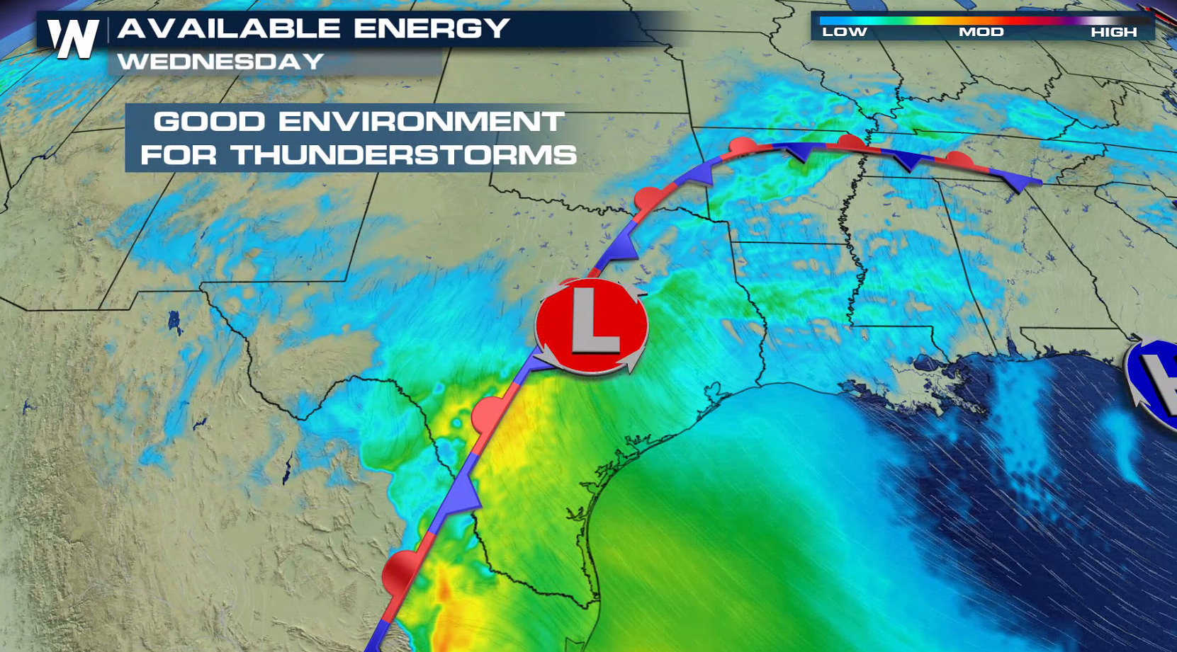
 A potent Jet Stream will dig into the region, providing upper level support for severe storms. A southerly wind flow will push warmth and humidity into the region from the Gulf of Mexico. Increasing instability will help to create and sustain severe thunderstorm development, especially in the afternoon and evening.
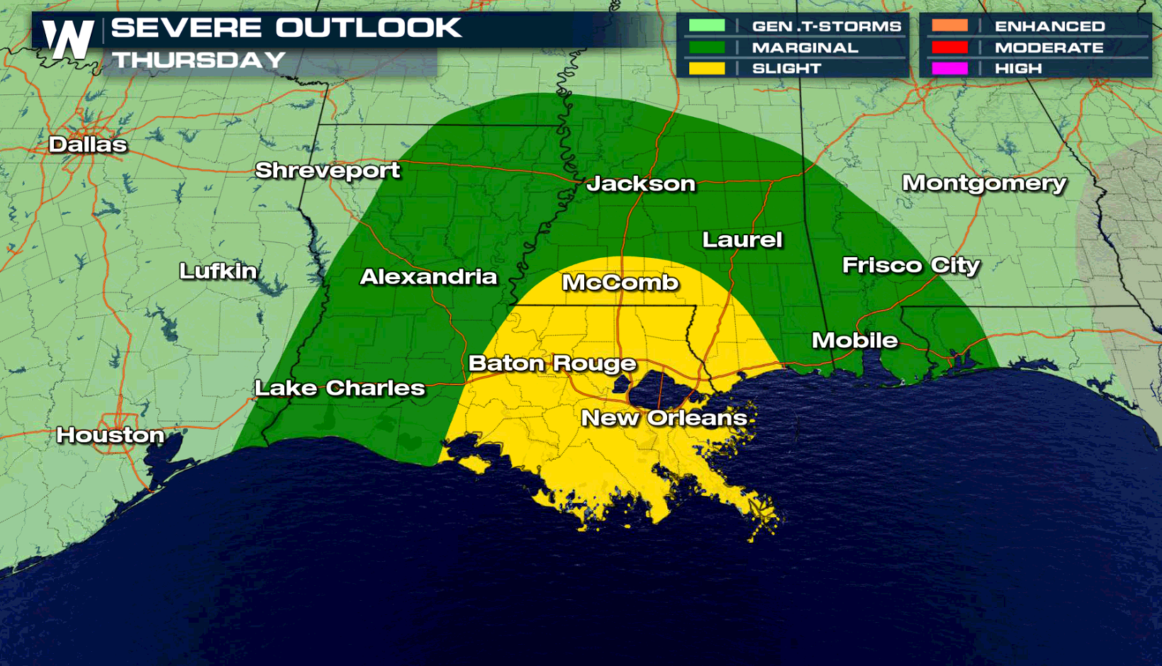
 The threat for severe thunderstorms shifts east of the Lone Star state on Thursday. Coastal areas along the Gulf of Mexico in Louisiana and Mississippi, including New Orleans and Baton Rouge, have the potential to see severe weather.
 Have a severe weather plan in place, in case you need to take shelter if threatening storms approach your area. Be sure to check back with WeatherNation on-air and online if you are in the severe weather risk areas.
For WeatherNation: Meteorologist Mace Michaels
Have a severe weather plan in place, in case you need to take shelter if threatening storms approach your area. Be sure to check back with WeatherNation on-air and online if you are in the severe weather risk areas.
For WeatherNation: Meteorologist Mace Michaels
For today (Tuesday), a cold front will push slightly southward into Central Texas. Areas from the Rio Grande to Dallas will be the focus area for severe thunderstorm development, especially in the late afternoon and evening.
A slow moving front and low pressure center will sink southward throughout the day. An upper level disturbance will move across the area aloft in the afternoon, creating thunderstorms. As heat and humidity builds throughout the day, severe storms are possible into the night.
On Wednesday, southern Texas will have the potential to see severe weather. Large hail and strong wind gusts will be the biggest threat in the late afternoon and early evening. The risk area includes Austin, San Antonio, and Laredo.
A potent Jet Stream will dig into the region, providing upper level support for severe storms. A southerly wind flow will push warmth and humidity into the region from the Gulf of Mexico. Increasing instability will help to create and sustain severe thunderstorm development, especially in the afternoon and evening.
The threat for severe thunderstorms shifts east of the Lone Star state on Thursday. Coastal areas along the Gulf of Mexico in Louisiana and Mississippi, including New Orleans and Baton Rouge, have the potential to see severe weather.
Have a severe weather plan in place, in case you need to take shelter if threatening storms approach your area. Be sure to check back with WeatherNation on-air and online if you are in the severe weather risk areas.
For WeatherNation: Meteorologist Mace MichaelsAll Weather News
More
Wildfire Outbreak in the Pacific Northwest
Conditions have been incredibly dry out west.
2 Aug 2026 1:30 PM

After Reaching Category 5, Genevieve Weakens in the Pacific
PacificGenevieve formed on last Friday south
2 Aug 2026 1:25 PM

More Storms for the East Sunday and Monday
A low-pressure system crashing through the Mi
2 Aug 2026 1:25 PM


Flooding, Severe Storms Target the Midwest Again
After an active week of storms across the nor
1 Aug 2026 1:40 AM

Flooding Risk Increases as Heavy Rain Targets the Tri-State Area
Tuesday, heavy rainfall moved across the Nort
30 Jul 2026 12:25 AM

Severe Weather: Energy From the Midwest Now in the Southeast
UPPER MIDWEST - Through Monday, dangerous tor
29 Jul 2026 10:30 PM