Potential Record Highs and Above Average Temps
Special Stories
24 Dec 2019 3:51 PM
Above average temperatures are prevalent throughout the central U.S. with some temps ranging 25-30 degrees warmer than average. there is a chance some cities could be nearing or breaking afternoon high temperature records, in the northern Midwest on Wednesday and Thursday this week.
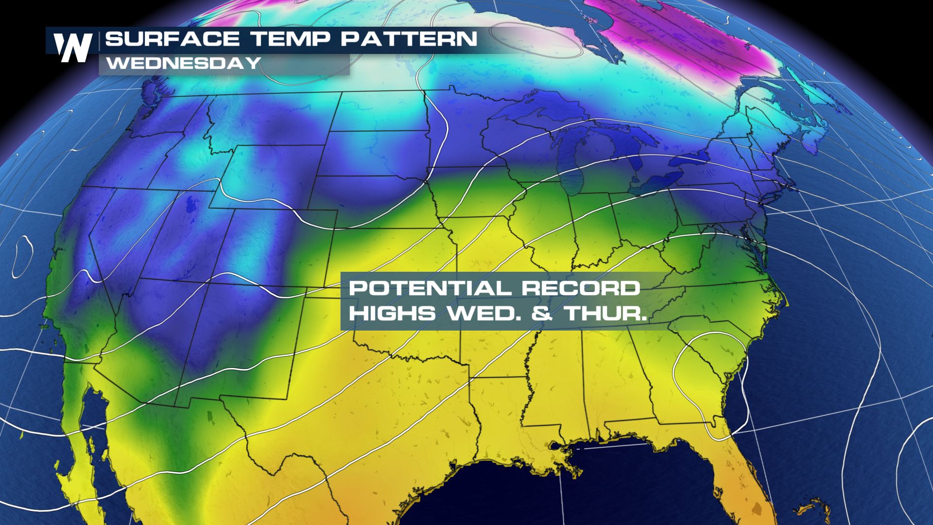 The warmth will last for the southeast through the end of the week but with it stretching into the southern parts of the Great Lakes; Illinois, Michigan, Indiana and even southern Wisconsin could near the record highs for a few cities for the date by Thursday.
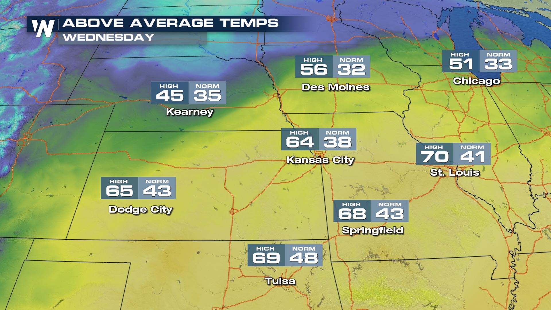
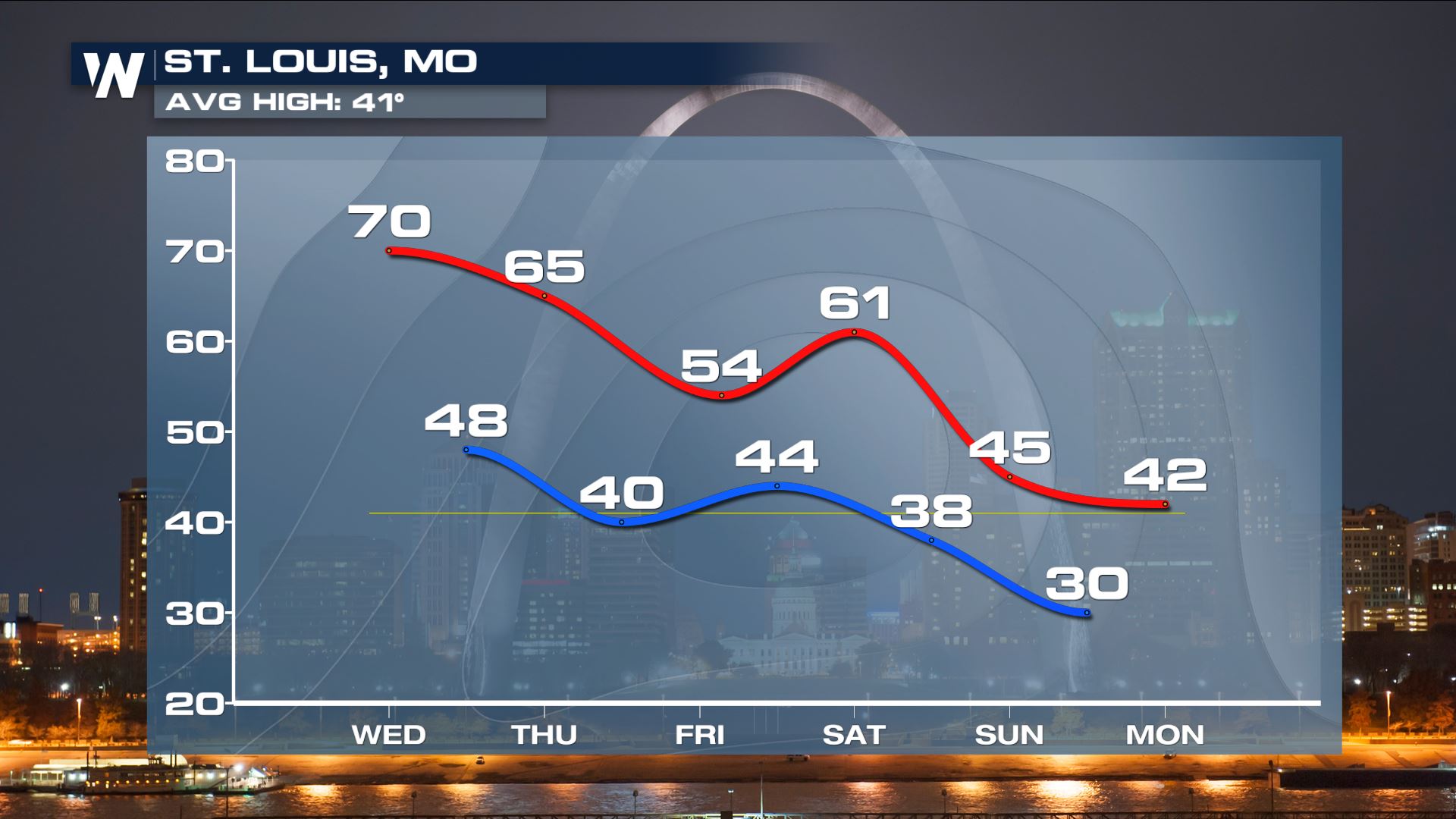
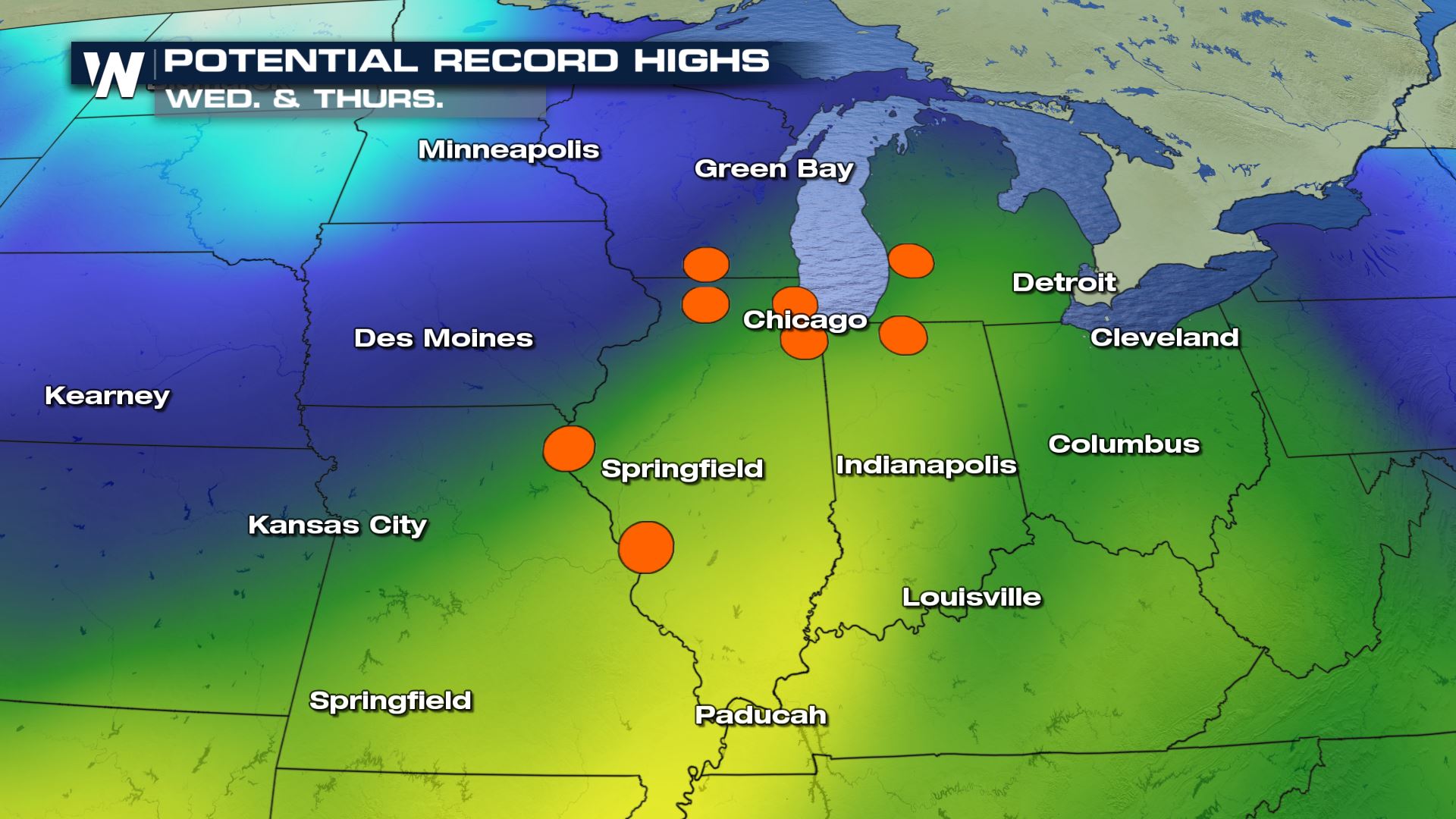 St. Louis could be seeing record high for Christmas Day with high temperature forecast nearing 70 degrees. The warmth lingering even as cold air tries to catch up as a center of low pressure begins to develop and bring rain into the forecast. Kansas City is another which is featuring a large gap between average and the forecasted high temperature.
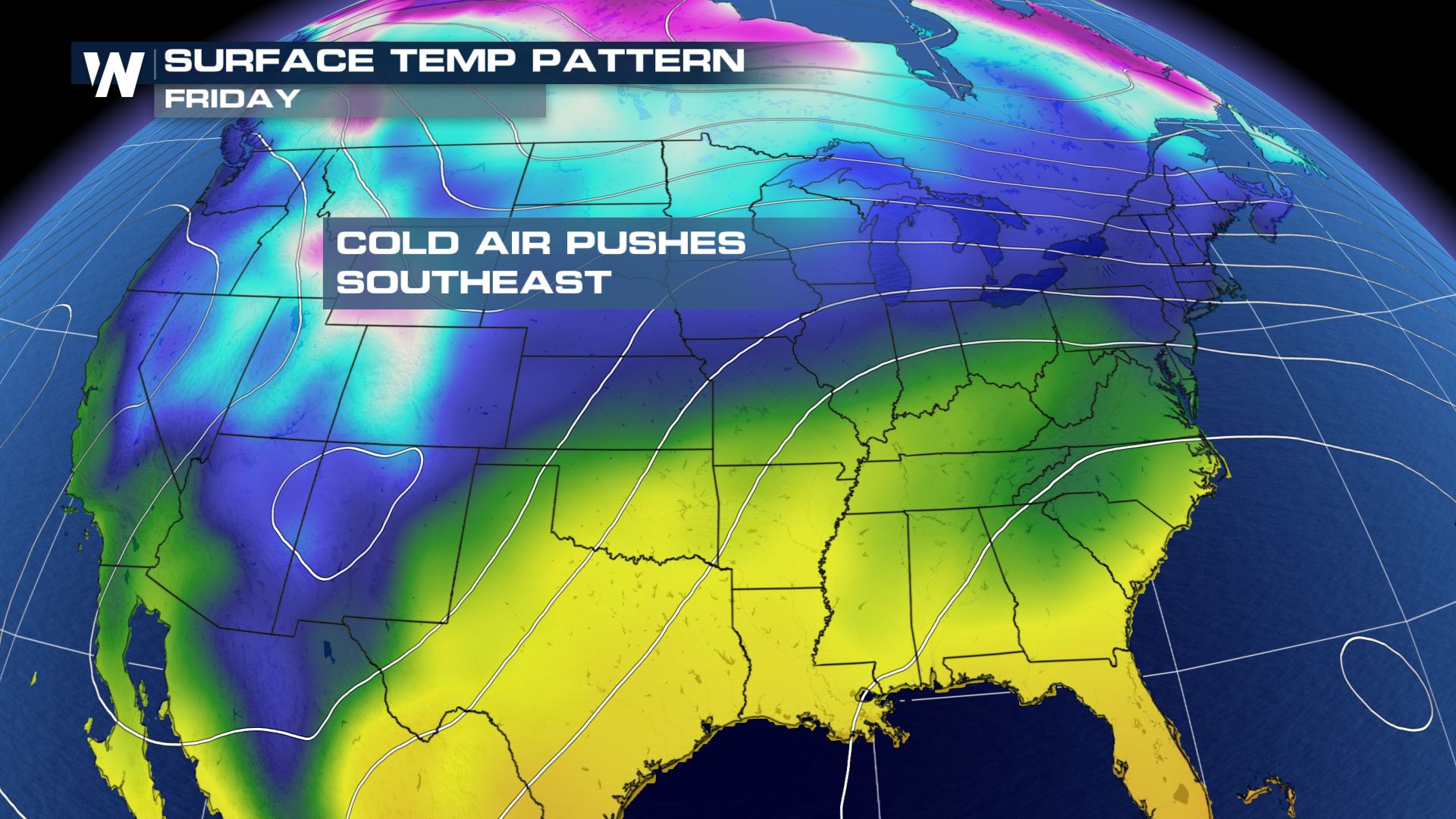
 The cold air tries to follow behind the front but it's going to take some time for it to finally catch up which will be by early next week.
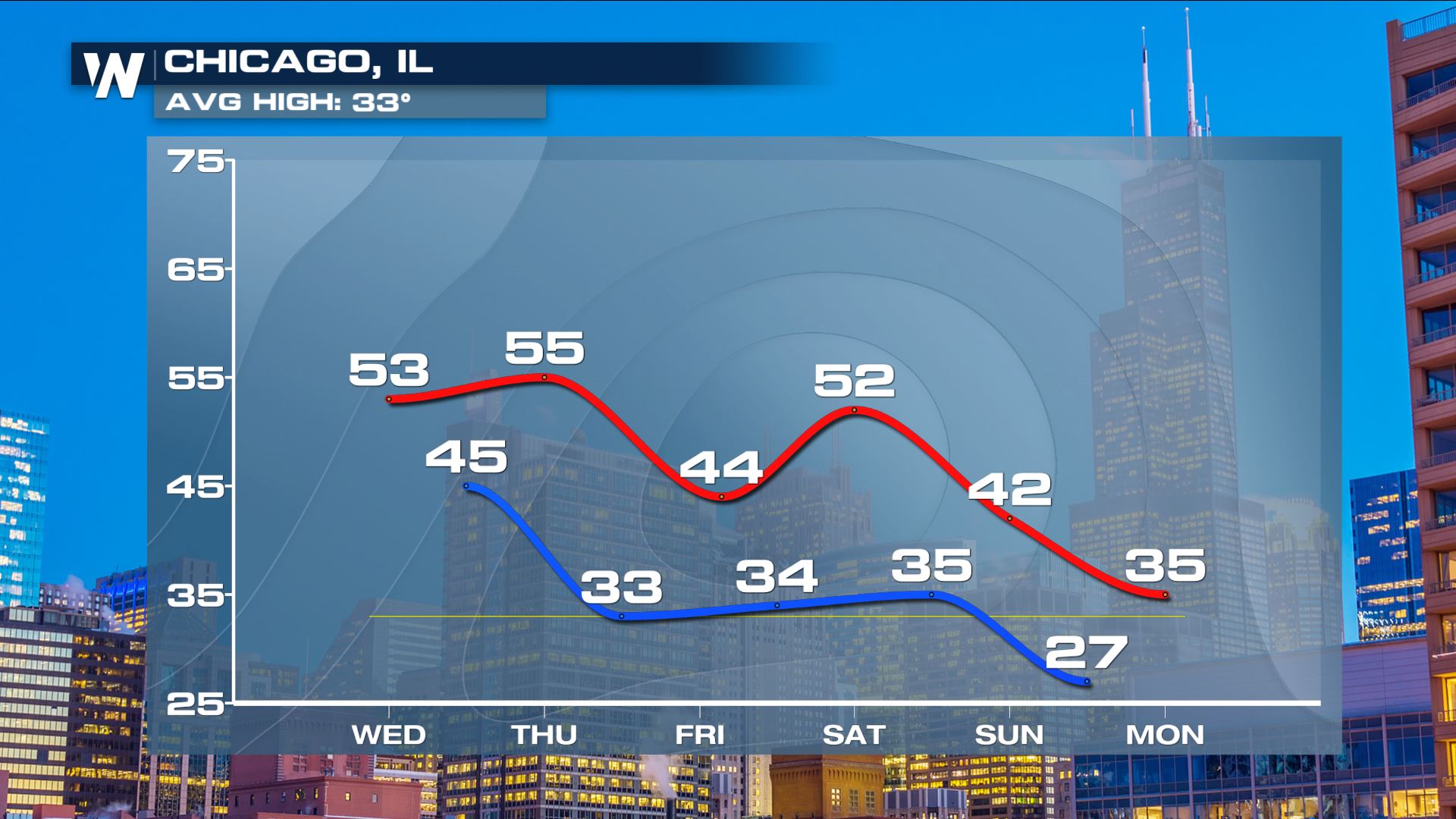
 Chicago remains warm until the rain moves in by the end of the week, but even then highs still remain above the average through the weekend - as does St. Louis, which also returns to about average for this time of year by the end of the weekend and into next week.
 The warmth will last for the southeast through the end of the week but with it stretching into the southern parts of the Great Lakes; Illinois, Michigan, Indiana and even southern Wisconsin could near the record highs for a few cities for the date by Thursday.
 St. Louis could be seeing record high for Christmas Day with high temperature forecast nearing 70 degrees. The warmth lingering even as cold air tries to catch up as a center of low pressure begins to develop and bring rain into the forecast. Kansas City is another which is featuring a large gap between average and the forecasted high temperature.
 The cold air tries to follow behind the front but it's going to take some time for it to finally catch up which will be by early next week.
 Chicago remains warm until the rain moves in by the end of the week, but even then highs still remain above the average through the weekend - as does St. Louis, which also returns to about average for this time of year by the end of the weekend and into next week.


All Weather News
More