Potential Significant Weekend Impacts for the Northeast
Special Stories
2 Jan 2020 11:58 AM
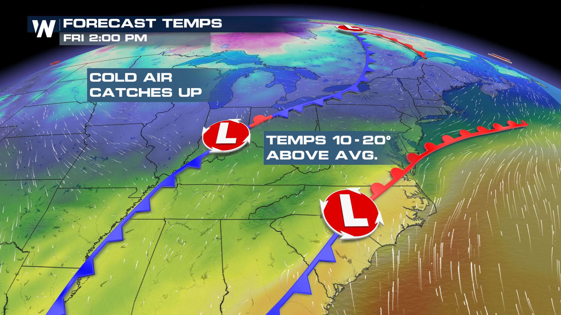
As a strong storm system swirls through the Mid Atlantic and into the northeast into the upcoming weekend, the potential for widespread impacts remain possible through the area. Temperatures will remain well above average to end the week by nearly 10-20°.
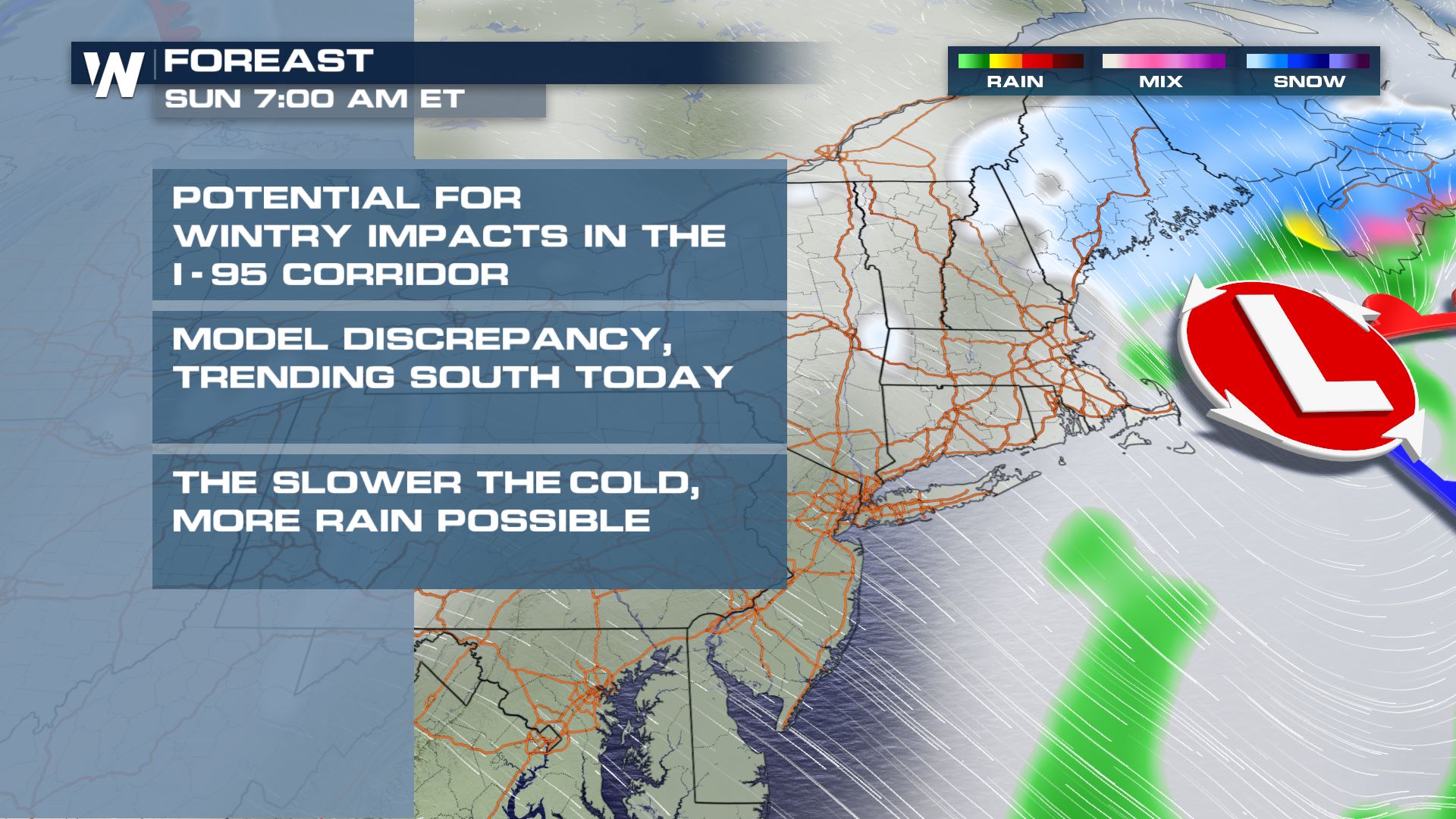
 Although there are still uncertainties to the forecast, the potential for wintry weather exists across the region, as colder air fills in on the backside of the storm.
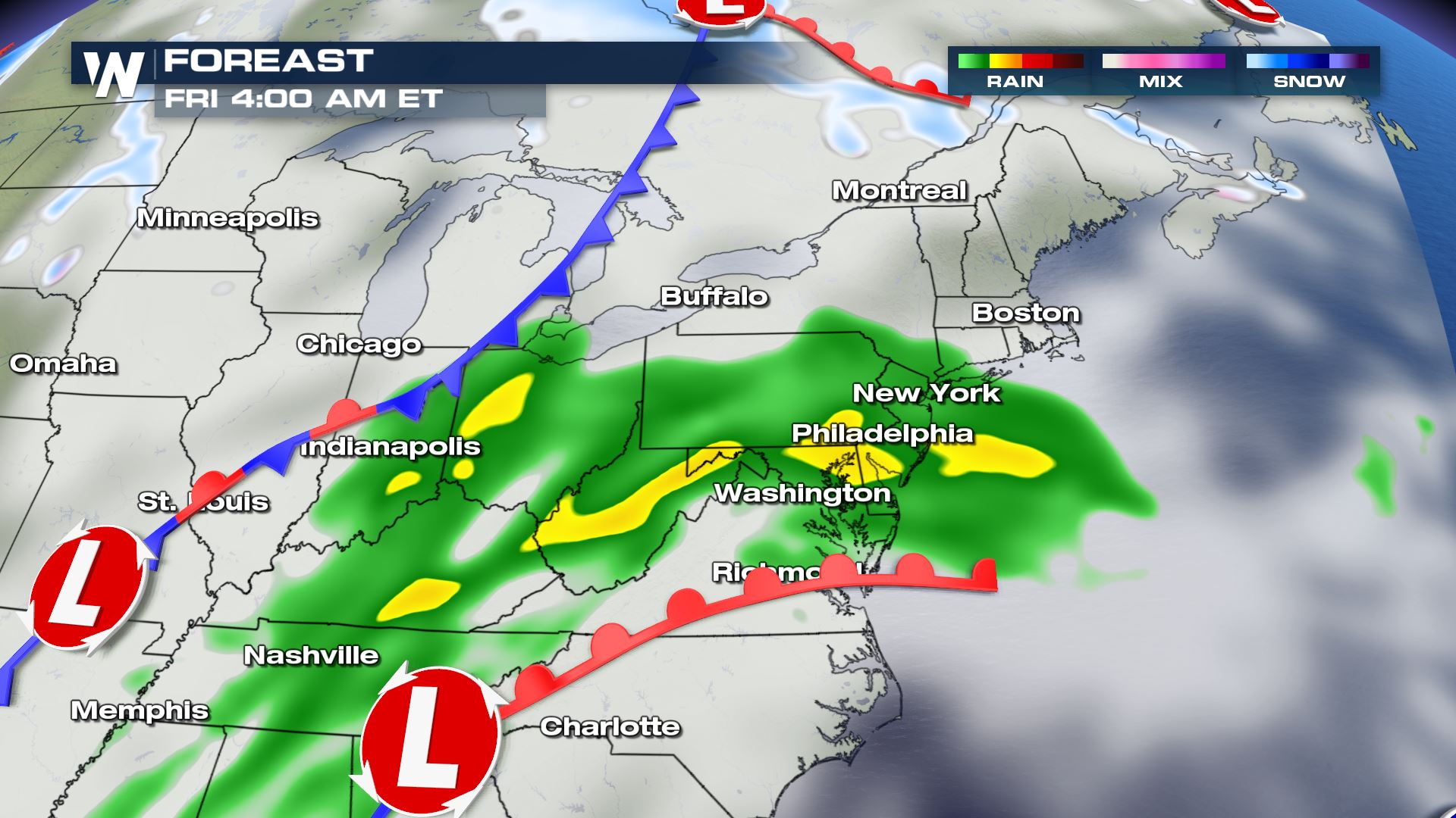
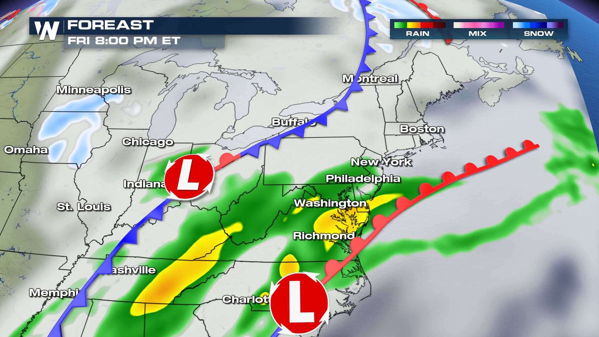
 Here is the timing of the expected cold front into early Friday. Moisture will stream north along and ahead of the frontal boundary, producing widespread showers. The majority of precipitation will likely be rain, as temperatures will remain well above average through Friday afternoon.
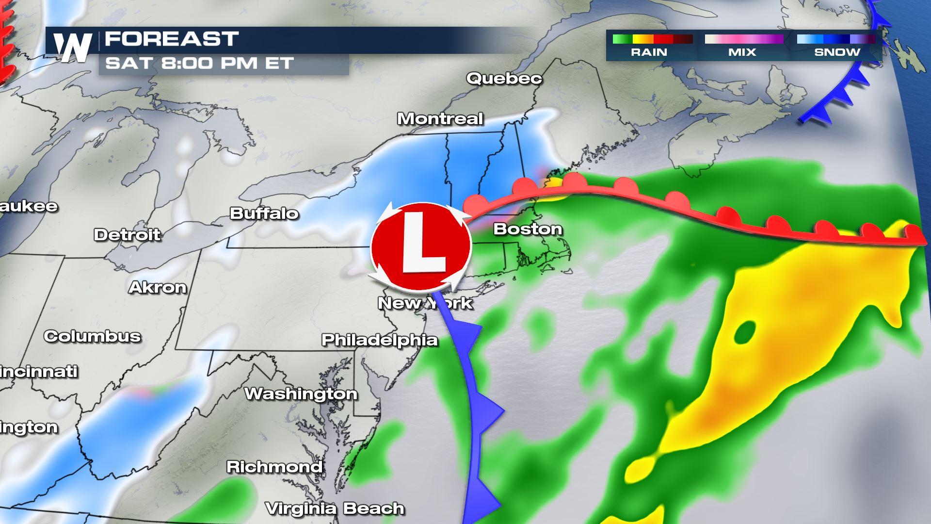
 Colder air will begin to fill into the region by Saturday afternoon, allowing for rain to transition to snow through portions of the region.
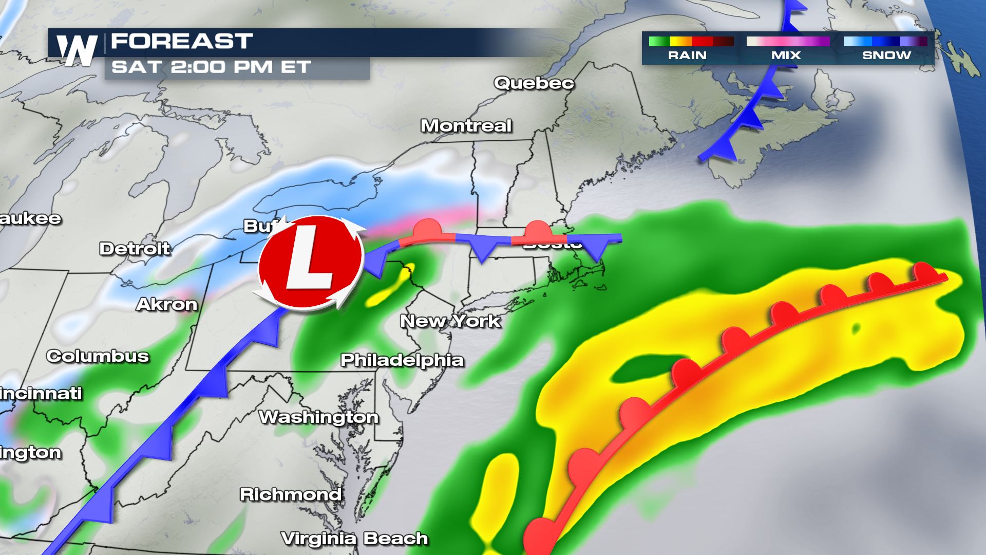 By Saturday, snow will likely become widespread from New York and into New England. Snow totals have the potential to exceed 6".
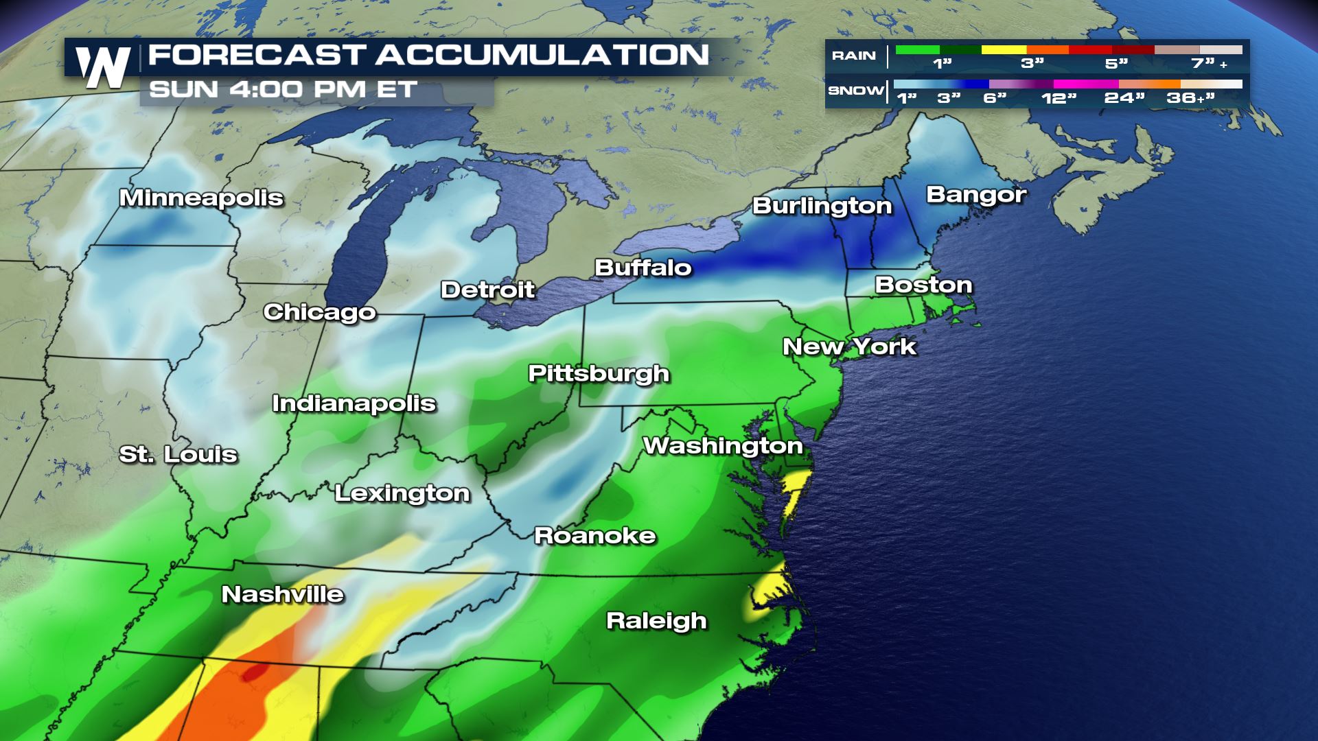
 Below are the projected snow and rain totals from Friday morning into Sunday afternoon.
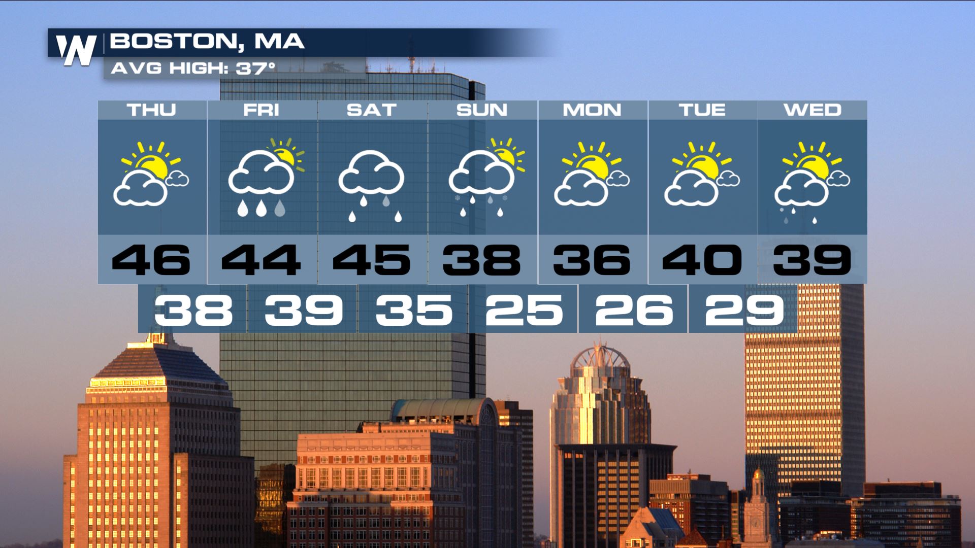
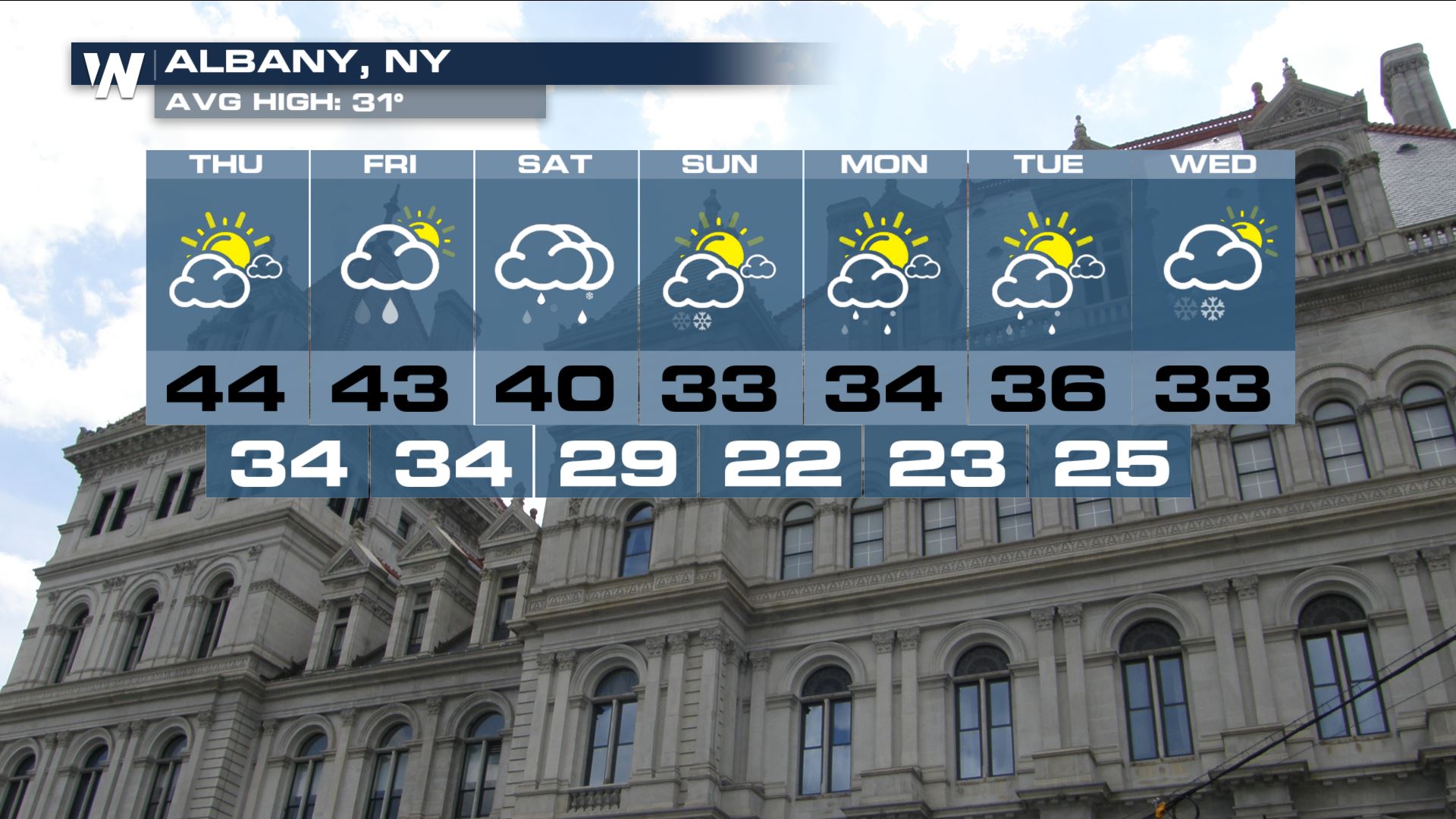
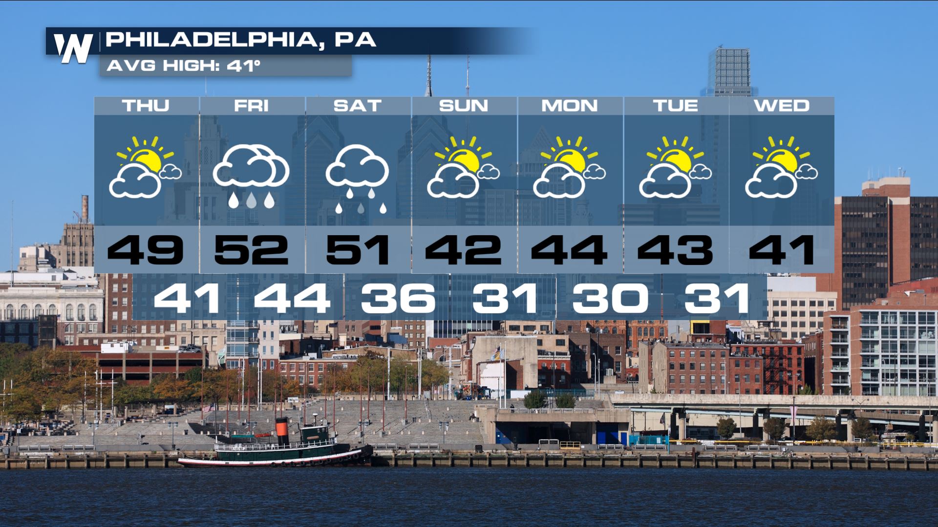
 The extended forecast for Boston, Albany and Philadelphia all have rain or snow in the forecast into the weekend.
 As always, forecasts are subject to change, so make sure to stay tuned into WeatherNation for all the latest developments.
Although there are still uncertainties to the forecast, the potential for wintry weather exists across the region, as colder air fills in on the backside of the storm.
Here is the timing of the expected cold front into early Friday. Moisture will stream north along and ahead of the frontal boundary, producing widespread showers. The majority of precipitation will likely be rain, as temperatures will remain well above average through Friday afternoon.
Colder air will begin to fill into the region by Saturday afternoon, allowing for rain to transition to snow through portions of the region.
By Saturday, snow will likely become widespread from New York and into New England. Snow totals have the potential to exceed 6".
Below are the projected snow and rain totals from Friday morning into Sunday afternoon.
The extended forecast for Boston, Albany and Philadelphia all have rain or snow in the forecast into the weekend.
As always, forecasts are subject to change, so make sure to stay tuned into WeatherNation for all the latest developments.All Weather News
More

Flooding, Severe Storms Target the Midwest Again
After an active week of storms across the nor
1 Aug 2026 1:40 AM


After Reaching Category 5, Genevieve Weakens in the Pacific
PacificFausto is now a post-tropical cyclone.
31 Jul 2026 1:30 AM

Flooding Risk Increases as Heavy Rain Targets the Tri-State Area
Tuesday, heavy rainfall moved across the Nort
30 Jul 2026 12:25 AM

Severe Weather: Energy From the Midwest Now in the Southeast
UPPER MIDWEST - Through Monday, dangerous tor
29 Jul 2026 10:30 PM