Potential Tropical Cyclone 14 Forms in the Caribbean
Top Stories
6 Oct 2018 2:56 PM
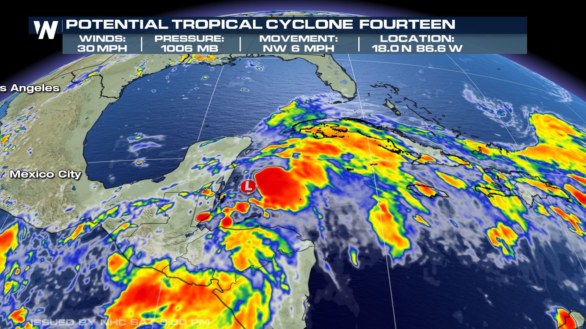
After days of monitoring a disturbance in the western Caribbean, the National Hurricane Center announces that 'Potential Tropical Cyclone 14' has formed, just east of the Yucatan Peninsula.
PTC 14 has maximum winds of 30 mph and is traveling at 6 mph to the northwest. The minimum central pressure is near 1006 millibars.
PTC 14 is expected to move northward into the Gulf of Mexico over the next several days.
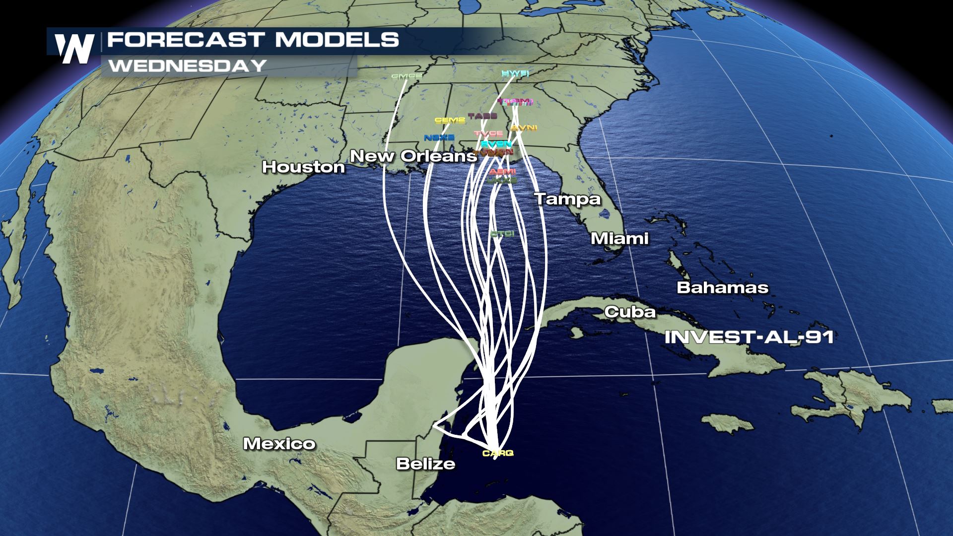
Areas along the Gulf Coast from Louisiana to Florida need to continue to monitor the progress of this system, which is expected to be named Michael. Computer models show a general trend in that direction. The strength of the system is always difficult to pinpoint, so preparation is key.
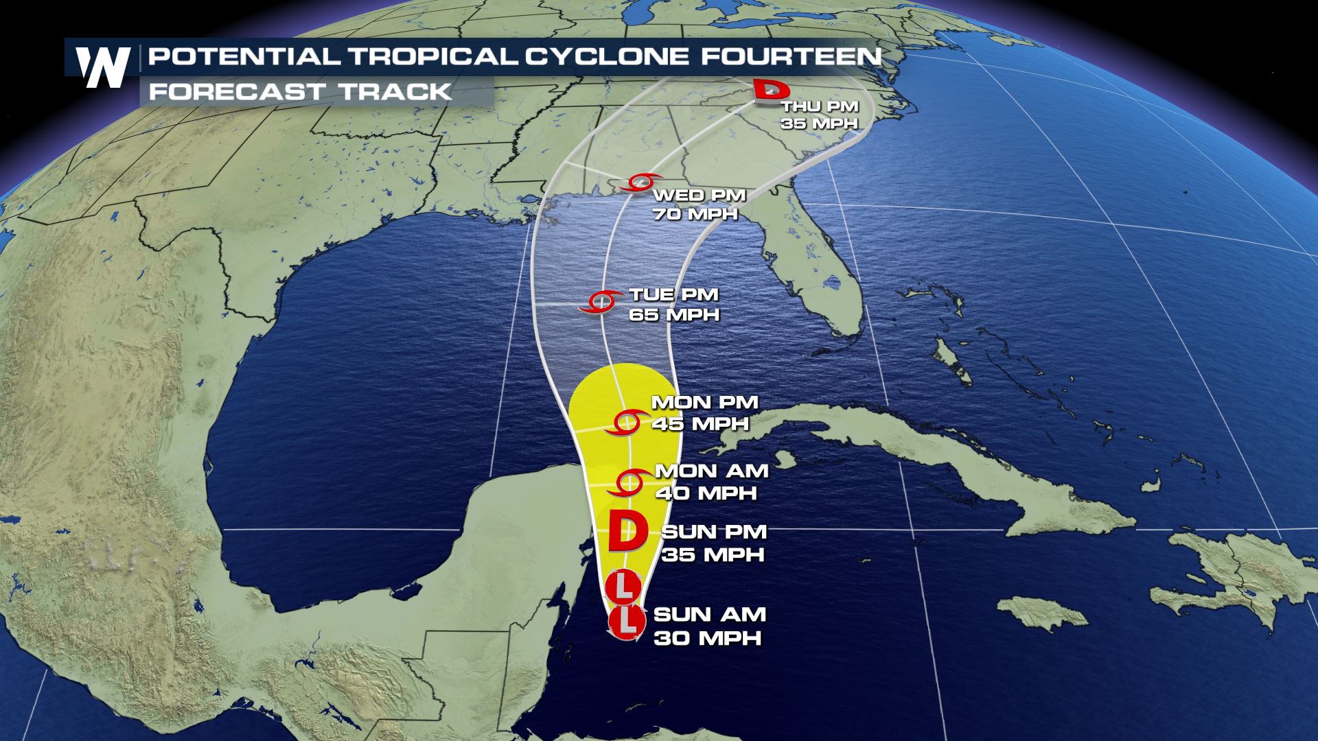 Forecast cone through Thursday, October 11
Forecast cone through Thursday, October 11
All Weather News
More


More Storms for the East Sunday and Monday
A low-pressure system crashing through the Mi
2 Aug 2026 2:20 AM

After Reaching Category 5, Genevieve Weakens in the Pacific
PacificGenevieve formed on last Friday south
2 Aug 2026 1:30 AM

Flooding, Severe Storms Target the Midwest Again
After an active week of storms across the nor
1 Aug 2026 1:40 AM

Flooding Risk Increases as Heavy Rain Targets the Tri-State Area
Tuesday, heavy rainfall moved across the Nort
30 Jul 2026 12:25 AM

Severe Weather: Energy From the Midwest Now in the Southeast
UPPER MIDWEST - Through Monday, dangerous tor
29 Jul 2026 10:30 PM