Probabilistic Hazard Information Experiment at NOAA's Hazardous Weather Testbed
Special Stories
16 Mar 2018 10:10 AM
From NOAA
The NOAA Hazardous Weather Testbed is once again busy buzzing with activity as researchers kick off the year’s first research activities. Located in the National Weather Center in Norman, Oklahoma, the testbed is operated by the NOAA National Severe Storms Laboratory and the NOAA National Weather Service.
Starting this week, participants will assess a new tool using rapid-updating, high-resolution Probabilistic Hazard Information, known as PHI. From March 12-16, April 2-6 and April 9-13 the Hazard Services – Probabilistic Hazard Information Experiment is testing an experimental concept for delivering information to the public in a way that simulates how National Weather Service forecasters would use it within their software.
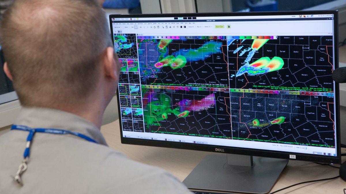
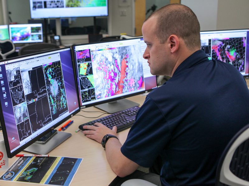
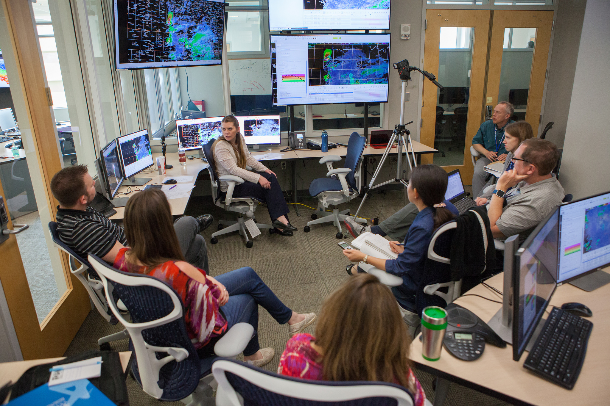 [The NOAA Hazardous Weather Testbed during the Hazard Services – Probabilistic Hazard Information Experiment in 2017. (Photo by James Murnan/ NOAA NSSL)]
“PHI will bring the public more specific weather information, but most importantly it will deliver severe weather information hours, rather than minutes before severe weather could become a threat,” said Alyssa Bates, University of Oklahoma cooperative institute and NWS Warning Decision Training Division researcher. “That will allow ample time for businesses, outdoor venues, and healthcare facilities to execute their severe weather preparedness plan.”
This experiment is one of many under the umbrella of NSSL’s FACETs, Forecasting a Continuum of Environmental Threats project. FACETs is an initiative aimed at improving the communication of hail, wind, and tornado hazards to save lives and property. Instead of a creating a warning area, in the FACETs paradigm forecasters would create probabilistic hazard information “plumes.” New types of severe weather warnings can be derived from the plumes. These include the traditional warnings the public receives today, to special warnings for specific users that have a lower tolerance to severe weather and require longer lead times to take action.
[The NOAA Hazardous Weather Testbed during the Hazard Services – Probabilistic Hazard Information Experiment in 2017. (Photo by James Murnan/ NOAA NSSL)]
“PHI will bring the public more specific weather information, but most importantly it will deliver severe weather information hours, rather than minutes before severe weather could become a threat,” said Alyssa Bates, University of Oklahoma cooperative institute and NWS Warning Decision Training Division researcher. “That will allow ample time for businesses, outdoor venues, and healthcare facilities to execute their severe weather preparedness plan.”
This experiment is one of many under the umbrella of NSSL’s FACETs, Forecasting a Continuum of Environmental Threats project. FACETs is an initiative aimed at improving the communication of hail, wind, and tornado hazards to save lives and property. Instead of a creating a warning area, in the FACETs paradigm forecasters would create probabilistic hazard information “plumes.” New types of severe weather warnings can be derived from the plumes. These include the traditional warnings the public receives today, to special warnings for specific users that have a lower tolerance to severe weather and require longer lead times to take action.
 Participants for the week include NWS forecasters from Albany, New York, and Tulsa, Oklahoma, as well as researchers from NOAA’s Earth System Research Laboratory and the University of Akron.
HS-PHI was developed by the National Severe Storms Laboratory with the National Weather Service and ESRL, and is in its second year of evaluation. PHI is one of six different experiments taking place in the NOAA HWT this spring.
Edited for WeatherNation by Meteorologist Mace Michaels
Participants for the week include NWS forecasters from Albany, New York, and Tulsa, Oklahoma, as well as researchers from NOAA’s Earth System Research Laboratory and the University of Akron.
HS-PHI was developed by the National Severe Storms Laboratory with the National Weather Service and ESRL, and is in its second year of evaluation. PHI is one of six different experiments taking place in the NOAA HWT this spring.
Edited for WeatherNation by Meteorologist Mace Michaels
[The NOAA Hazardous Weather Testbed during the Hazard Services – Probabilistic Hazard Information Experiment in 2017. (Photo by James Murnan/ NOAA NSSL)]
“PHI will bring the public more specific weather information, but most importantly it will deliver severe weather information hours, rather than minutes before severe weather could become a threat,” said Alyssa Bates, University of Oklahoma cooperative institute and NWS Warning Decision Training Division researcher. “That will allow ample time for businesses, outdoor venues, and healthcare facilities to execute their severe weather preparedness plan.”
This experiment is one of many under the umbrella of NSSL’s FACETs, Forecasting a Continuum of Environmental Threats project. FACETs is an initiative aimed at improving the communication of hail, wind, and tornado hazards to save lives and property. Instead of a creating a warning area, in the FACETs paradigm forecasters would create probabilistic hazard information “plumes.” New types of severe weather warnings can be derived from the plumes. These include the traditional warnings the public receives today, to special warnings for specific users that have a lower tolerance to severe weather and require longer lead times to take action.
Participants for the week include NWS forecasters from Albany, New York, and Tulsa, Oklahoma, as well as researchers from NOAA’s Earth System Research Laboratory and the University of Akron.
HS-PHI was developed by the National Severe Storms Laboratory with the National Weather Service and ESRL, and is in its second year of evaluation. PHI is one of six different experiments taking place in the NOAA HWT this spring.
Edited for WeatherNation by Meteorologist Mace MichaelsAll Weather News
More
East Gears Up for Stormy, Wet Weekend
A low pressure system crashing through the Mi
1 Aug 2026 11:35 AM

Flooding, Severe Storms Target the Midwest Again
After an active week of storms across the nor
1 Aug 2026 1:40 AM


After Reaching Category 5, Genevieve Weakens in the Pacific
PacificFausto is now a post-tropical cyclone.
31 Jul 2026 1:30 AM

Flooding Risk Increases as Heavy Rain Targets the Tri-State Area
Tuesday, heavy rainfall moved across the Nort
30 Jul 2026 12:25 AM

Severe Weather: Energy From the Midwest Now in the Southeast
UPPER MIDWEST - Through Monday, dangerous tor
29 Jul 2026 10:30 PM