A Rare Tornado Confirmed in New York City

Special Stories
3 Aug 2018 11:12 AM
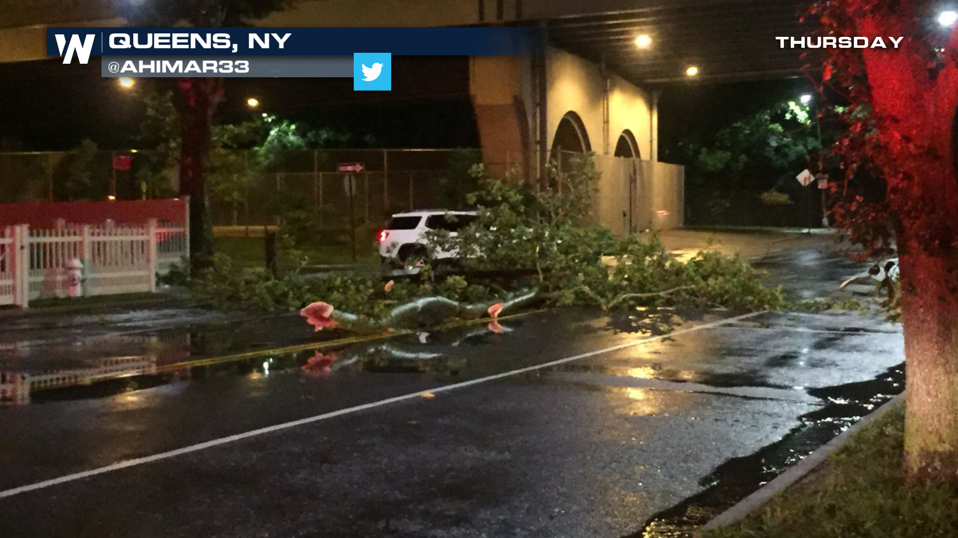
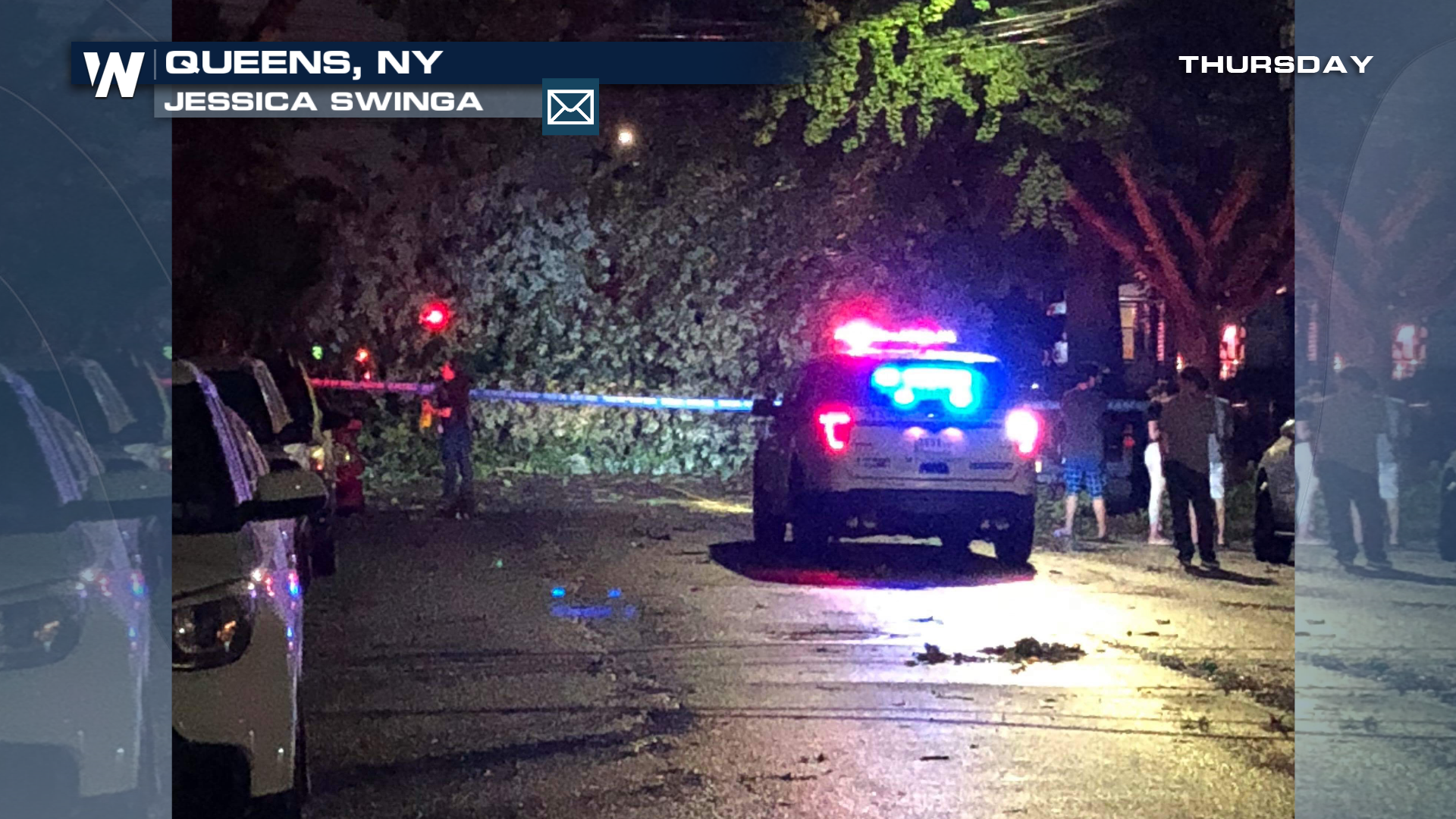
Thursday night's weather proved to be quite turbulent in the New York metropolitan area. A number of powerful thunderstorms marched across the region. One storm appeared to have rotation, and the National Weather Service issued a Tornado Warning around 10:20 pm EDT. The warned area included the Bronx, Queens, and Nassau County on Long Island. Well over two million people were in the warned area. After the thunderstorm roared through, reports of downed trees and power lines began to surface in Queens. The storm also peeled siding off several homes. A tornado was the suspected cause of the damage.
https://twitter.com/NWSNewYorkNY/status/1025204305966579713
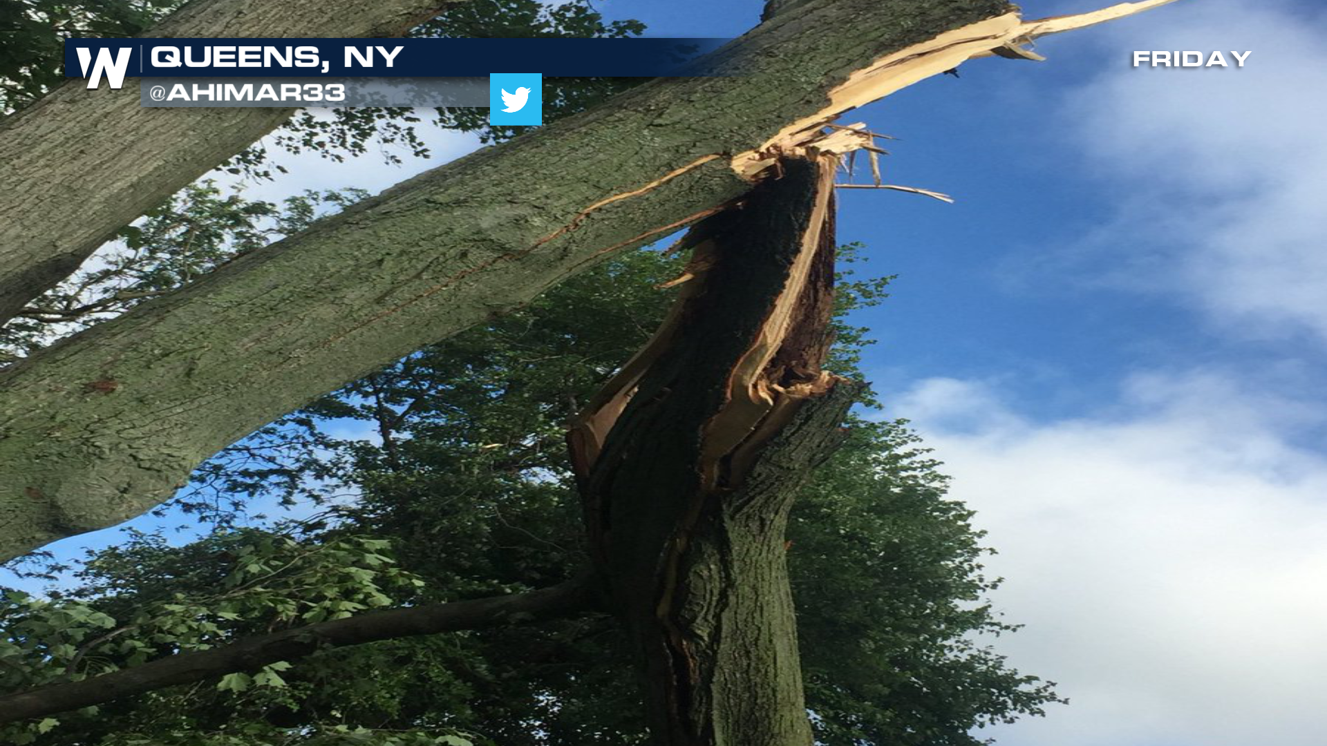
Earlier today, the National Weather Service surveyed the damage. They confirmed an EF-O tornado touched down near St. Fidelis Catholic Church on 14th avenue, in the College Point Station of Queens. Winds were estimated to be 70 to 85 mph. The path of the tornado was three-quarters of a mile long, and a hundred yards wide. The National Weather Service stated that the tornado strengthened as it moved toward Powell's Cove Park. It moved along the shoreline and dissipated just before reaching 138th Street.
 How rare was this weather event? It's only the seventh confirmed tornado in New York City since 2010. So a pretty rare occurrence indeed!
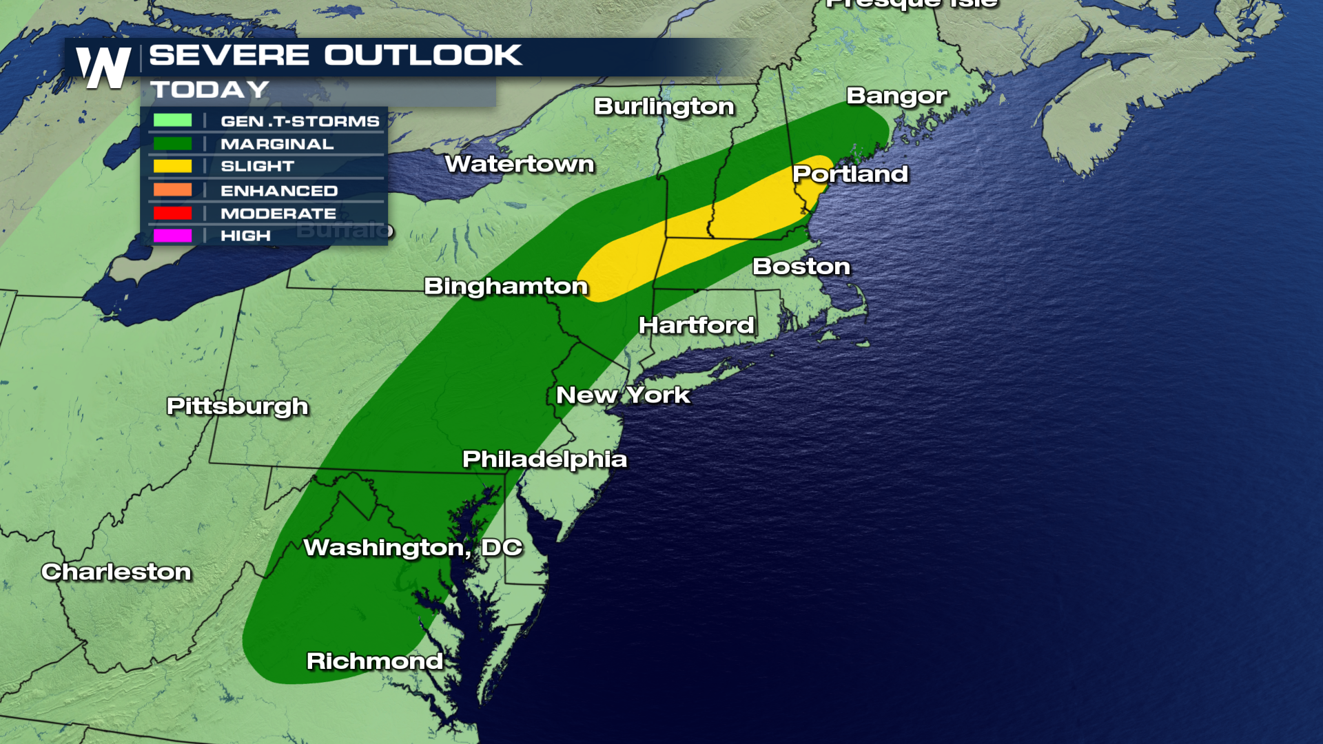
More storms are in the forecast for Friday afternoon and evening. The greatest threat for severe storms will be to the north and west of New York City. Damaging straight-line winds are possible, along with a small chance for more weak tornadoes. However, strong storms are still possible for the Tri-State area, including New York City. Stay tuned for what could be another wild weather ride!
How rare was this weather event? It's only the seventh confirmed tornado in New York City since 2010. So a pretty rare occurrence indeed!
More storms are in the forecast for Friday afternoon and evening. The greatest threat for severe storms will be to the north and west of New York City. Damaging straight-line winds are possible, along with a small chance for more weak tornadoes. However, strong storms are still possible for the Tri-State area, including New York City. Stay tuned for what could be another wild weather ride!
 For WeatherNation TV: Meteorologist Matt Monroe
How rare was this weather event? It's only the seventh confirmed tornado in New York City since 2010. So a pretty rare occurrence indeed!
More storms are in the forecast for Friday afternoon and evening. The greatest threat for severe storms will be to the north and west of New York City. Damaging straight-line winds are possible, along with a small chance for more weak tornadoes. However, strong storms are still possible for the Tri-State area, including New York City. Stay tuned for what could be another wild weather ride!
For WeatherNation TV: Meteorologist Matt MonroeAll Weather News
More
Fronts Continue To Spark Severe Weather Across the Plains
A cold front that brought record lows to the
18 Jul 2025 10:40 PM

Extreme Heat Impacts for the East Coast & South
Extreme heat continues to impact several area
18 Jul 2025 10:05 PM

Flooding Threat Remains Elevated in the East
A cold front pushing through the Eastern Seab
18 Jul 2025 9:10 PM

EF-2 Firenado from the Deer Creek Fire in Utah
A fire tornado was spotted near La Sal, Utah
18 Jul 2025 7:30 AM

Tropical System Brings Flood Risk to the Central Gulf
Time has run out for notable tropical develop
18 Jul 2025 3:05 AM

Heavy Rain, Flooding Threat Returns to Florida
Keep the rain boots handy in Florida - heavy
13 Jul 2025 12:50 PM

Severe Storm Risk Pushes into the Great Lakes, Ohio Valley
Friday was another busy day with severe weath
12 Jul 2025 8:00 PM